Eastern Sierra Anniversary
24-26 July, 2021
It has now been thirty years since we brought together our friends and family at the First Unitarian Society of Albany and, before them, said our vows. Here we still are, having endured the horrorshow of 2020 together.
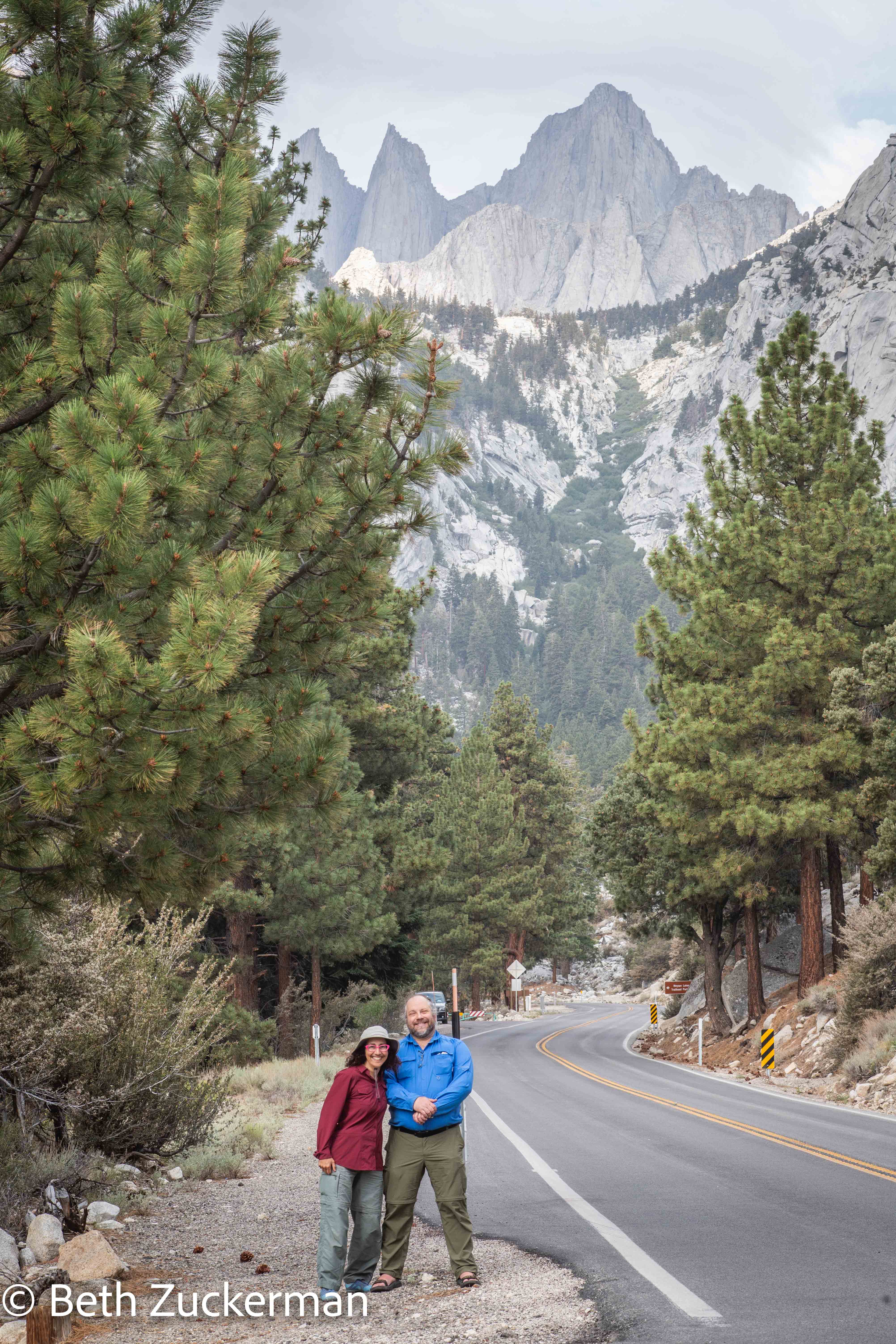
Us on Whitney Portal Road, looking up at the hightest mountain in the continental US, 4,418 m (14,495 ft).
Overcoming a frustrating confluence of obstacles (described below), we had a lovely celebration at high altitude, exploring the eastern Sierra.
Having traveled to Svalbard in 2019 to visit the Arctic environment before it disappeared, our hope for our 30th anniversary was to visit Antarctica and see the South Polar environment before it was forever lost. Late winter (late summer in the Southern Hemisphere) of 2022 would have been the targeted time for such an adventure. But, with the continuing threat of COVID, and considerable uncertainty about my employment situation next year, we were reluctant to plunk down a large deposit to reserve a place on such an expedition. We had made a backup plan, in the event that Eric hadn't made enough money to visit Maui, hike Haleakala, and dive the reef. But... COVID. Air travel? Even planning more than a few weeks in advance seems fraught right now.
So, we resorted to our backup plan for 2020, Crater Lake National Park. We could spend a night in the historic Crater Lake Lodge, and take the boat trip out to Wizard Island. As I wrote last year, we had twice previously failed to reach Wizard Island, once due to rain and once due to wildfire smoke. Then, of course, in 2020, the COVID pandemic ruined our Wizard Island plans for a third time, along with an untold host of other plans made by us and other humans the world over. This year, I reserved one night at the lodge, a previous night in nearby but cheaper Medford, and kept trying unsuccessfully to make a reservation for the boat trip. A week or so before we were about to leave, the concessionaires finally announced that, due to COVID, they were cancelling all Crater Lake boat trips for 2021. Eric believes that something will always interfere with our attempts to get to Wizard Island, and that we will never get to do it.
Not to be undone, we dug out our maps, and formulated yet a third backup plan. Lacking the centerpiece of the Crater Lake visit, we would spend only the one planned night in the lodge. For the other day of our trip, I would take Eric to see delightful Bodie State Historic Park. This plan was superbly satisfactory in that it would involve more driving than any of the other plans we considered. It also would: (a) allow Eric to see Bodie before another fire destroyed what remains of it; (b) enable us to find geocaches in four more California counties, and particularly elusive Modoc County, nestled far away in the northeastern corner of the state; and (c) still fit in a visit to a national park.
However, as we were packing our bags (along with my usual large bag of assorted travel, photography, and geologic guides, which somehow turned out not to be enough) for the trip, the Tamarack Fire burst out over northeastern California. We got up early Saturday morning and examined the smoke maps. Crater Lake and the Mono-Bodie area were mildly affected but not looking too badly (yet), so we decided to proceed as planned. Had we known that the fire had already closed US Highway 395 along our planned caching route, we would surely have scrapped the plan and tried to find last-minute lodging in Eureka, Arcata, or Crescent City, and visited Redwoods National Park in northwestern California instead, even though we had already crossed all of those counties off our list.
Underinformed and against all good sense, we loaded Mather up and climbed over the Sonora Pass, CA Highway 108, an amazingly gorgeous road, to avoid the wait in line at the Yosemite gate on CA Highway 120, the Tioga Pass. We left before 7:30 and arrived in Bridgeport a little after noon, having found that Tulomne County was still on our list and so having stopped to pick up a geocache by the side of the road. We grabbed lunch at a burger and taco place where you could order through a window and sit outdoors. The competition for seating in the shade was tough. It was uncomfortably hot, and smoke was in the air. I couldn't believe I had brought along my Arctic parka. It was here that we caught wind of the bad news, overhearing someone mentioning the 395 closure. Perhaps we should have turned around at that point and just driven right back over the Sierra. But we were there, right near Bodie, and we had a reservation in the area for the night. So, we decided to carry out our Saturday plan and look at the smoke maps in the evening.
It was becoming evident that our Crater Lake plan had become impractical at best, and that there was too much smoke for a visit there to be enjoyable in any case. We reconsidered going out to the north coast, which would have been a 9-hour drive. Timbisha/Death Valley wasn't smoky, but did we really want to go to one of the hottest places in the US in July? Kings Canyon wasn't smoky, but the map showed no road into it from the east--you're supposed to trek up Mt. Whitney. We were unprepared and untrained for that level of adventure. If we wanted to visit Kings Canyon, we would have had to drive back over to the west side of the mountains and then a few hours south. And where would we stay? Fresno?
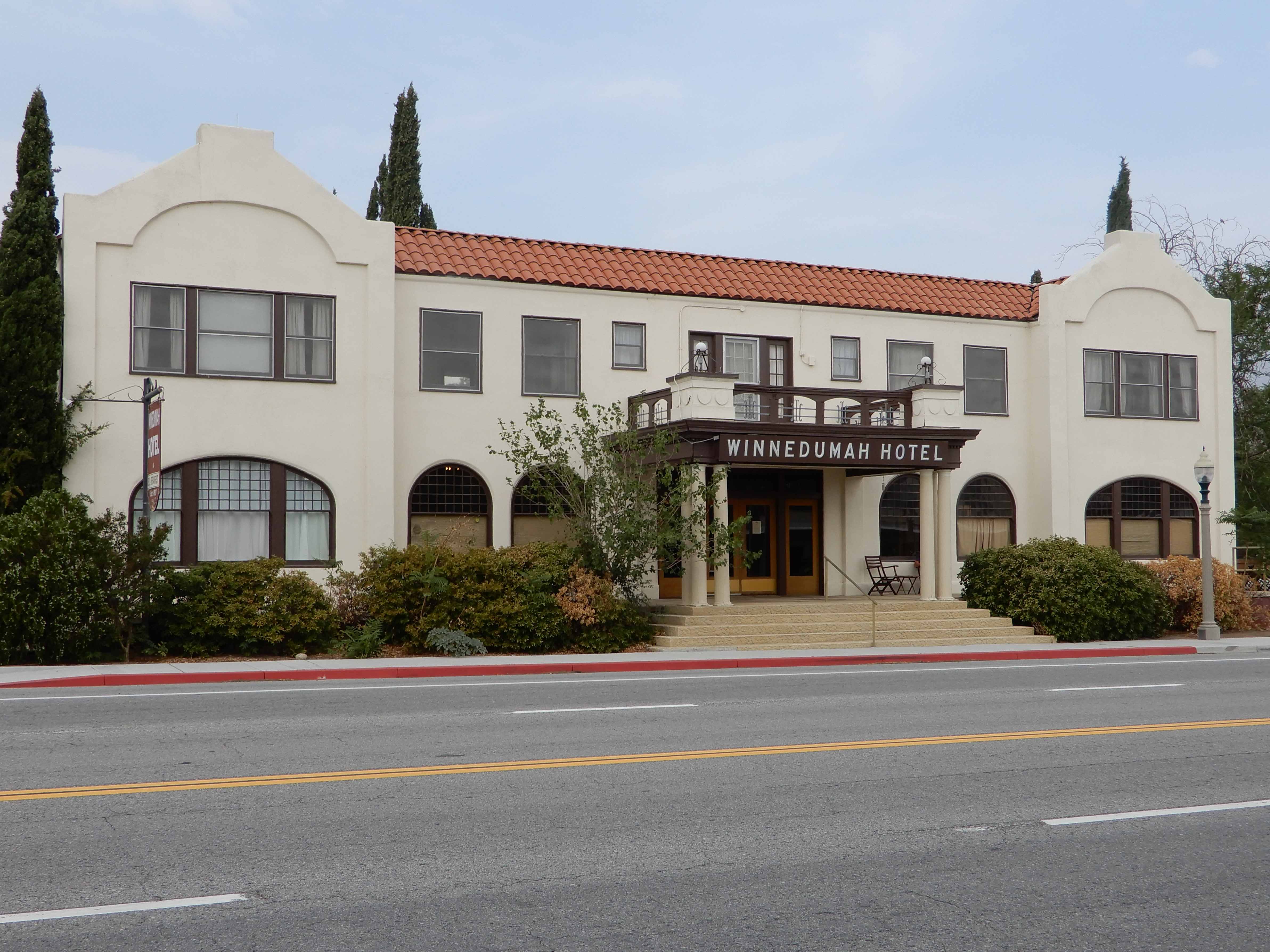
By evening, however, smoke was spreading all over northeastern California and southern Oregon. I consulted my friend Ellen, who had gotten married in the eastern Sierra and has spent a lot of time there. She suggested staying on the east side of the Sierra and going south to the Bristlecone Pines (only two hours away) and the Alabama Hills (another half hour further). Those places were on our bucket list, so we were greatly cheered, even though this further revised plan meant we wouldn't be going to any counties that we hadn't already crossed off of our geocaching list. We told Ellen we were looking for some lodging with character, so she suggested the Winnedumah Hotel in Independence. This historic hotel had been built in the 1920's to accommodate film crews working on location in the nearby Alabama Hills. We were able to make a reasonably-priced reservation. We were tired from the elevation and all of the last-minute planning, and COVID and smoke management, so we went to sleep early with a plan to sleep later than we would have had we been trying to get to Crater Lake.
Eric took a picture of the Winnedumah from across 395.
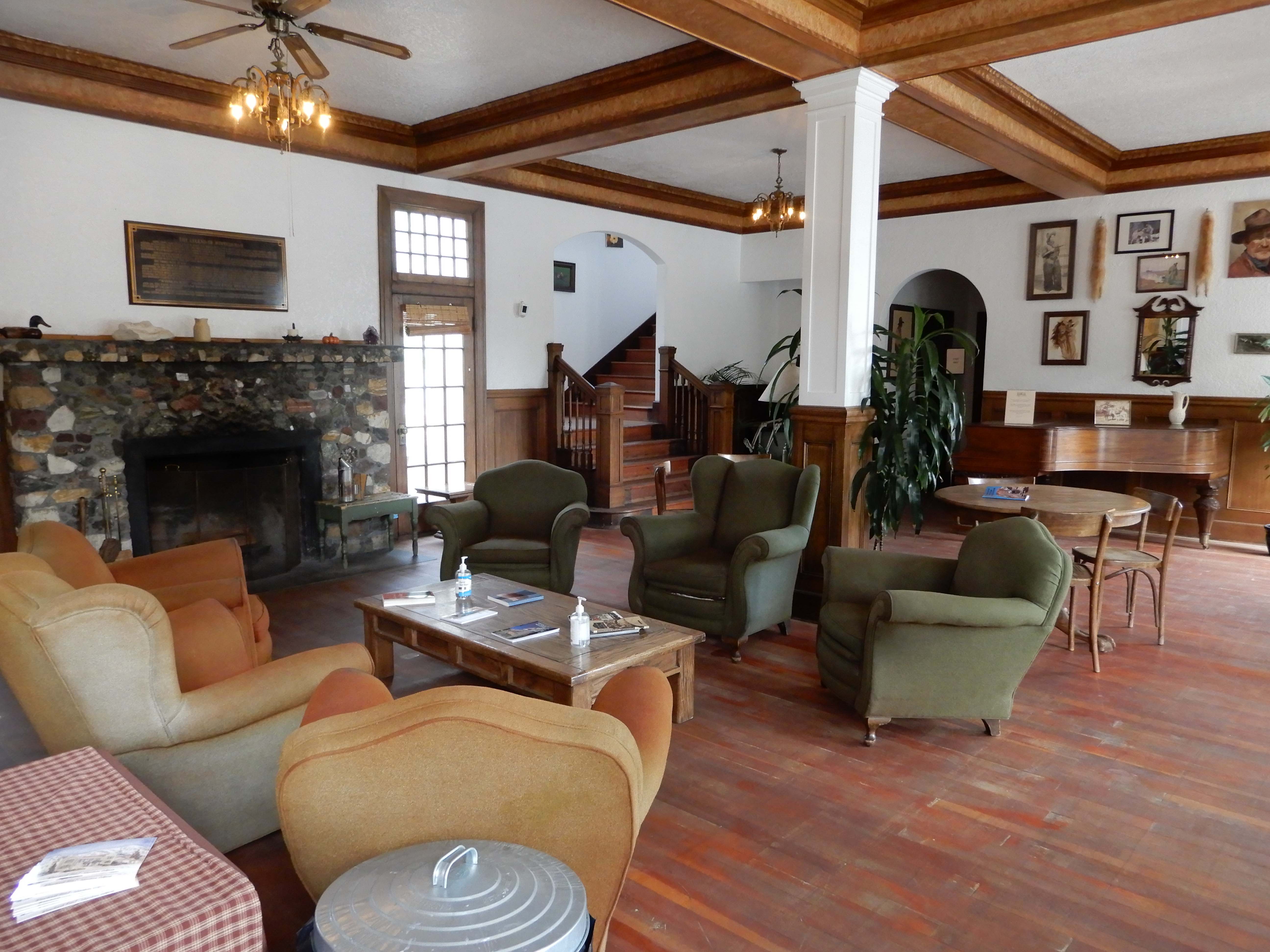
Lobby of the historic Winnnedumah. Photo by Eric.
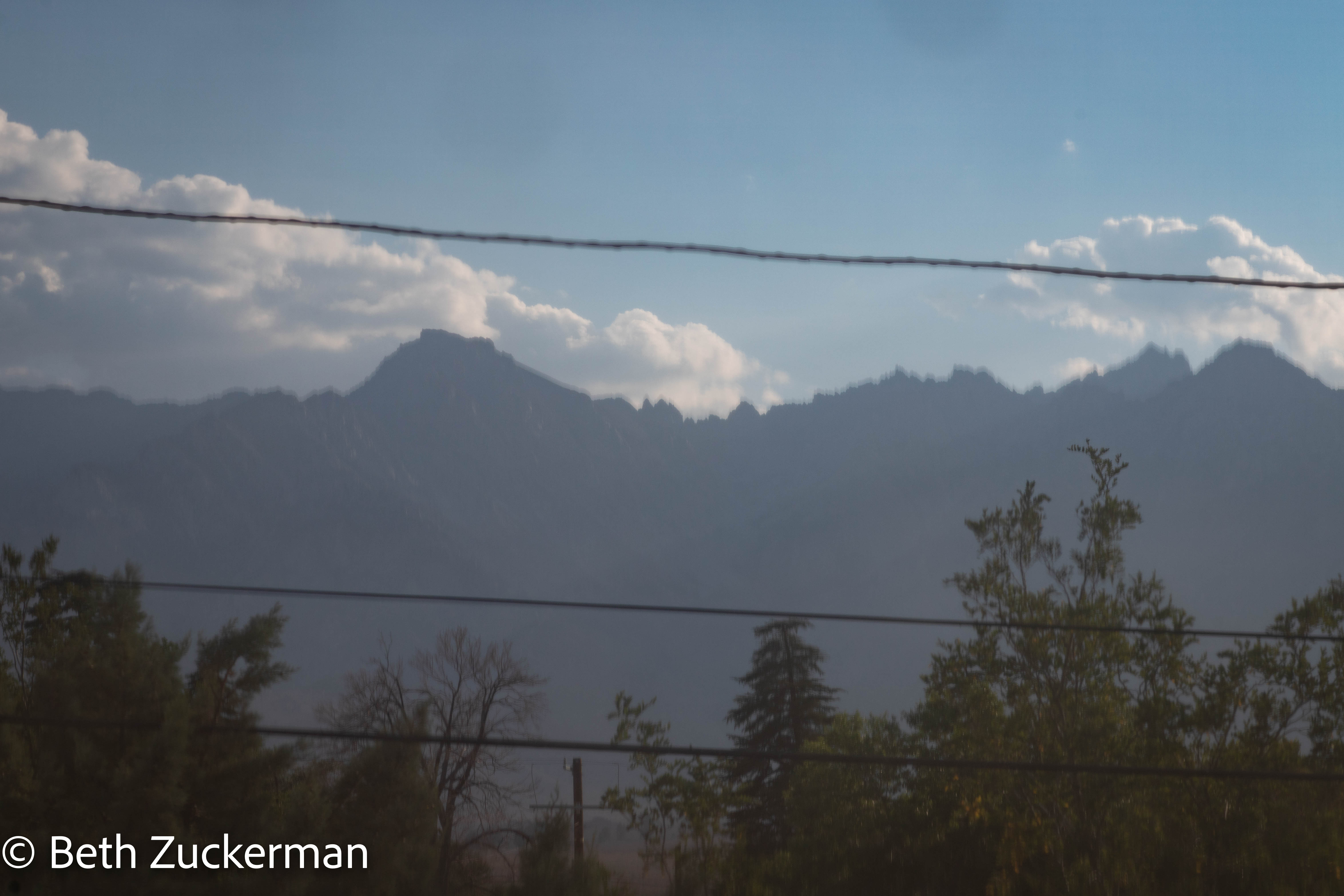
Our room on the southwest corner of the Winnedumah, facing the Sierra crest.

View from our room, full of phone wires. We should just bury them all underground.
The whole trip, even though at elevation, was so hot. While I had carefully packed, in addition to the Arctic parka, a wool hat, wool neckwarmer, wool sweater (all from Norway), smartwool socks, and an Icebreaker 260 base layer, I found myself in the highly unusual position (for me) of only feeling vaguely comfortable when standing directly in front of the air conditioner.
While this 1,345-km (836-mi) road trip was far less grandiose than what we normally would have done for a landmark anniversary such as three decades, we definitely had a satisfying and romantic expedition. We did cross one more California county off of our geocaching list, and we did "visit" a national park, cruising through the Yosemite high country on the way home. It was so good to be out on the road adventuring together again after so long!
Last updated: 30 July, 2021 by Eric and Beth Zuckerman