Icefields Parkway--Banff and Jasper National Parks
Monday 17 June, 2024
Looking down from the roadway at Cirrus Mountain viewpoint. A fault runs through here. Photo by Eric.
After two days of long, steep hikes, I planned a relatively easy day of mostly driving, along the famed Icefields Parkway. Known as one of the most scenic drives on Earth, it features views of jagged mountains towering above the parkway.
Alas, it was snowing when we got up, and it continued to snow much of the day. Fog obscured many of the views we had hoped to see.
Our first stop was bubbling springs, where bubbles come up in the spring from some source at a higher elevation.
Beautiful Tangle Falls, right beside the road.
Snow continued to fall on us as we visited the falls.
As there was only one gas station along the Icefields Parkway, we stopped for some very expensive gas at the Saskatchewan River Crossing. The gas jockey was ready and prepared so that I did not have to undo my seat belt, pull the parking brake, and put the engine in neutral in order to reach the credit card reader. I was highly amused.
Eric photographed a goat as traffic was stopped at the Saskatchewan River Crossing.
Our Canadian friend Brad, who is very well traveled and maintains that Banff is the most beautiful place in the world, recommended a visit to Peyto Lake.
We hiked 700 m/.4 mi out on a paved trail to the viewpoint, but it was completely fogged in. You're supposed to be able to see a glacier above the lake.
Us at Peyto Lake.
Ben Gadd's Canadian Rockies Geology Road Tours brought us to Mistaya Canyon, a gorge carved in middle carbonate rock, similar to Marble Canyon and Johnston Canyon.
Eric's view looking down from the bridge.
Another of Eric's views of this incredible gorge.
This being our third such gorge, we knew that somewhere in there would be a waterfall.
Us at Mistaya Canyon.
We headed back north, and found that views at Waterfowl Lake were much more clear than they were when we had passed by southbound.
Us at Waterfowl Lake, with more fog cleared.
We got hopeful that the weather was changing, and turned around and went back south for another opportunity to see Peyto Lake. But hikers coming back to the parking lot said it was still completely fogged in. Waterfowl Lake is at a lower elevation. We gave up and turned northbound again.
Beautiful Hilda Peak, from a roadside viewpoint.
Stutfield Glacier from another roadside viewpoint. The glacier splits in two and comes down around both sides of an uneroded part of the mountain.
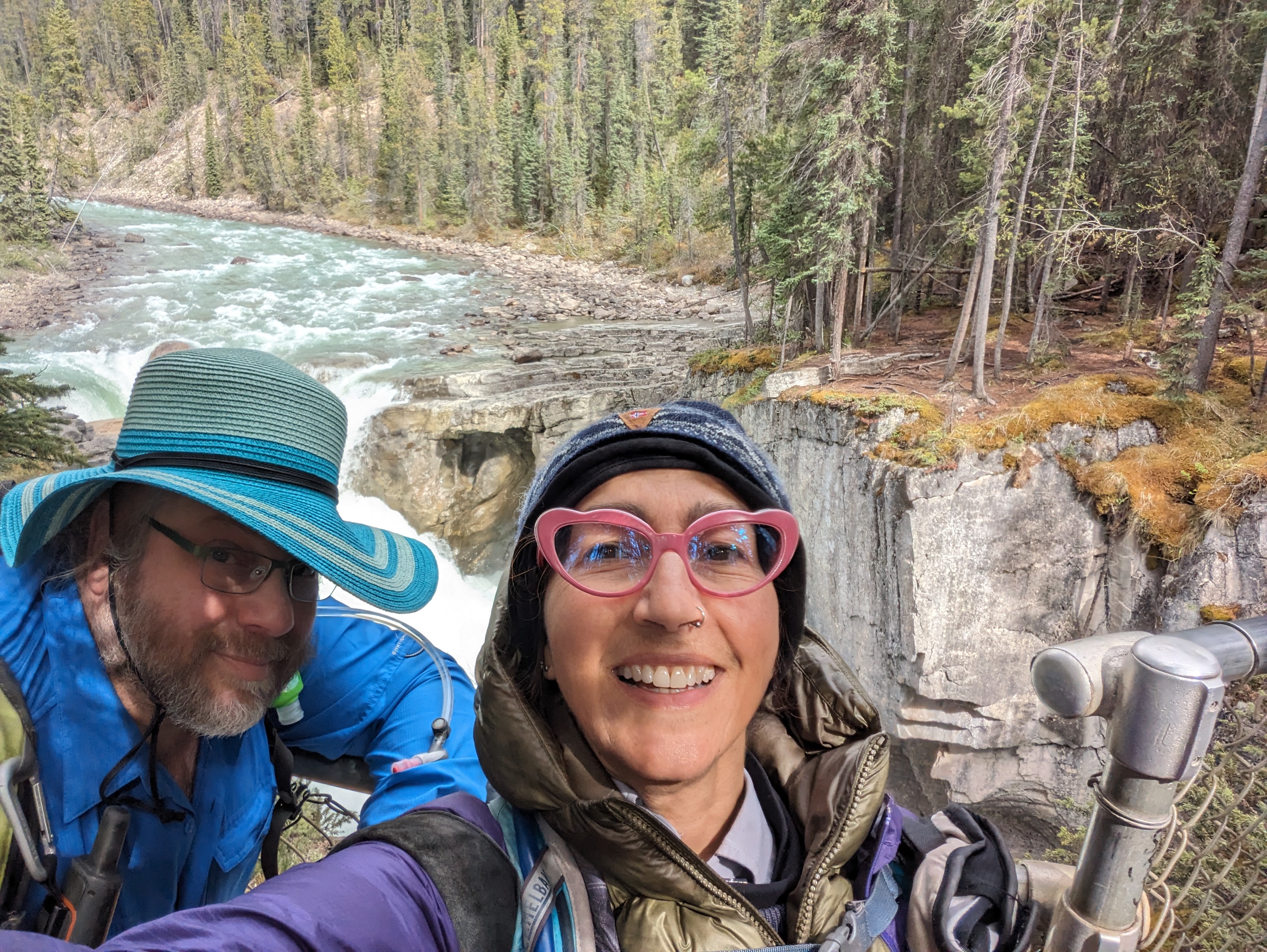
We took a brief walk down to Sunwapta Falls, just a short jaunt from our lodging.
Eric had lost his favorite sun hat somewhere along the way, and the only shopping for more than an hour's drive in either direction was a couple of gift shops. He decided he had three requirements for a replacement hat: (i) broad brim; (ii) chin string, with cinching mechanism; and (iii) fits his large head. He had thought that "men's hat" would be subsumed by item (iii), but he couldn't find any men's hats with chin straps. He did find a hat that met his requirements.
We did not have time to visit a couple of remaining sites on the Icefields Parkway north of our lodging in Sunwapta Falls, but we had a good day of sightseeing in spite of the weather and snowy, overcast conditions much of the day.
On to Wilcox Pass.