Channel Islands National Park
Saturday-Monday, 14-16 December, 2023
Scorpion Landing, Santa Cruz Island, CA.
Midwinter is always a dark and difficult time. From 2008-2020, we spent a whirlwind week visiting friends and family in the northeast, culminating in the grand and friendly party that is the Arisia science fiction convention. For the third year now, COVID has prevented us from carrying out our accustomed itinerary and seeing our people. To add to our unhappiness, we have been hit by incessant storms since before Christmas. We have spent weekends mostly cooped up in the house, unable to get out to parks. The rain has been so constant and so heavy that even a few minutes in the yard were unpleasant.
So, in an effort to overcome seasonal depression and comfort ourselves over missing our usual vacation, I planned an excursion for the three-day weekend celebrating the birth of the Rev. Dr. Martin Luther King. I looked carefully at weather forecasts around the state. The Sierra was right out, but the central coast was looking like it might have a relatively dry period on Sunday. I booked a boat trip out to Anacapa Island, reserved a motel in Port Hueneme, and did the geocaching research for visits to three lighthouses.
We set out around 9:30 on Saturday, with the idea that we could take our time getting out in the morning and still have time to do a little bit of exploring around Santa Barbara before the early fall of darkness. Unfortunately, I realized, in Fremont, that I had left my hiking pack, with my wallet, back at the Zuckershack in the garage. So, we had to turn around and go back home, costing us almost two hours.
The travel was discouraging. We drove down US 101 all day in driving rain. There was so much water, everywhere. While we managed to reach Santa Barbara before it was entirely dark, we found that the lighthouse had been permanently closed. You couldn't even see it from anywhere you could walk to, and the whole area was surrounded by fencing with incongruous signs that said "US Government" and "Private Property."
It was around this time that I checked my email and found a notification that our trip for the next day had been canceled. We could have a refund, or, if we would like, we could go to Santa Cruz Island instead. I called and said that, assuming it wasn't raining heavily, we'd like to do the alternative trip.
So, we headed south and checked into the Seaside Motel in Port Hueneme, near the Oxnard boat landing. We would instead now be heading out of Ventura, about 20 minutes' drive further north. We ran back and forth in the downpour to unloaded our bags from Mather into a superbly awful motel room.
What can I say? It's not just that it was small and that the lighting was bleak. It's not just that it was missing many items that you would think would come standard with a motel room--hand-sized towels, hot liquid cups, a coffee maker, a do-not-disturb tag, table lamps. Good thing we had brought our own electric kettle! The closet was so full of the owners' belongings that it was unusable, in addition to being difficult to open, tucked as it was behind one of the nightstands. The single chair, which took up most of the area through which you walk around the bed, had armrests that prevented it from being pushed under the desk, and at the same time was difficult to roll around because it was missing a couple of casters. "Couldn't you have booked the second-worst motel in town?" Eric asked.
We got a GrubHub delivery of Thai food and planned our revised outing. Unpacking containers and eating in the bed, I desperately missed the restaurant experiences that used to be a part of travel. But the research got me excited about the next day. While Santa Cruz Island lacked a beautiful lighthouse, it had a lot more hiking than Anacapa Island. There would be opportunties to see some endemic birds and mammals. We had been to Channel Islands National Park before, but only on a liveaboard dive boat (the ill-fated Conception), back in 2003. This would be an opportunity to set foot on land.
A cute road-trip decoration at the boat landing.
The boat ride out was much fun. We met Sarah(?), visting from Chicago, and a couple of her friends. She identified me as a birder by my binoculars, and we talked about the birds we hoped to see. It turned out we had several other interests in common, and it was a fun conversation. Then we caught a glimpse of a Gray Whale. Our guide told us that they mated in groups of three or more.
Once we landed, Eric took the obligatory park sign photo.
Eric also photographed our vessel, the Island Adventure. It was 10:40, and we were to report back to the dock at 15:45 for a 16:00 departure. That menat that we had five hours in which to do a moderate 7.2-km/4.5-mi hike. Given our typical pace of at most 1 mph, I was concerned. There was camping on the island, but we had only day-trip gear with us, so the consequences of missing the boat would be disastrous.
The trail climbed steeply up from the harbor. Photo by Eric.
Eric took a picture of my hiking along the ridge, hands in my pockets for warmth.
The island has many endemic plants, so we took pictures of every plant we saw that we didn't recognize. The first one is a Liveforever.


We hiked out onto a broad bluff and admired the view of Anacapa Island in the mist. Photo by Eric.
We reached the high point on the trail and found our first geocache of the year--Terrain 5!--amongst this ancient oil drilling equipment. It was a virtual cache, since physical caches aren't allowed in national parks. Photo by Eric.
On our way down into the canyon, I photographed the beauty of the hills around us.
As we came down into the canyon, the beautiful blue endemic Island Scrub Jay posed for Eric.
I spotted a Golden-crowned Sparrow.
I photographed this bird from a great distance, impressed at the resolution of my new camera. I thought it was the endemic Island Loggerhead Shrike, but, in looking at the photos, it seems to be a Northern Mockingbird.

The trail back down to the river was extremely muddy and slippery. We had to ford the river twice. I was impressed with the performance of my new boots.
As we hiked back toward the boat landing along the river, we spotted this endemic Island Fox.
We came to a campground, where some campers had spent a very wet night. We had eluded this fate due to Eric's insistence that it was January and we should stay in a motel. The campground was in an incongruous Eucalyptus grove, no doubt planted in a less enlightened age.
Within the Eucalyptus grove, I spotted this on a tree. I think it is guano.
There was also this incredible... protist. A slime mold?
As we approached the boat landing, another fox got very close to me. It is unclear whether they are unafraid of humans because they are not hunted or because people irresponsibly (accidentally or on purpose) feed them.
I spotted the endemic Island Song Sparrow.
We had hiked 7.2 km/4.5 mi, on a moderate trail with 250 m/820 ft of elevation gain, and arrived back at the trailhead with time to spare! So we started looking for another Terrain 5 geocache, a multi-stage cache where you needed to see something on the island in order to obtain the coordinates to find the actual physical cache back on the mainland.
The information we needed was in a collection of old farm equipment that the Park Service had arranged for viewing. Photo by Eric.
I liked this broken-down wheel with the tire still partially attached.
I found these... invertebrates growing on the equipment. I think they are Scaled Worm Snails
More Scaled Worm Snails on the farm equipment.
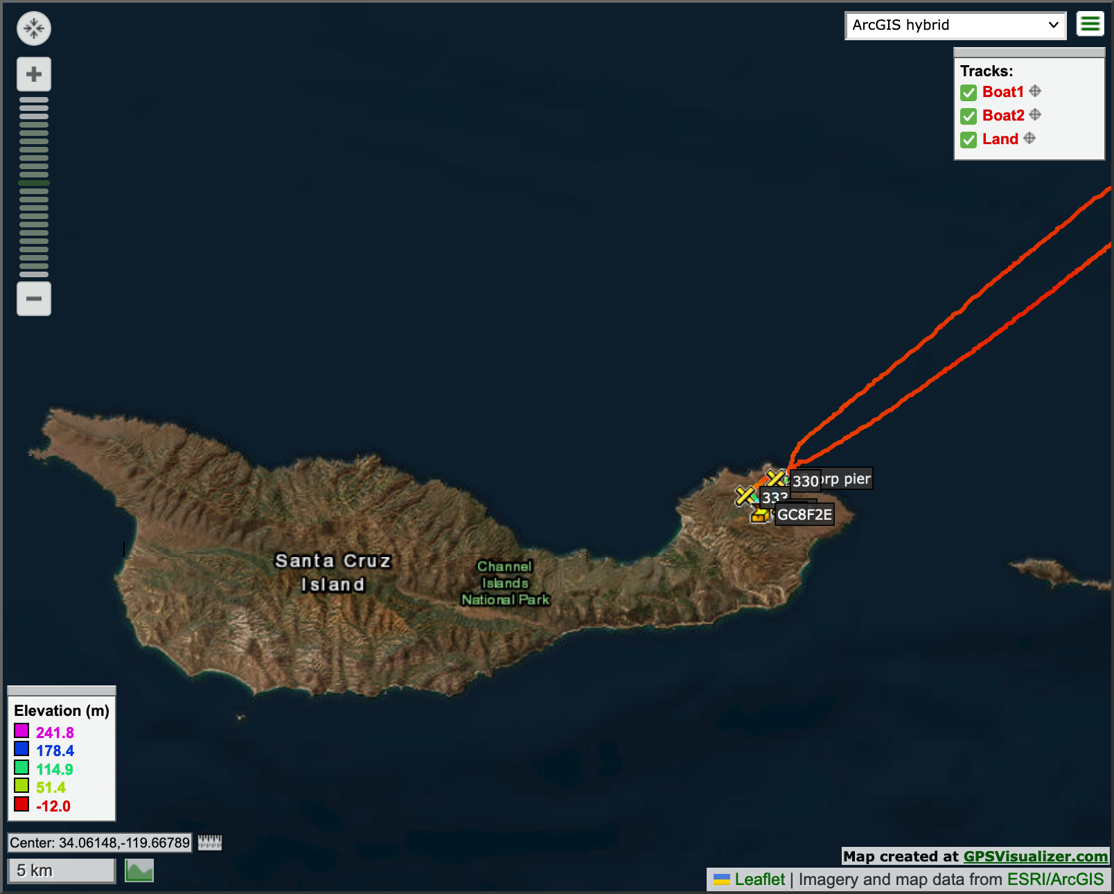
Map of our hike.
While we had had a blissfully dry (if muddy) day up to that point, while we were examining the farm equipment, the rain really began to fall. We were quite wet by the time we boarded the boat for the return journey. We found some outdoor seating under an overhang, but it was still a sopping trip back. I don't think my camera bag has been this wet since we celebrated our 25th anniversary in New Zealand back in 2016.
Map zoomed out to see more of boat trip and context.
We drove back to the horrible motel in Port Hueneme and unloaded our very wet things, setting them up in the room to dry out. We got another GrubHub delivery, this time of some questionable chilaquiles that were reasonably tasty at the time but that later made my insides very upset.
In the morning, we drove out to a county park and found the second stage of the cache in a grove of trees not too far from the parking lot. Our first two caches of 2023 were Terrain 5!
On the way back home, we tried to look for a geocache at Emma Woods State Beach. The road out to the beach was closed because of fallen or washed-up debris, but I played with my camera.
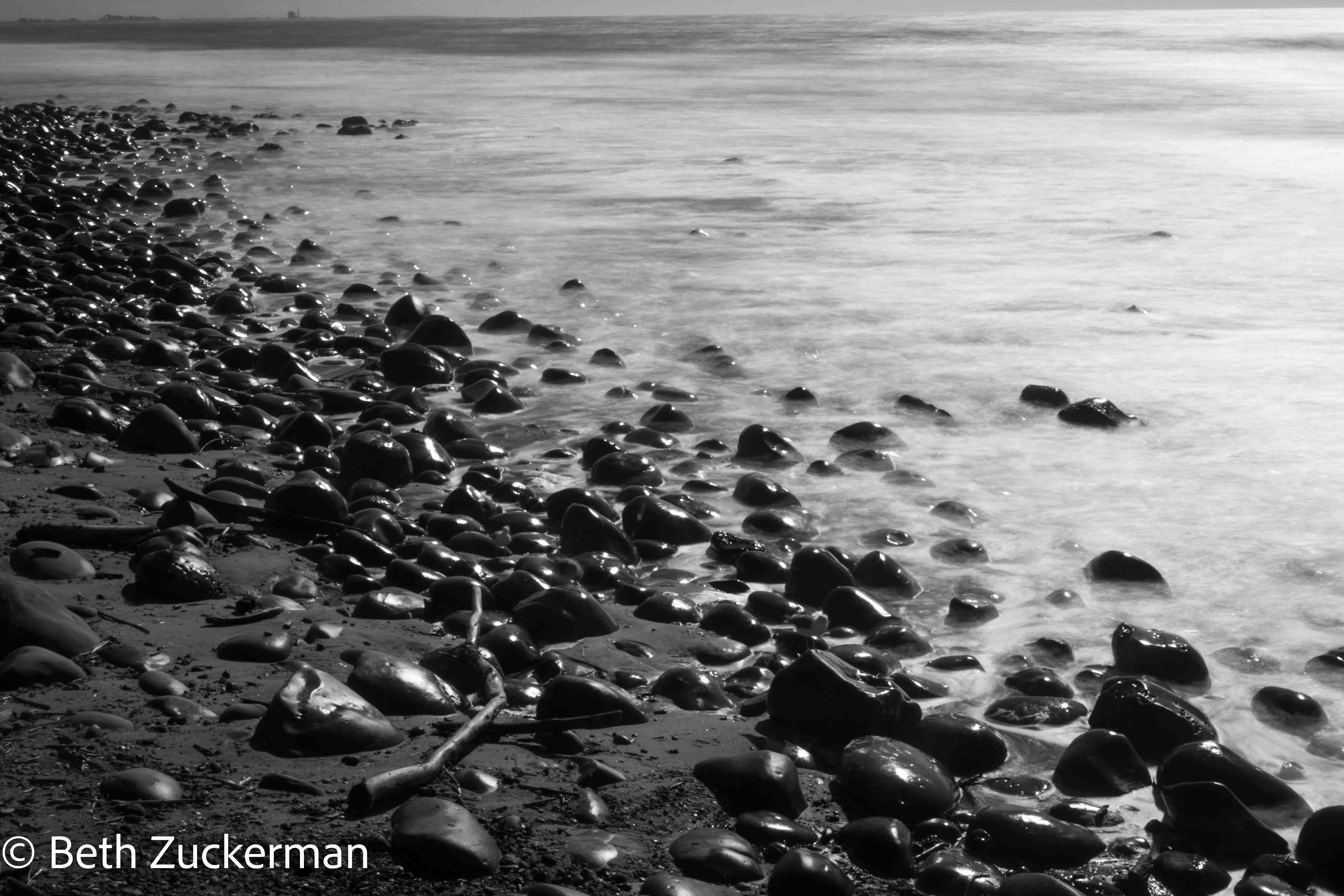
Eric took a picture of my playing with my camera.
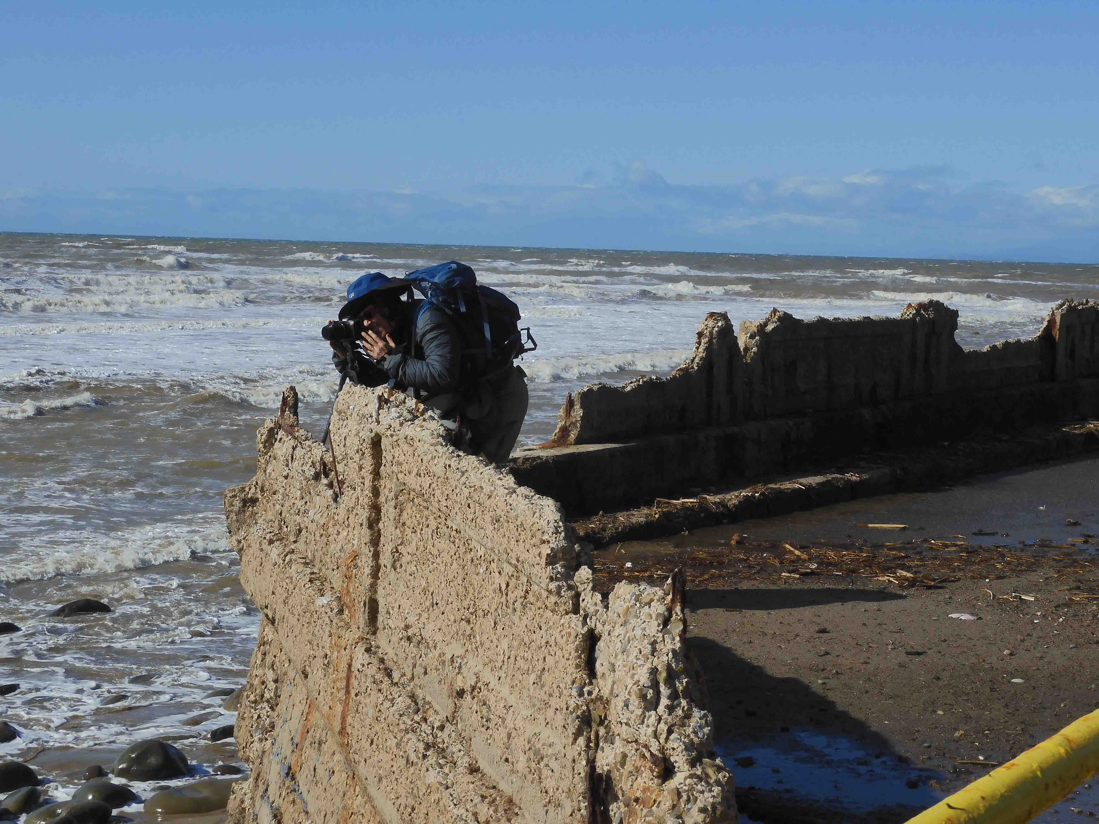
It was early in the day, and we had thoughts of trying to check out some more of the beaches along the coast, but it was the same story everywhere: closed. Such extensive damage!
We turned inland up 101 and headed back to the Bay Area in on-and-off rain. I had to adjust the wiper speed almost constantly. A bit south of Salinas, we saw a remarkable sight that I was unable to photograph: a snowplow pushing a huge spray of water off of the freeway! Did they really bring snow equipment down from the Sierra to manage flooding on major roadways?
While there were some issues with weather, travel, and cancellations, we managed to have a pretty good cheering ourselves up trip, doing some wonderful hiking and seeing some incredible wildlife.