Canyonlands National Park
Tuesday 27 September, 2022
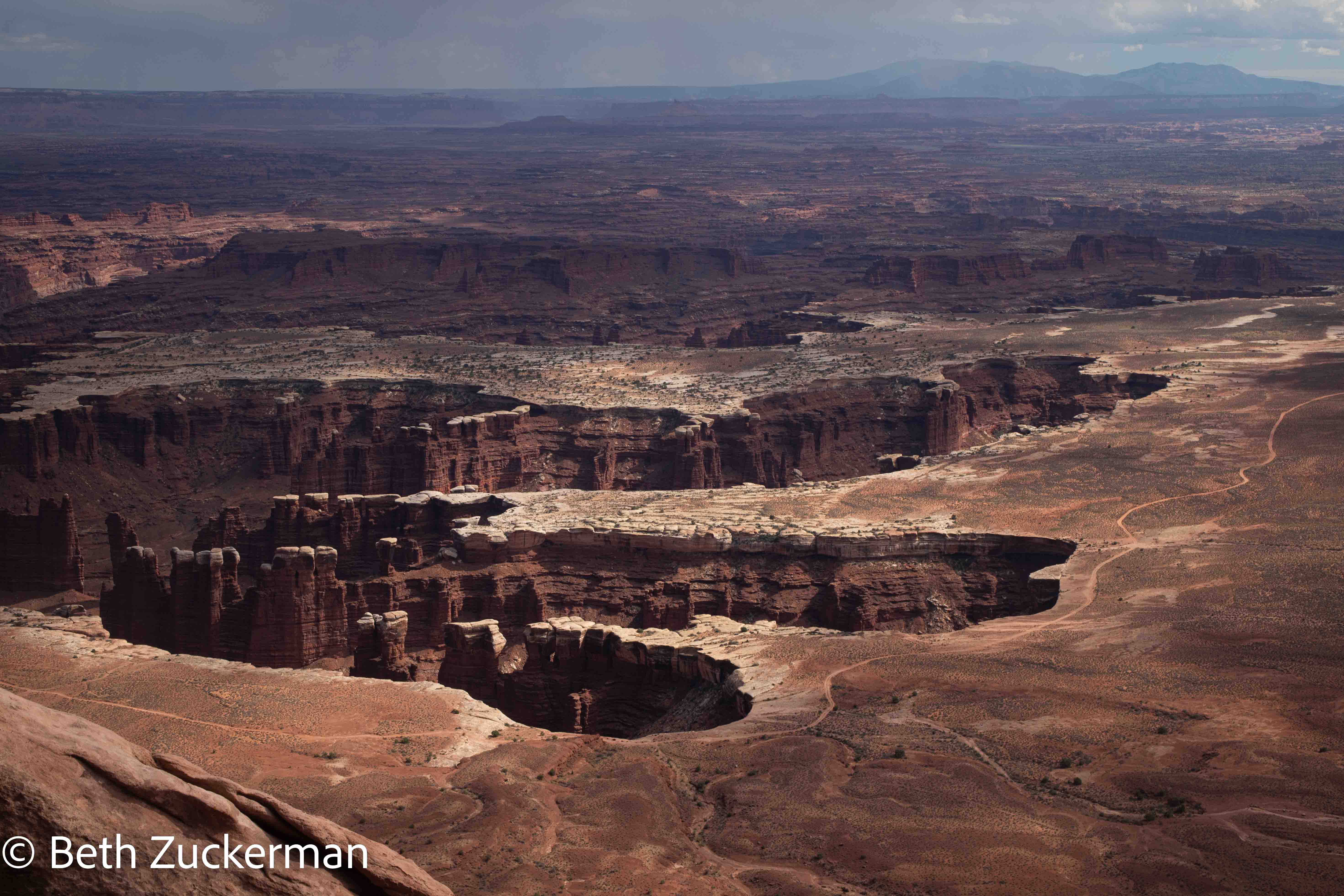
Looking down into the canyons from Grand View Point.
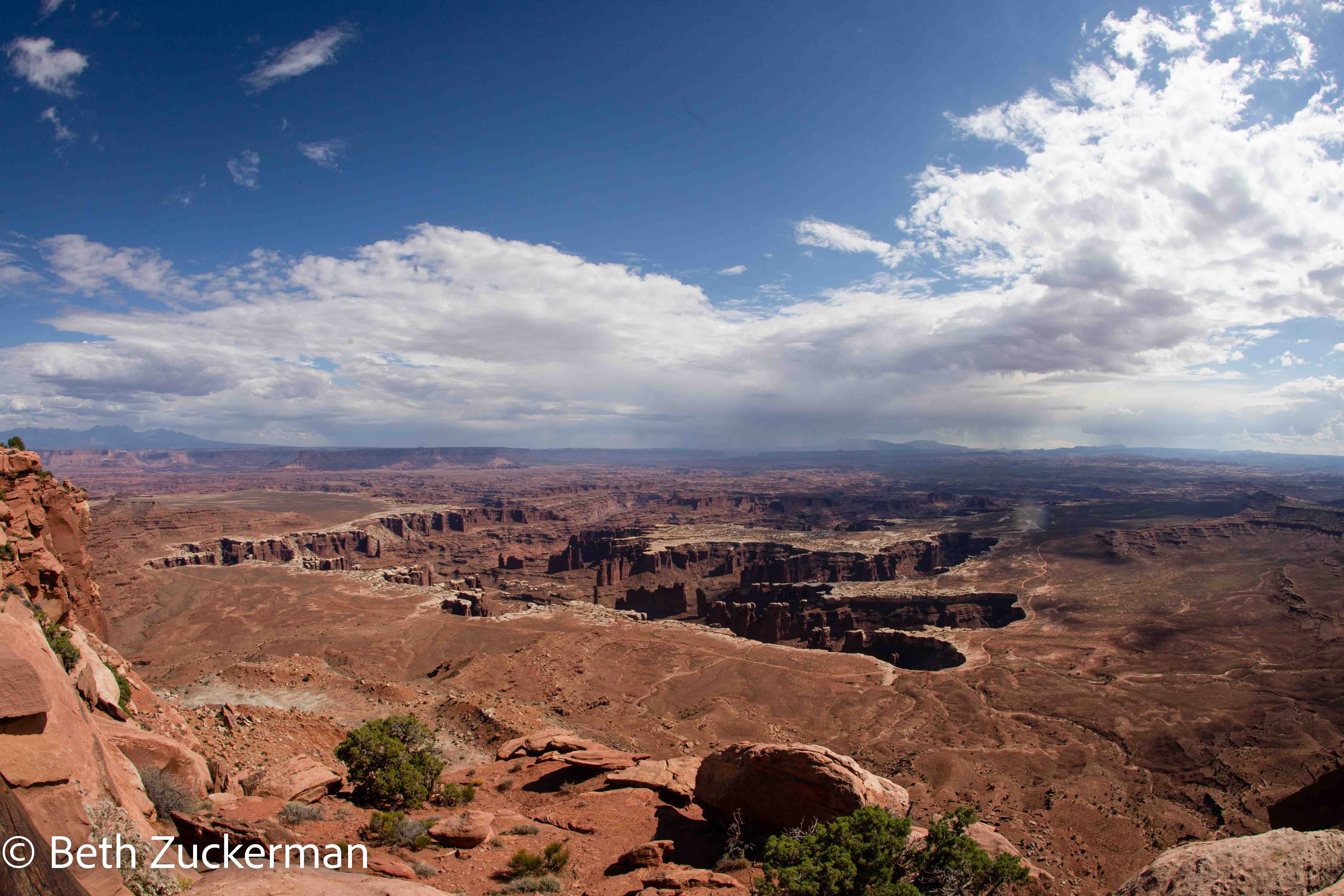
Canyonlands National Park lies where the Green River joins the Colorado River. Here, as at Bryce Canyon, Zion, and Grand Canyon, the Colorado River has cut through layers of beautiful rocks, exposing eons of geologic history. Rocks from the Pennsylvanian Period of the Paleozoic Era, 290-340 million years old, are visible at the bottom of the 670-meter/2,200-foot canyon.
The park has three major areas, two of which are remote and difficult to reach without a vehicle more stout than Mather. I had made a plan to visit the outskirts of the Needles area, which should have been passable for us, but the primary paved road to that point was closed for construction, necessitating a multi-hour detour. So, we limited our Canyonlands visit to the most accessible and most visited area of the park, known as Island in the Sky, the high overlook above the canyons.
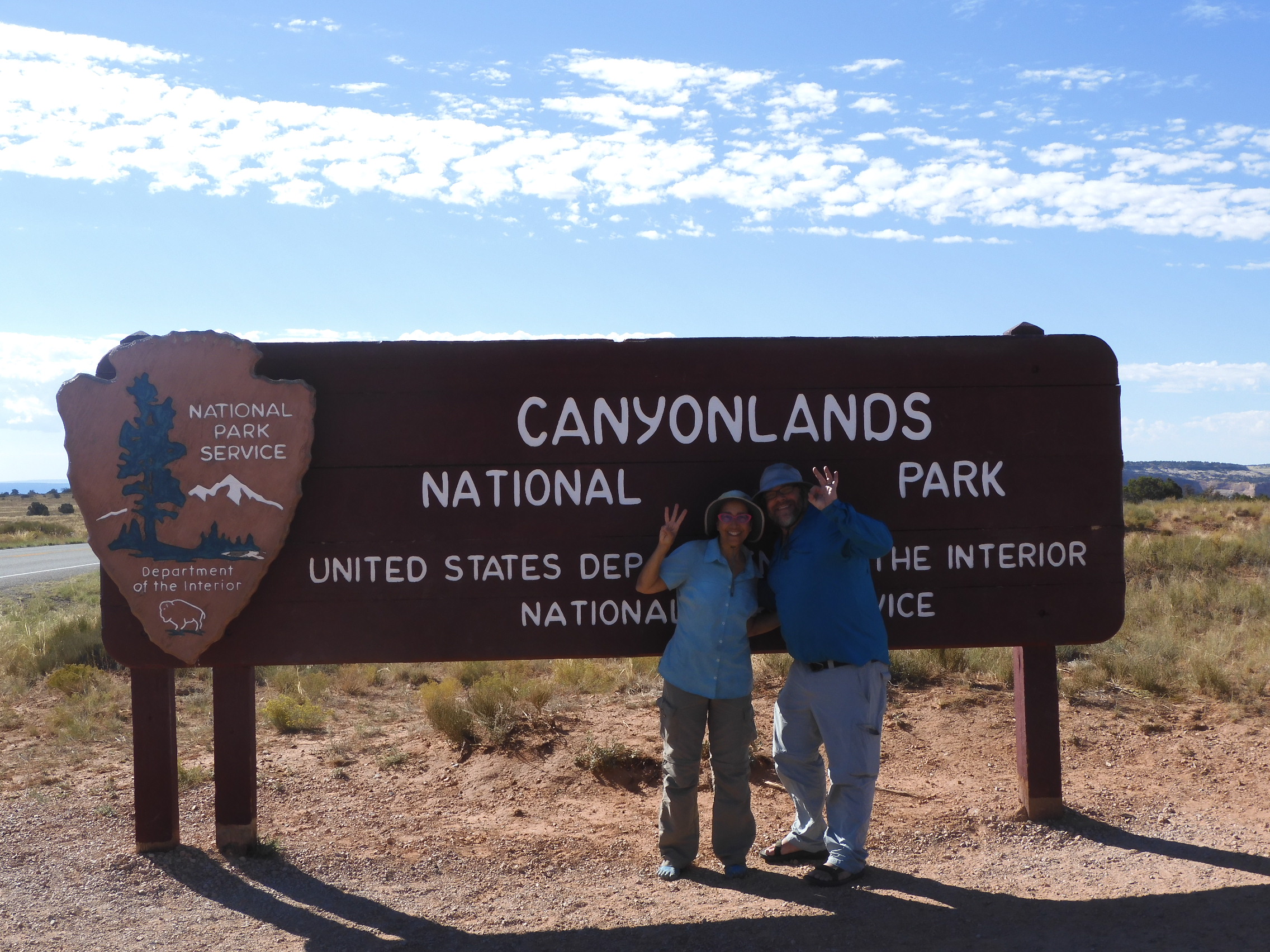
Eric set up a photo of us at the monument sign. Our 30th US national park together!
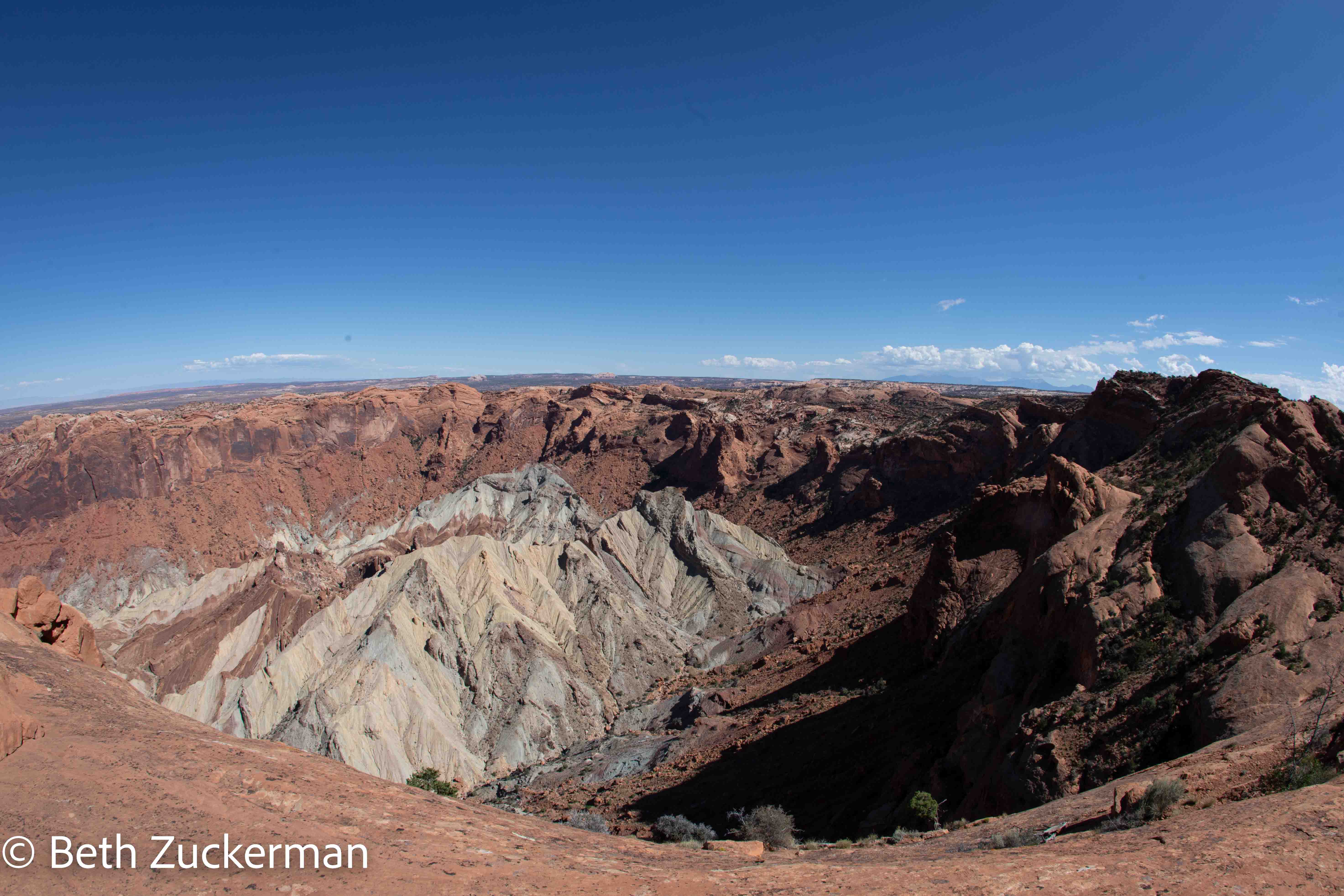
We hiked out to see Upheaval Dome, a geologic mystery, along this expanse of rock.

Upheaval Dome has puzzled geologists for years, but most now believe it is a remnant of a meteorite strike. The dome arose after the strike, in the same way that a bubble of water pops up out of a pond after you drop a stone into it. [Geology Underfoot in Southern Utah, Orndorff, Wieder, & Futey, 2006]
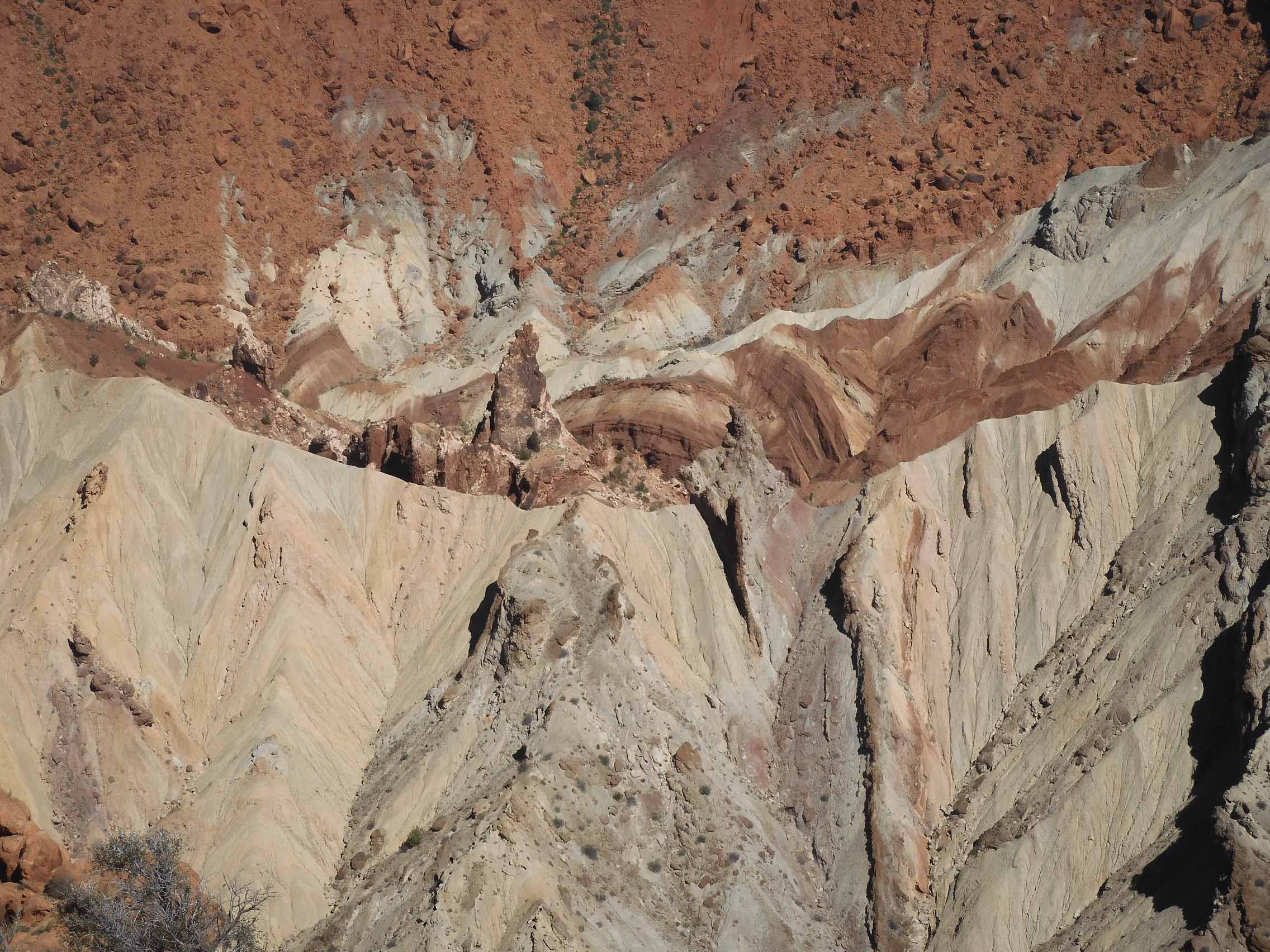
Eric's detail shot of Upheaval Dome.
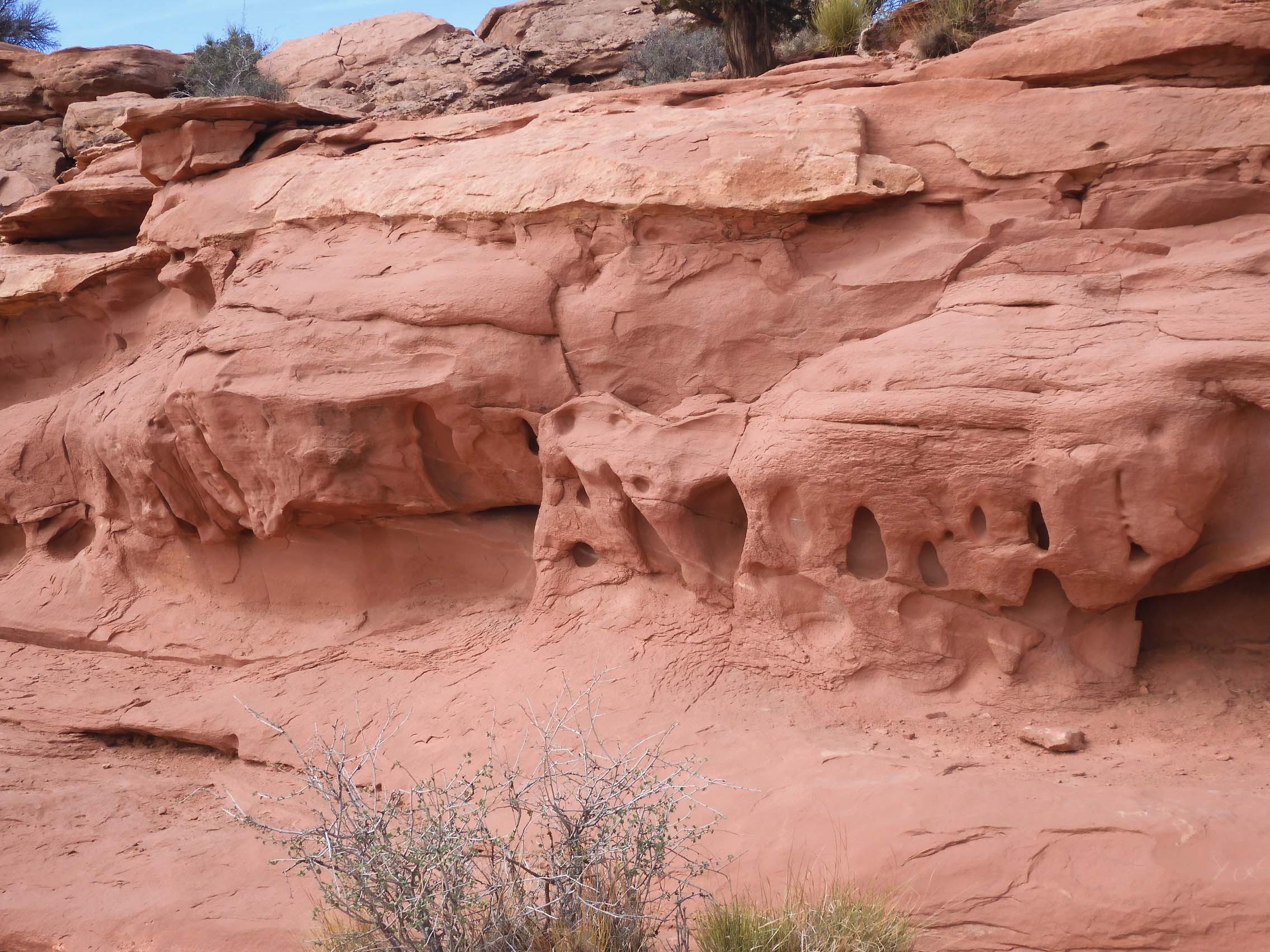
Eric found tafoni, water erosion, along the trail out to Grand View Point.
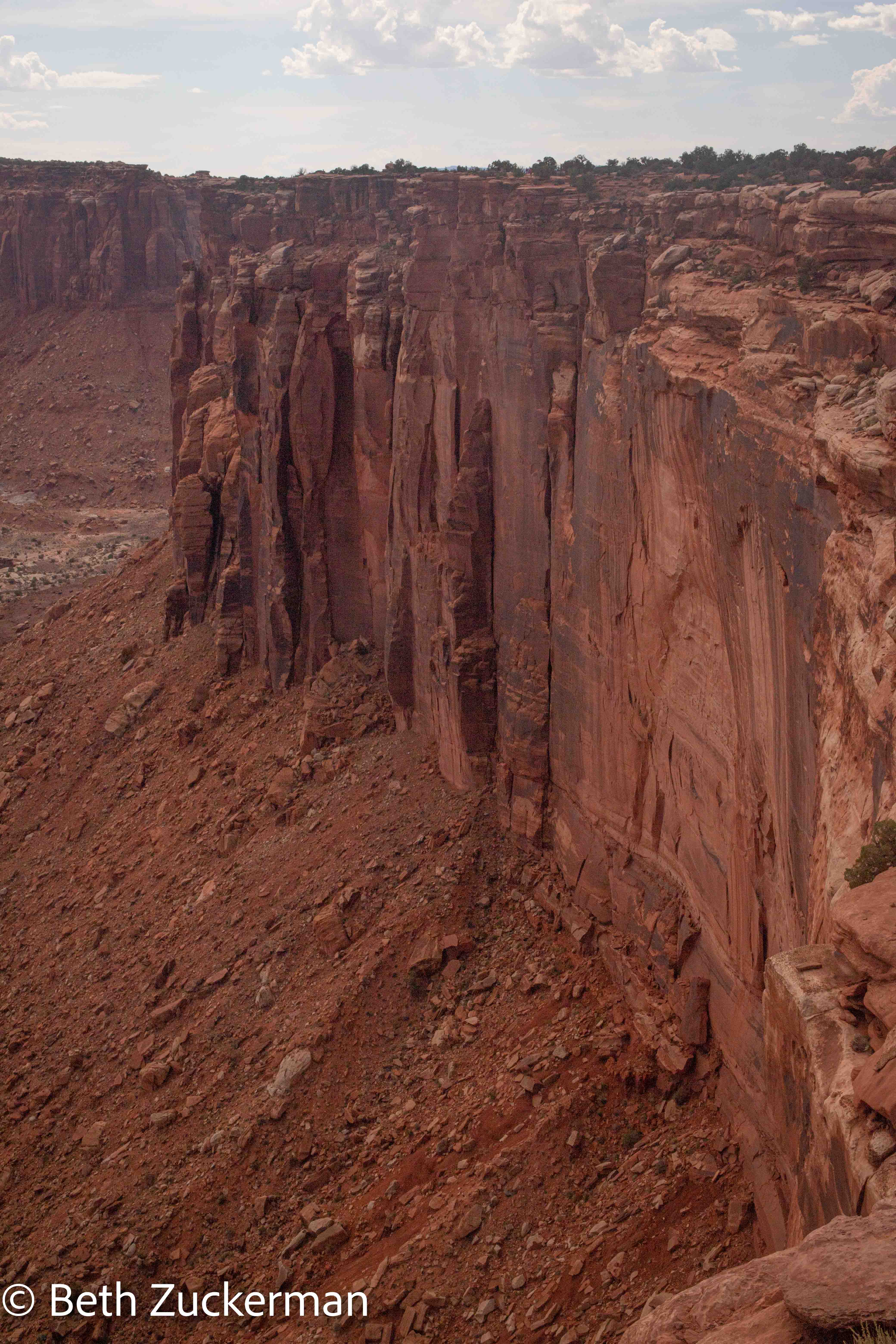
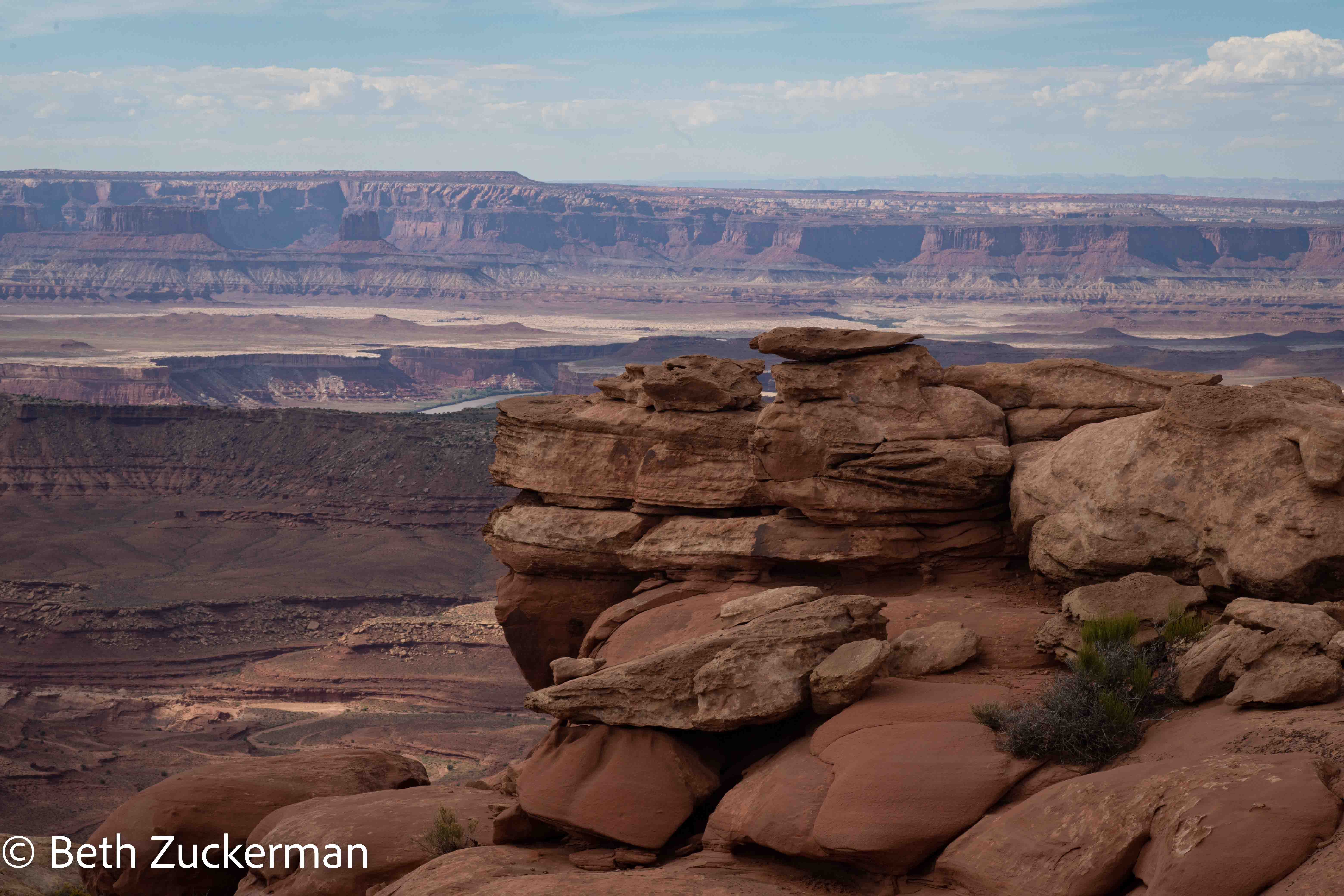
I believe these dramatic vertical cliffs are Triassic Wingate Sandstone.
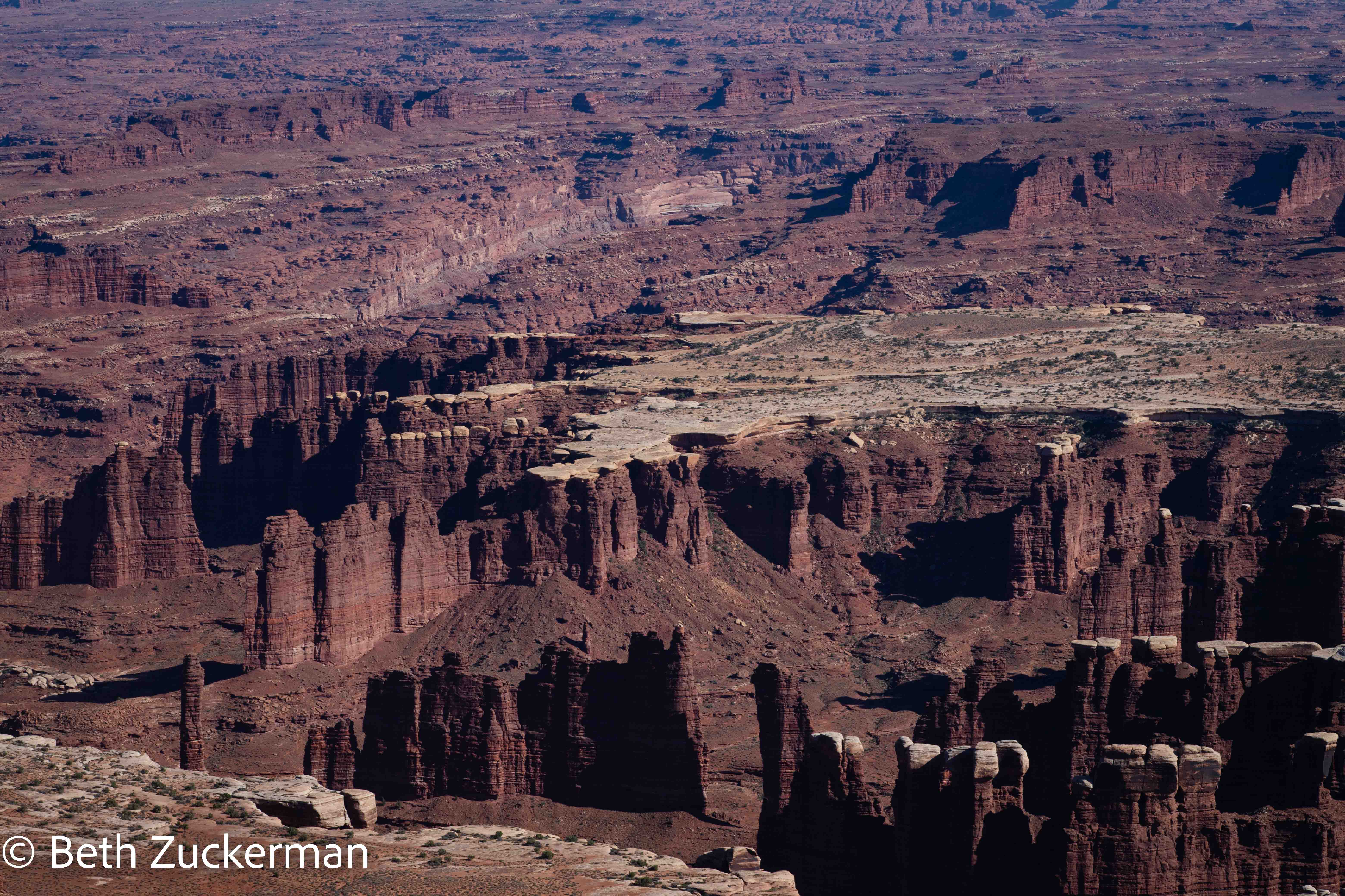
The canyons of the Needles look like fingers spread across the land.
Distant feature.
View from Grand View Point, Green River in background.
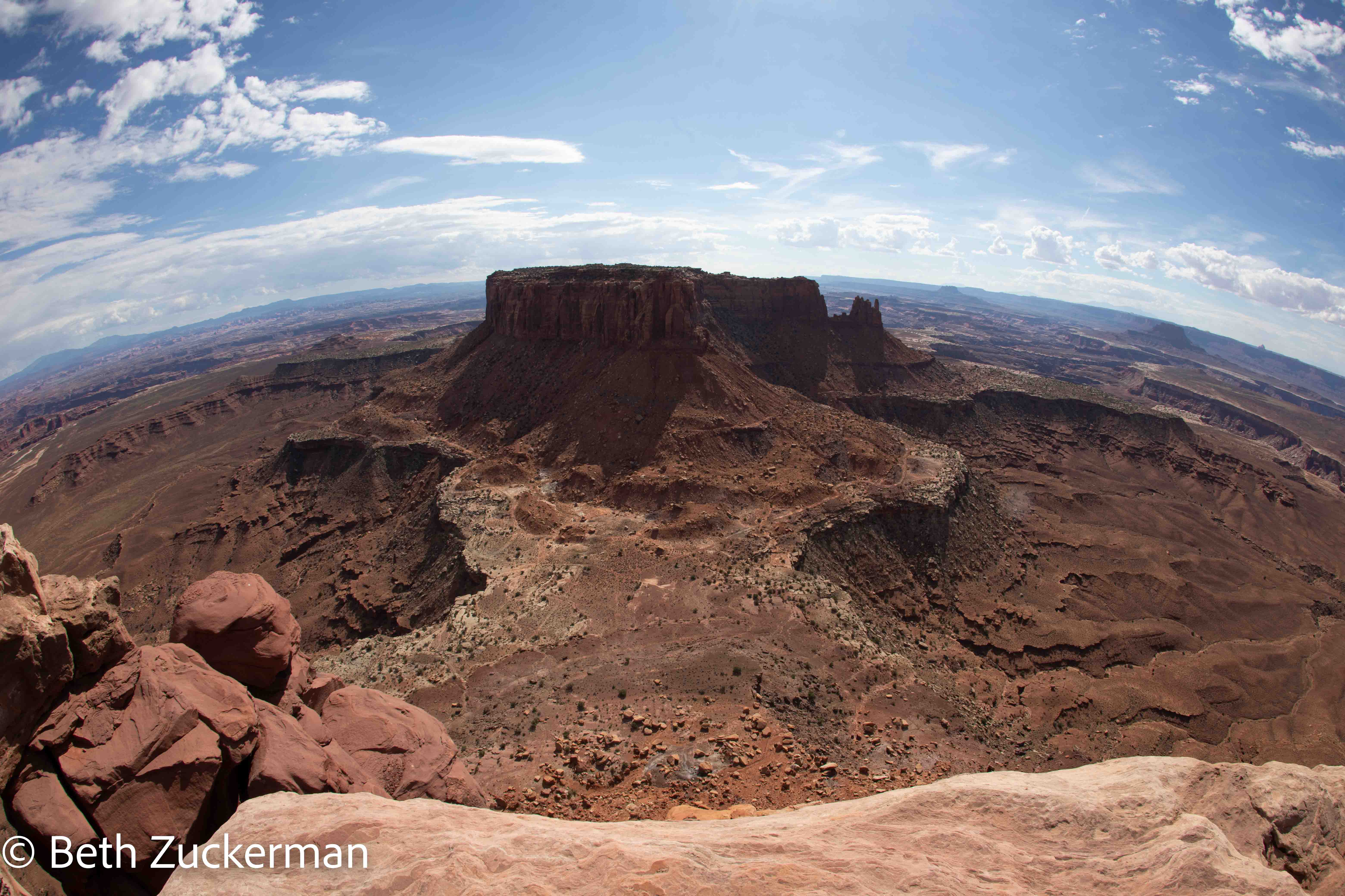
Looking down from Grand View Point at the dramatically-carved canyon.
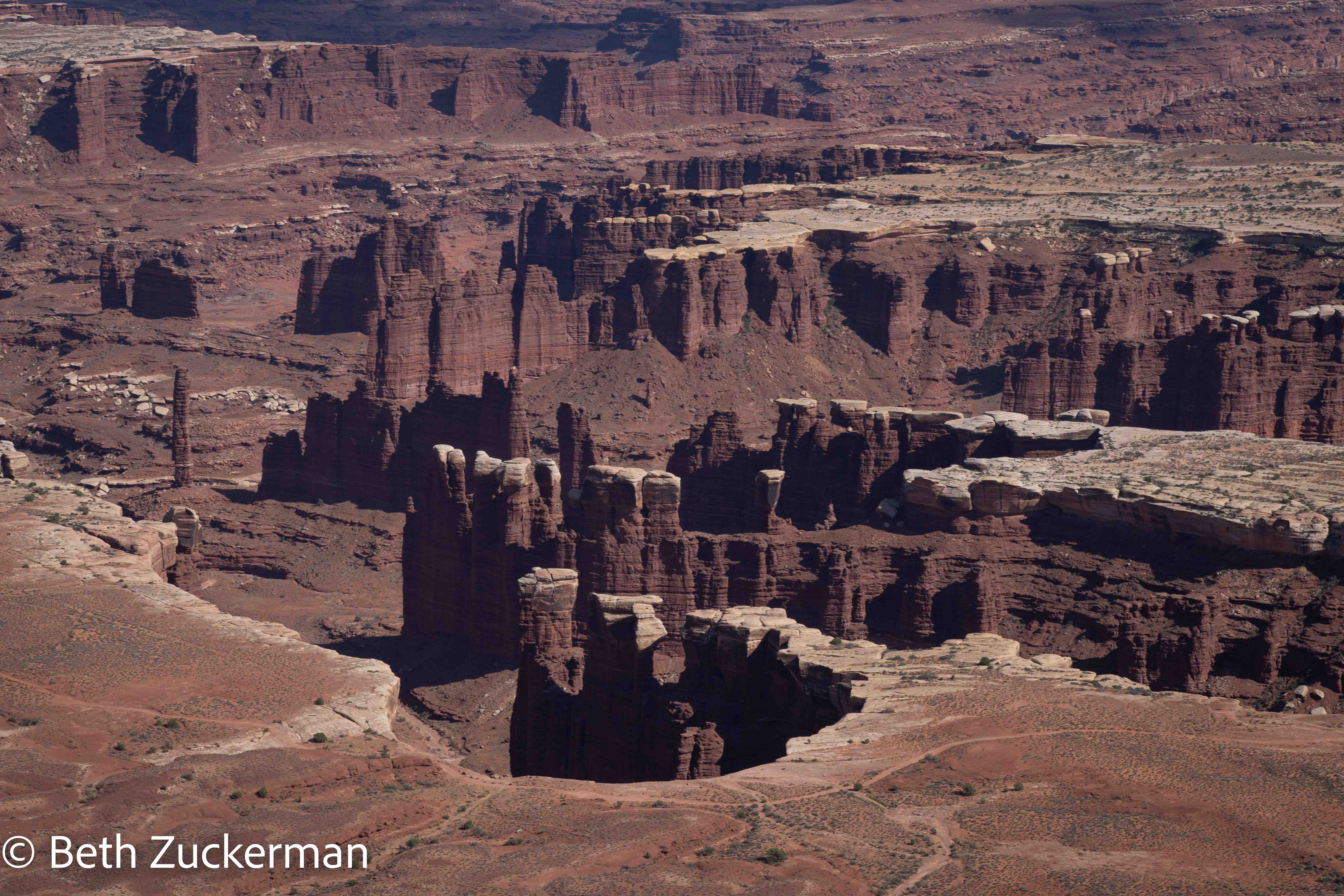
Peeking down into the Needles from Grand View Point. The Needles were formed by erosion of Permian Cedar Mesa Sandstone along intersecting sets of joints. The proximity of the joints to each other created this fascinating landscape. [Pages of Stone, Chronic & Chronic, 2004]
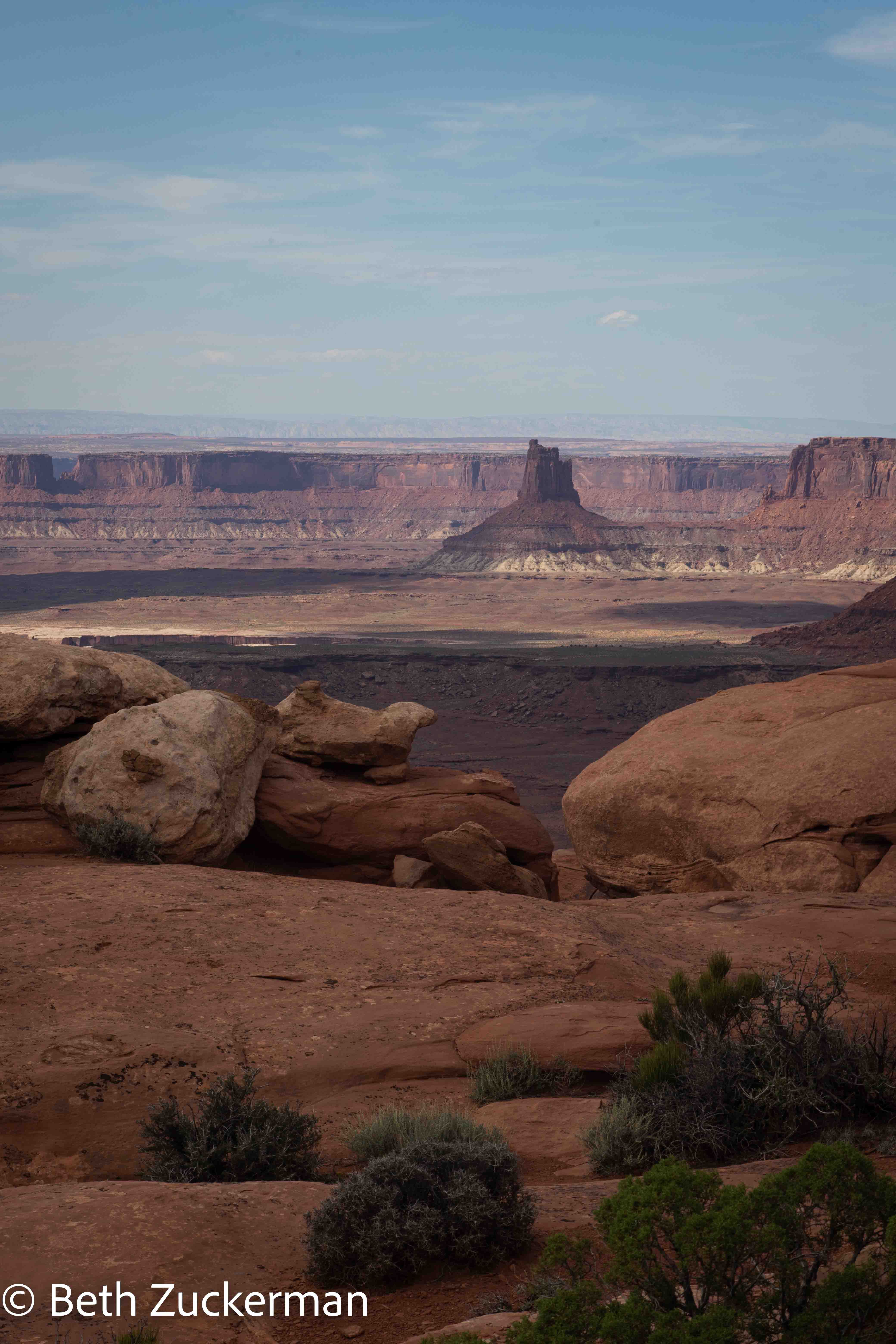
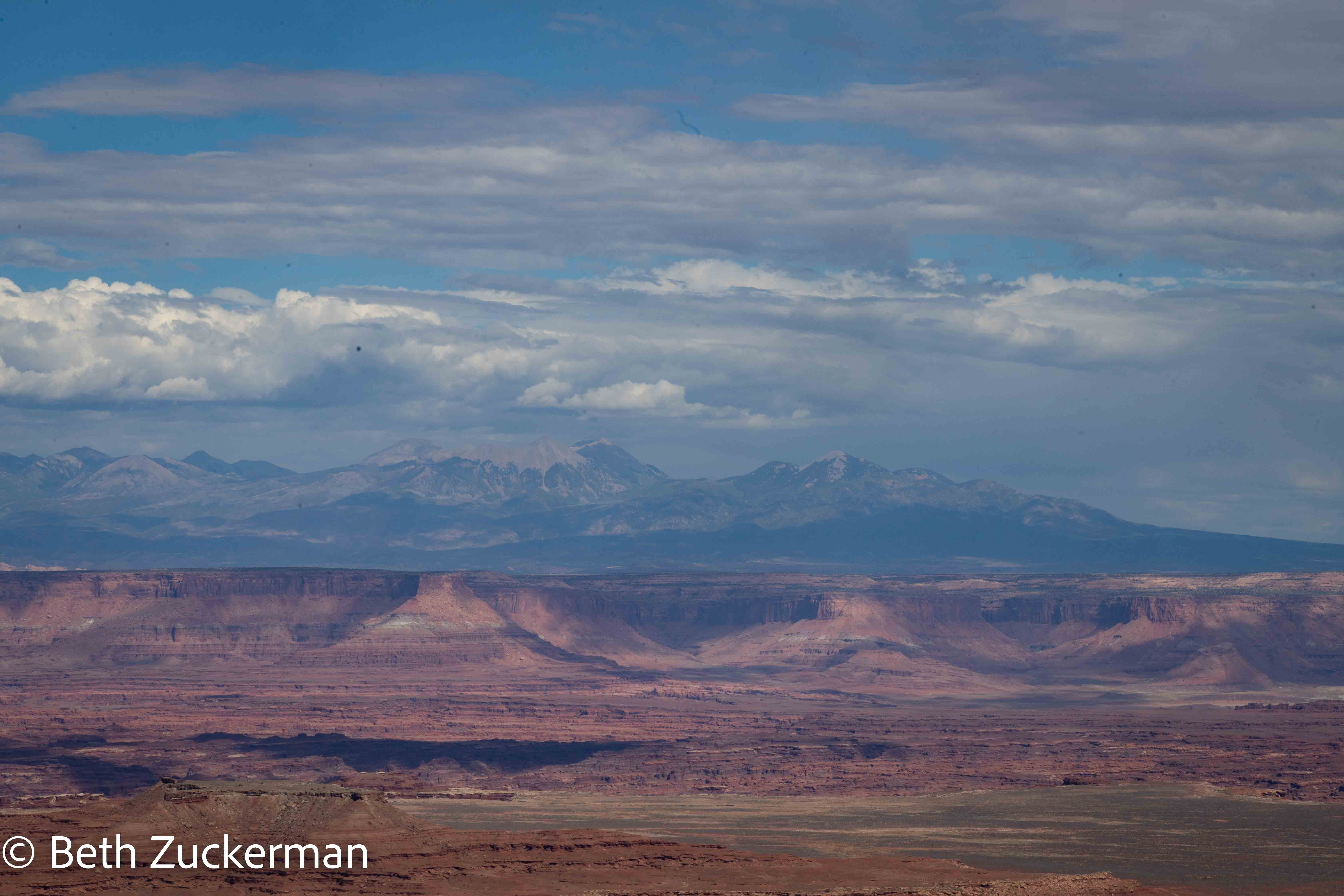
Distant skyline from Grand View Point, La Sal Mountains in background.
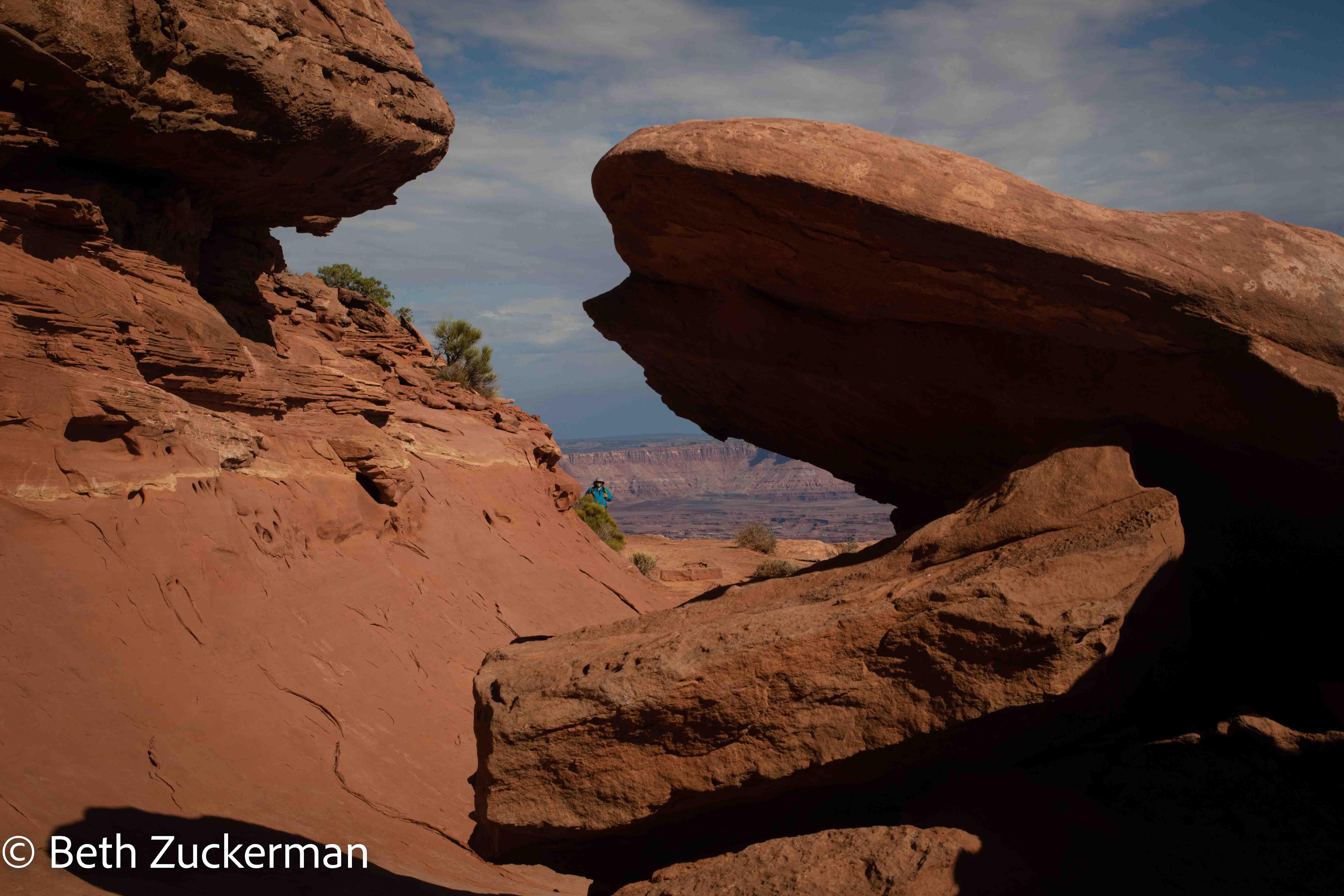
Eric peeking back through rock formations on the trail as we returned.
On our way back, Eric cheerfully greeted a couple with a man who was carrying a baby in an Osprey carrier on his back: "Sorry, the ranger said no more baby sacrifices from the ridge today. I know it's supposed to be good for the harvest, but... " Fortunately, they laughed. A young woman gazing into the canyon said, "I wouldn't mind being sacrificed here!"
A closer view into the spiky Needles.
Last, we took a short hike out to Mesa Arch.
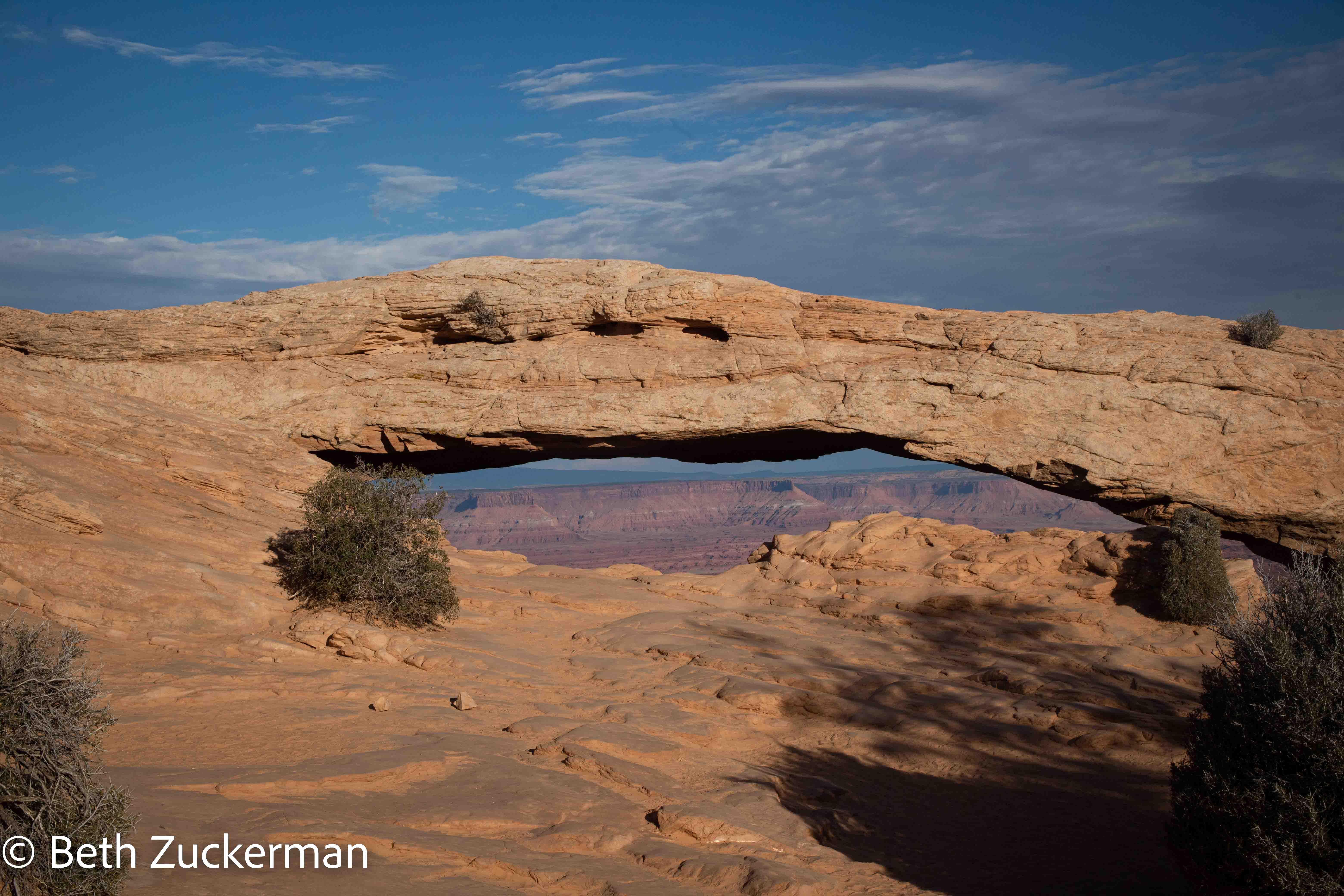
Eric's view through Mesa Arch.

We had to take turns with other people for Eric to take my picture in front of Mesa Arch.

I looked through Mesa Arch down at the Needles spread before me.

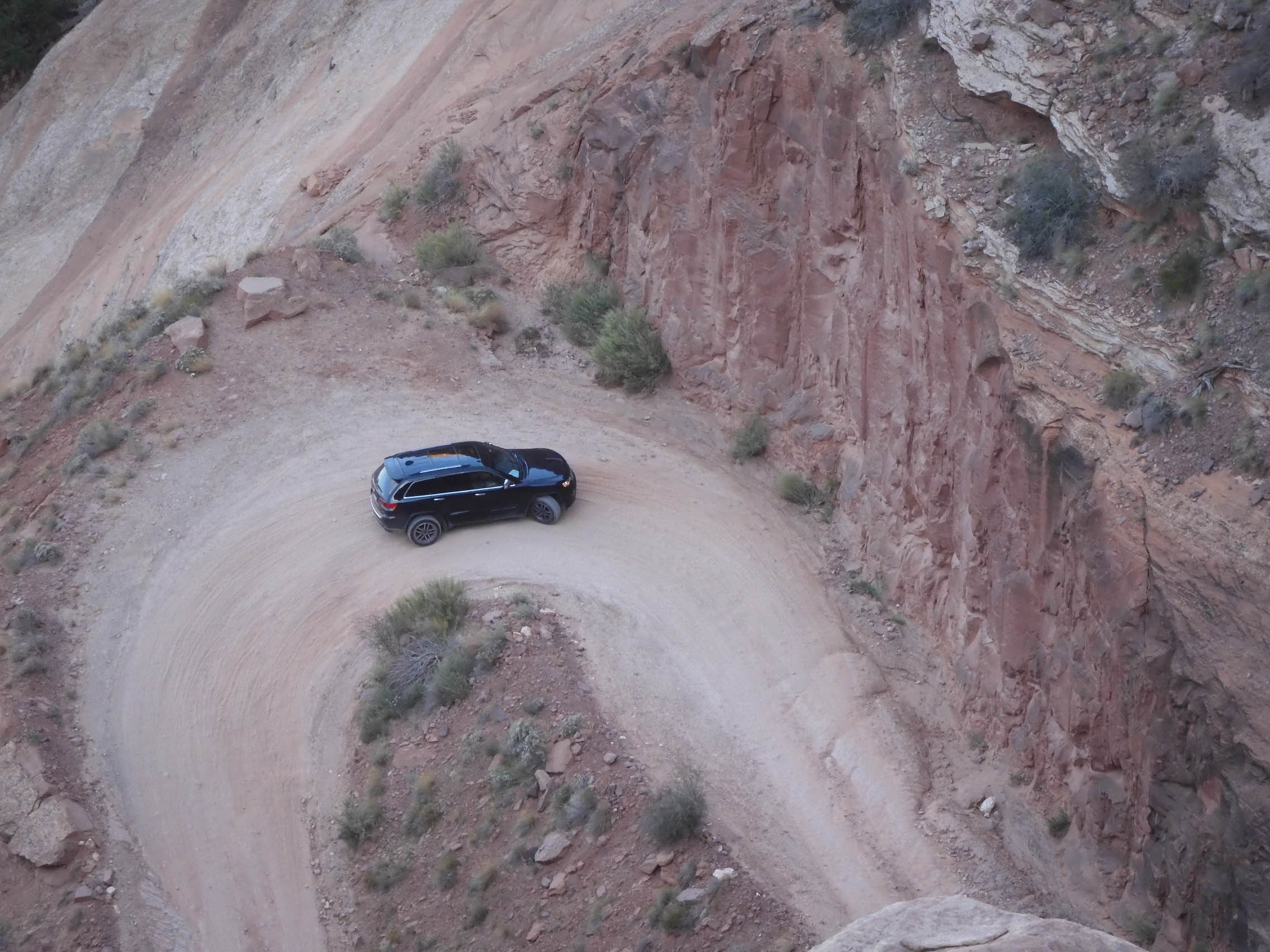
We looked down from an overlook at Shafer "Trail," actually a dirt car route.
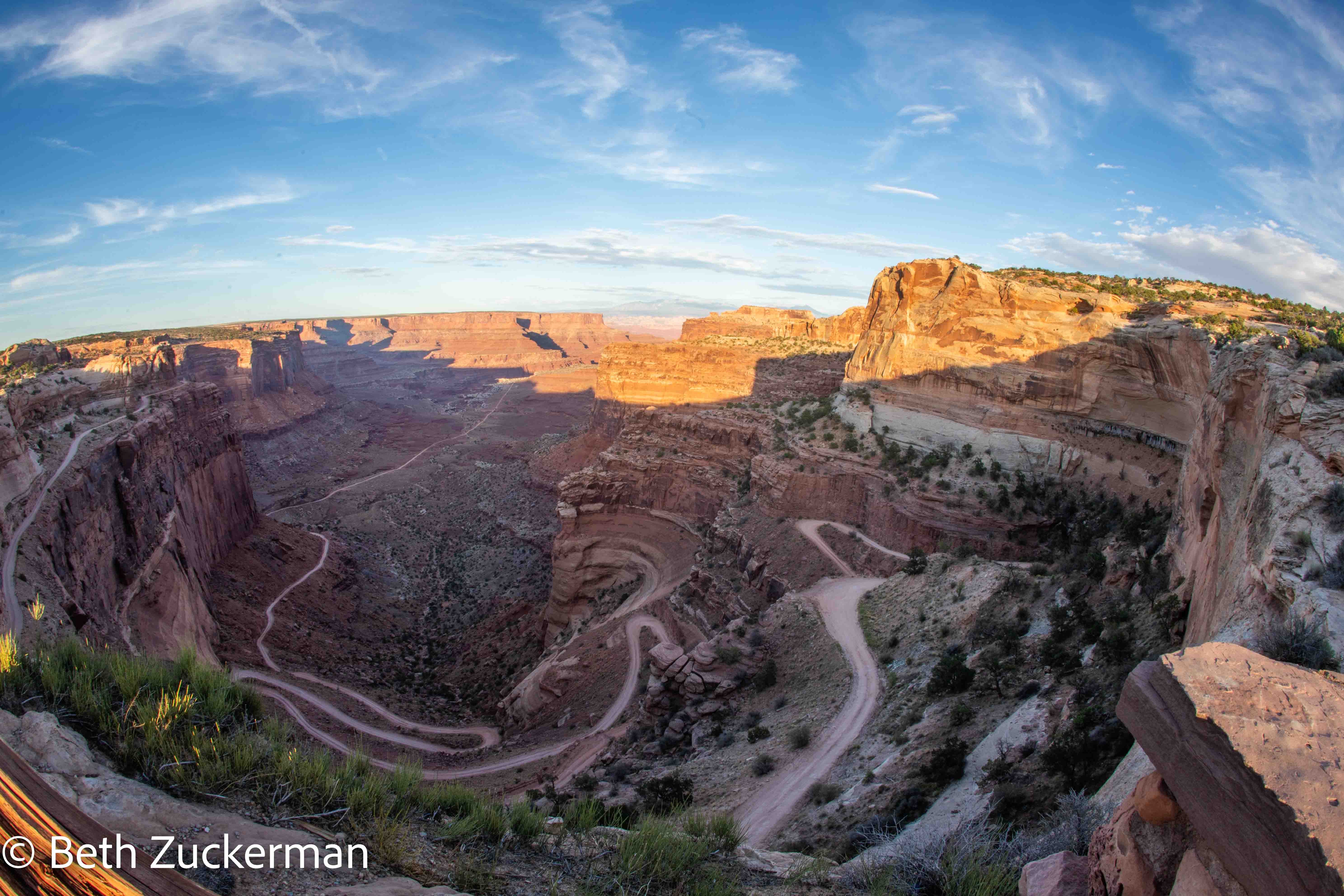
I was having issues with my camera, but Eric managed to capture a vehicle slowly making its way up the road.
Photographing the Southwest: Volume 1 - A Guide to the Natural Landmarks of Southern Utah [Martr
On to Dead Horse Point State Park.