Anza-Borrego Desert State Park
Part 1, 22-23 December, 2018
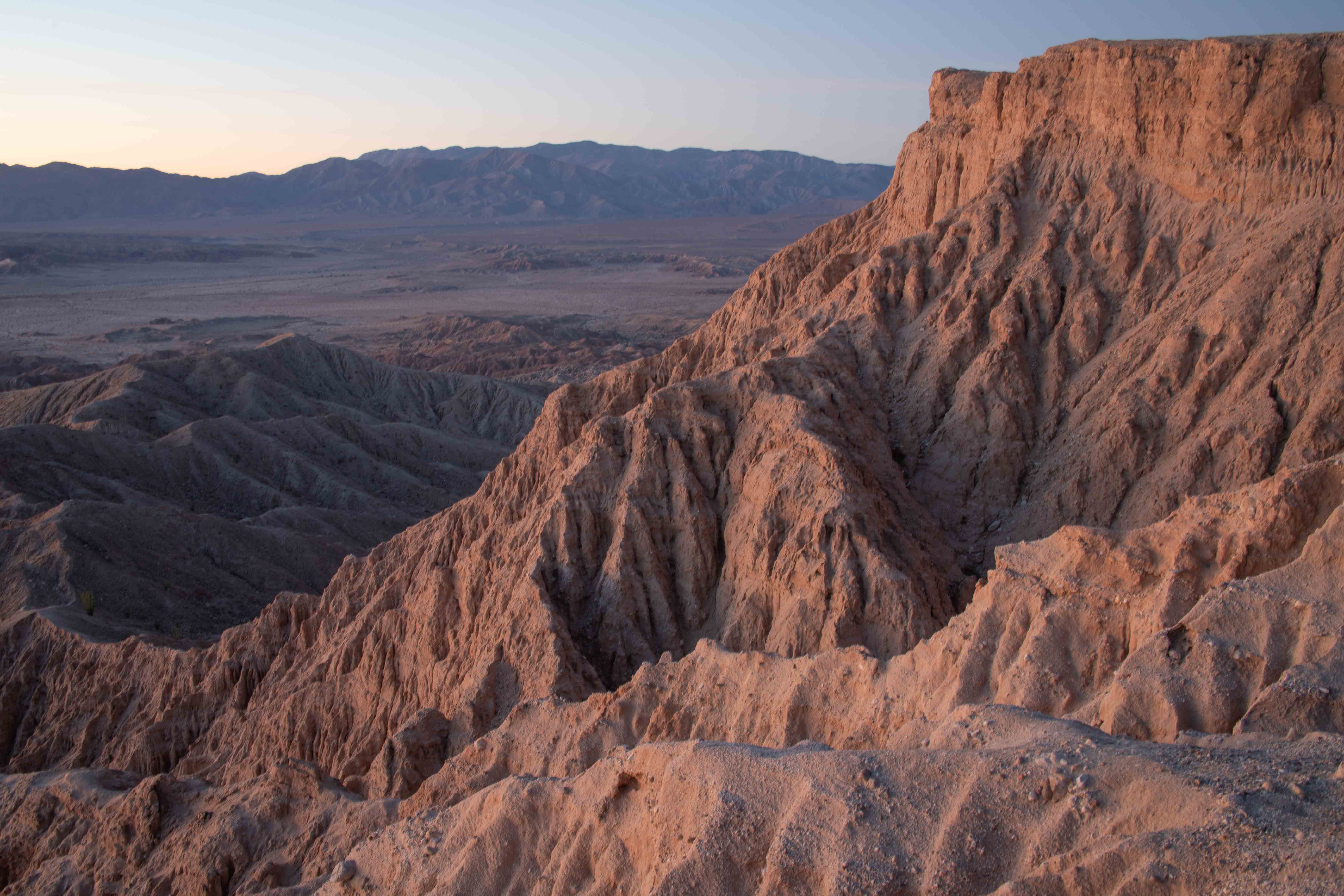
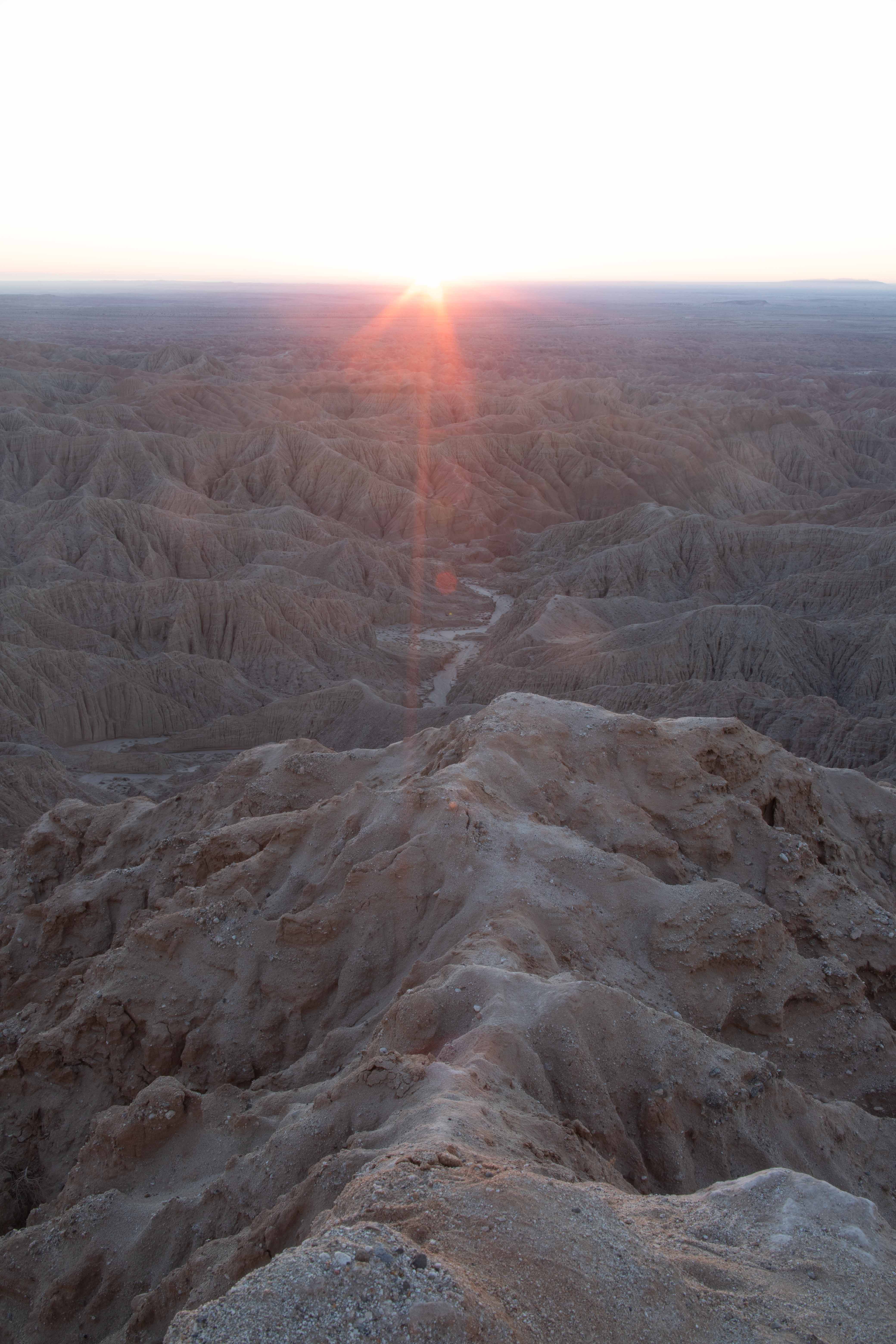
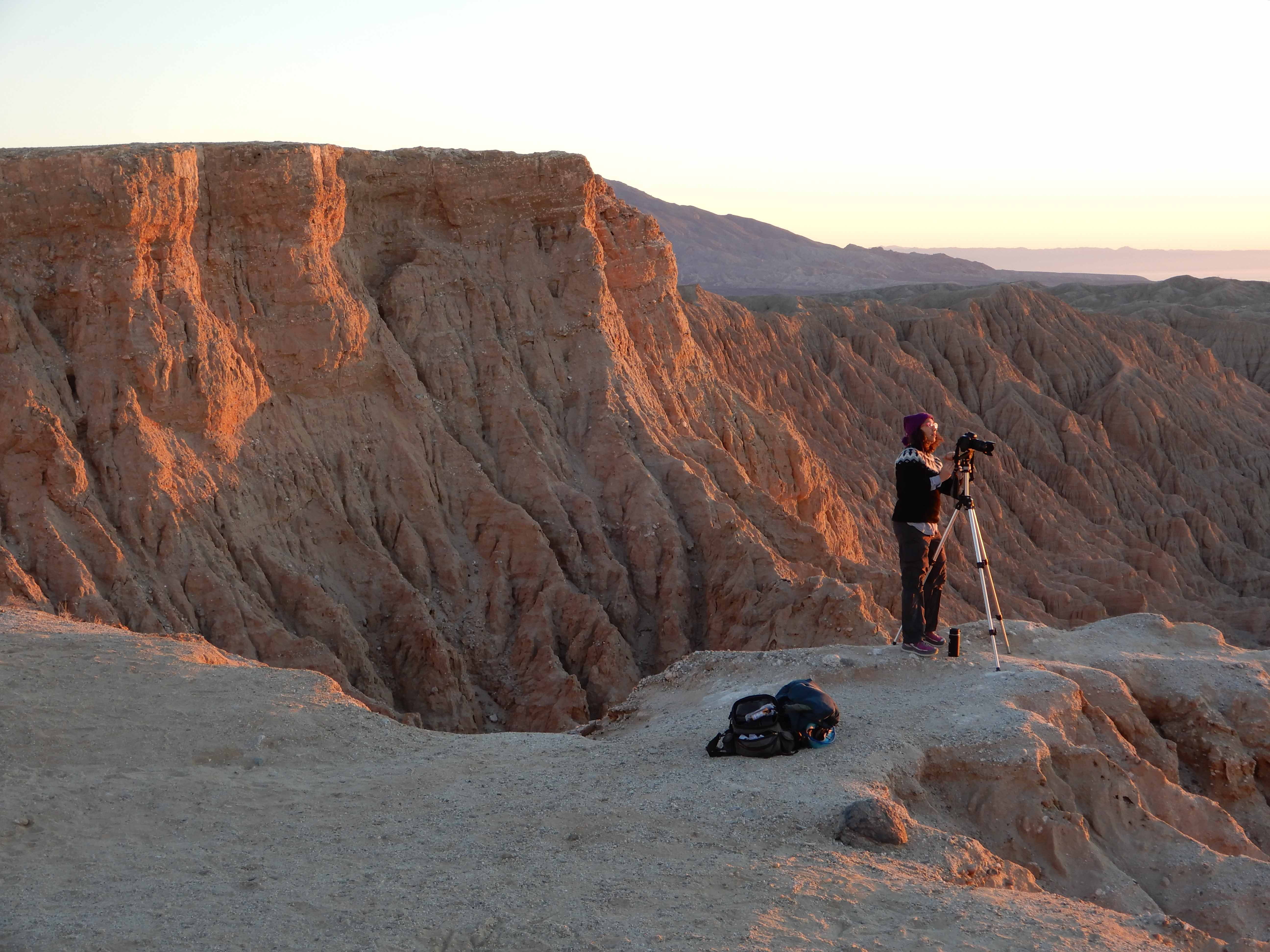
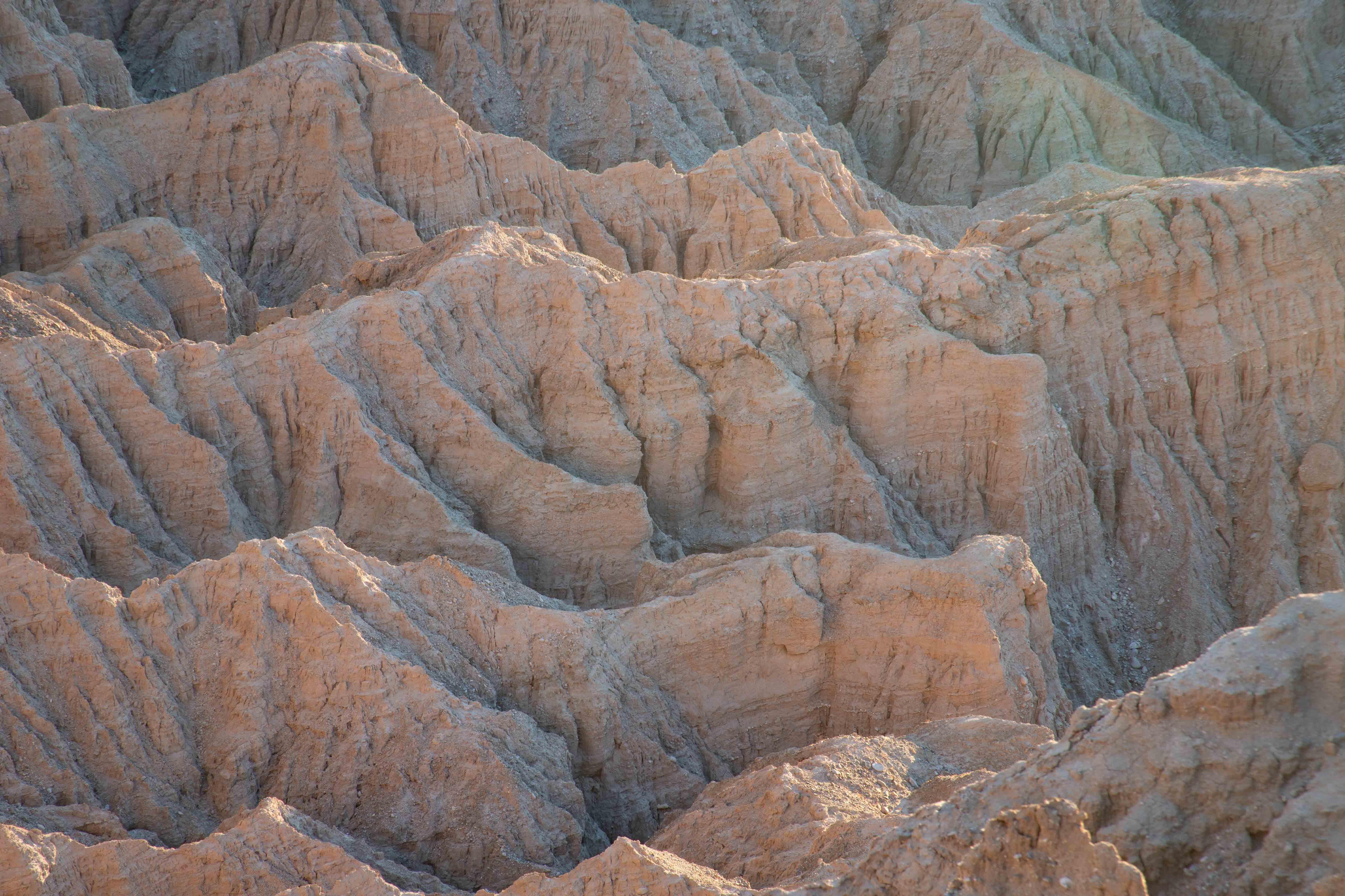
Fonts Point at sunrise.
Tiresome Travel
I found myself with a delicious four-day weekend for Christmas, with no firm commitments until a family party Monday evening, Christmas Eve, in the Los Angeles area. I composed an elaborate plan to visit first Anza-Borrego Desert State Park, hitherto unknown to us, and then Joshua Tree National Park. As ambitious as ever, I plotted a sunset shoot in Anza-Borrego Saturday evening, a sunrise shoot there Sunday morning, a drive between the parks in time for a sunset shoot in Joshua Tree, and then a sunrise shoot there Monday morning.
As ever, reality interfered with my plans. Reality came first in the form of a federal government shutdown late in the day Friday. The California State Park ranger at Anza-Borrego was nice enough to tell me that, while you were allowed to drive into Joshua Tree, her colleagues there were not working, and that the Visitor Centers and bathrooms there were closed. "Well," I said, "I guess we will spend two days in the state park, then." The ranger responded with a delighted cheer.
Reality next implemented traffic in its efforts to interfere with my plans. Despite leaving Berkeley at 05:30, we did not reach the Tejon Pass until 11:30. Normally, you can get all the way to Los Angeles in six hours. True, in our effort to find a geocache in every California county, we had stopped to find a geocache at an In 'n' Out Burger in Kettleman City in order to cross Kings County off our list, but that had not taken long. Eric and I spent hours in our car, trying not to stop to go to the bathroom until we were overcome by desperation.
We got off the freeway on Lake in Pasadena, a densely urban area and not a great place to try to find a bathroom. I found a Union 76 station, where I parked near the air and water hoses and limped out through the door with my nearly bursting bladder. A young man in an old beater from the '80's was pulling away from the gas pumps and tried to cut in front of me. The idea of waiting an extra ten seconds was so intolerable that I yelled "NO" at him and went ahead in front of him.
"Get a car, ya fuckin' weirdo!" he yelled out his window after me.
What an Angeleno. I suppose he doesn't get out of his car even to go to the bathroom.
I staggered into the 76 station to find that it had, unbelievably and probably illegally, a $.25 coin slot on the restroom door. Thinking I couldn't make it back to the car and back again to get a quarter, I begged the clerk to borrow one long enough to go to the bathroom. She insisted the bathroom was out of order in any case. I begged her in tears, but she would not let me use whatever bathroom she was obviously using. I had to stagger back outside, wait for a traffic light and limp across the street to a Jiffy Lube, where I begged a group of young men to let me use their bathroom. They were all extremely polite and solicitous and directed me straight to their bathroom, even letting me run through the lube area. Thank you, oil jockeys of Pasadena!
As we left the LA Basin and headed east, still in heavy traffic, it became increasingly apparent that we were not going to reach Anza-Borrego in time for the sunset.
We got there just in time for the moonset.
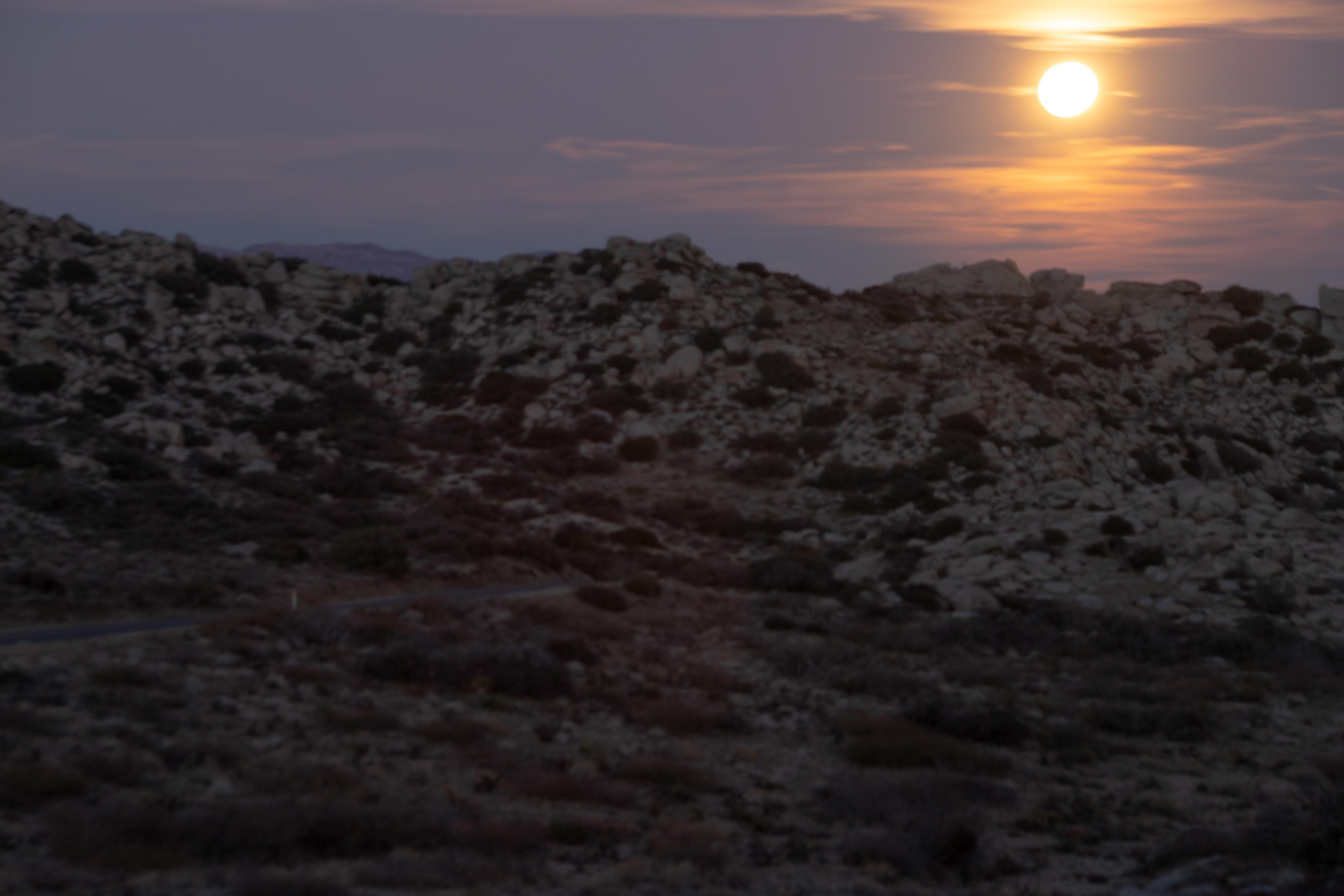
We rolled along in the dark around a deep hairpin, imagining the views we would have had into the canyon below. We checked into the Palms at Indian Head, and walked along the patio to our room, looking over the pool and what surely must be a nice view during the day. We ended our aggravating day by turning in early enough to get up for the sunrise.
Fonts Point
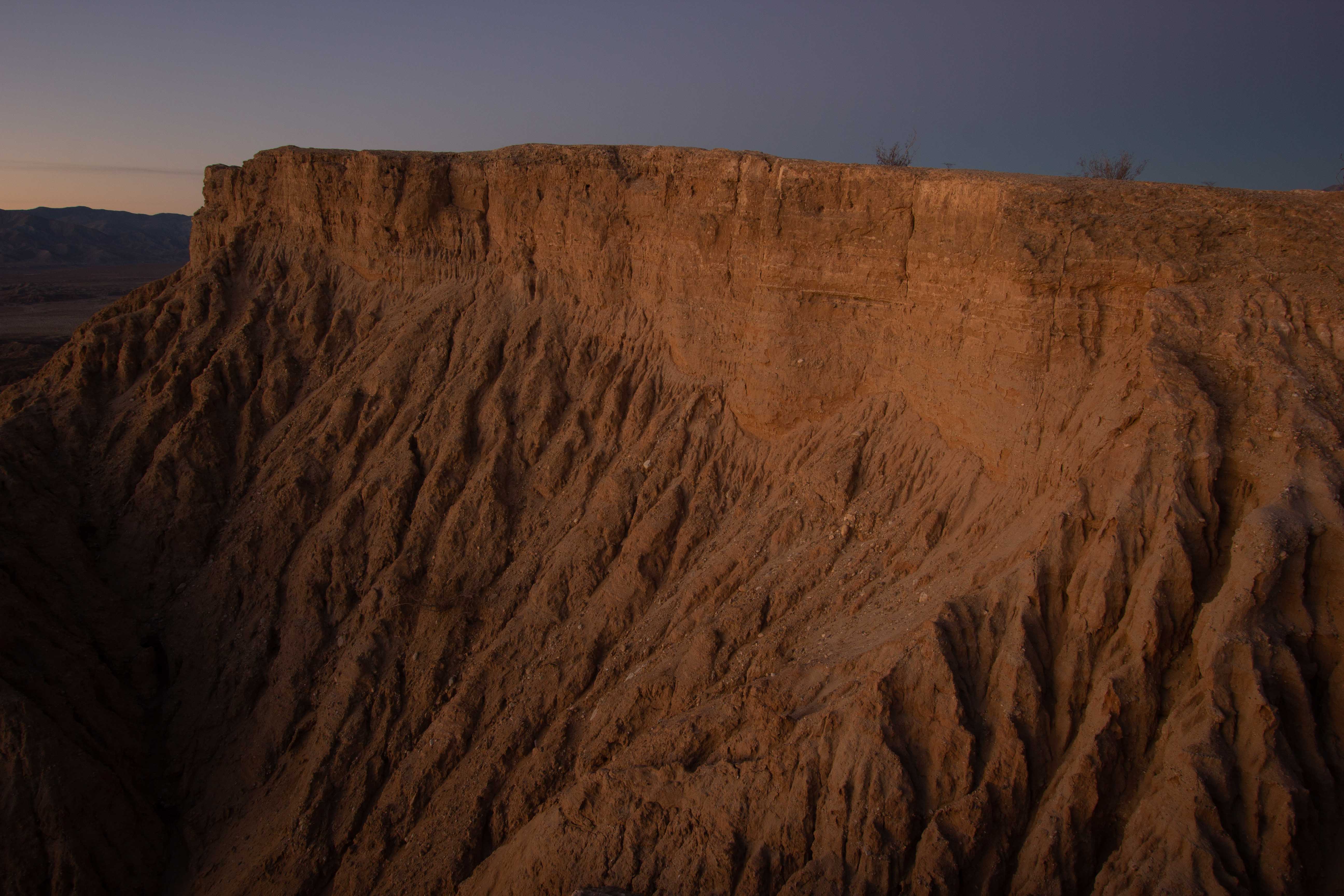
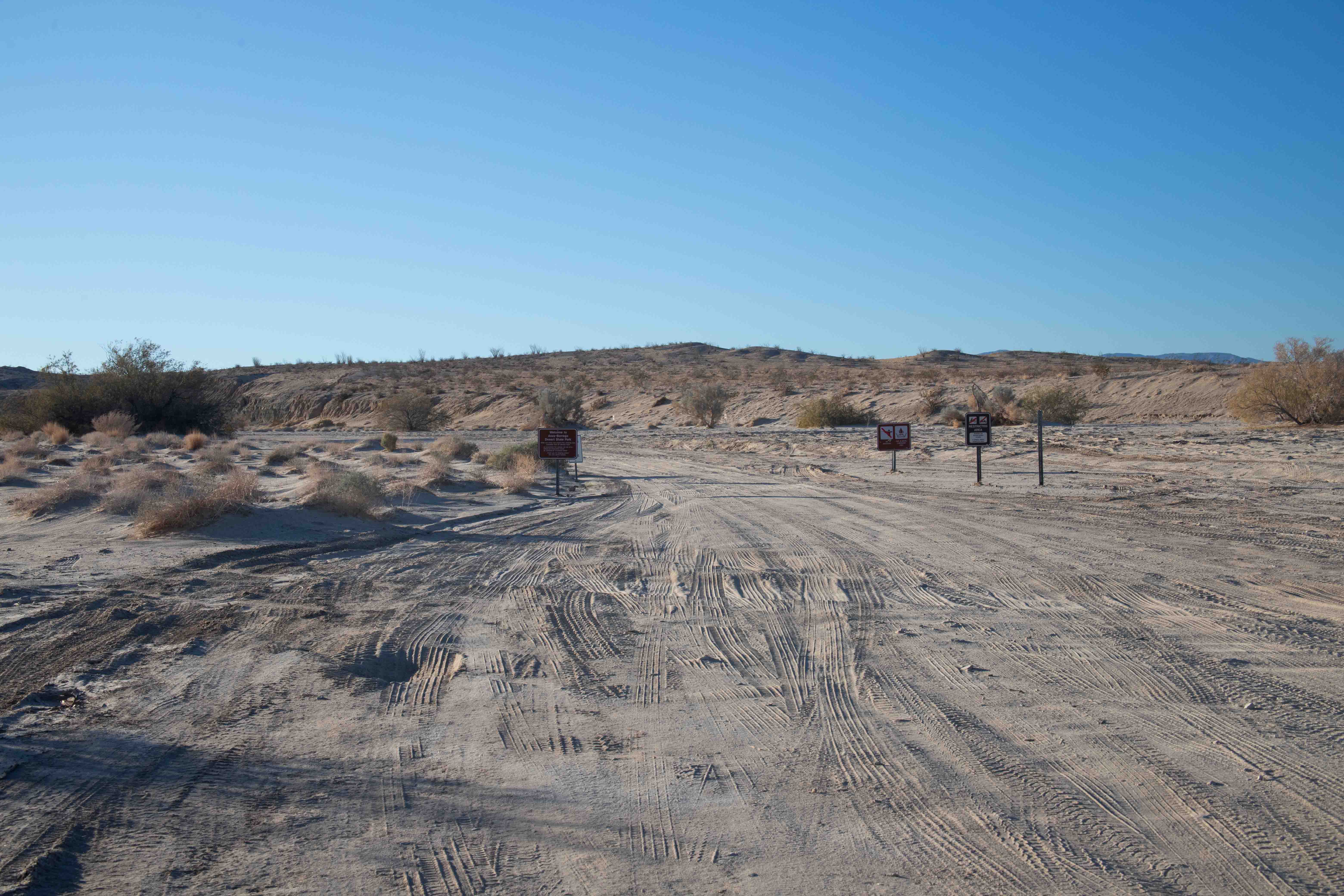
Our chosen site for the sunrise was Fonts Point, overlooking the Carrizo Plain of badlands. Reaching Fonts Point involves a 7-km/4-mi drive through a wash (dry desert creekbed), which would be poorly distinguished from the surrounding desert. Reaching the point in time for sunrise would, of course, necessitate making the trek in the dark. Thanks to Eric's navigation skills, Google Earth, a trail GPS receiver, the familiarity with washes we had gained with our Navajo guides in Page, Arizona, and a lack of rain in the previous few days, we reached the point in plenty of time with no problems. This was the first place we had gone where I felt we absolutely could not have made the trip in Sydney the Civic. This was the sort of trip for which we had bought Mather the Subaru! The road was rough and bumpy, but in a good way. I had brought along a large, cast iron pan hanger, which I was returning to my friend Sarah, who moved from Oakland to Pasadena last year. We had to strap the pan hanger in with the seat belt, because it clanged annoyingly and slammed into the window on the bumpy road.
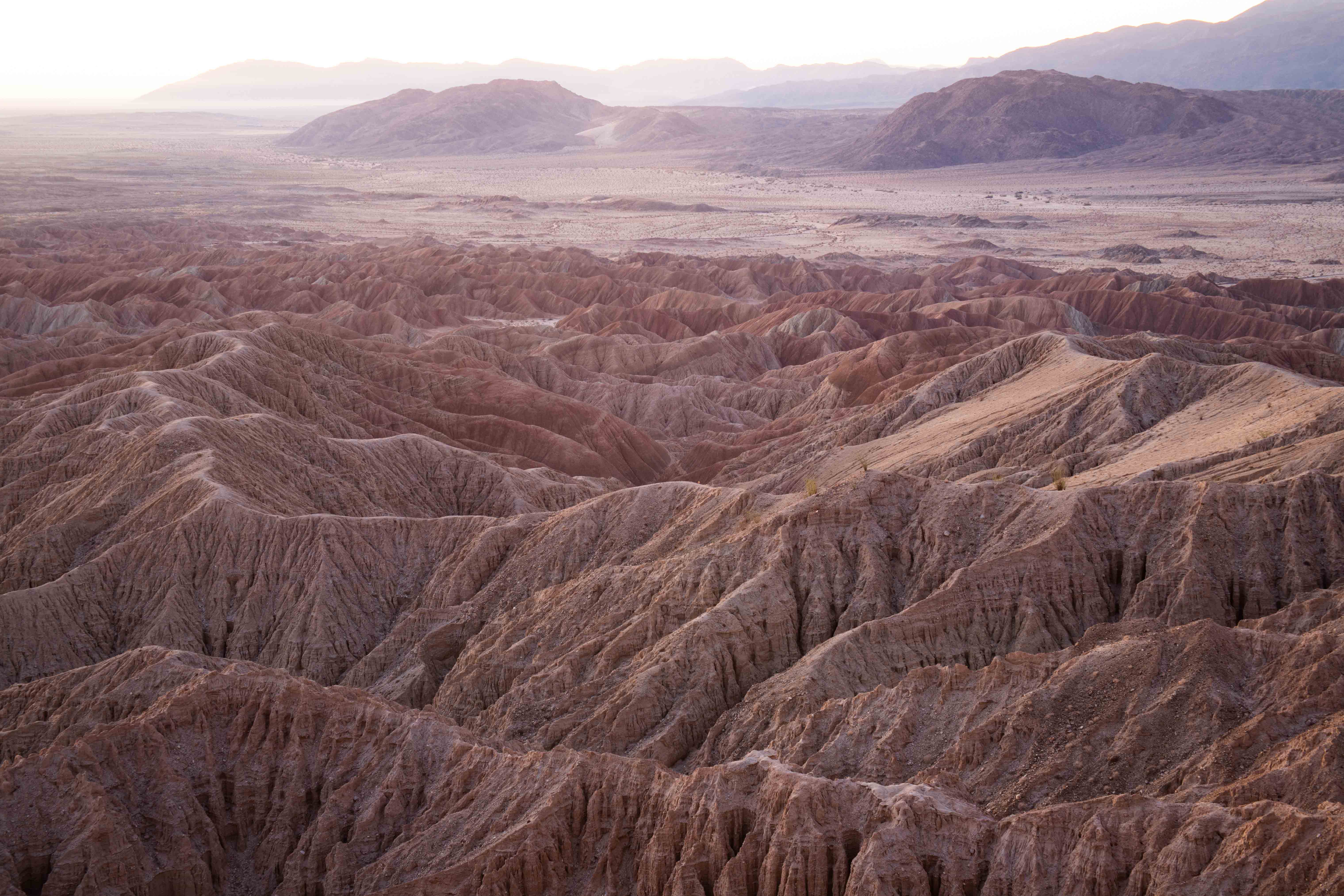
As the light began to emerge over the horizon, we were rewarded for our efforts with a tremendous view.
Eric's view of the ridge beside us.
The sun rose over the badlands.
Eric took a picture of the lovely light as it reached the hills.

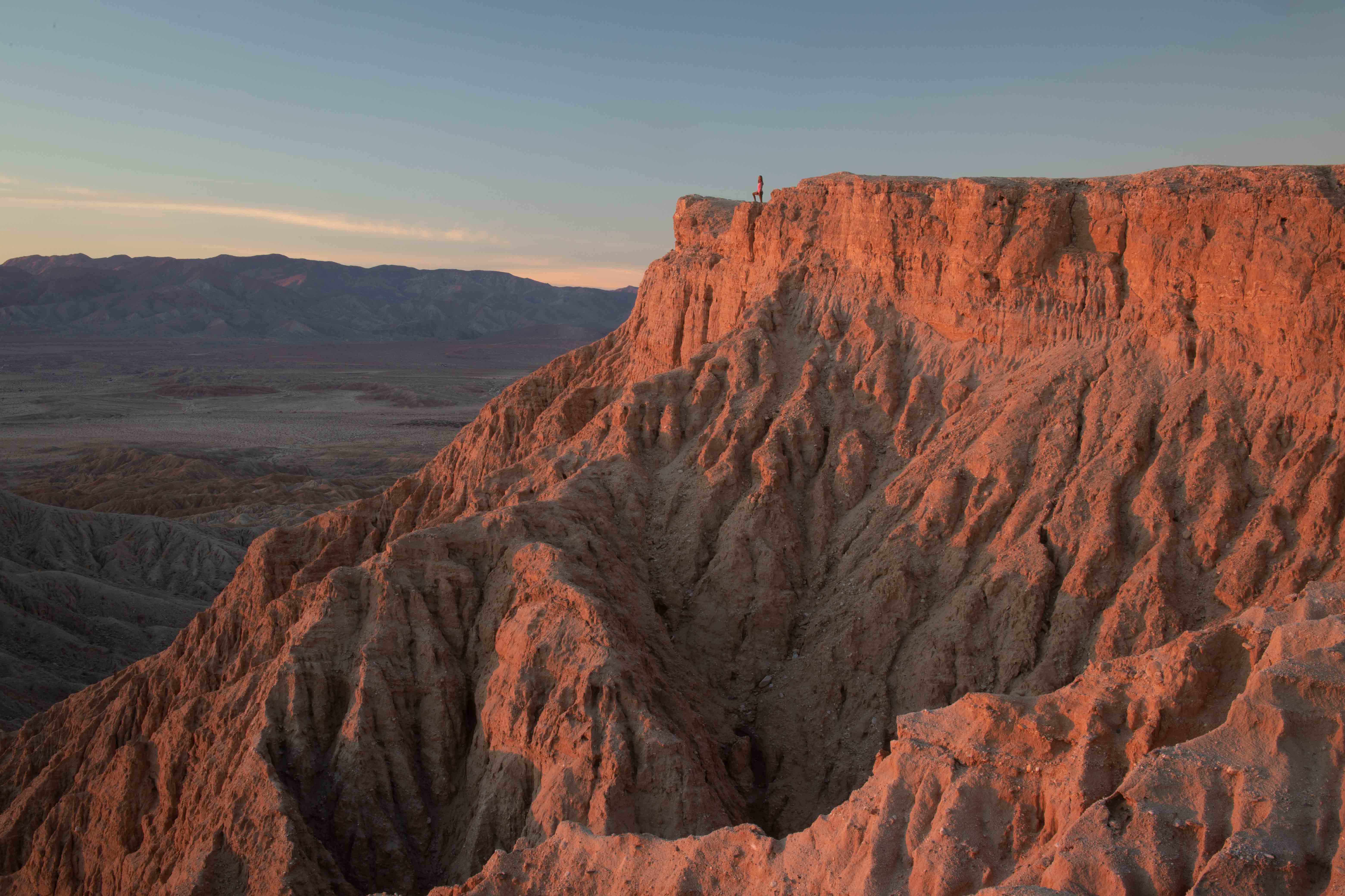
We were no longer alone--another photographer had arrived, with a model. Here, the model poses at the end of the point.
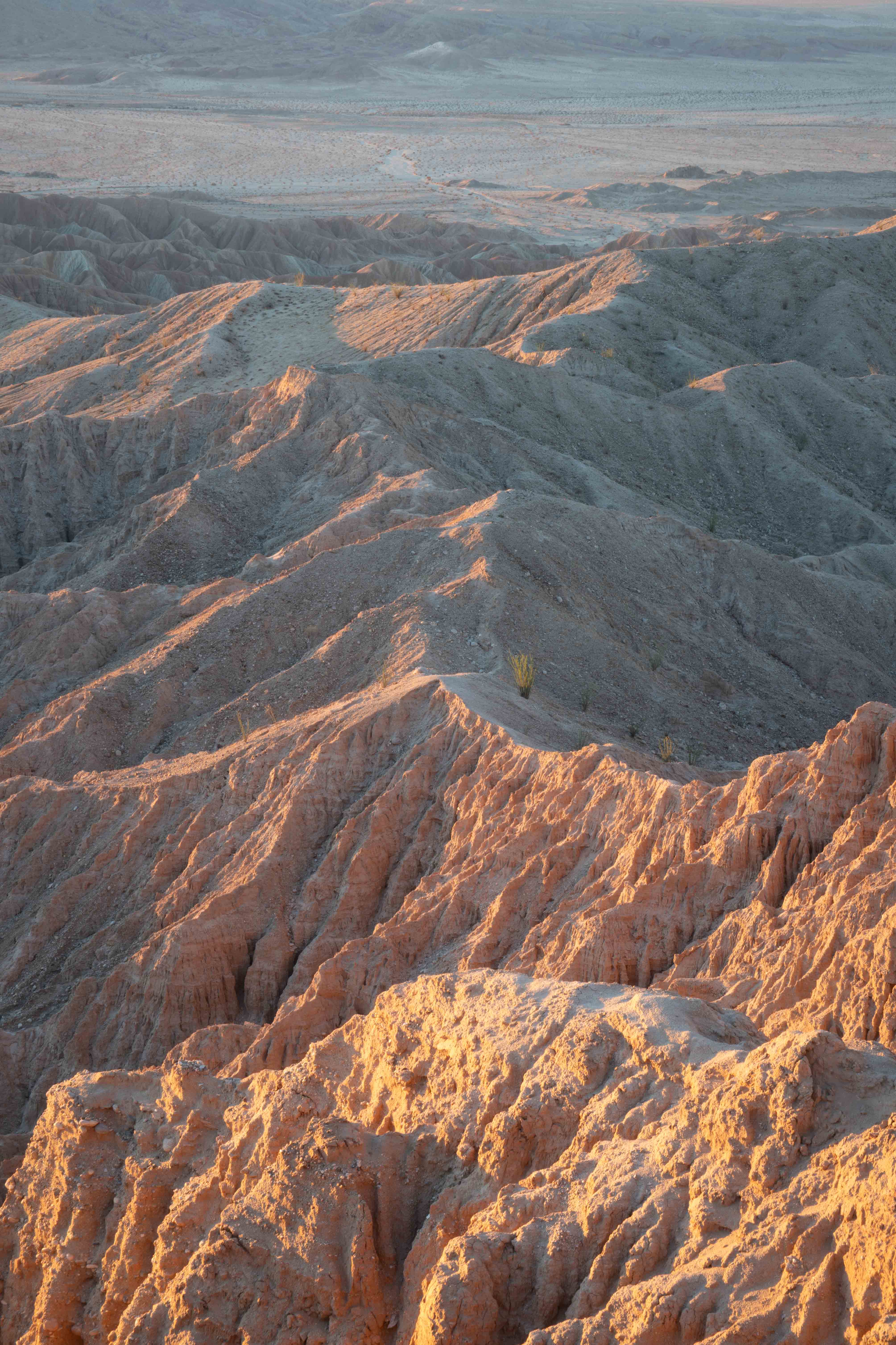
I loved looking along this ridge in the badlands.
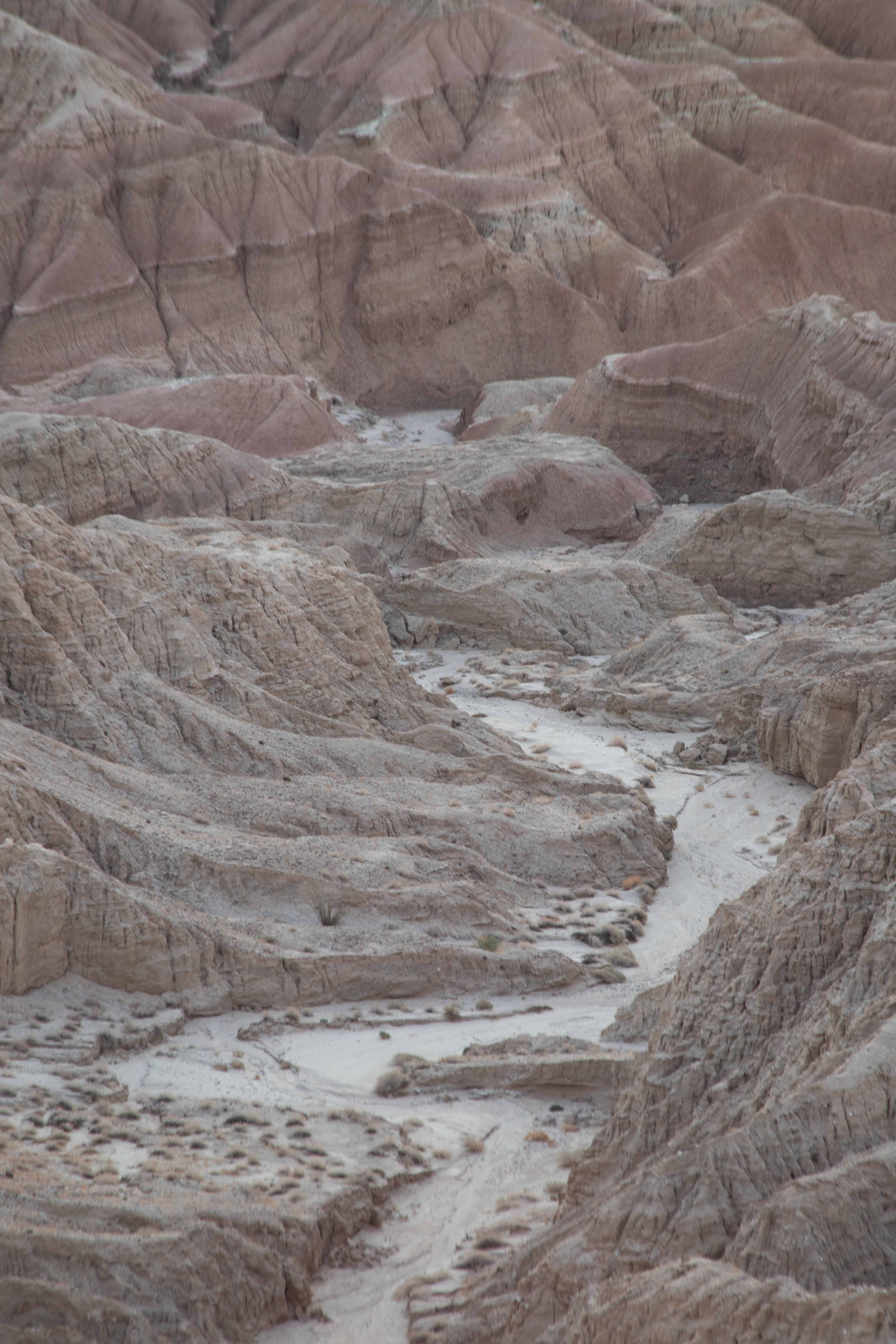
I could see that the wash continued down into the badlands, but it was too narrow to drive a car through.
Eric told me that he had taken a photo for the dust cover of my second book.
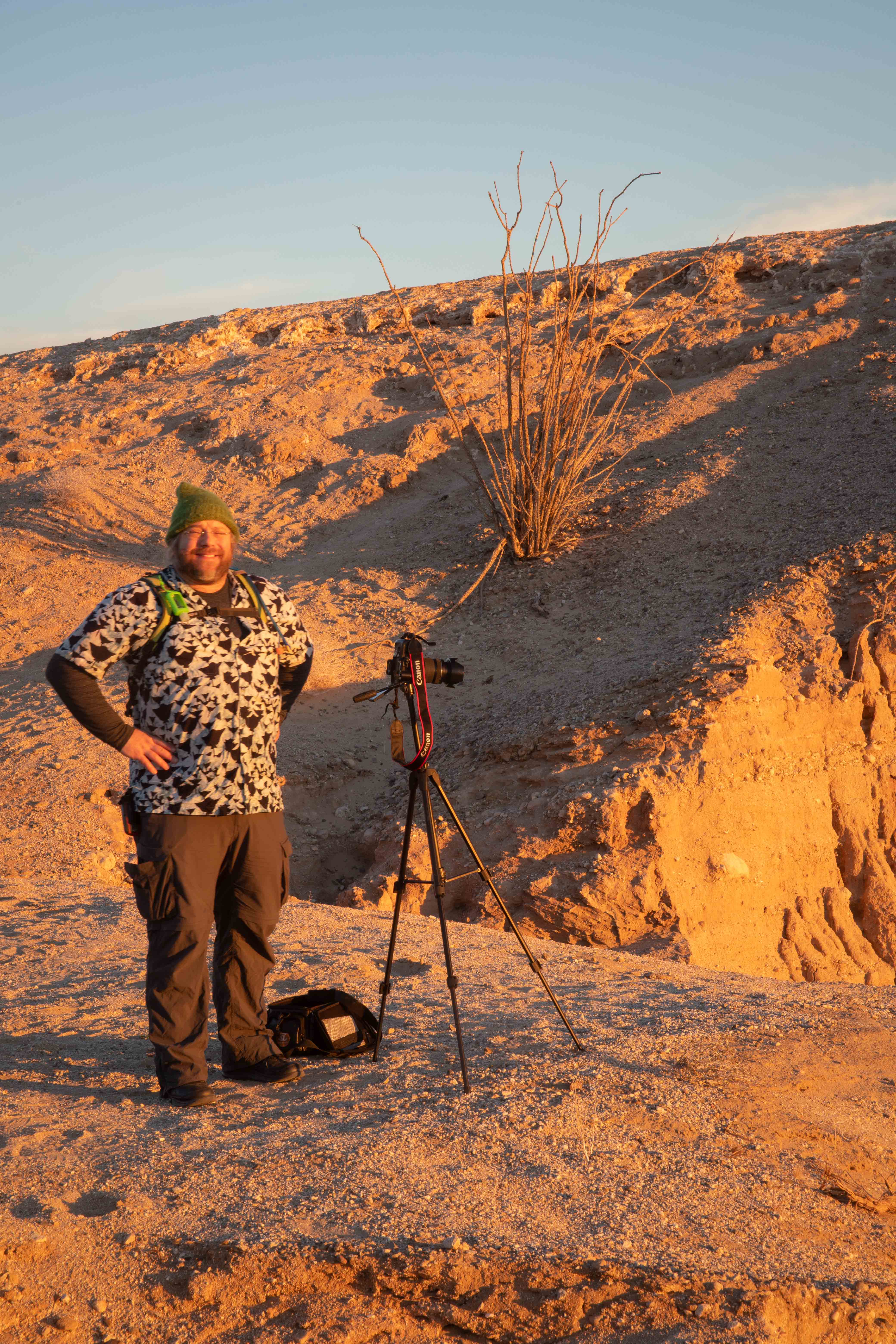
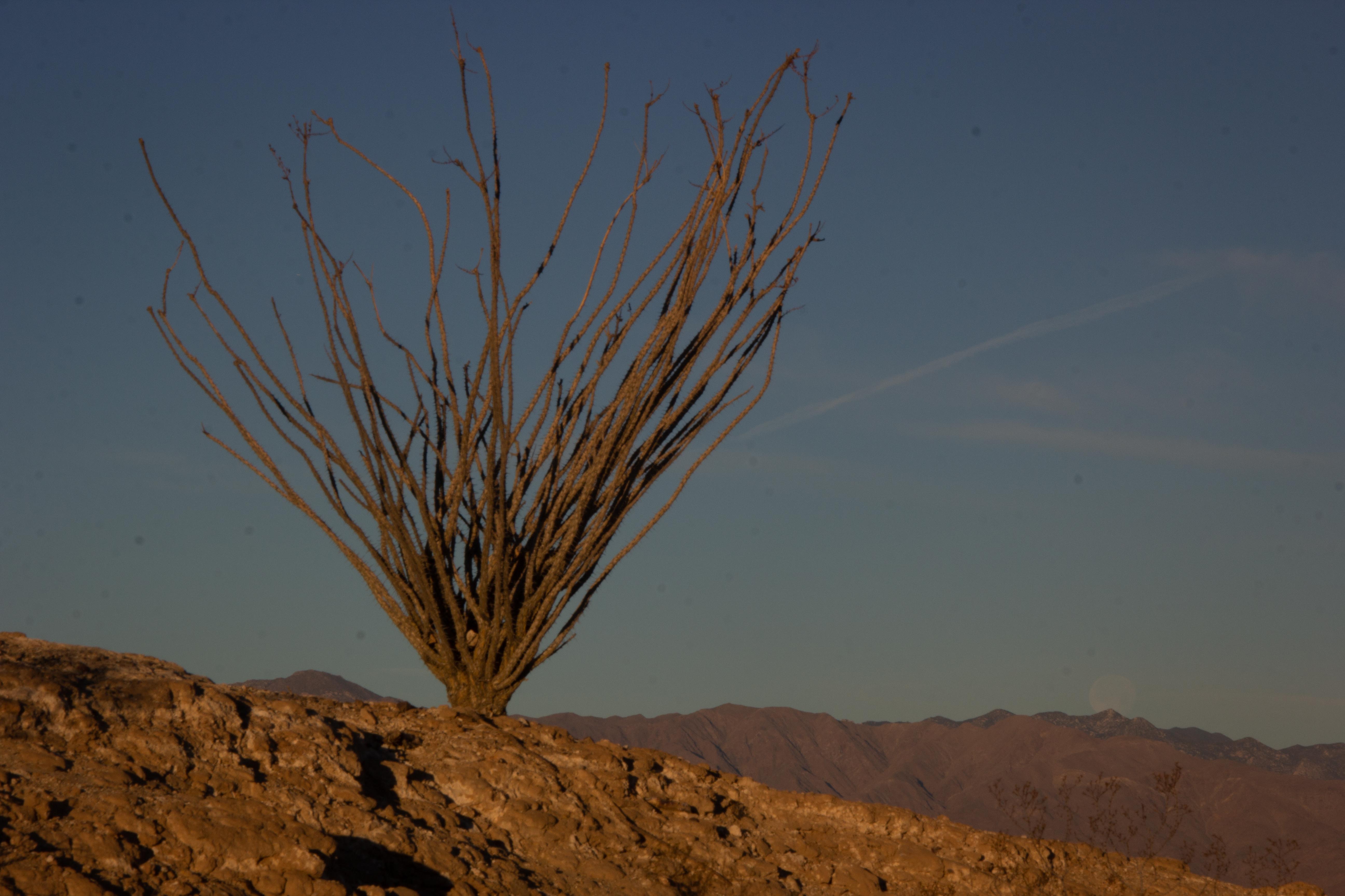
Eric at Fonts Point at sunrise, shooting with my old camera, with an ocotillo cactus behind him.
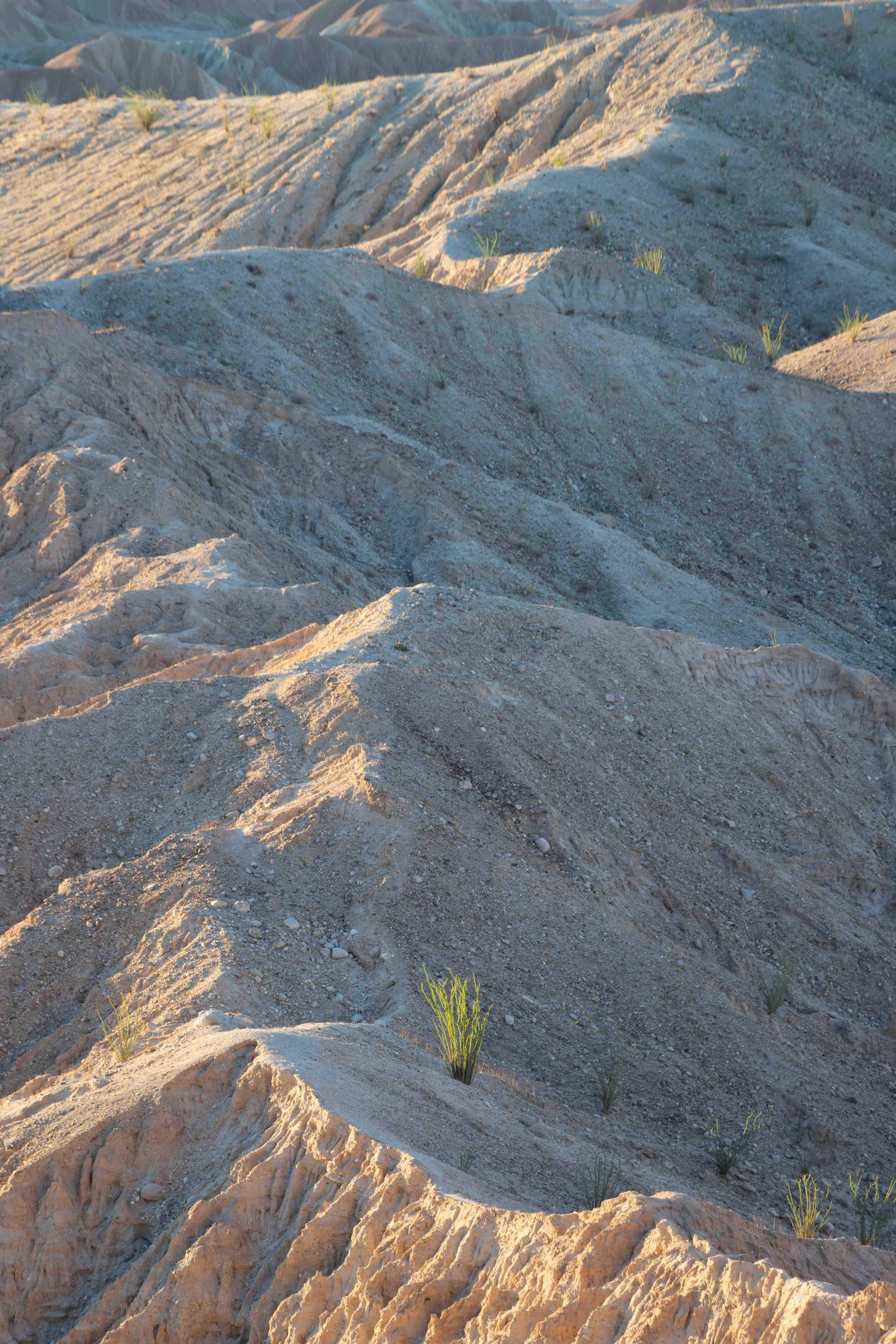
The sand near us turned blue in the early morning light.
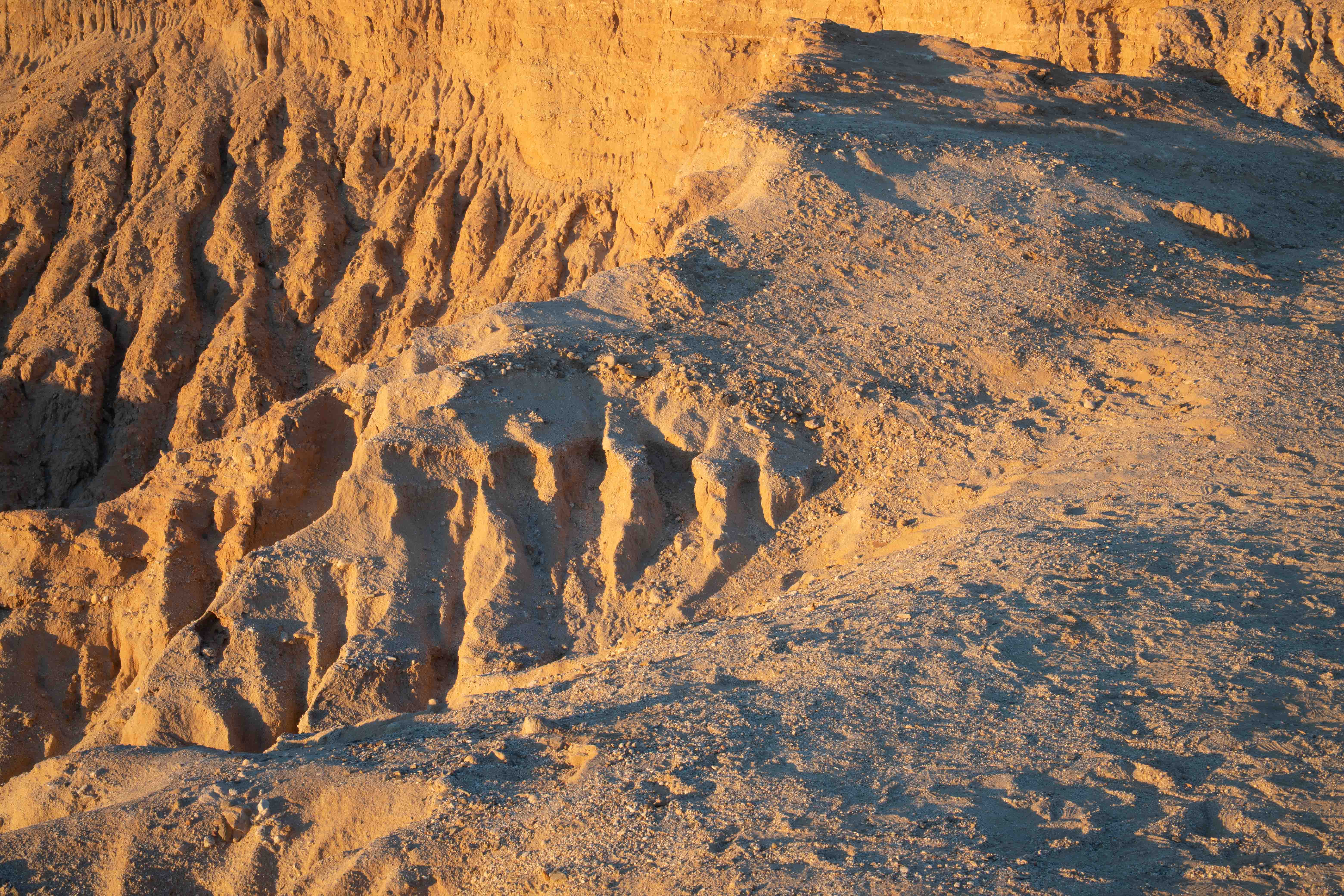
The ridges were lovely.
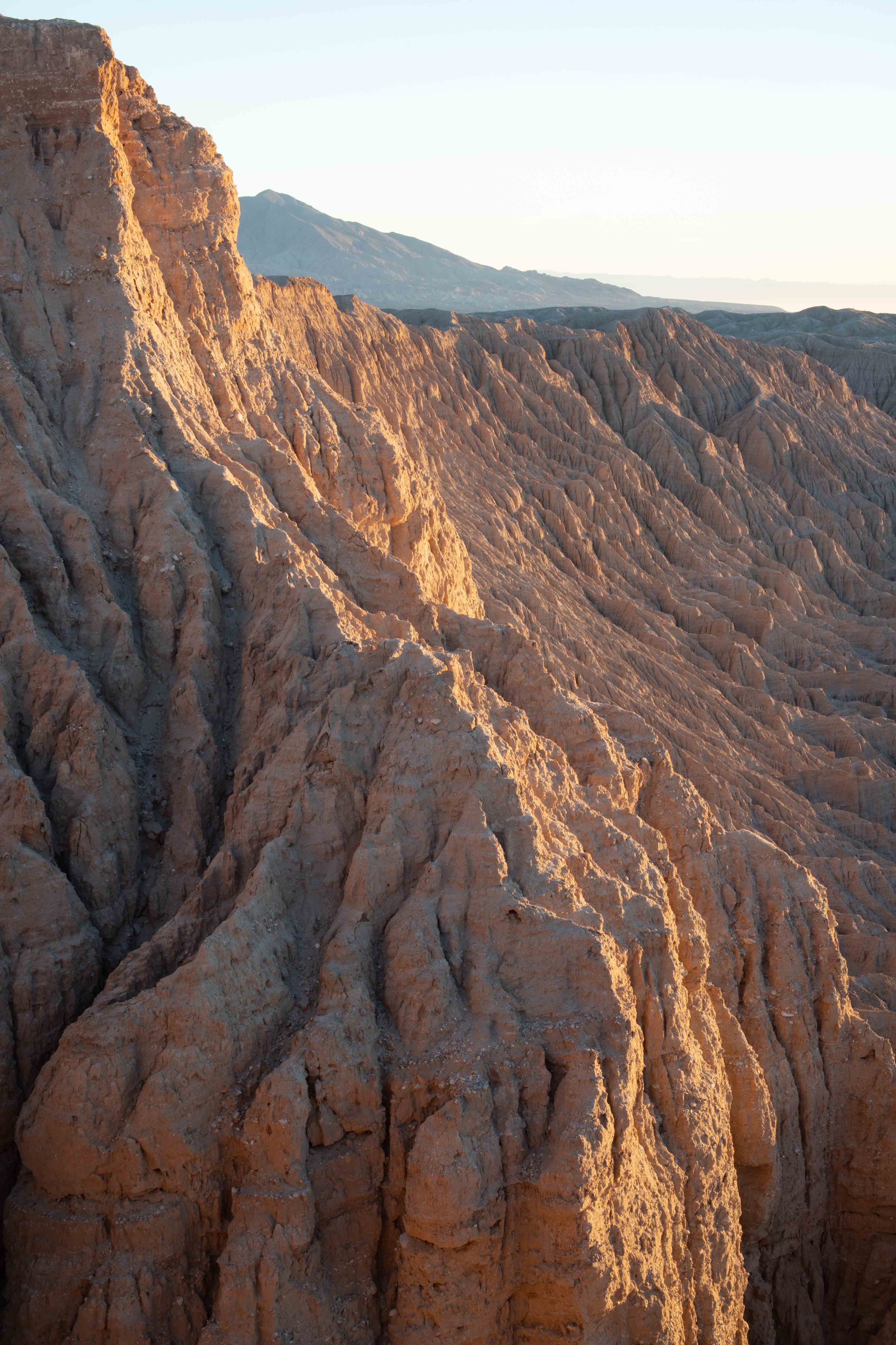
As more light became available, I could see the tilted layers in the badlands.
I could see the ocotillo growing along my favorite ridge.
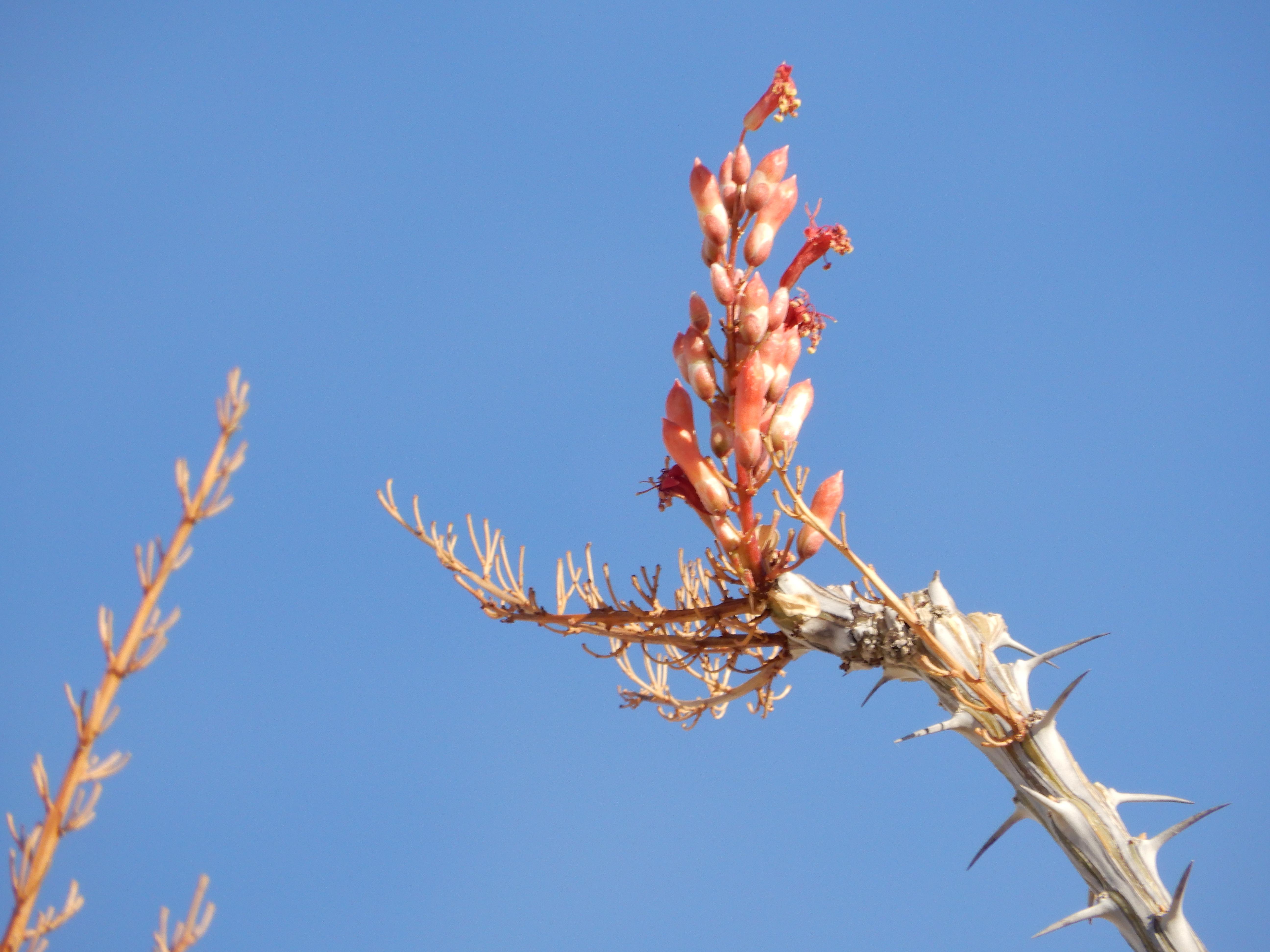
Eric took a picture of the ocotillo behind him.
The ocotillo was blooming, and he took a picture of one of its flowers.
As the light flattened, we decided to head back into town for breakfast and showers. As we were leaving, I had to read loudly the sign prohibiting drones, as the other photographer was making rude noises with one.
This is the wash we had to navigate in the dark.
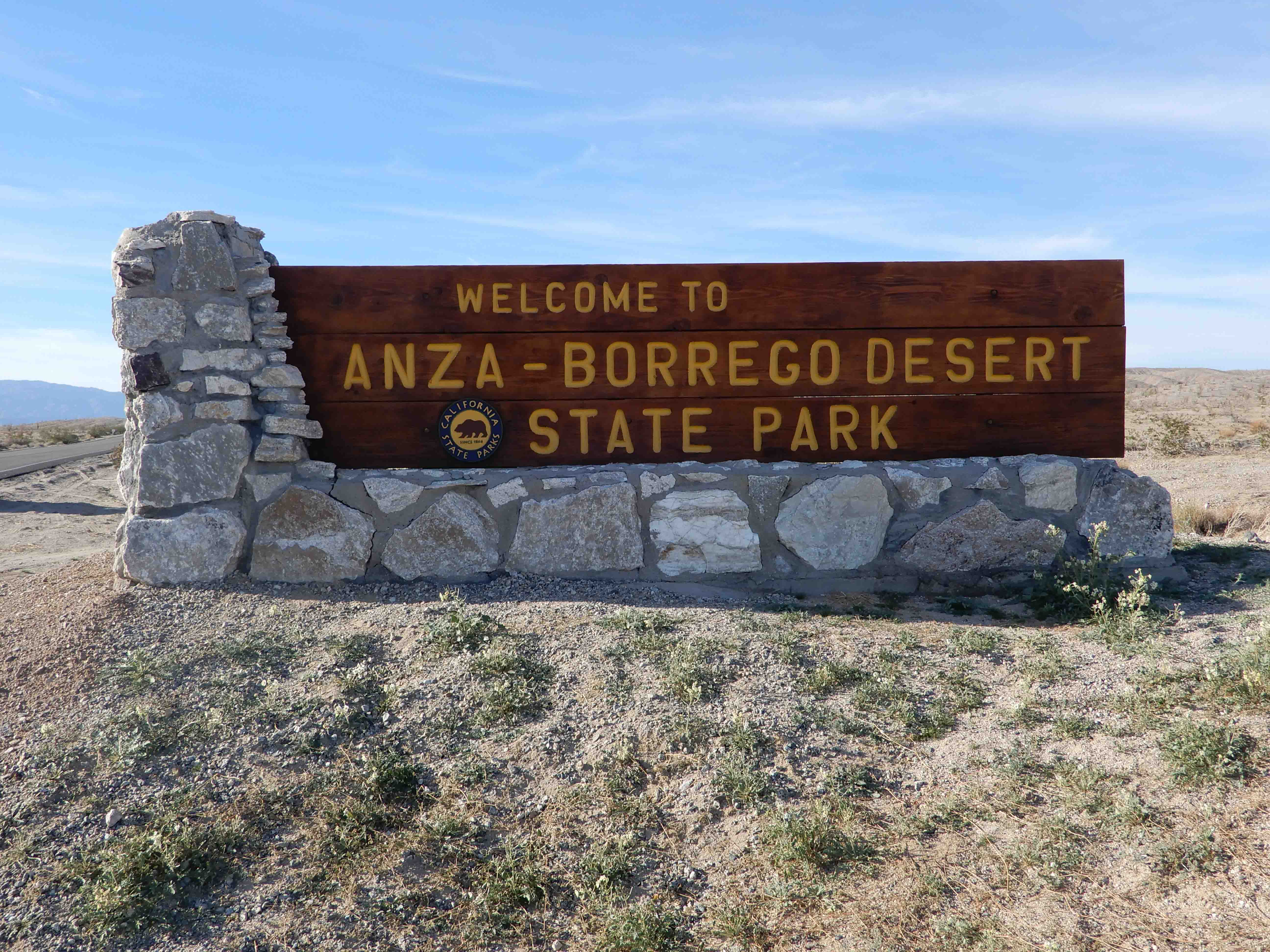
Eric's customary park entrance "monument sign" picture.
Back in Borrego Springs, we had a lovely breakfast of omelets and chilaquiles at a pleasant restaurant called Carmelita's. The tomatillo salsa was delicious. We were so close to Mexico that, when we ordered guacamole, they asked us, "Chunky or cream?"
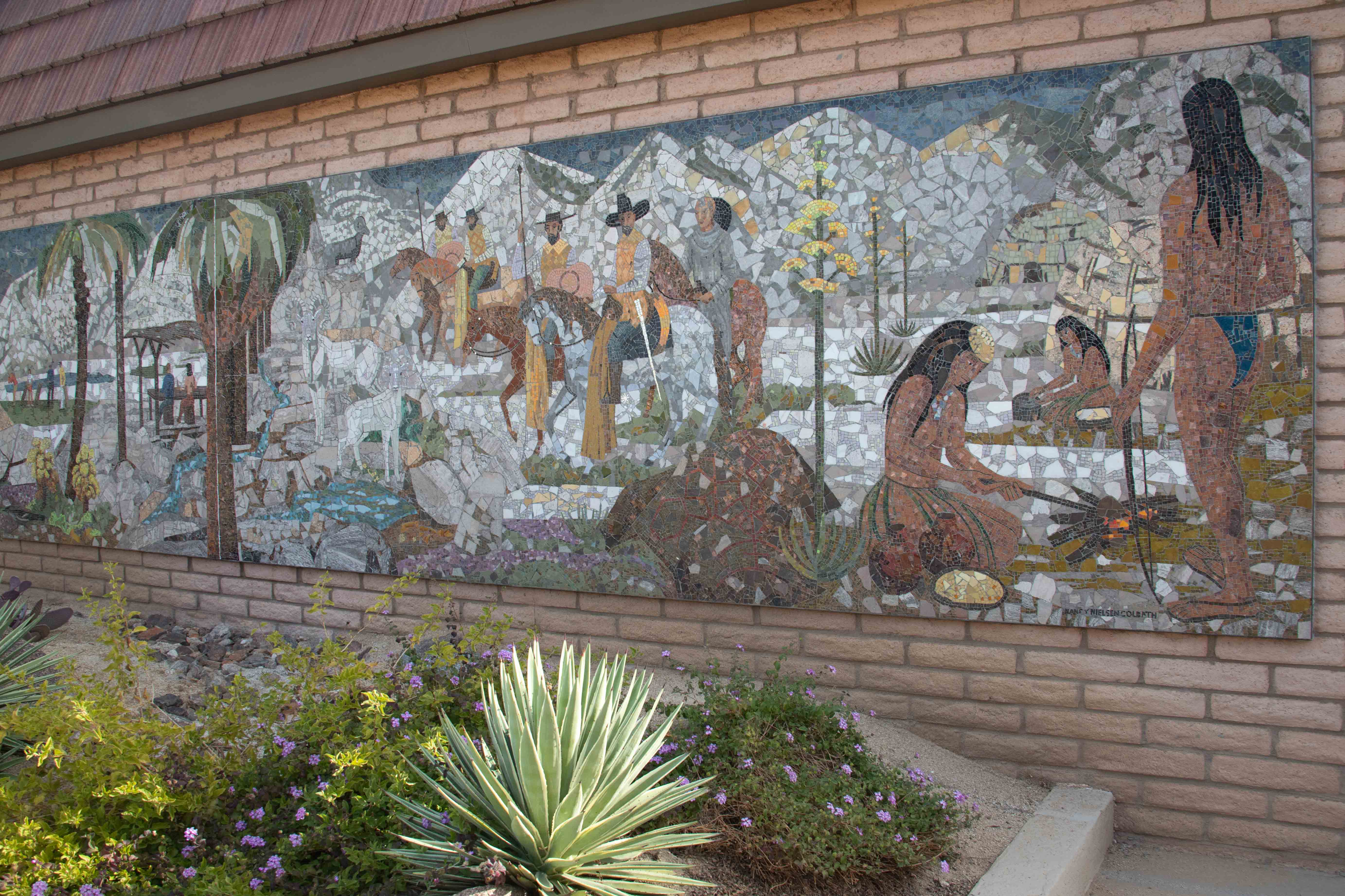
Near the restaurant, we found a tile mural depicting the history of the area.
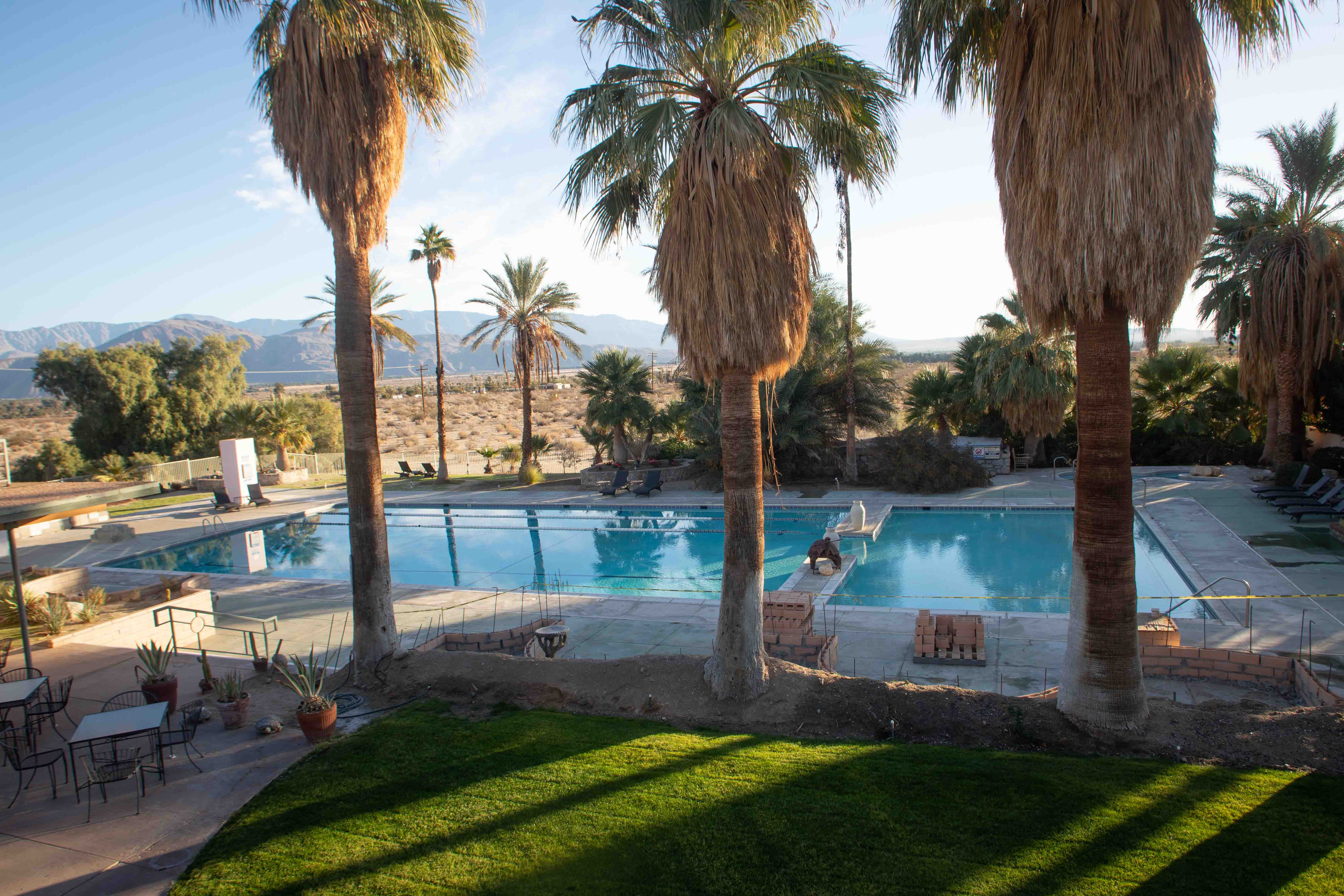
Now, in the daylight, we could see the beauty of the view from the patio of the resort.
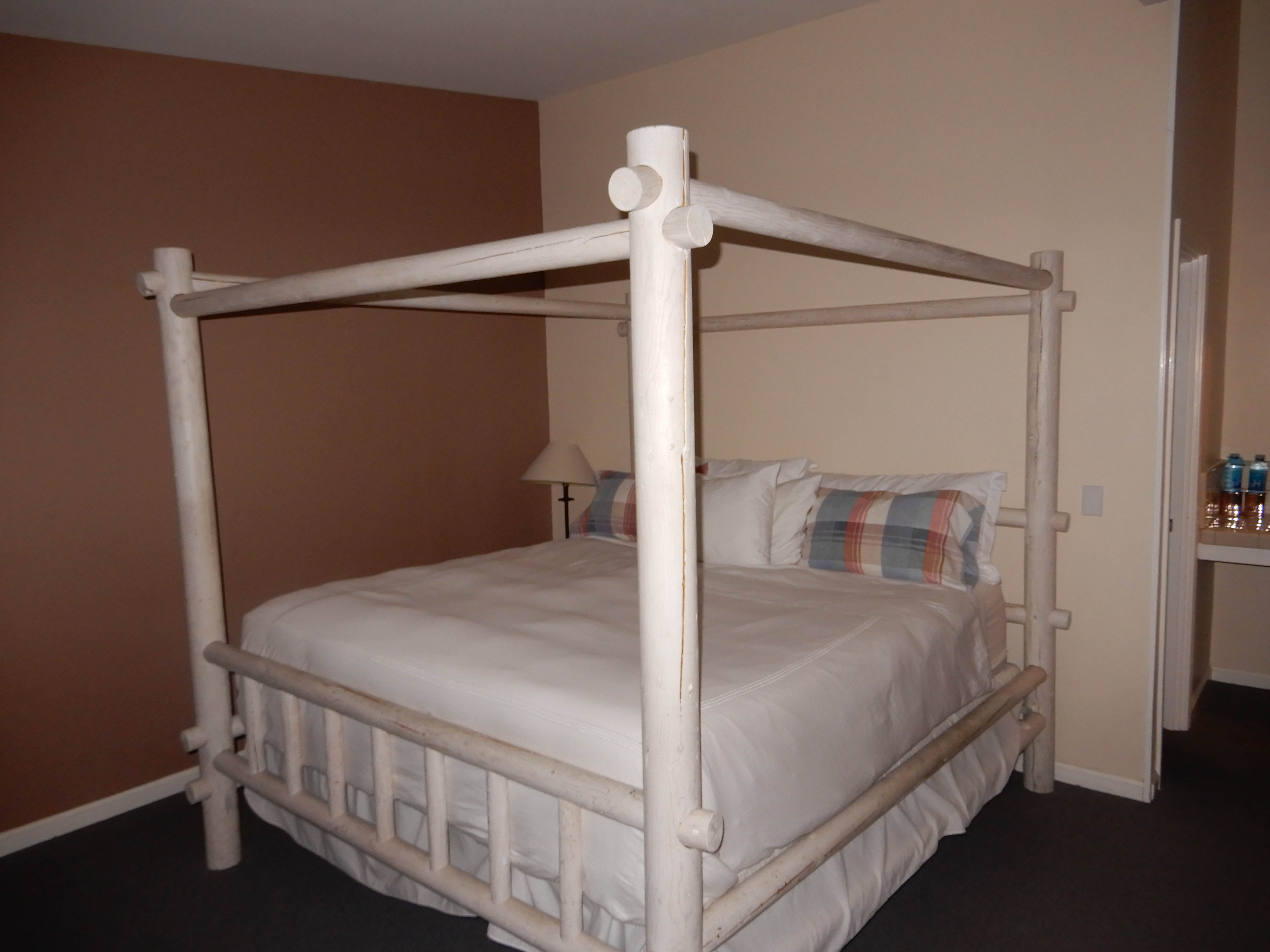
Eric had fortunately taken the time to photograph our lovely bed before we made a mess of it.
Salton Sea
When we began the quest for a geocache in every California county, it was obvious that the most difficult county for us to get to was Imperial. Imperial County is far in the southeast of the state, the furthest place from Berkeley. This trip was planned partly as an opportunity to bag a cache in Imperial County. I discovered that the state park ended just about at the county line. The part of the Colorado Desert that is in Imperial County has been designated instead as "state vehicular recreation area"--in other words, sand dunes that you're allowed to ruin with dirt bikes and ATV's.
I would have been satisfied just to duck into Imperial County far enough to grab the closest cache to the county line along the road, but Eric wanted to see the Salton Sea. The "Salton Sea" sounds like a lovely place, until you understand that it is not natural, but rather formed by a dam on the Colorado River. As it was designed to collect water, it has no drainage. This means that, along with water, it also collects salt from the desert and is saline rather than fresh. It also collects runoff from the nearby farms, and thus is a toxic, environmental disaster. The beaches are reportedly replete with the bones of dead fish. Yet, it attracts a variety of seabirds and is a well-known birding destination.
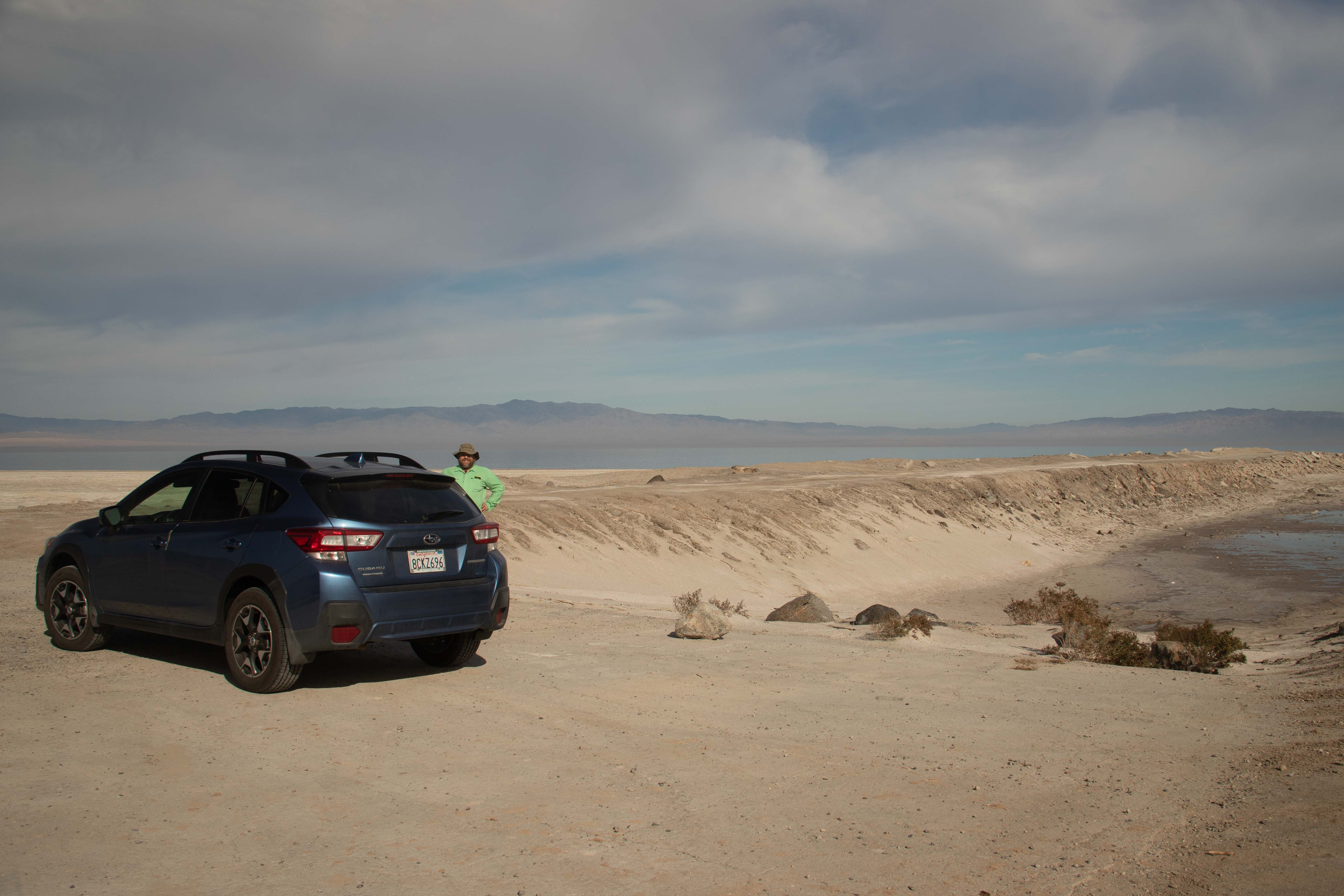
We looked for a cache near what in the past had obviously been a boat launch.
While Eric searched for the cache, I extracted my binoculars and examined the bird life. At first, I was disappointed only to see gulls and American Avocets. But then I saw something that was not a gull flying above us. I thought it was probably an osprey, but I was puzzled by a bright-red color in its bill. With some help from Denis, I identified it later as a Black Skimmer, a life bird for me, and a relatively rare sighting!
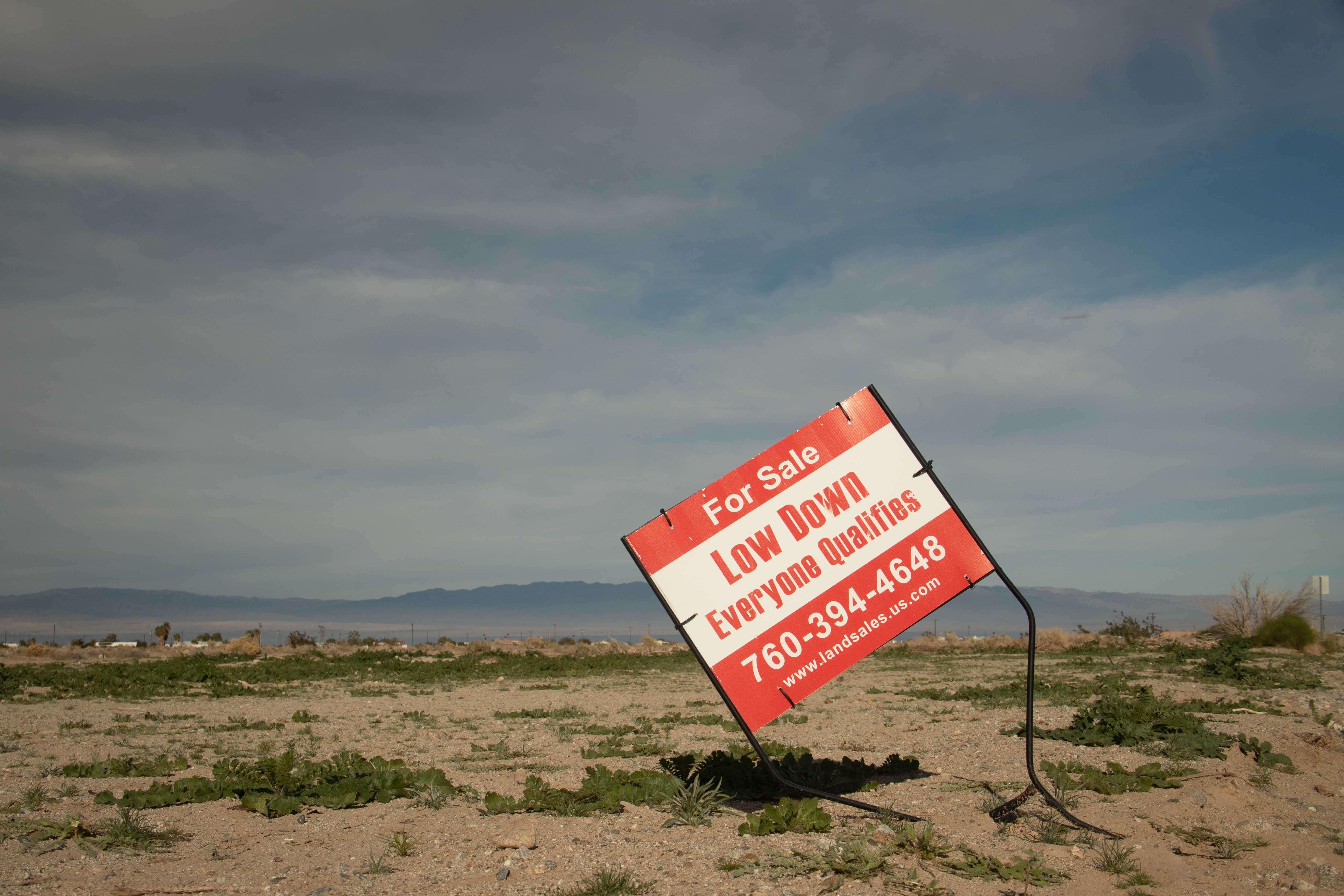
We failed to find that cache, and so had to seek another one in nearby Salton City. We found ourselves driving along an array of paved roads, each signed as "Sea-something," "Sea View," "Sea Nymph," "Sea Wind," etc., with nothing but dirt and weeds between them. Well, nothing but a geocache and some litter.
"Someone paid to pave this," Eric pointed out. "Why?"
Real estate speculation, as it turned out. Yuck.
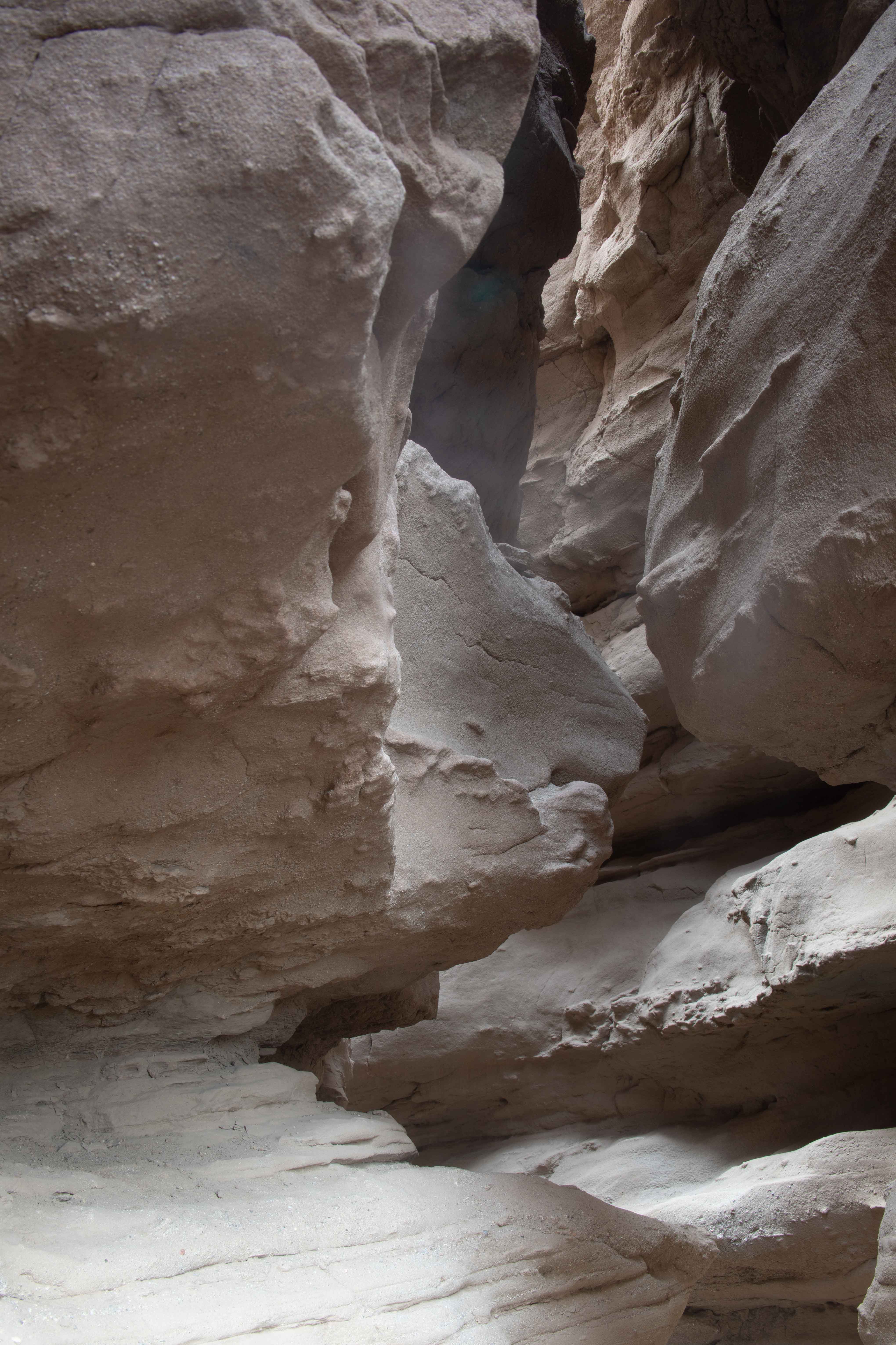
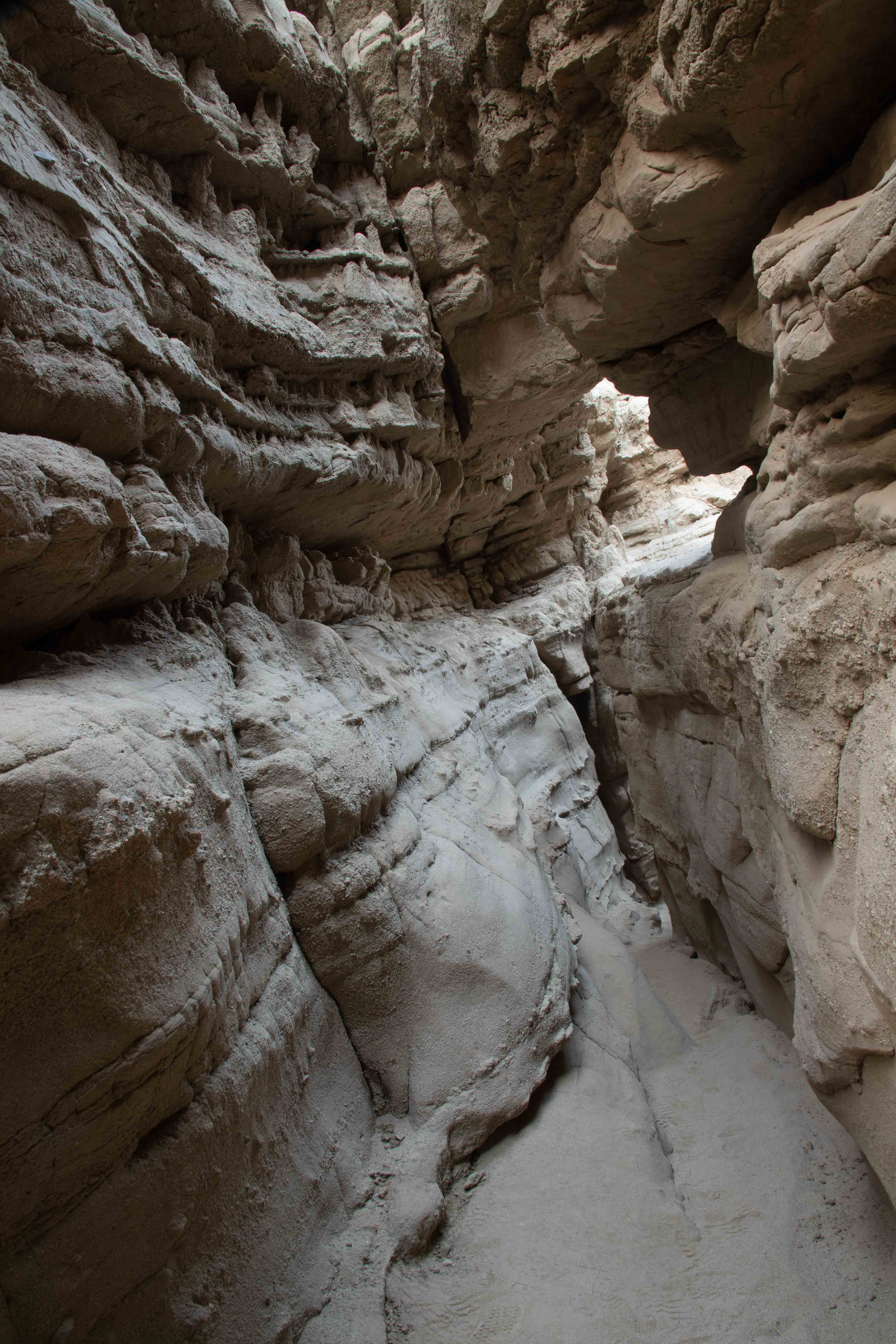
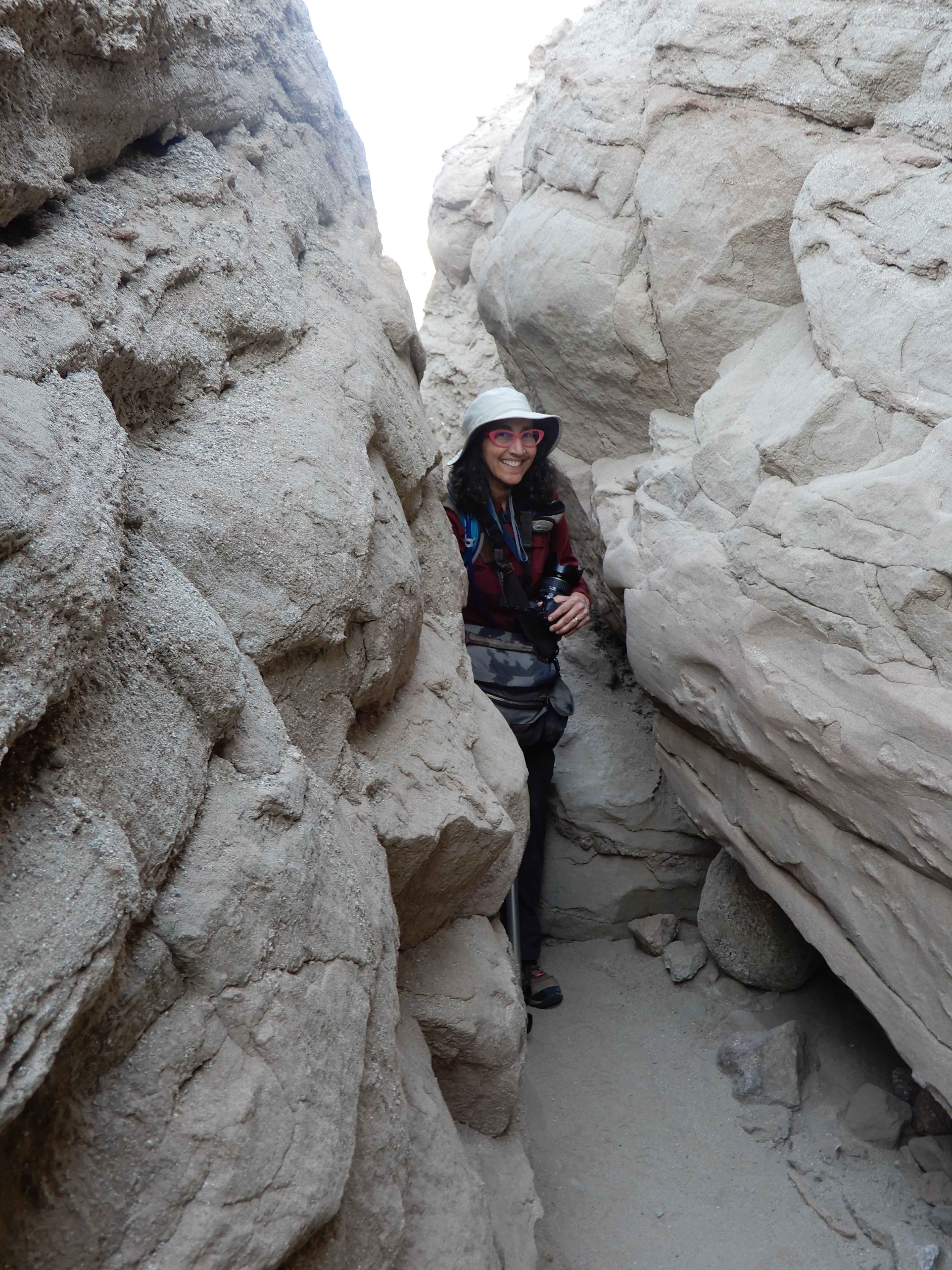
We returned to San Diego County and the state park proper, headed for a site called the Slot.
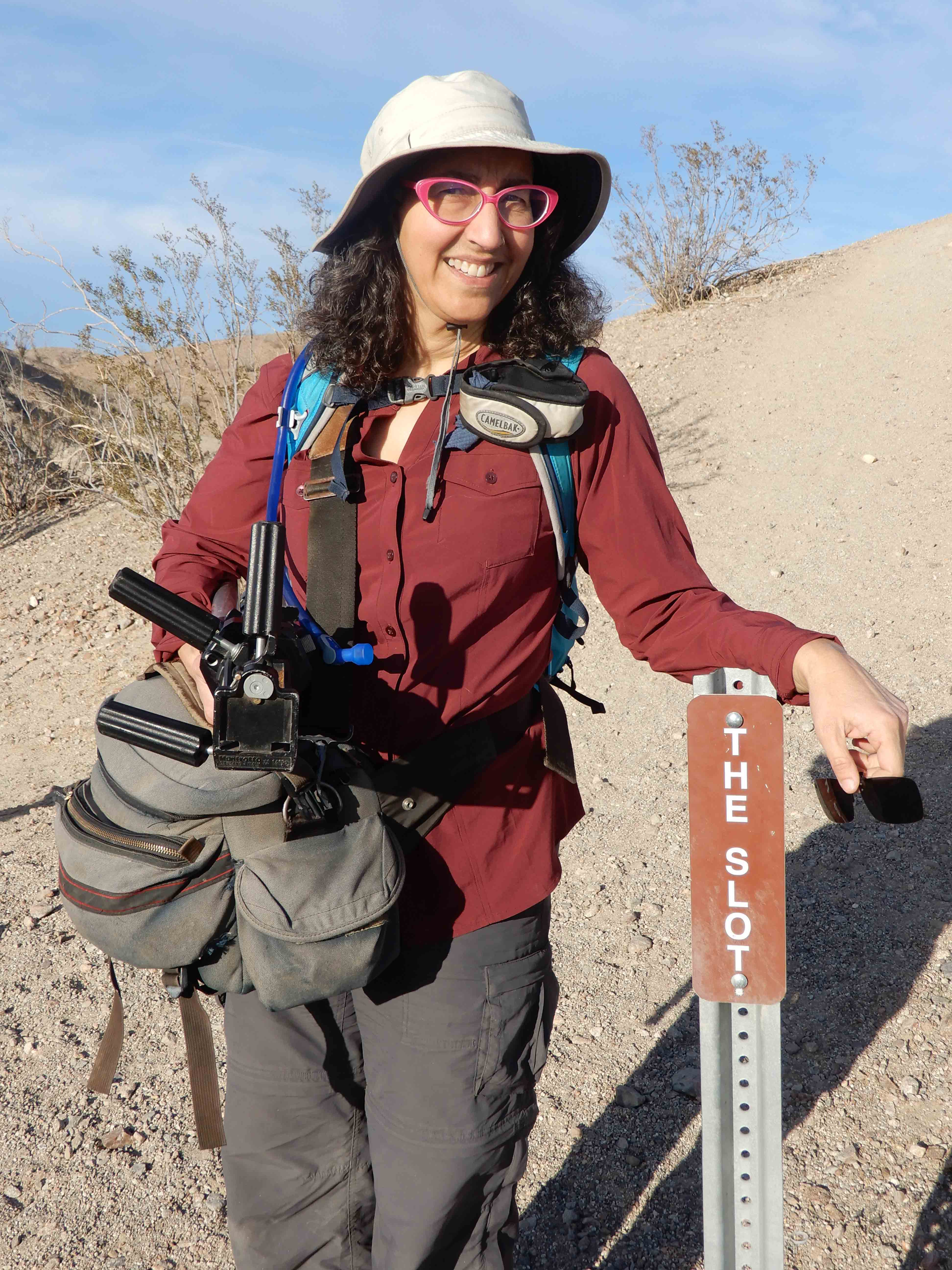
Eric took my picture at the trailhead.
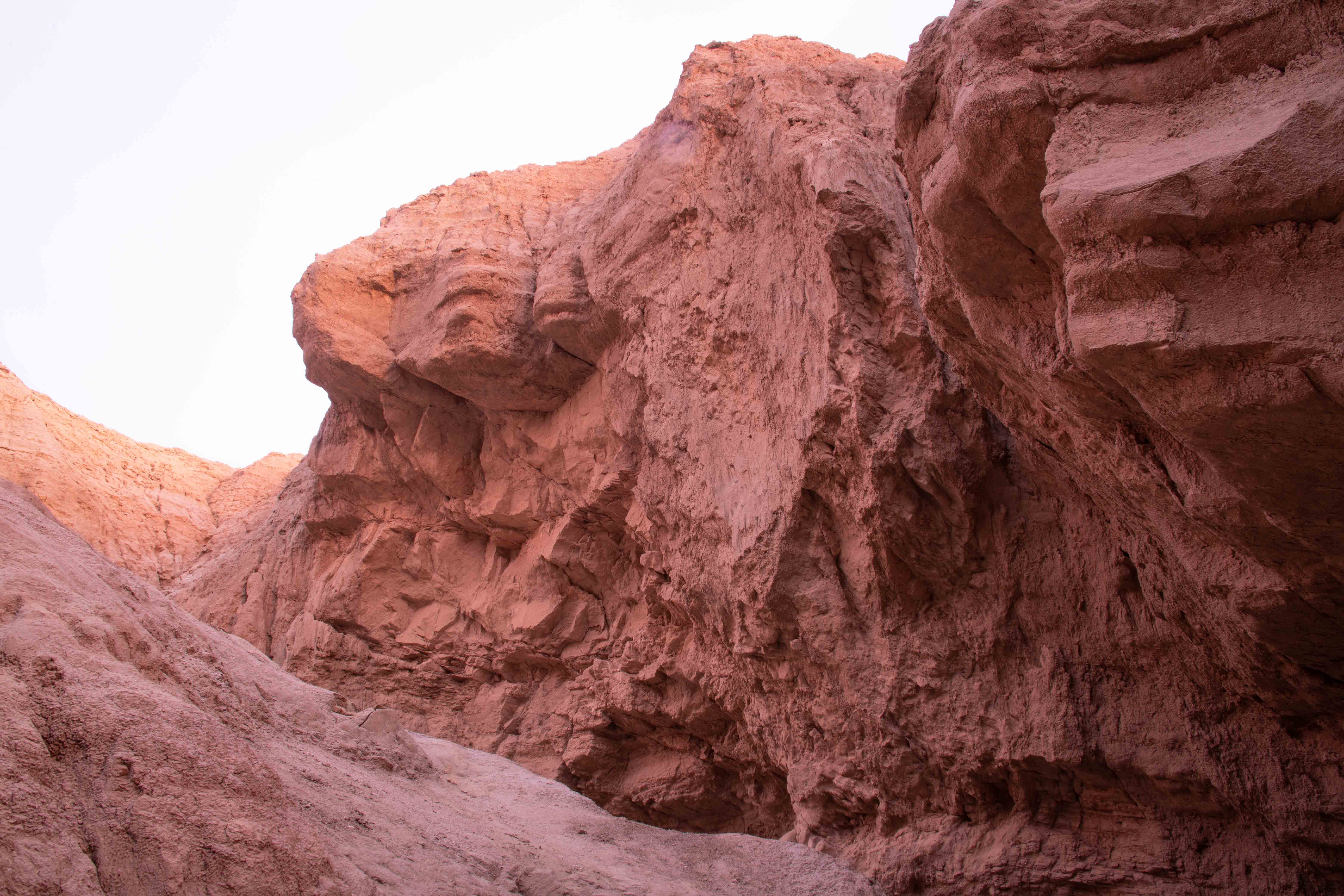
While not as colorfully impressive as the slot canyons near Page, Arizona, the Slot was still geologically impressive.
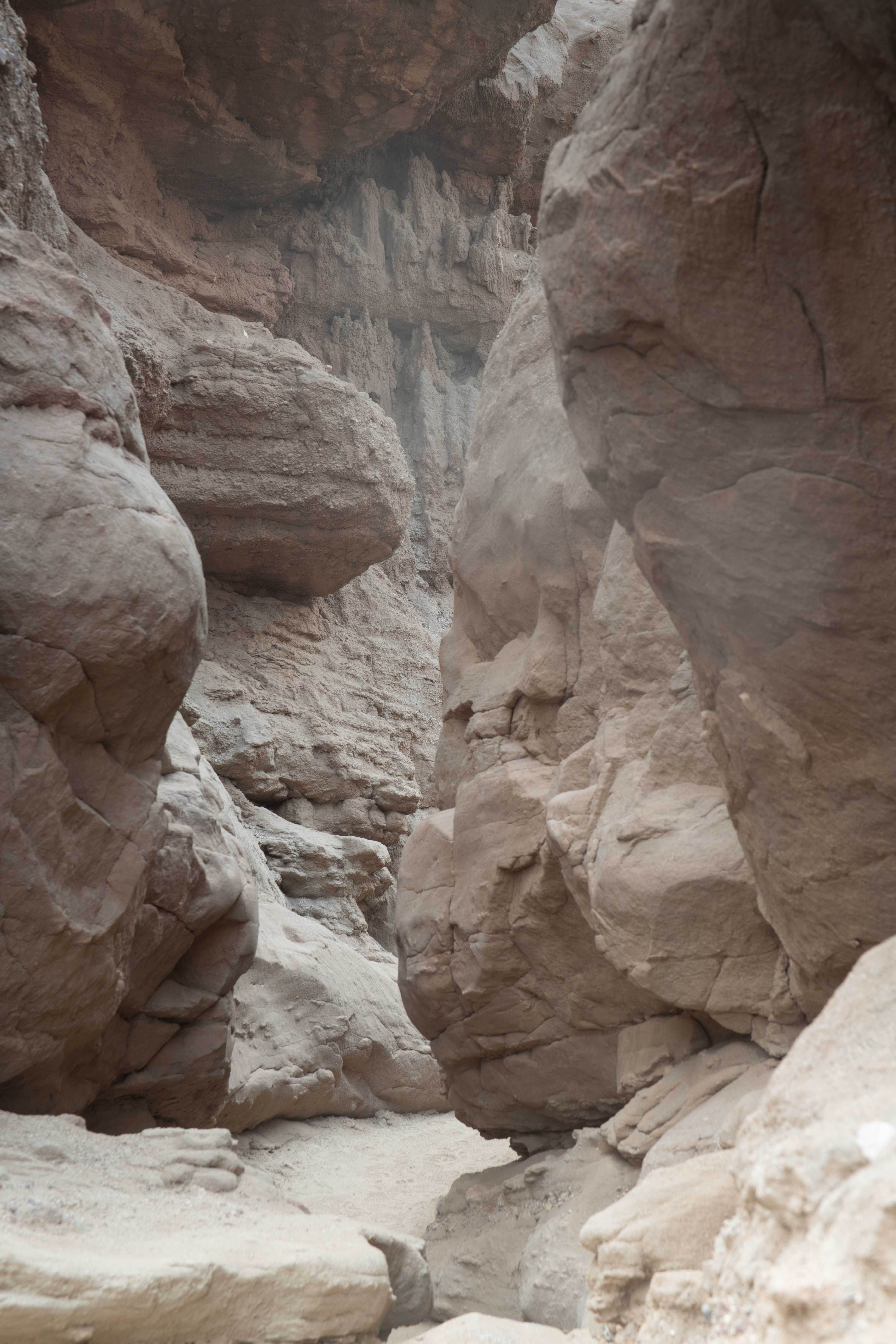
I enjoyed photographing the flash flood-carved canyon walls.
Eric took my picture photographing the Slot.
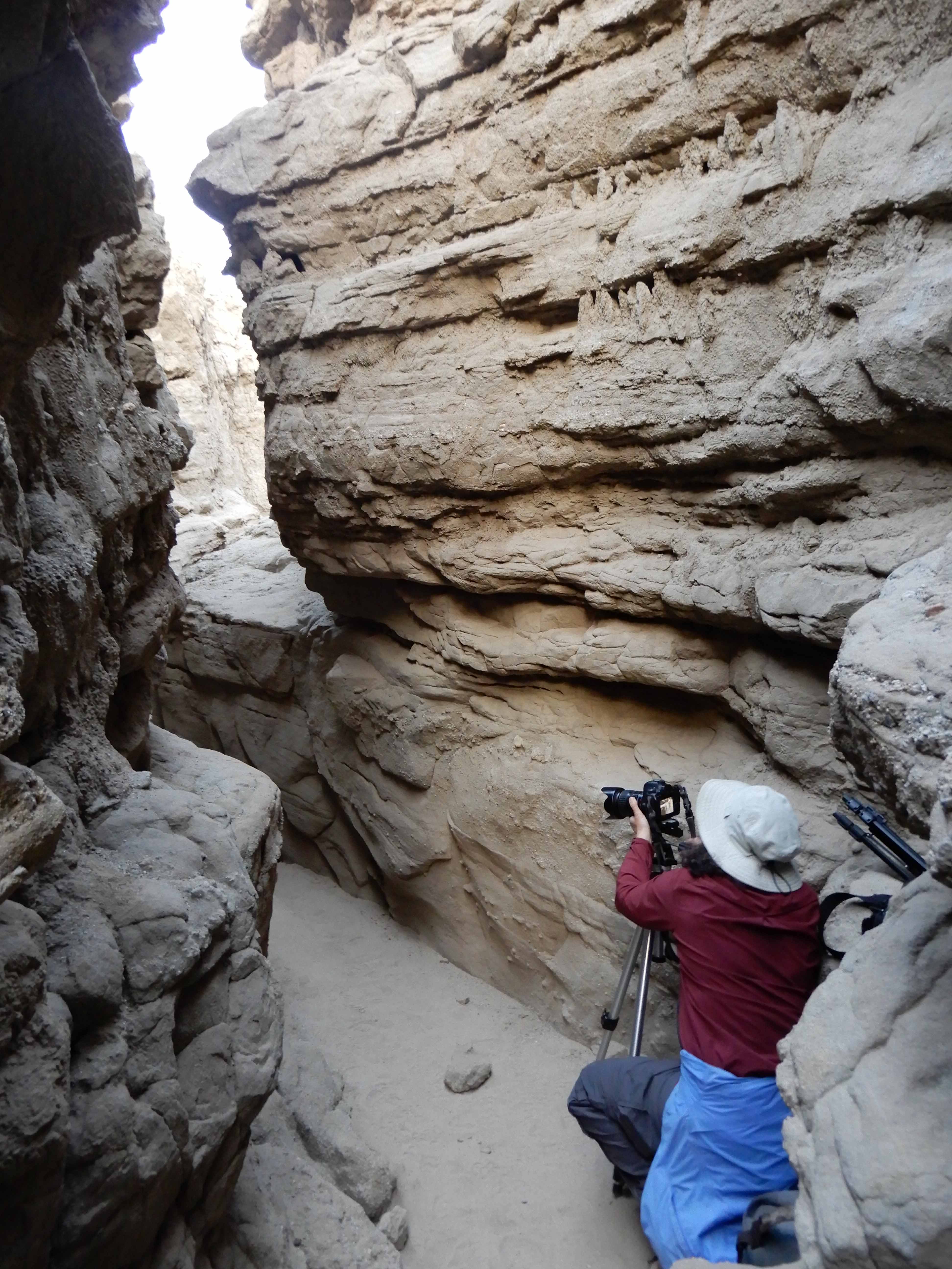
And trying to squeeze through it with all of my equipment.
As we were nearing the sunset, we tried to figure out how long we should hike through the canyon. We had been told that the trail was a loop, that it came out at the other end of the canyon and then went back to the parking lot up on the surface. Jeff Sullivan, author of "Photographing California, Vol. 2: South," had recommended the area for shooting the sunset, but we think he must have meant the view of the sun setting over the badlands from the parking lot, not necessarily inside the canyon.
Eric asked a young man coming from the other direction how far it was to the other end of the canyon.
"Far!" the man declared.
"Like, how far?" Eric asked for a clarification.
"Really far!" he said. "Like, more than ten minutes!"
Trying not to laugh out loud, I muttered, "That's the second most LA thing I've heard this weekend."
However, the canyon narrowed as we continued on, and, while we were sure many other people were doing the same thing all day, we felt guilty about the damage we were doing to the canyon walls by squeezing through them. Another couple told us that, while the canyon widened beyond that point, we still had a ways to go and that it would probably be better to turn back rather than to go on. We turned around.
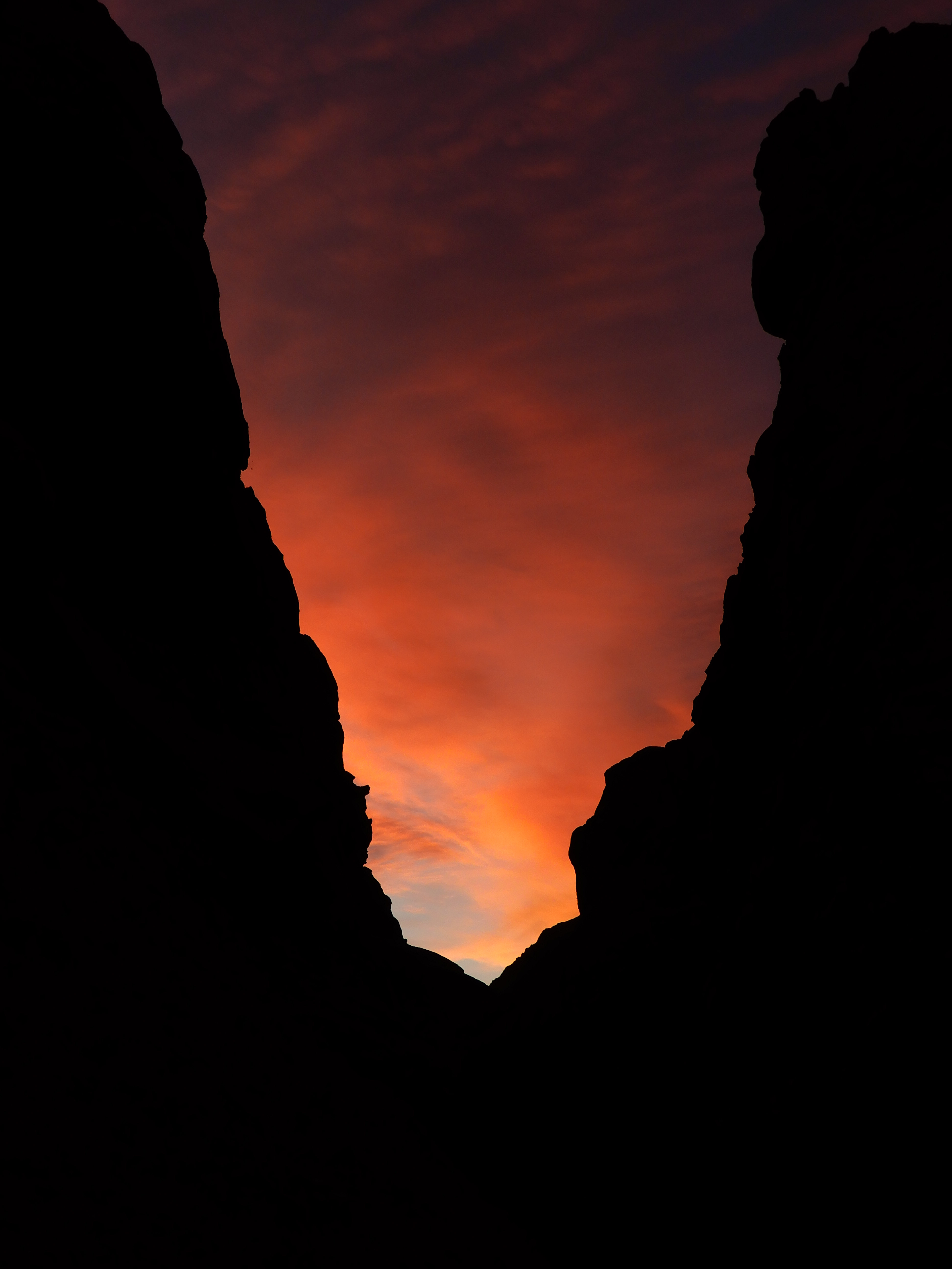
The setting sun did create some color inside the canyon.
Eric took a picture looking across a narrow point of the Slot at the lovely colors in the sky.
We stayed in the Slot long enough that we overshot the path back up to the parking lot in the fading light, but the GPS tracks helped us find our way back to Mather. The Slot was a delightful diversion.
Eric drove back into town while I processed our photos. We stopped at the market in town for some frozen food to heat up in the microwave in our room. We enjoyed our spacious room at the resort, and once again went to bed early enough to see the sunrise.
Part 2.