Maligne Canyon
Thursday 20 June, 2024
Cascade along Maligne Canyon.
We spent our last day in Jasper back in our hiking boots, exploring Maligne Canyon. Like Johnston Canyon in central Banff, Marble Canyon in Kootenay, and Mistaya Canyon along the Icefields Parkway in northern Banff, Maligne Canyon is carved in middle Carbonate rock. Unlike the others, however, Maligne Canyon appears not to have been carved by the river in the area, in this case, the Maligne River. Maligne Canyon might be a cave that has been exposed by glacial erosion.
I had failed to set an alarm. With such long days close to the solstice at high latitude, we had none of the usual circadian clues to wake us up, and we slept until 8:30. Crowds were increasing as summer was beginning, and we had to park in overflow parking more than 1 km/.6 mi from the trailhead.
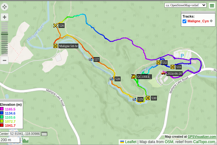
There are six bridges over the Maligne River. Eric took my picture on Fifth Bridge...where we should have just parked, and started the loop from the middle (see map, later).
Eric's view of the Maligne River.
Maligne River with backdrop of mountains.
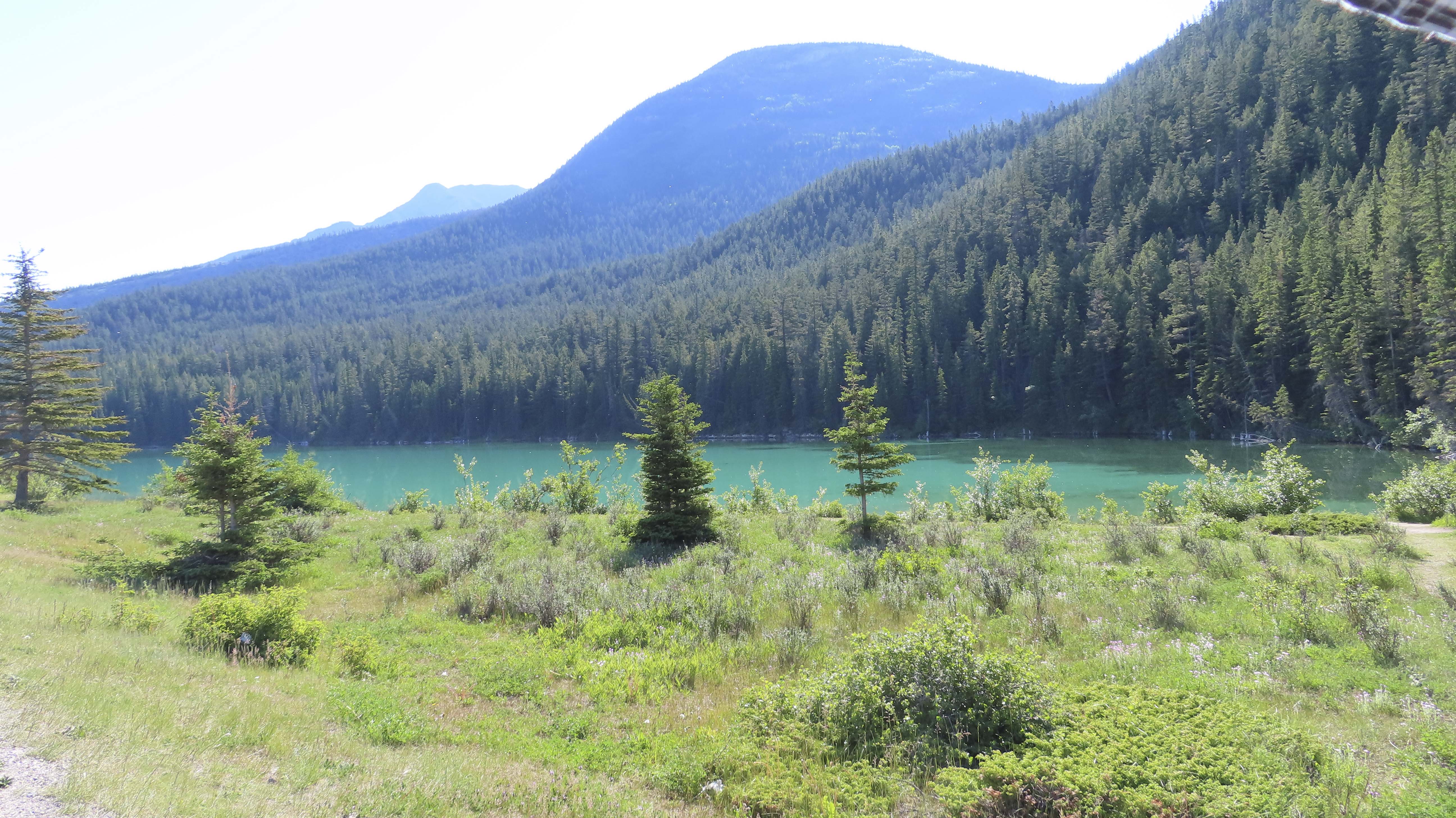
Eric admires the green glacial meltwater of the Maligne River.
We knew well by this point that these canyons always have waterfalls. Maligne Canyon had several of them.
Us in Maligne Canyon.
We found a geocache and observed the view from the overlook in the overflow parking where we had had to park. Jasper Town is in the distance.
We had a little bit more time, so we went to see Pyramid Mountain, a beautiful red peak made from iron.
My weekly photo challenge was "portrait," so I shot a portrait of Eric gazing up at Pyramid Mountain in his new hat.
A crack of thunder roared from the sky, prompting us to hurry back toward Mather.
A couple of quick views of the lovely mountains from a footbridge extending into Pyramid Lake.
Us at Pyramid Lake.
We hadn't seen Mt. Edith Cavill, but we generally felt we had seen the major sights of Jasper and could go home satisfied.
We did have one more geologic stop along the road, Cold Sulphur Springs. This is the sight of an unconformity, where about 120 million years' worth of rock are missing in the layers.
Eric's view of the mass of rock above Cold Sulphur Springs.
Eric spotted a goat atop the feature.
Cold Sulphur Spring. Fortunately the odor does not come through in the photo.
Eric points to the unconformity, the line that is slightly off vertical.
Detail of the unconformity. Left (below) the unconformity is late Cambrian dolostone of the Lynx Group, about 500 million years old. To the right (above) the unconformity is late Devonian dolostone of the Flume Group, about 380 million years old. Rock of the Ordovician and Silurian periods is just gone.
Ben Gadd's Canadian Rockies Geology Road Tours explains that, in the late Silurian, this part of the Rockies rose above sea level and became an island. While it was so exposed, erosion removed the Silurian and Ordovician layers.
Eric was fascinated by the glacial greens in this unnamed lake near the unconformity.
We got some acceptable takeout burritos for dinner and turned in early so we could get an early start on the long way home in the morning.
Map of our Maligne Canyon hike.
On to the journey home through Seattle and Portland.