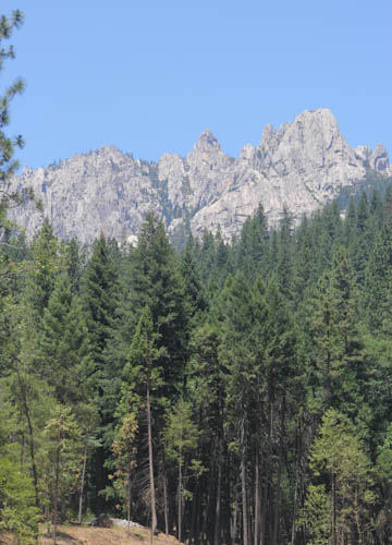
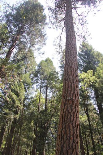
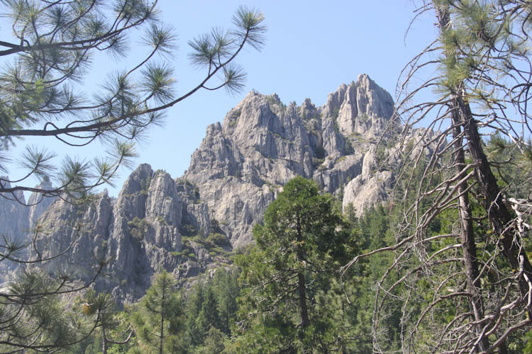
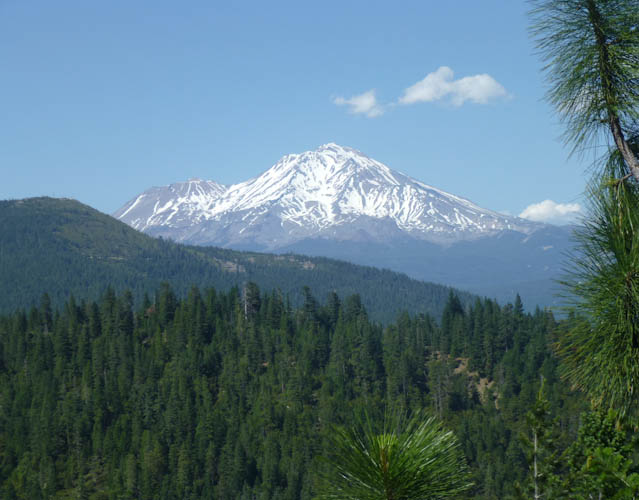
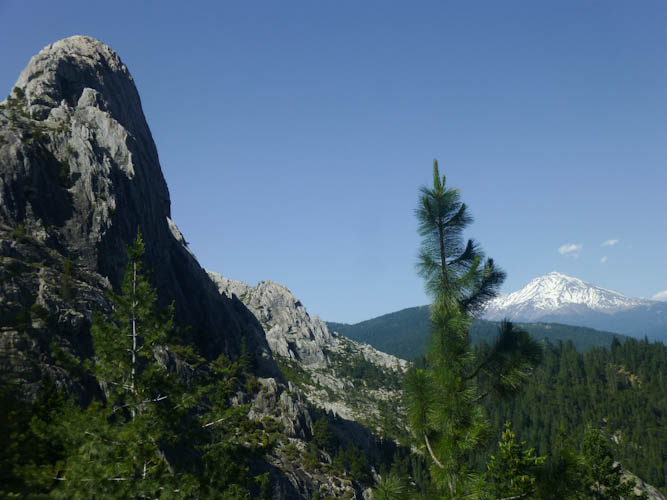
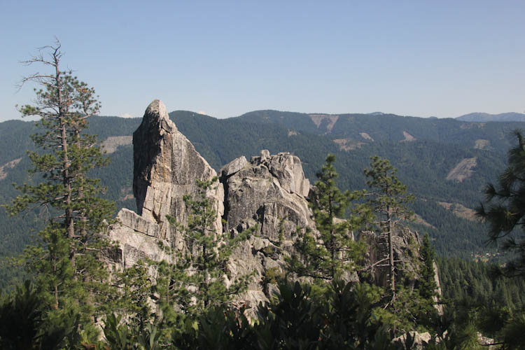
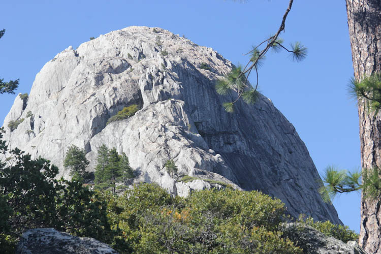
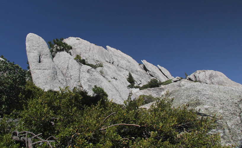
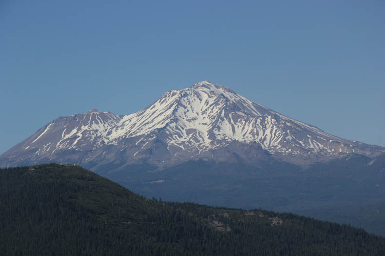
The Castle Crags look very impressive from Interstate 5, which runs right past them. The view above, taken from the Visitor Center in Castle Crags State Park is very similar to what you can see from the freeway. For years, as we entered the Cascades on our way to points north, Eric and I had enjoyed the view of the crags, and hoped to hike them someday. We decided to spend our annual weekend camping trip in this state park so that we could hike the Crags at last.
As the Castle Crags are so close to Mt. Shasta, we had always thought they were a Cascade formation. This turns out not to be the case. The Crags are about 200 million years old, and were formed at the same time and by the same forces that uplifted the Sierra to the south and the Klamath Mountains to the north. The Cascades started erupting only about 40 million years ago, and, of the major ones that we can see today in California, Lassen is a newer remnant of 450,000-year-old Mt. Tehama, and Shasta is only about and 600,000 years old, both much younger than the Castle Crags. [Source: Roadside Geology of Northern and Central California, Alt & Hyndman]
We found a site that was near a bathroom at the intersection of two loops with, unbelievably, no other campers in the loop. We've been to a lot of California state parks, and usually you have to make a reservation weeks or even months in advance. This was unbelievable. As isolated as we were, however, we were right next to the interstate and the railroad tracks. Trees blocked the view of the freeway, but there was still a lot of road noise.
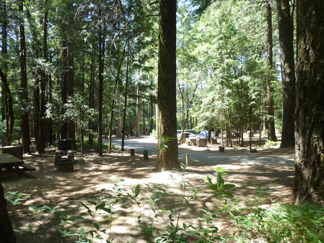
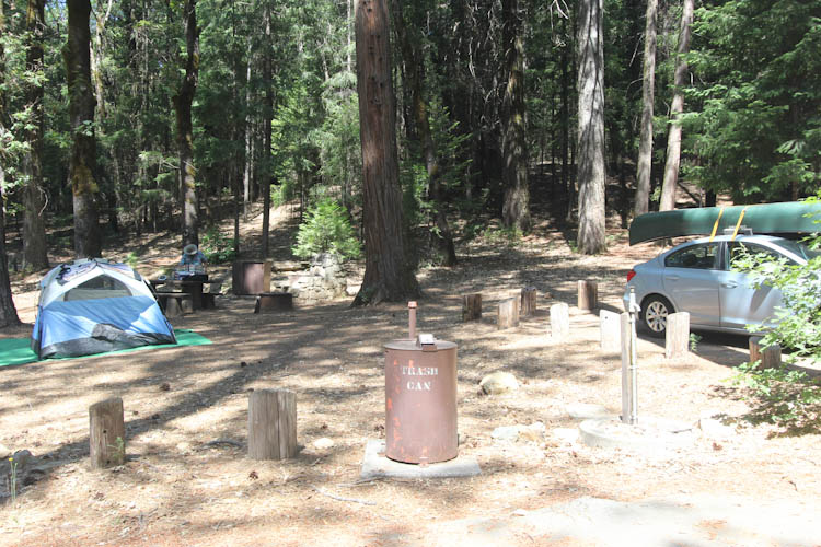
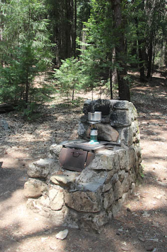
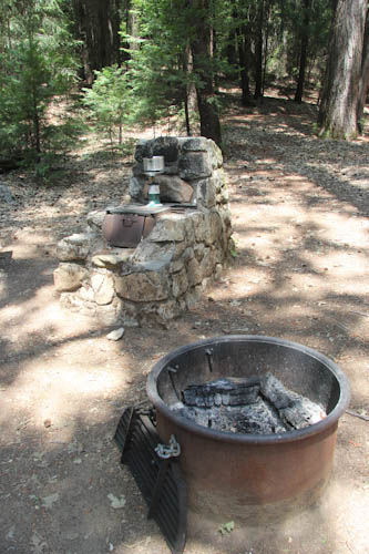
I had successfully returned the unsatisfactory shock cord tent to Target, and acquired a nice, new poles-sewn-in Coleman tent. The thing was just easy as pie to set up. The poles were telescoping! It even had the fly attached as part of the tent, and it had a pole on a swivel to prop up the fly. Unfortunately, however, signs indicated that we were in a bear area and that we had to put anything that might attract a bear in a special bear locker. For those of you who have never camped in places like Yosemite, this doesn't just mean your food--it means anything that has a smell. Sunscreen, chapstick, deodorant, toothpaste... we've been told by rangers that some bears have broken into campsites for gum. And these items aren't safe in your car, either--a bear can grab a door by the frame above the window and yank it down in order to get inside your car. So we had to get all the food, all the kitchen stuff, all our toiletries, everything, out of the car and into the bear locker, and pull out all the scented items from the bags we wanted to have with us in the tent. Thus, by the time we found a site, got set up, protected all of the potential bear attractants, performed our nightly ablutions, and went to sleep, it was nearly 1:00.
Our sleep was fitful, and I had specifically planned this trip as one where we didn't particularly have to hurry, so I let us sleep until 10:00. I keep reminding Eric of how my father always cooked bacon in camp when I was a child, so he had packed some turkey bacon in a mini-cooler with an ice pack. Dad had had a large, two-burner Coleman stove, though, and we had only one burner and a small frying pan. Too bad the big REI sale was a couple of weeks ago! We had to cook the bacon two or three strips at a time, with the ends of the strips curling up the sides of the pan. It was good, though!
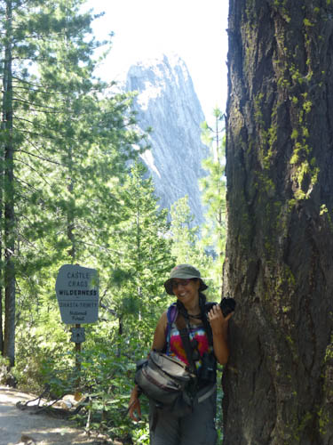
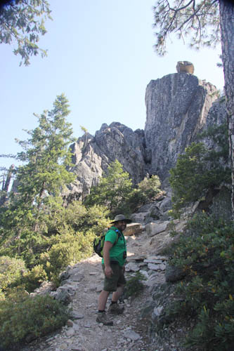
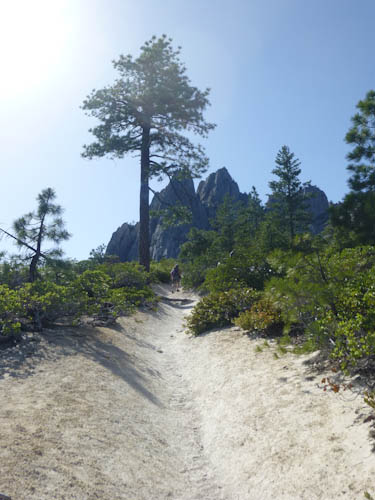
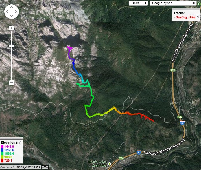
We stopped at the Visitor Center to pick up helpful trail maps and talk to the ranger. We drove up the road to the actual trailhead, set out at 13:44, and then promptly had to turn around because a misleading sign sent us in the wrong direction at first. By the time we actually got started on the right trail, it was 13:55.
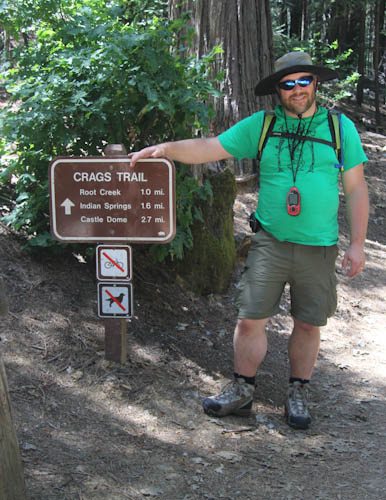
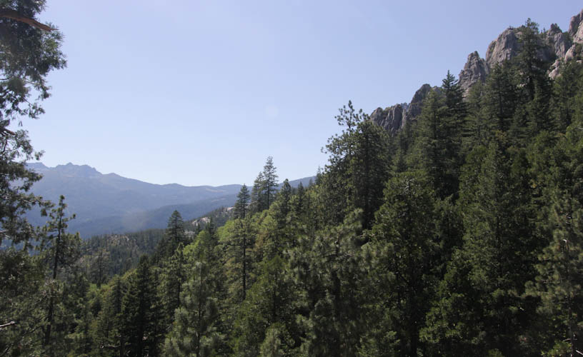
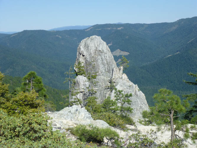
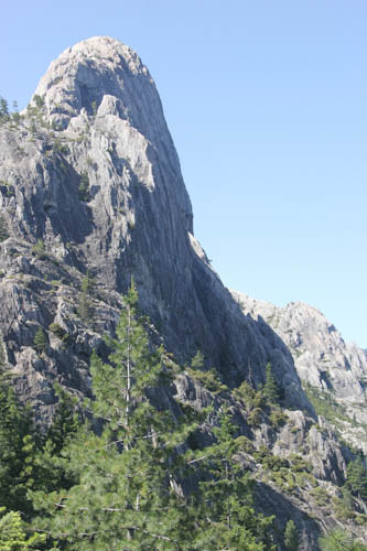
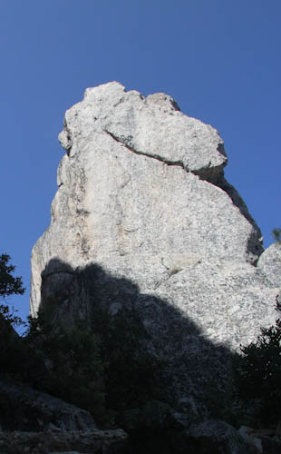
The trailhead is at about 792 m (2,600 ft), and the summit at 1463 m (4,800 ft). Castle Dome tops out at 1523 m (4,996 ft). [Source: park brochure] The trail is steep, and the lower part has quite a few switchbacks.
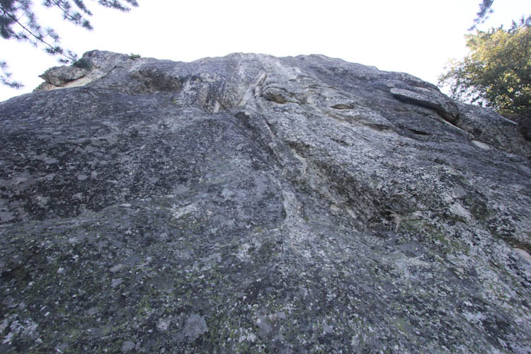
The trail was not at all crowded, but it wasn't as isolated as the campground. We did see some other hikers. Particularly memorable were a pair of backpackers on their way down. They said they had gone not just to the top of the trail, but had done the additional 61 m (200 ft) of technical climbing up to the top of Castle Dome. When we suggested that, in order to accomplish this, they must have arrived last night earlier than we did, they said, no, they had arrived around midnight. We are baffled as to how they could have done this (did they backpack up the trail in the dark and sleep near the top?), but in any case, I am quite sure that, in order to have been so fast, they must have skipped some essentials like, say, tooth brushing.
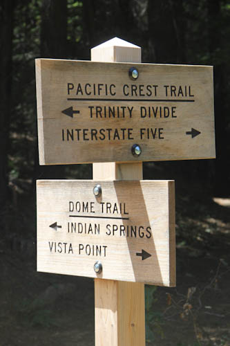
About two-thirds of the way up the trail, there was a turnoff for Indian Springs. Yes, the Department of Parks and Recreation is still using that name. We heard from other hikers that the springs were nice, but figured we should press on toward the top and see them on the way back if time somehow permitted. On the plus side, though, we had made it up this far in only about 1.5 hours. Not so bad.
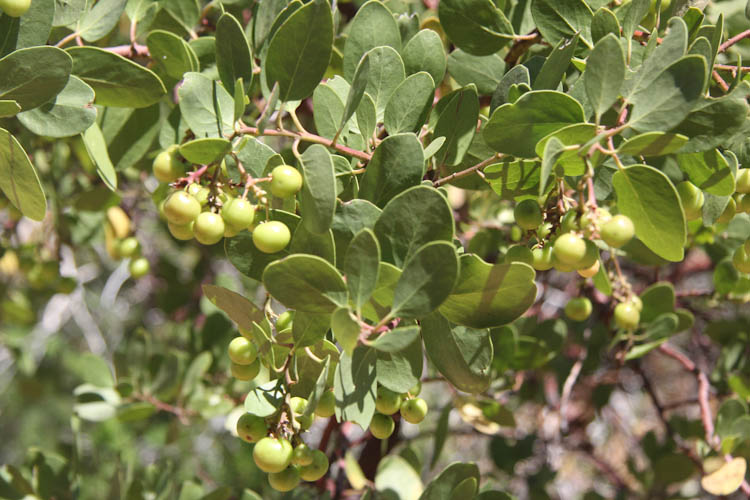
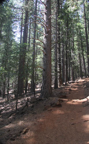
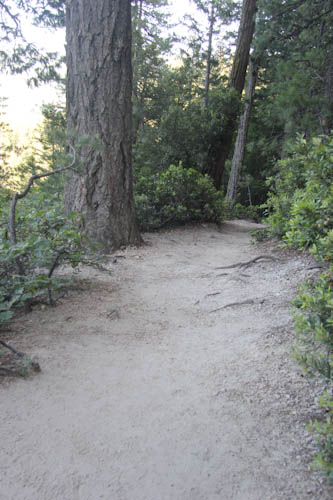
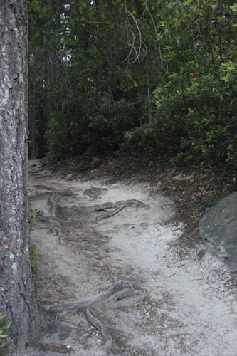
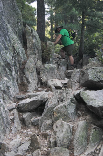
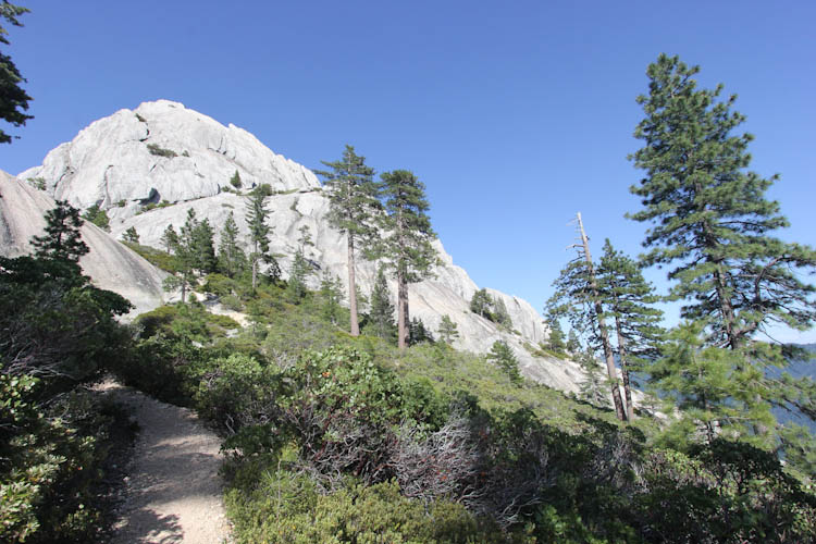
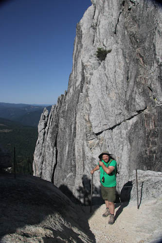
The trail became rougher almost immediately.
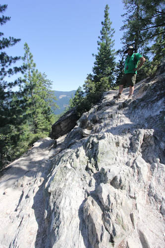
But I loved the trail even where the views were behind the rocks. It was exhilarating.
The park brochure had told us that the trail, like the stoves in the campground, had been built by the Civilian Conservation Corps. I thanked them with every fast aerobic beat of my heart. They made so very many fantastic places accessible to people like you and me. We thank our veterans every Veterans Day, but when do we ever thank the Civilian Conservation Corps for their service here at home? It's not like it wasn't dangerous work--some of them, as we can see in this article from the National Archives did make the ultimate sacrifice. But we don't remember them on Memorial Day. I'd like to thank the Civilian Conservation Corps for making our national parks what they are today.
I thought of Teddy Roosevelt, creating several national parks and monuments and signing the Antiquities Act. But I thought more about Franklin Roosevelt, sending the Civilian Conservation Corps out to develop the park system, even though he, in his wheelchair, could never enjoy much of it himself. There were certainly some problems with the presidencies of both Roosevelts, but they also did some very good things.
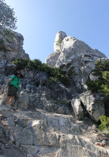
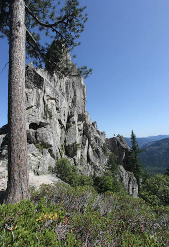
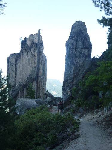
The trail, such as it was, was not easy to find in the rocks, and we were forced to rely on pink plastic ribbons that the Forest Service had tied to the bushes. Fortunately, there seemed to be a pink plastic ribbon at every turn. Sometimes, though, we did find ourselves at dead ends and had to turn around and look more carefully for pink plastic ribbons.
As we hiked, we thought about other similarly epic hikes we had done. While we've done many short hikes that were truly amazing (the Halema'uma'u Crater in Hawai'ian Volcanoes, the Bear's Hump in Waterton Lakes, the falls trails in Grand Canyon of the Yellowstone, just to give some incredible examples), we haven't gone on many long hikes that were this exciting. We think it probably falls into the top five of best long hikes we've ever done. We think probably Yosemite Falls was better, but this was pretty close to our fabulous experience climbing the Lassen summit.
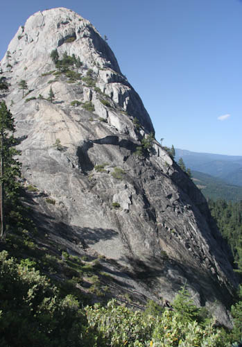
At 17:15, we triumphantly reached the top!
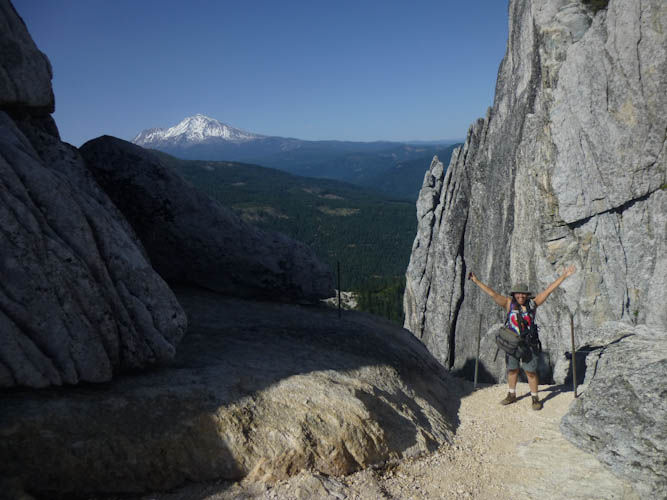
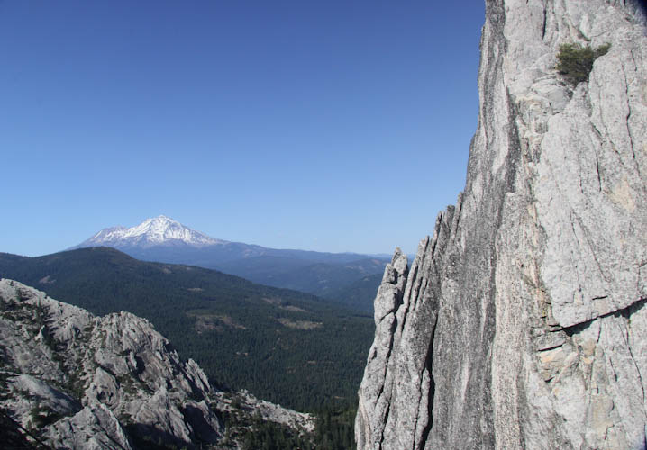
We were quite elated by our success in reaching the top of this amazing trail, having hiked up 670 m (nearly 2,200 ft). We were overjoyed. But now we needed to find the geocache.
This remote area was not exactly full of geocaches, but we wanted to find the one for the top. The listing indicated a guest book under a tree near the top, with coordinates for the tree. We found the tree, but no guest book! The listing described the tree, and there were no other trees in the vicinity that matched the description, so this must have been the right one. But the guest book was gone.
The listing gave another way of finding the cache, as a virtual. You had to give some information found at the summit, and then some other information found at Indian Springs. It was already 17:30, and we were still near the top. We would have to scramble down all of those rocks again, which would probably take about as long as coming up them had. Then, back in the state park, we would have to walk down all those switchbacks. That, hopefully, would take less than an hour. But we were still cutting it close if the restaurants closed at 20:00, so I did not particularly want to take the time to walk the .65 km (.4 mi) out to Indian Springs and back. But Eric really wanted to get the cache.
So, we began scrambling down rocks. Many times, I squatted down and scooted my butt along with my hands. It was lots of fun.
I watched the time the whole way down. We had some extra oatmeal with us, and there was a gas station with a market, so we wouldn't starve, but we might end up eating oatmeal and gas station food for dinner.
But we got the cache! It was probably only the second cache we've ever done with a terrain rating of 4, the other one being at the Lassen summit. We should do this more often.
Back on the better-maintained state park trail, we went down switchback after switchback. This part, at least, was much faster than coming up.
Since it was so late, we didn't see very many other hikers on the way down. But we noted that, of the other hikers we did see throughout the day, most of those who said they had actually been to the top were considerably younger than we were. We took pride in this. There is a real emotional reward in completing a challenging task.
We got back to the car at 19:45, just under the six hours I had expected. Had we started on time, everything would have been fine. We were left with insufficient time to get into town for dinner before 20:00. We had to hope something would be open later.
This turned out to be a good idea. We found the Dunsmuir Brewery Works. The menu had some items that were somewhat chi-chi for a brew pub, but they still had the traditional favorites. I couldn't resist a pretzel with mustard sauce and beer cheese. In addition to beer, they also made their own root beer, which was very good. They had a live folk band and outdoor seating (although Eric wanted to sit indoors to avoid what we call his Fan Club--he says that his fan page on Mosquito Facebook has 75 trillion likes). I noticed that the drummer was wearing a very obvious drag costume, unrealistically high and pointy breasts and a very fake-looking blonde wig. It turned out that the band was called No Boys Aloud, so the drummer had had to disguise himself as a woman to fit in. The effect was somewhat spoiled, though, because they had a guest keyboardist, the brother of the lead singer, who was not in drag at all. But the music was good and the atmosphere was fun, even when an overenthusiastic hockey fan suddenly let out a loud whoop and then turned around to apologize to the assembled crowd, "Sorry, the Kings just won!" The waitress was very friendly and talked to us for a while about hikes in the area--she had never done the hike up the Crags. At the end of the evening, we all sang "Happy Birthday" to a young woman named Laura, who had come up from Redding on a party bus with about a dozen rowdy friends. It was a lot of good fun, and I have to admit that it was better than cooking in camp would have been.
I have a collection of wonderful books from Foghorn Outdoors, mostly by extremely comprehensive outdoors writer Tom Stienstra, California Hiking, California Camping, etc. I think that these books should be essential for all Californians. There is nothing on the web, or anywhere else I've seen, that contains information as complete as what you find in the Foghorn books. They cover the whole state (which is larger than most of you from the east coast think), the entire state, section by section. Every trail has detailed directions to the trailhead, a complete description of the trail, and ratings for difficulty and scenery. These are the Bibles of California recreation.
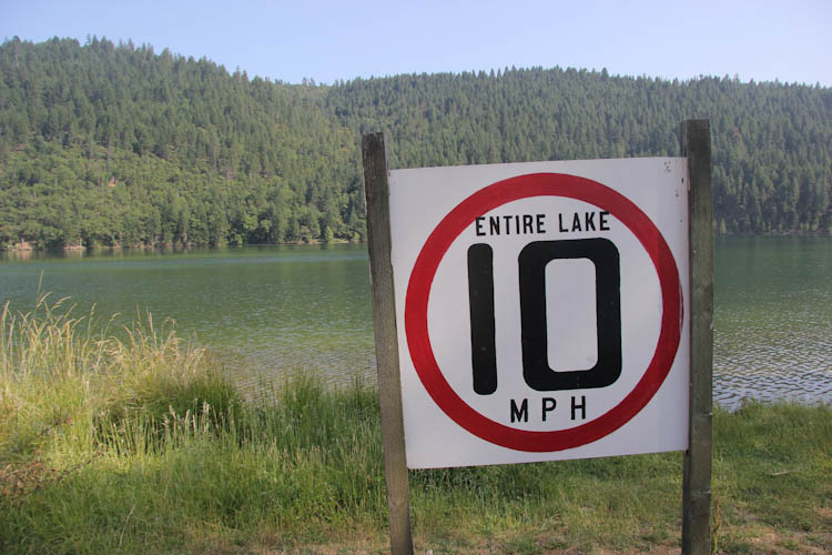
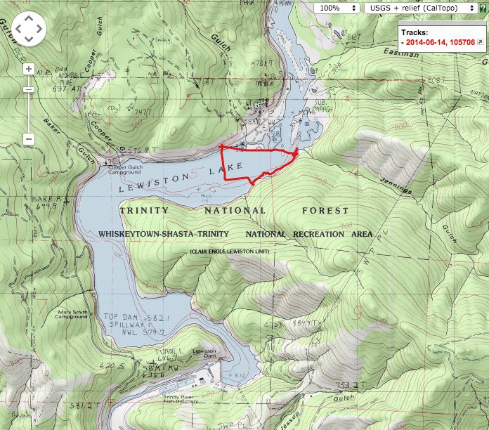
I had read about Lewiston Lake in Stienstra's California Recreational Lakes and Rivers. He gave it a 10/10 scenery rating, and said that the 16 kph (10 mph) speed limit made the lake perfect for muscle-powered boats like the Weeble. We had visited the lake before, but we had been canoeing in the rain, and found a duck with fishing line wrapped around her beak, so it had not been the greatest canoeing experience. We wanted to try it again in better weather.
It turned out that Lewiston Lake was rather further from the freeway than I had expected, about an hour west of I-5. This meant that, even though we'd driven an hour south, we would still have a four-hour drive home. We were hoping for a sit-down dinner in Redding rather than Subway again. Subway is about the only fast food I can digest, but I'm quite frankly tired of it. The ride was through a beautiful canyon, though, on CA 299 in the Trinity Alps.
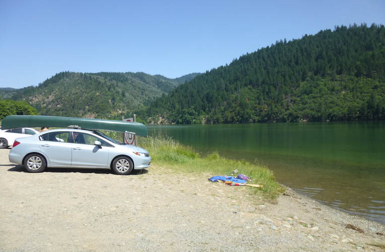
We had a lovely canoe trip. There were several caches along the lakeshore, but one, approximately directly across from the boat launch, had been placed specifically for canoes. Since we had found ourselves needing to drive quite a bit more than expected that day, we decided just to go for the canoe cache. In the Bay Area, it would have been much too windy to cross a lake in a canoe, but up here in the Trinity Alps, the air was calm enough for an open water crossing. So, while we only found two caches on this trip, their average terrain rating was 4.5.
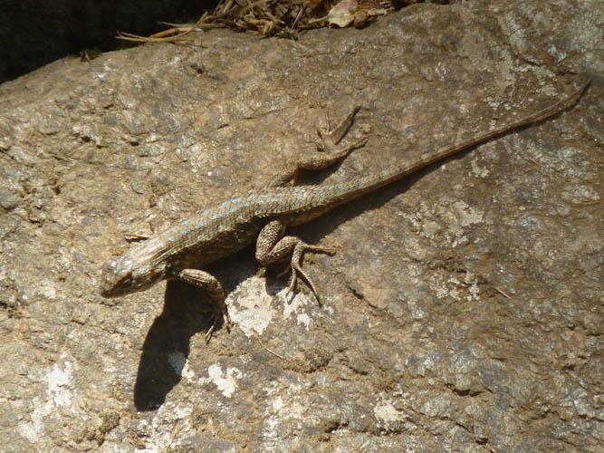
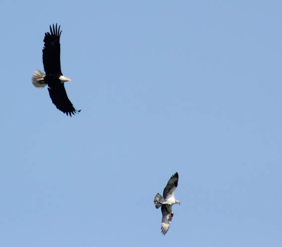
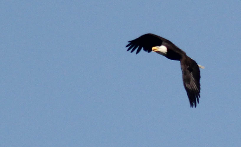
We ended up paddling about 2400 m (1.5 mi). We saw some cute duck mothers followed by baby ducks in various stages of development. We also saw some baby ducks that were apparently too young to swim sitting on a log--their feathers were still very poofy. I think these were Mallards, but it was hard to tell with no adult males around. At one point, we beached the Weeble and tried to take a swim. It was extremely hot that day, about 38 C (100 F). But the lake was very, very cold, probably about 14 C (high 50's F). Feeling that an upstate New Yorker such as I am should be made of stronger stuff, I tried valiantly to get into the lake. I did get in, but I wasn't able to stand it very long, and watching me did not inspire Eric to try it.
We did get back in time to have a sit-down Mexican dinner in Redding, although we got home somewhat later than would have been optimal.
All in all, it was an absolutely amazing weekend. We learned quite a bit about northern California's geology, faced and overcame physical challenges, saw wonderful wildlife, and enjoyed utterly incredible scenery. I know I keep going on about the stark beauty of the northern third of California, but every time I go up there, I am more and more enchanted by it. This is a truly wonderful place, and we are extremely lucky to have such easy access to it.