Navajo Nation - Monument Valley
Friday, 23 September - Monday, 26 September, 2022
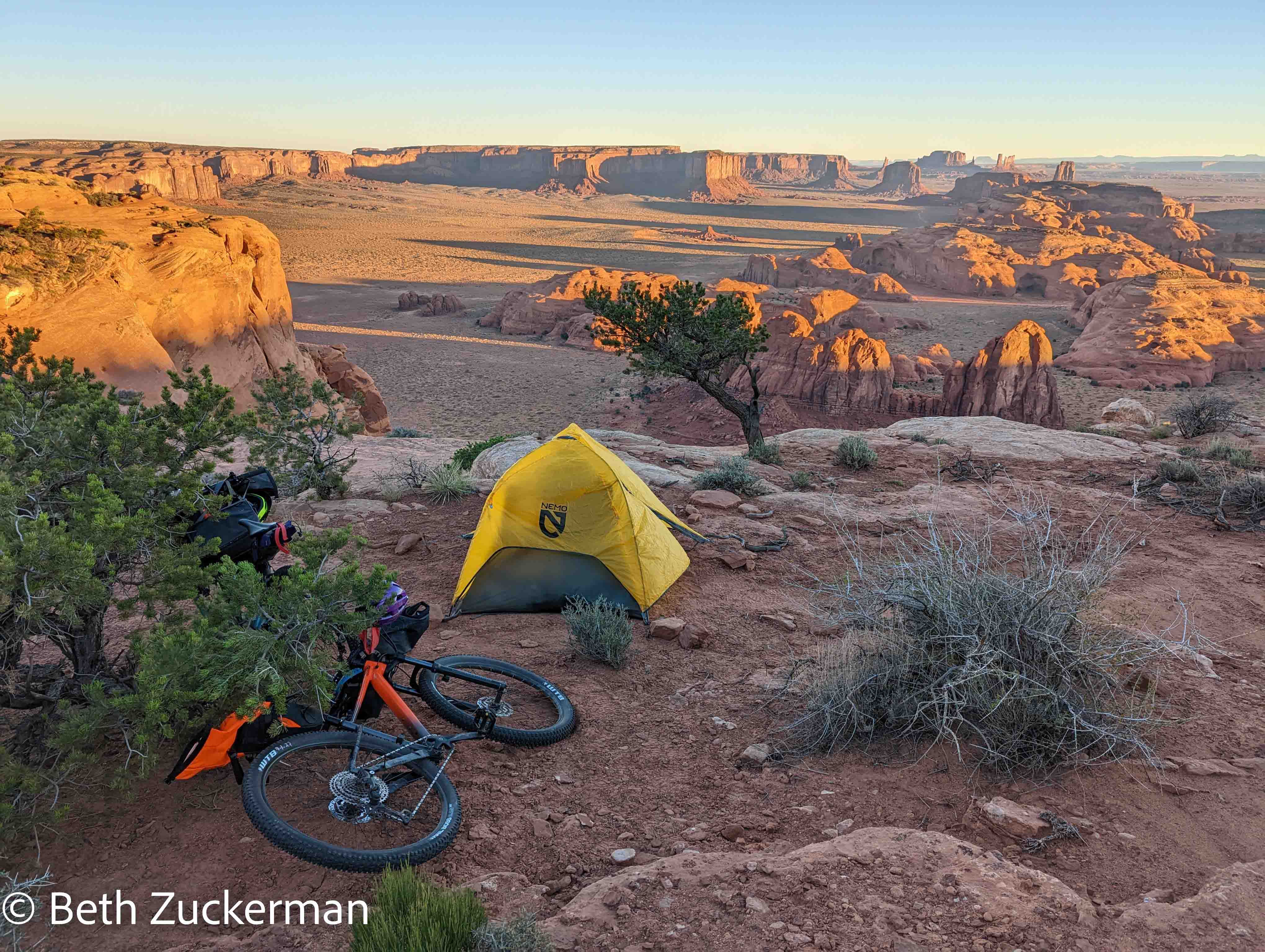
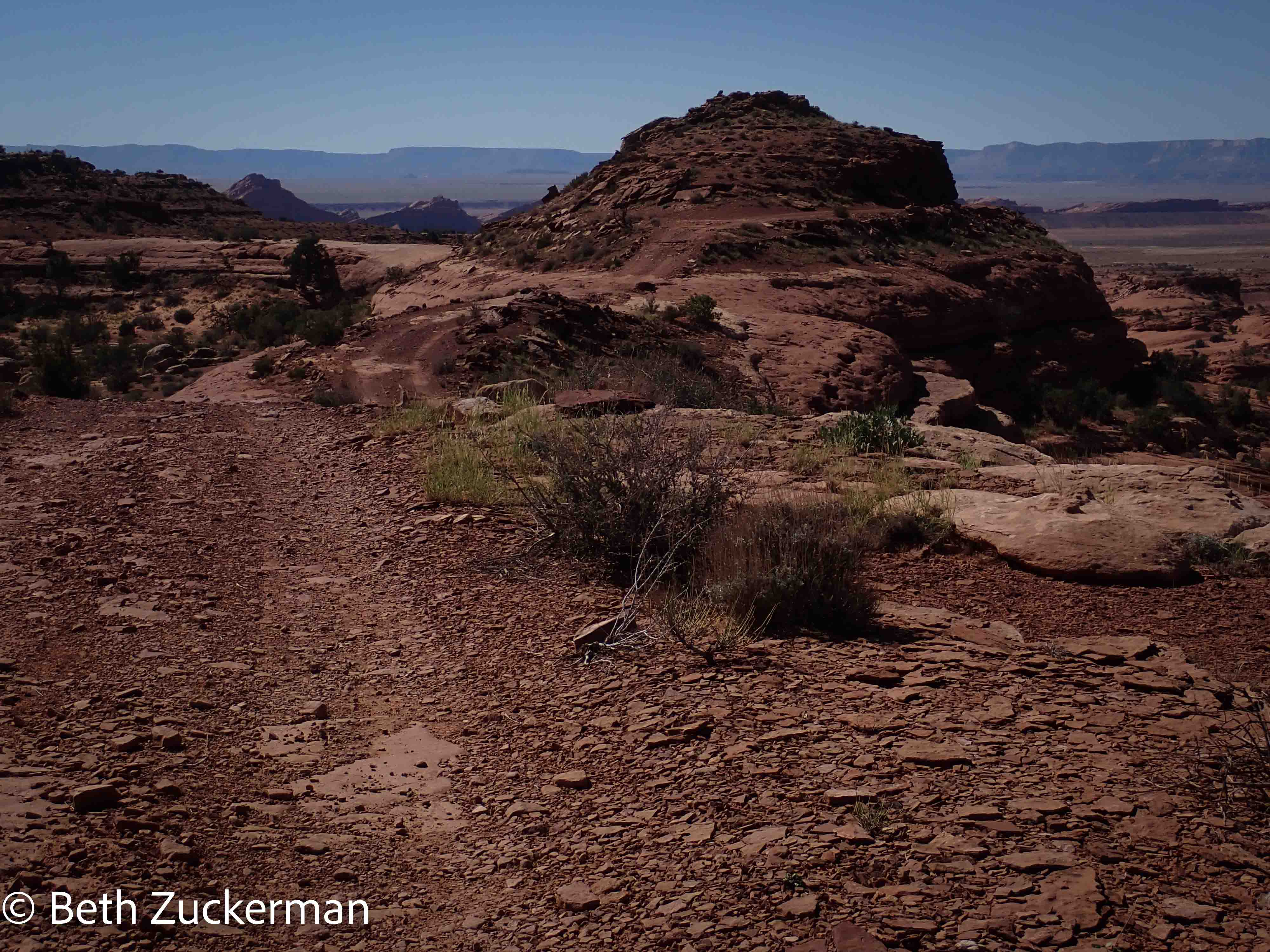
Sunrise in our campsite.
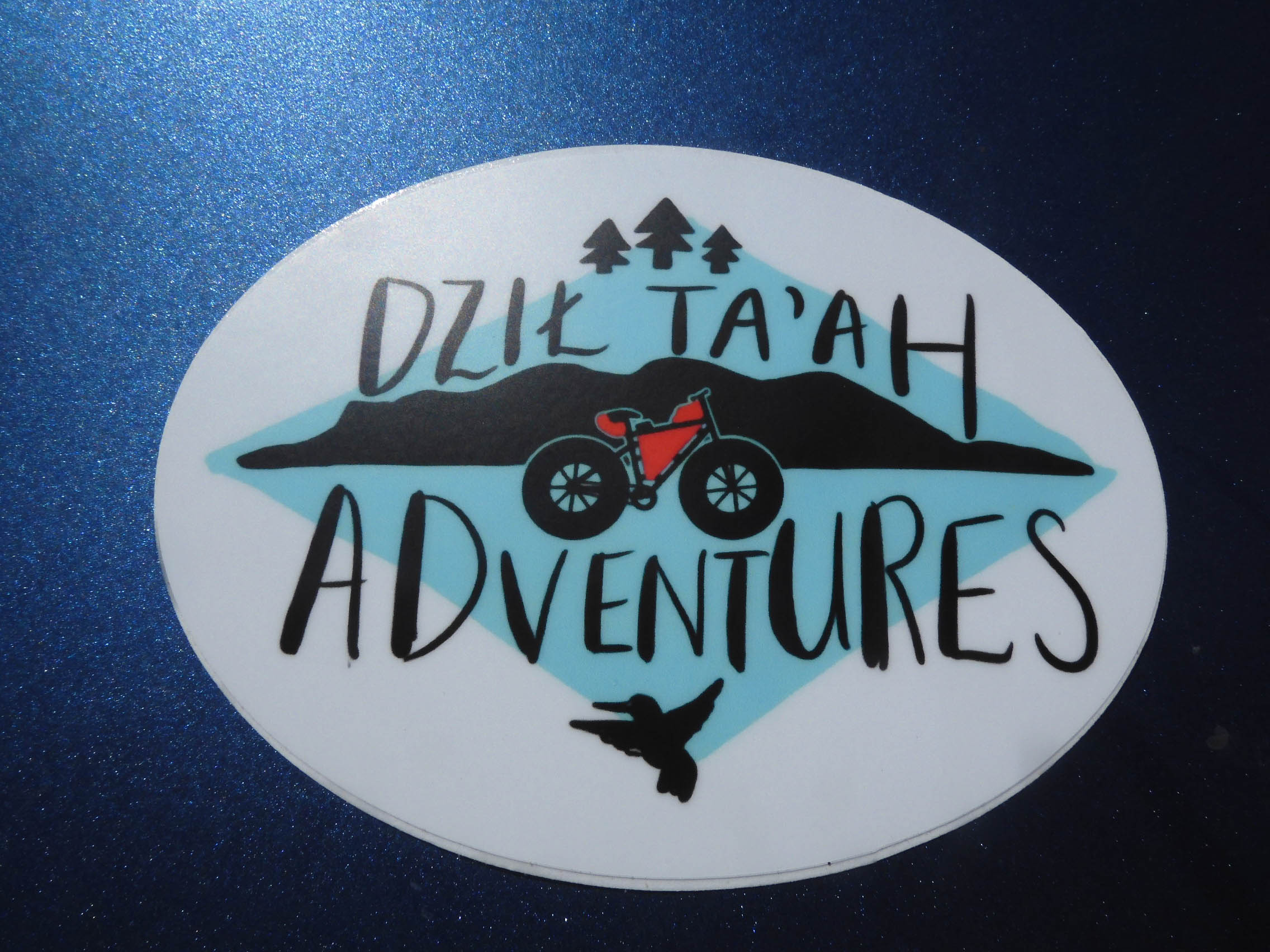
I had read in a recent issue of Sunset magazine an article about Dzil Ta'ah Adventures, a couple of Diné (Navajo) guides who were running bikepacking trips in beautiful areas in the Navajo Nation--riding bikes with camping gear out into the backcountry. Intrigued, I signed us up for a tour.
Rain can make the area impassable, so we had to hold alternative reservations until a few days before the trip. But on Thursday, our intrepid guide, Jon Yazzie, told us to cancel the alternatives.
Jon and his partner, Nadine Johnson, had been unable to obtain insurance for renting bikes. Their new enterprise has had difficulties in obtaining permits for its activities, as bikepacking is so unusual that there is no checkbox for it on the required forms. Jon and Nadine have worked for years to change laws and push through bureaucracy in order to bring their business into being. Most entrepreneurs would not have persevered. But Jon and Nadine, as we would soon discover, are much tougher than most.
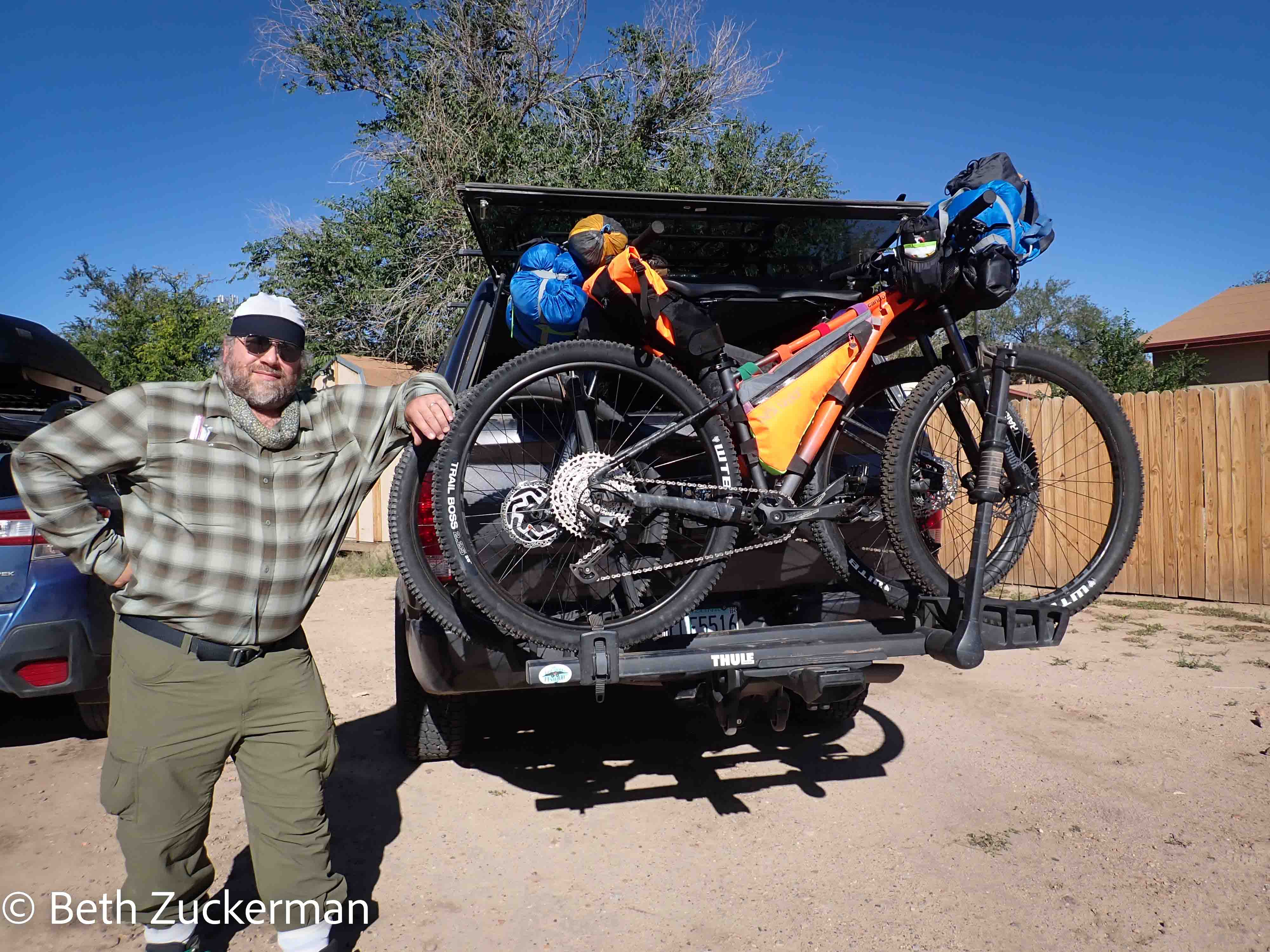
So, we would need to rent bicycles for the trip, and the nearest place Eric could find to rent them was Moab. Jon recommended that we get hardtails, and there was only one place in Moab where we could obtain them.
We rented a "bikepacking package" that included a collection of bags to carry our equipment. This was very different from the road touring equipment we were used to, as our own bikes have racks, and this was a rackless system with straps to hold the bags up off of the tires. Cleverly designed, and lighter than our own equipment, it was also considerably less capacious.
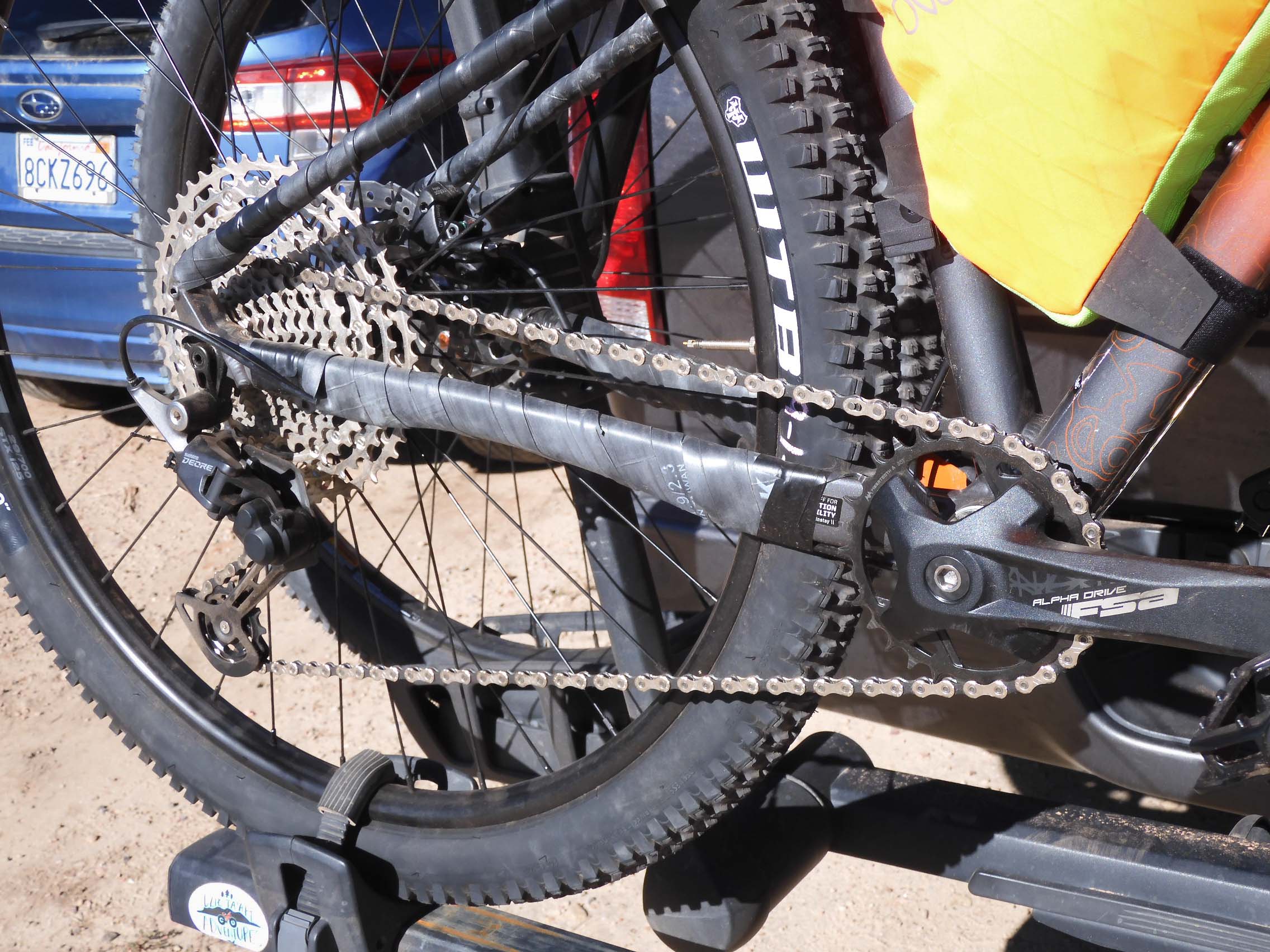
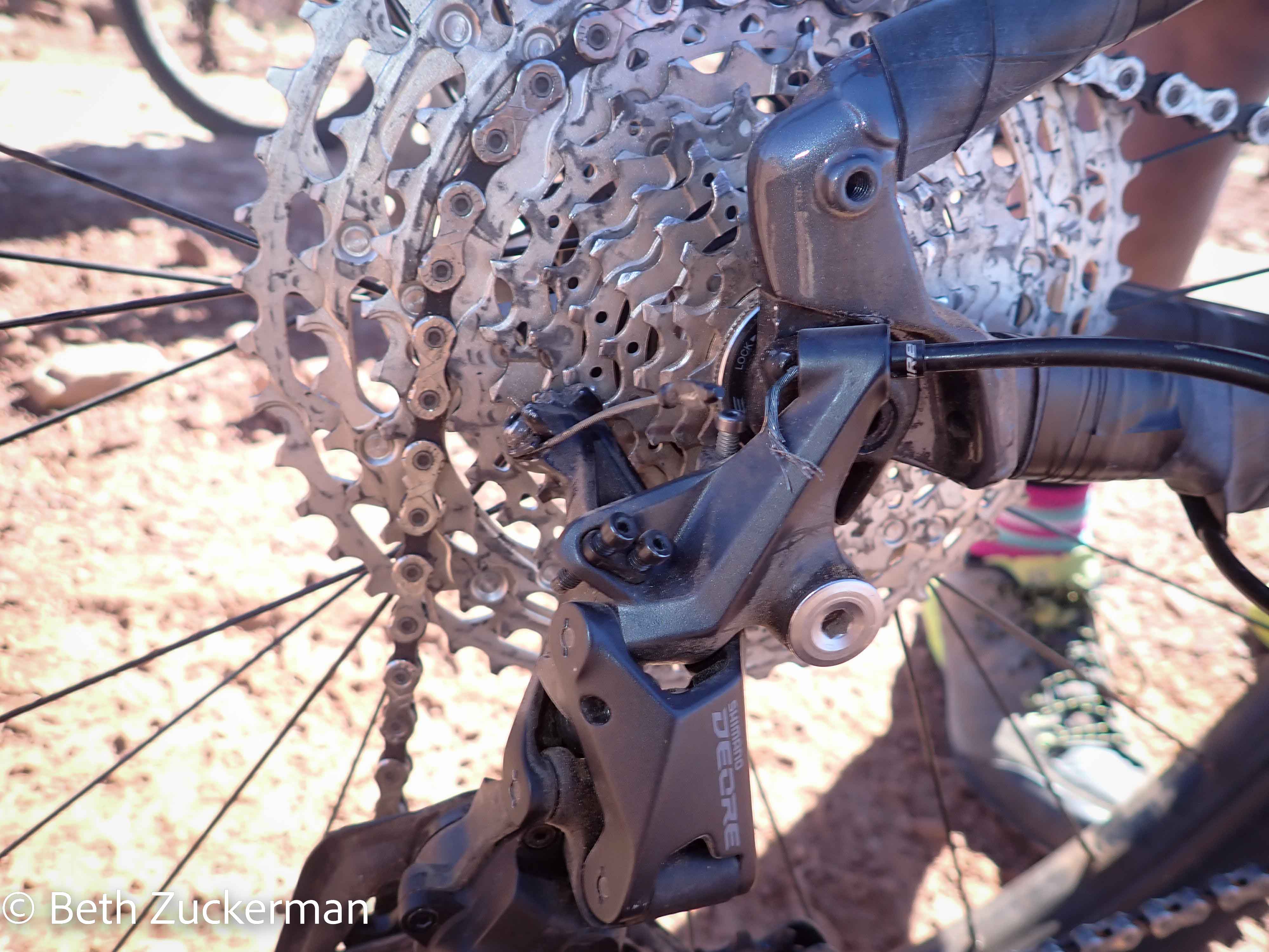
The bikes had rear cassettes with 11(!) sprockets -- 3 more than on our bikes at home -- but only one chainring. Photo by Eric.
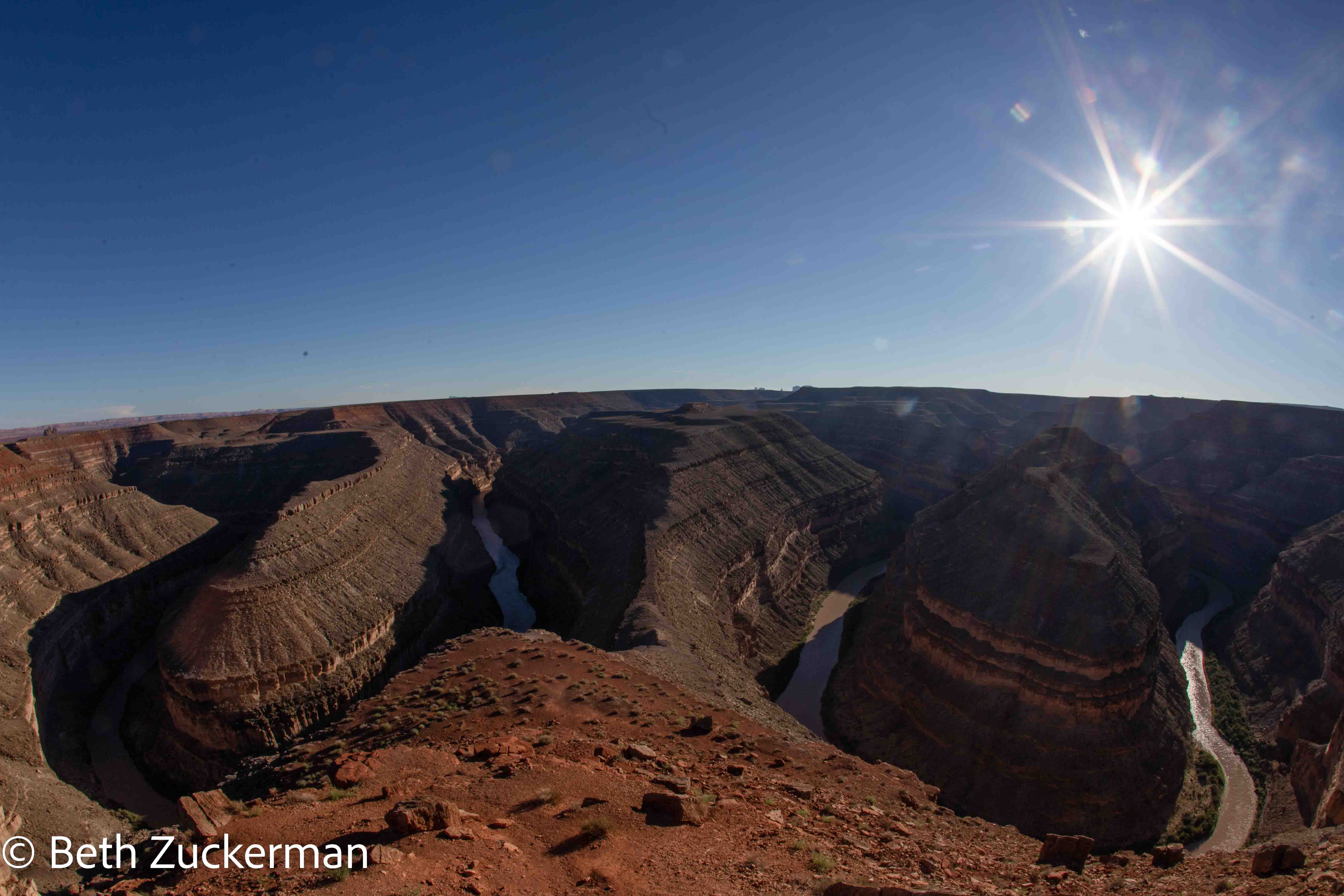
Along the way from Moab to Kayenta, we made a brief stop at Goosenecks State Park, Utah. As the Rocky Mountains uplifted, the lands below them were faulted and folded. The San Juan River always took the path of least resistance, creating the oxbow shapes we see here. Once the gorge began to develop, the rock in the middle of the oxbow rose faster as it became lighter, deepening the gorge. [Geology Underfoot in Southern Utah, Orndorff, Wider, & Futey, 2006]
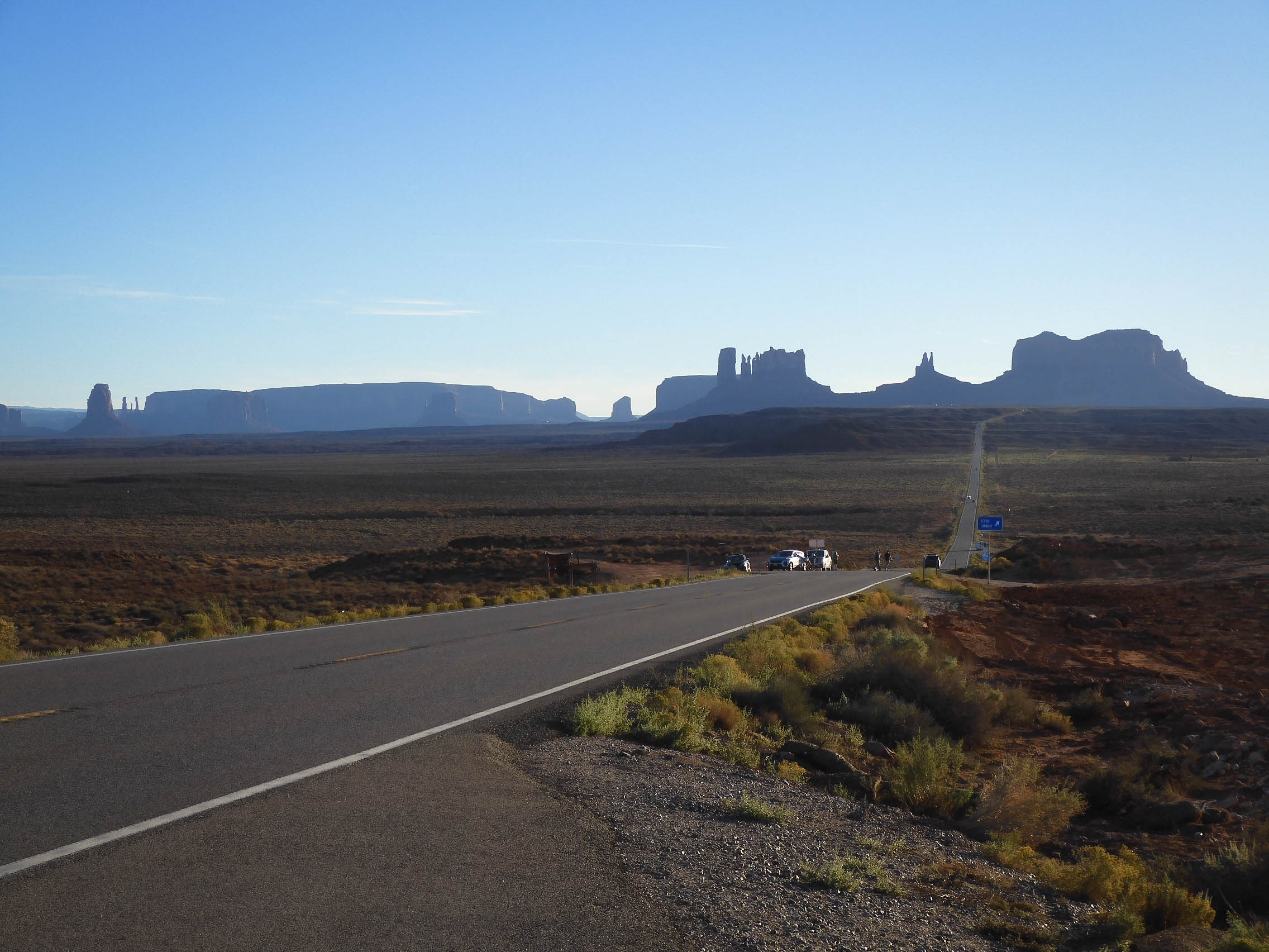
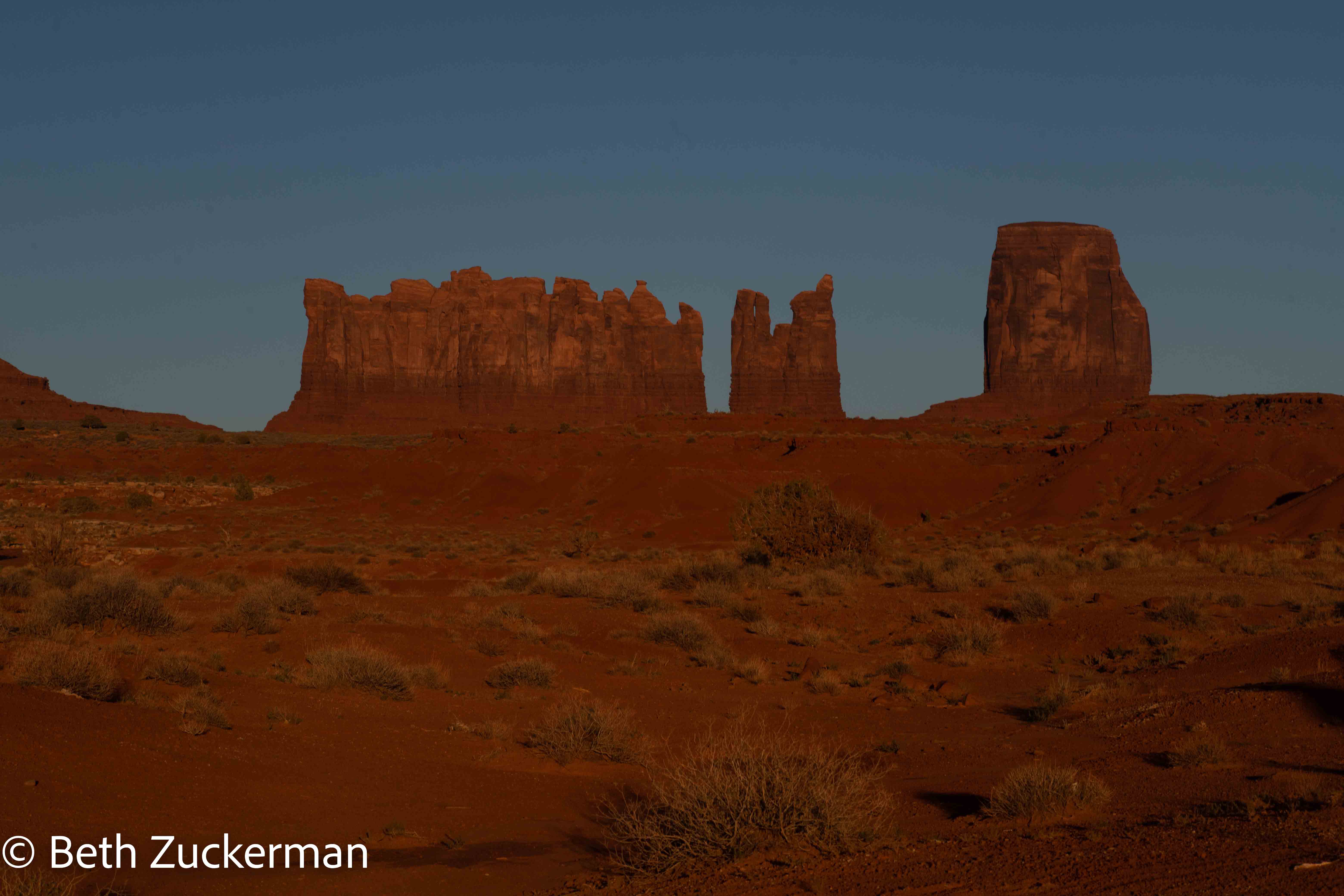
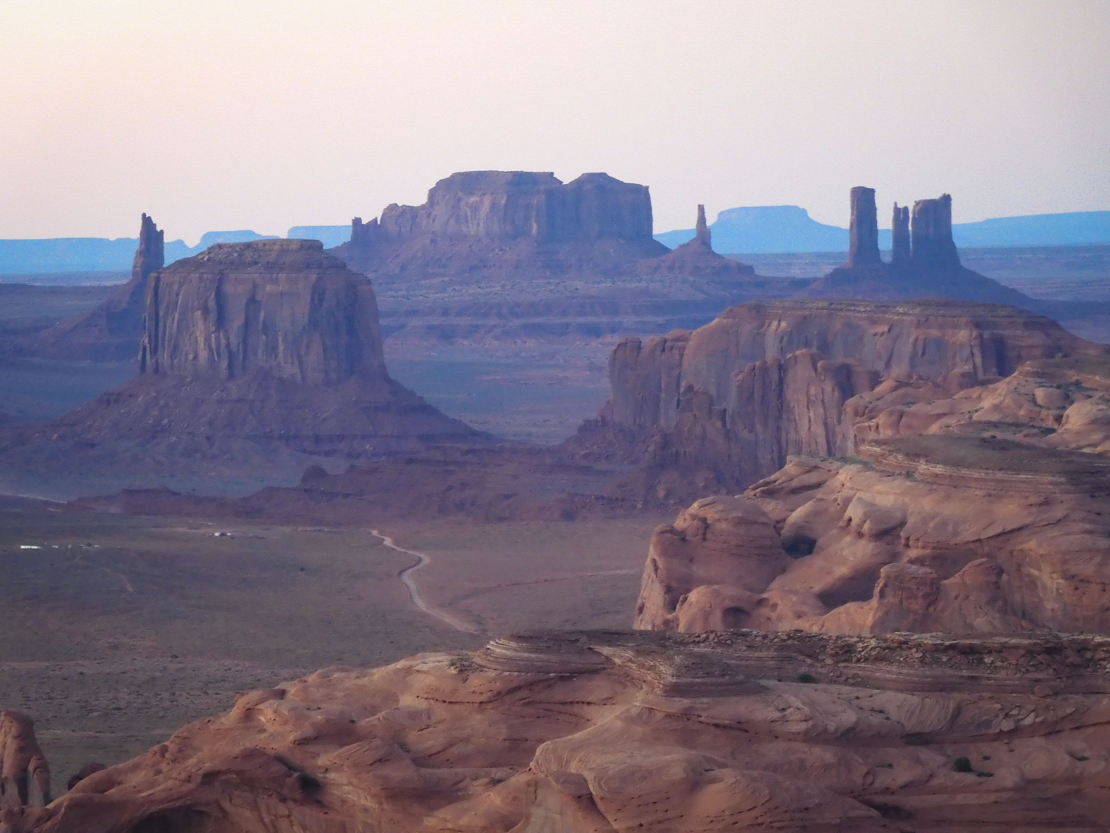
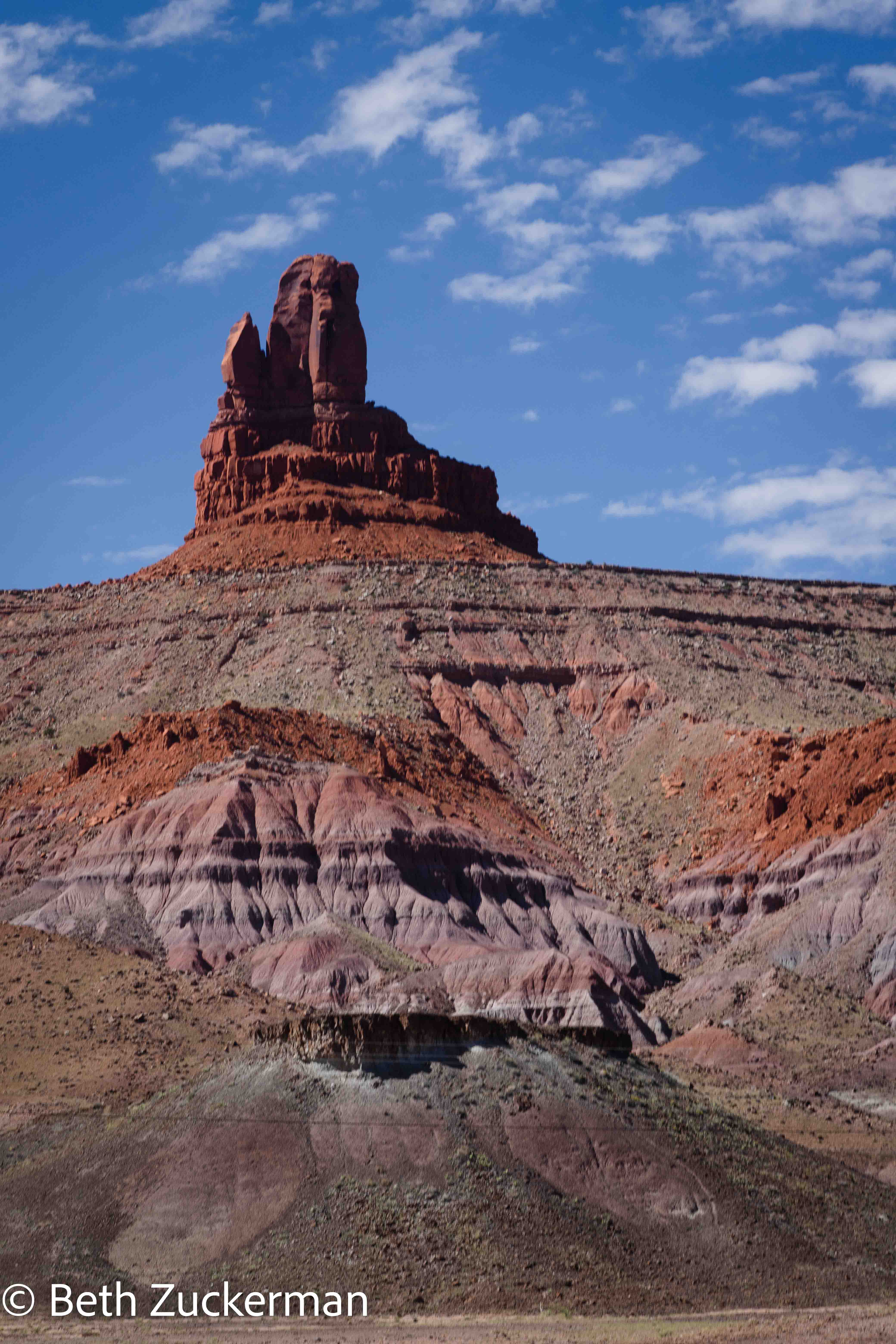
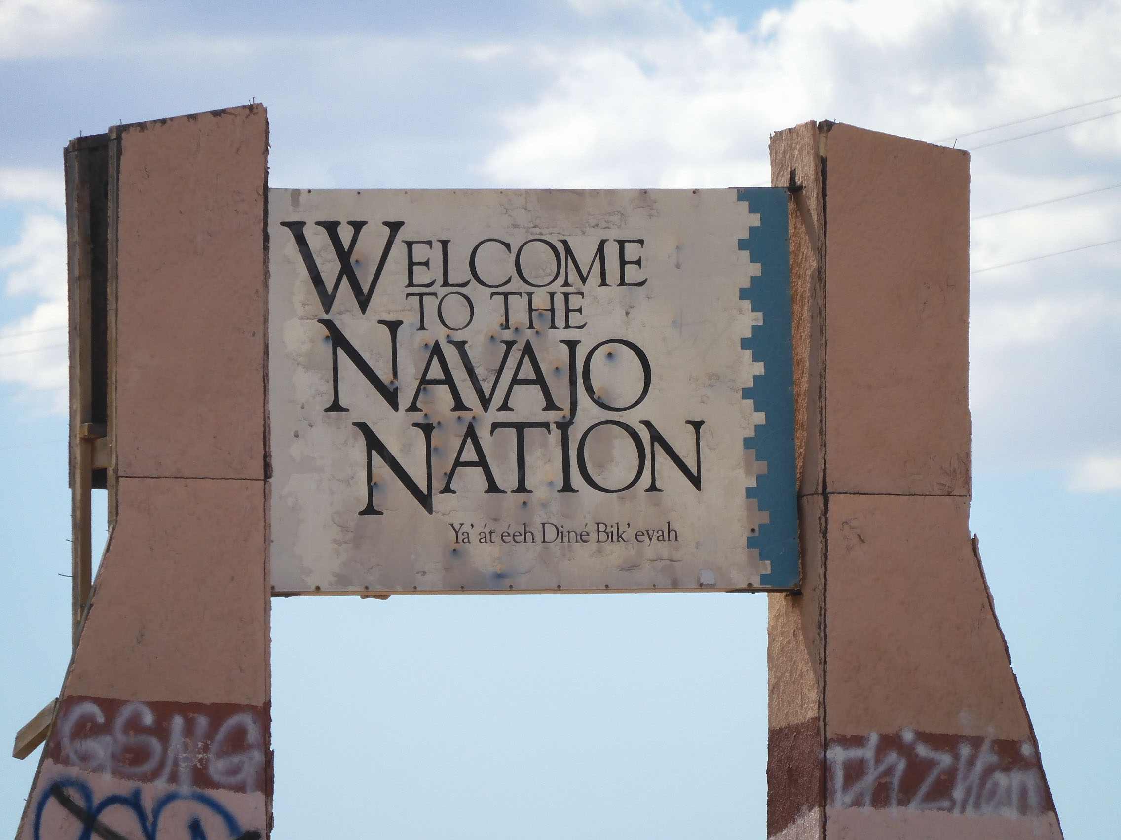
We crossed into the Navajo Nation. Eric took a picture of Monument Valley as we approached. There was no Tom Hanks in our vista; you can imagine him, if you must.
Monument Valley features by the roadside.
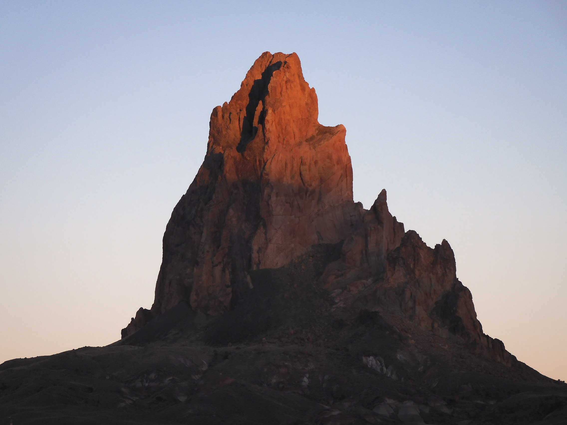
Eric photographed the sun fading on El Capitan.
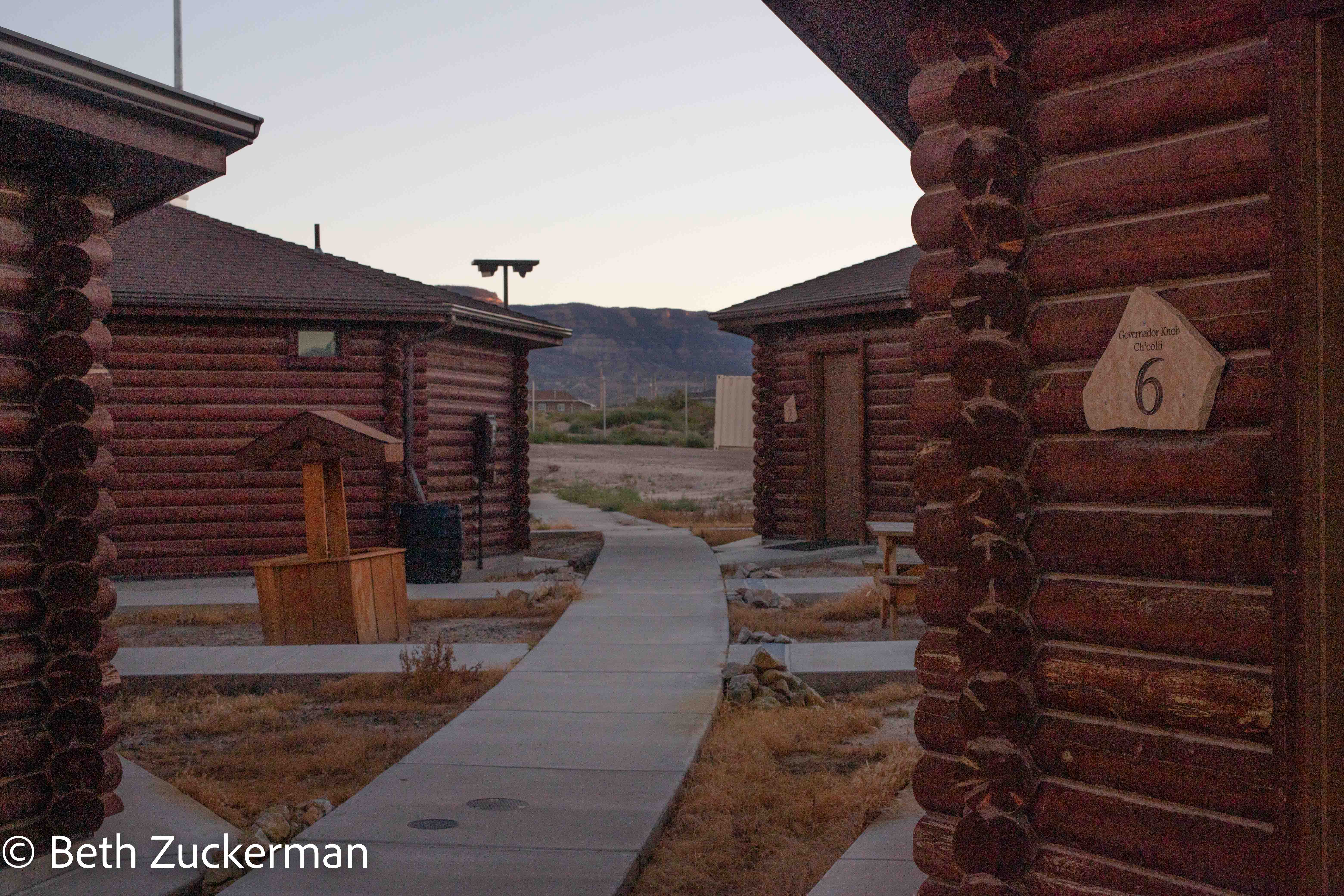
As part of our bikepacking adventure, Jon had offered to let us spend Friday and Sunday nights in some hogans operated by the school where he worked. I had to run into a post office in Blanding, UT to get a money order to pay for them, but they were less expensive than a motel, and our hogan was by far the most comfortable place we stayed on the trip.
Eric photographed the lovely interior of the spacious hogan.
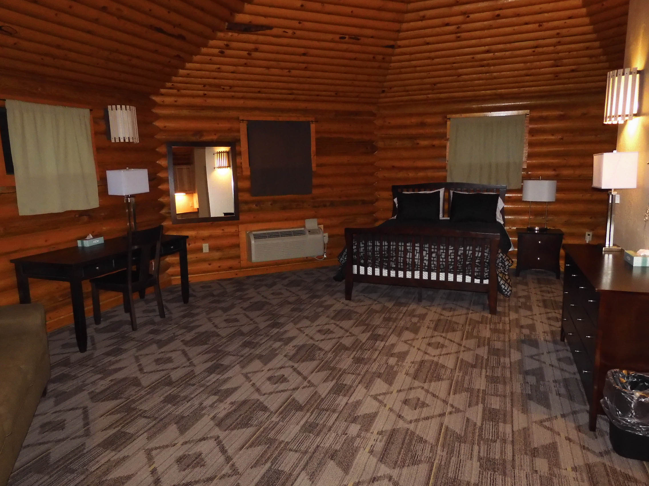
It even had a kitchen area with mini-fridge and microwave. No TV, though! Photo by Eric.
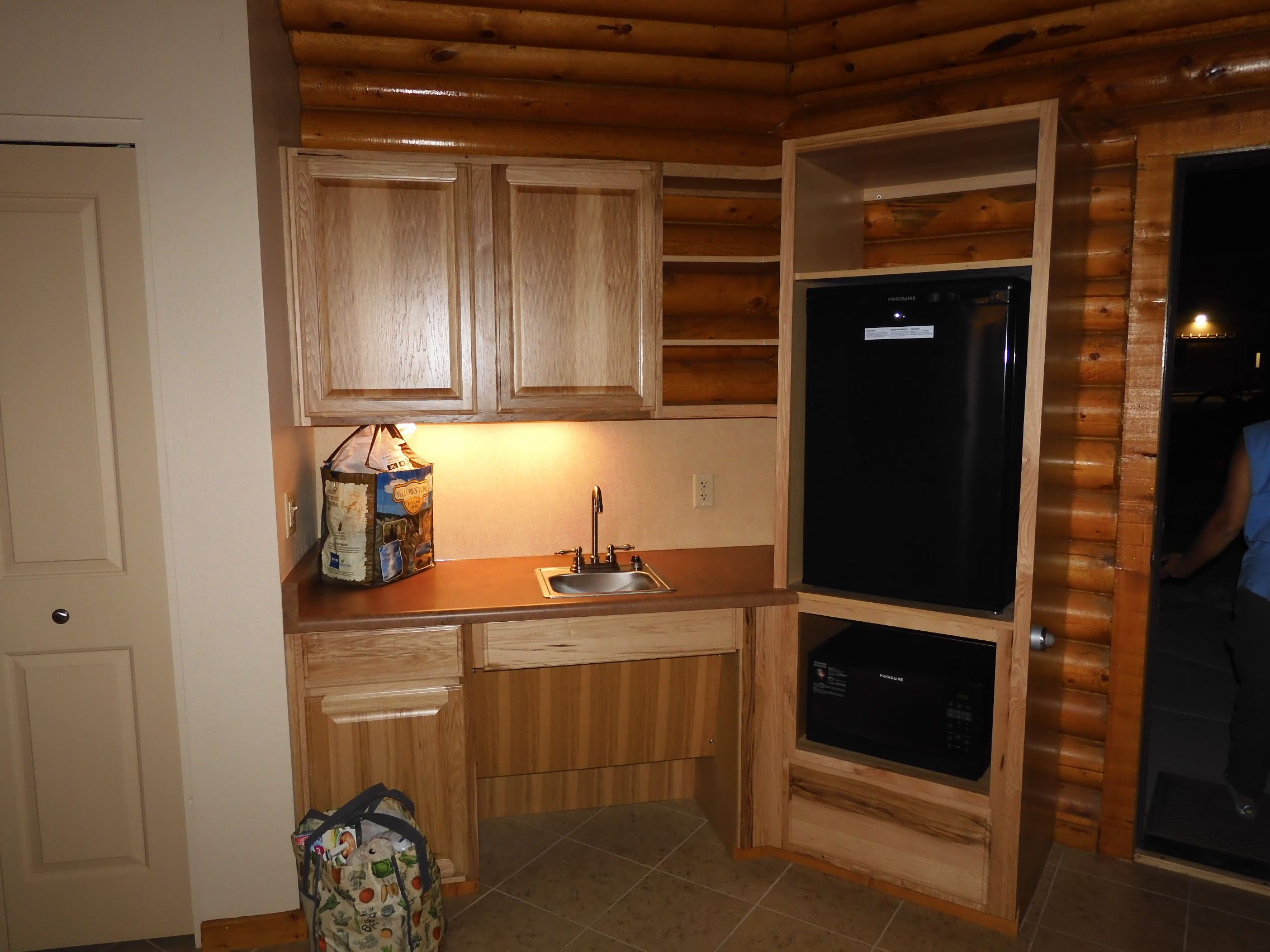
The hogans are entirely solar powered, built with natural materials, and LEED certified.
We had met Jon the night before, but met Nadine in the morning. She had just lost an aunt, and had spent the previous night with her family, who lived nearby. We felt terrible taking her away from her family at this moment, but she was dedicated to her business and committed to giving us a great experience. We found out later that we were the first customers to go on a trip with Jon and Nadine, although they had another couple signed up for the following weekend.
Jon and Nadine helped us load our bags onto our bikes, and then loaded our bikes onto their truck. Nadine thought our massive tires were "too skinny."
I was very disappointed that, with the rackless bikepacking system, I was unable to mount my camera along with my camping equipment. I had been hoping to do some astrophotography on that new moon night, but I had to leave that equipment in Mather. I took along my pocket Olympus, and found out only after we returned to the hogan that it had an astrophotography mode. I might have been able to carry my compact tripod and taken some great shots after all.
The Navajo Nation has stricter COVID rules than the surrounding State of Arizona, and so Jon and Nadine were great about keeping us all masked up in the truck as Jon drove us down a dirt road to a starting point. We had discussed whether to start out directly from their driveway in Kayenta, or to shuttle the first 5 km/3 mi to avoid cycling along the busy highway. Jon made the editorial decision to drive us even further, along the flat and relatively not scenic part of the ride, through the grazing land.
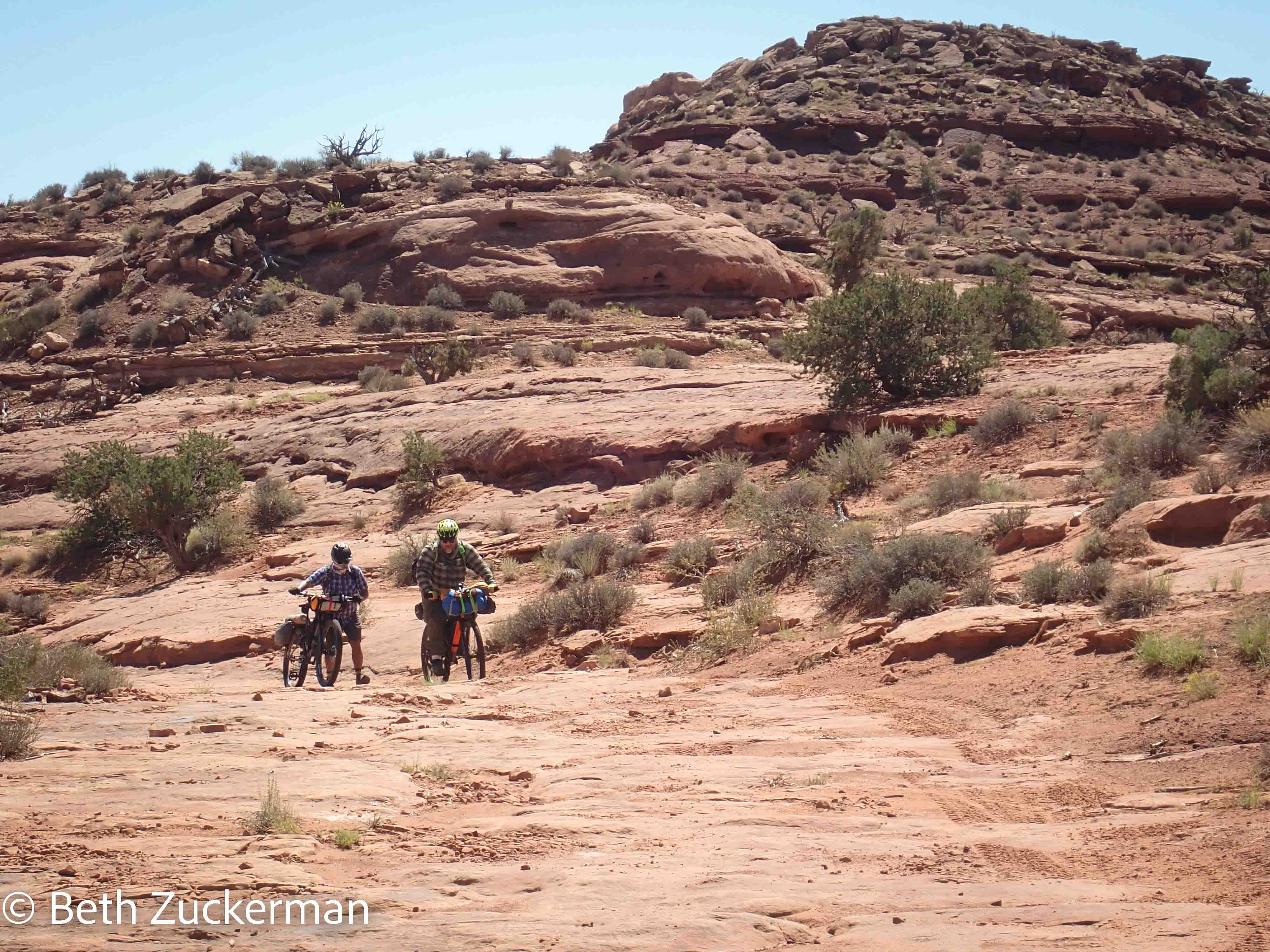
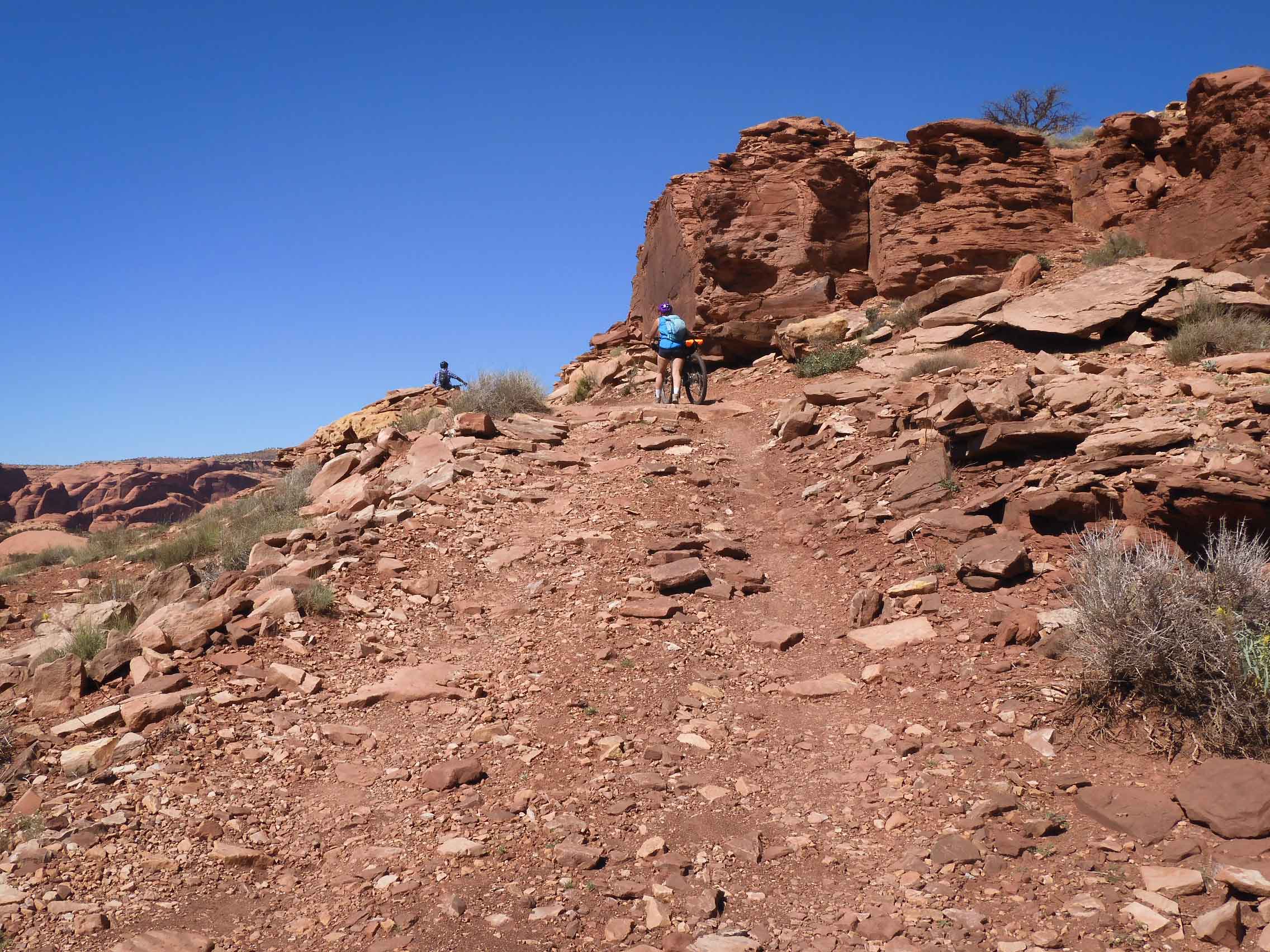
Nadine took the truck back home, and Jon guided Eric and me up the rocks and sand. We had to push the bikes up much of the way.
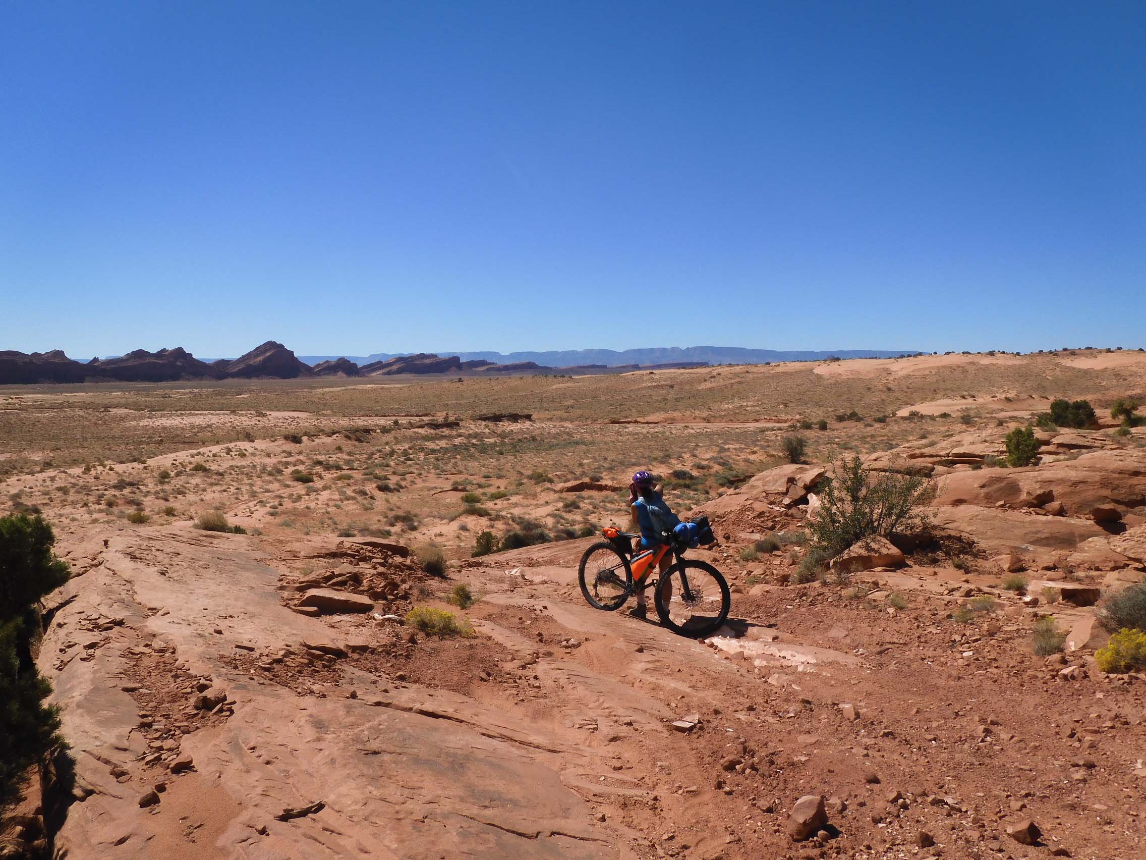
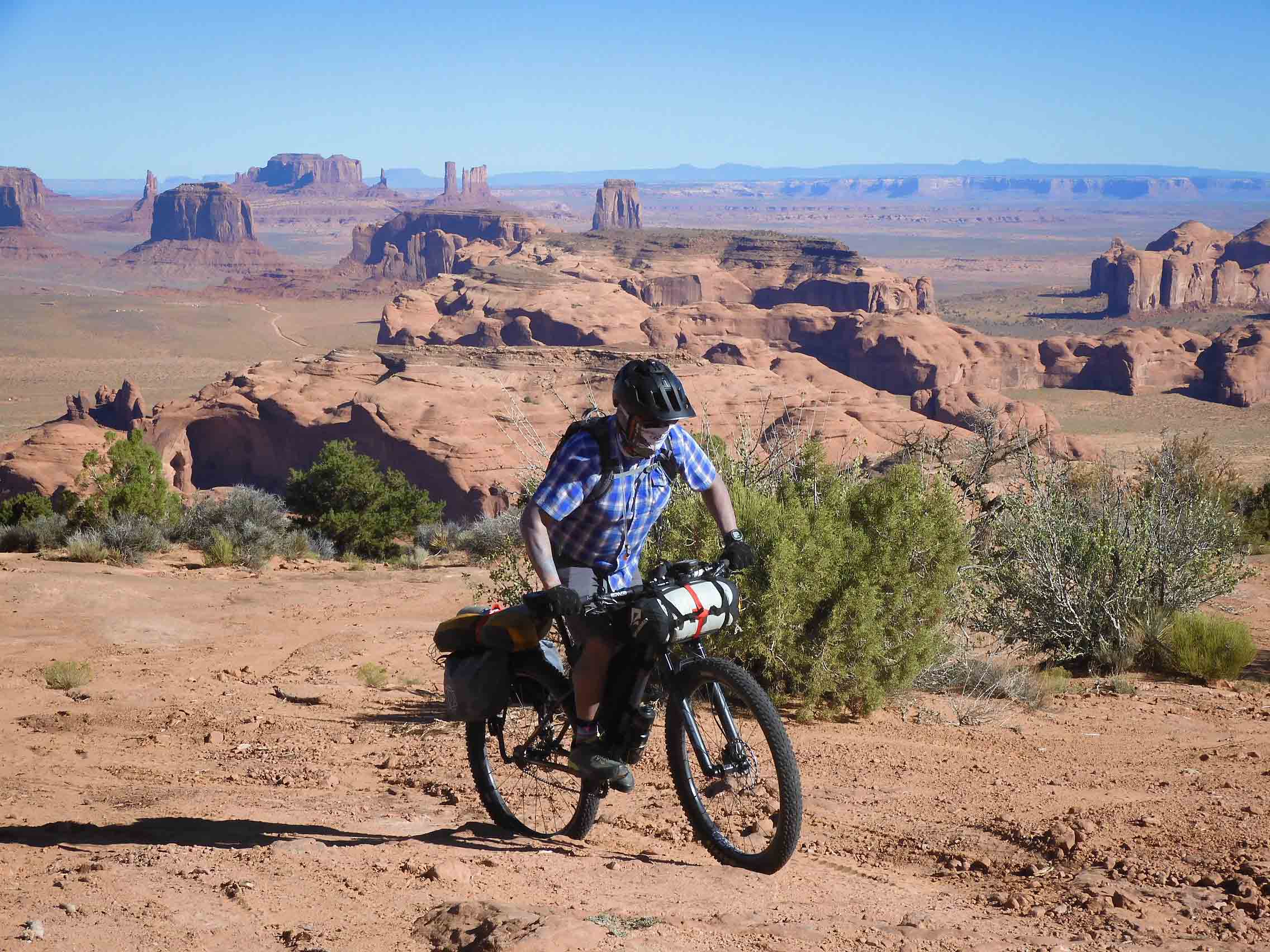
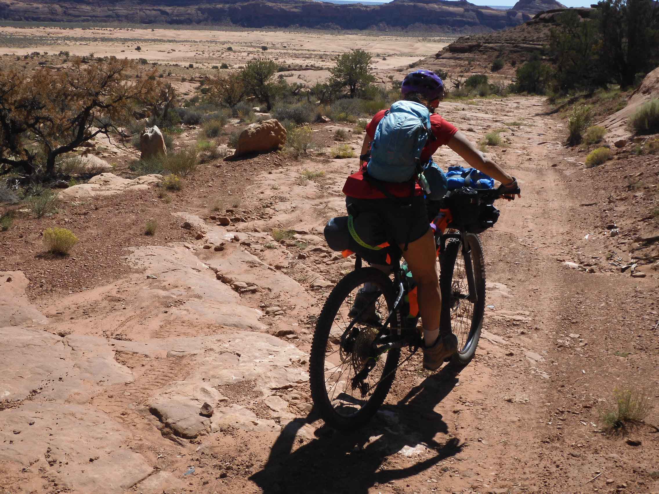
Eric took a picture of my stopping along the sand for a photograph.
At one point, Eric's chain became stuck in his sprockets and had to be extracted with tools. Jon felt that the large number of rear sprockets was too much for the single front chainring on our bikes, that it put too much pressure on the chain. This happened to both bikes, before we got going.
Eric photographed Jon and me pushing up a hill.
I was unused to the suspension fork, and I had a lot of trouble getting started at first, particularly on the soft sand. I kept pushing the pedal down with my foot and pushing down on the handlebars with my hands, but, instead of having the expected effect, I just pushed the suspension fork down and did not go anywhere. I kept remembering my father with the ripcord on the ancient lawn mower that the church had provided for the parsonage when I was a kid, pulling the cord again and again and failing to start the mower. Eventually, Dad would give up and walk over to the church a block away and borrow the mower for the lawn there. Eventually, I locked out the suspension fork and was able to start up that way, but I was unable to unlock it while riding, and so I lost the benefit of the fork. As we continued, I learned to start with the fork unlocked.
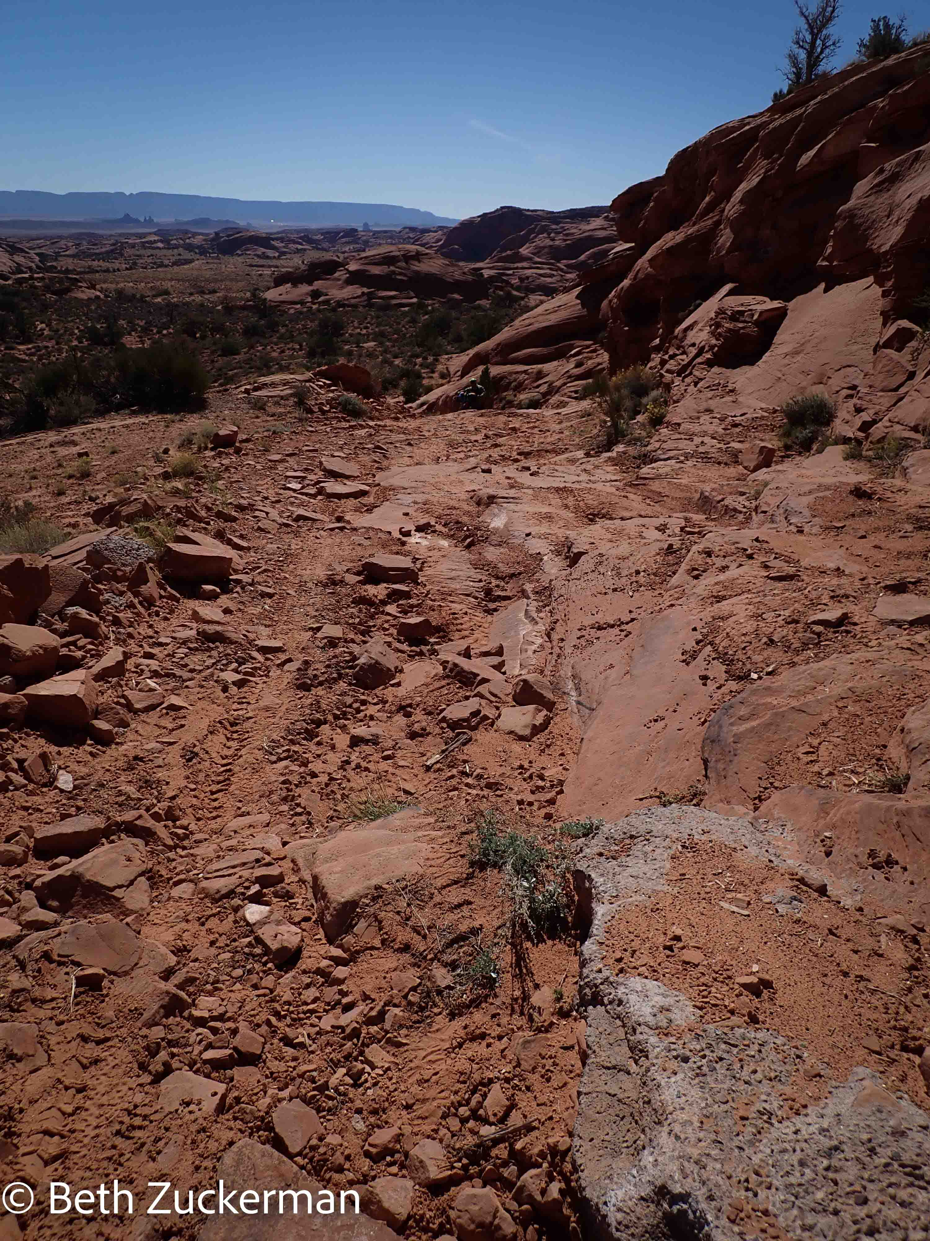
Some parts of the climb were very rocky. Jon told us that another group was coming up in a Chevy Suburban. We kept looking at the rocks and thinking, "A Suburban?" Jon said it was a specially outfitted vehicle with tough tires and a raised suspension.
I felt a little bit badly, because I had promised Eric that, after all the hiking we had done in the last week, his feet would get a break for a couple of days while we cycled. And yet, here he was on his feet, pushing his loaded bike up the side of the mesa.
Eric photographed the tremendous scenery.
We had carried 4.5 liters of water each, but, at some point, it became apparent to Jon that this was insufficient. He told us that Nadine was on her way up with more water for us. Photo by Eric.
We just couldn't believe how badass she was, coming up the hill as fast as she did.
We had almost reached the overlook when Nadine caught up with us, and she decided to come along to the top.
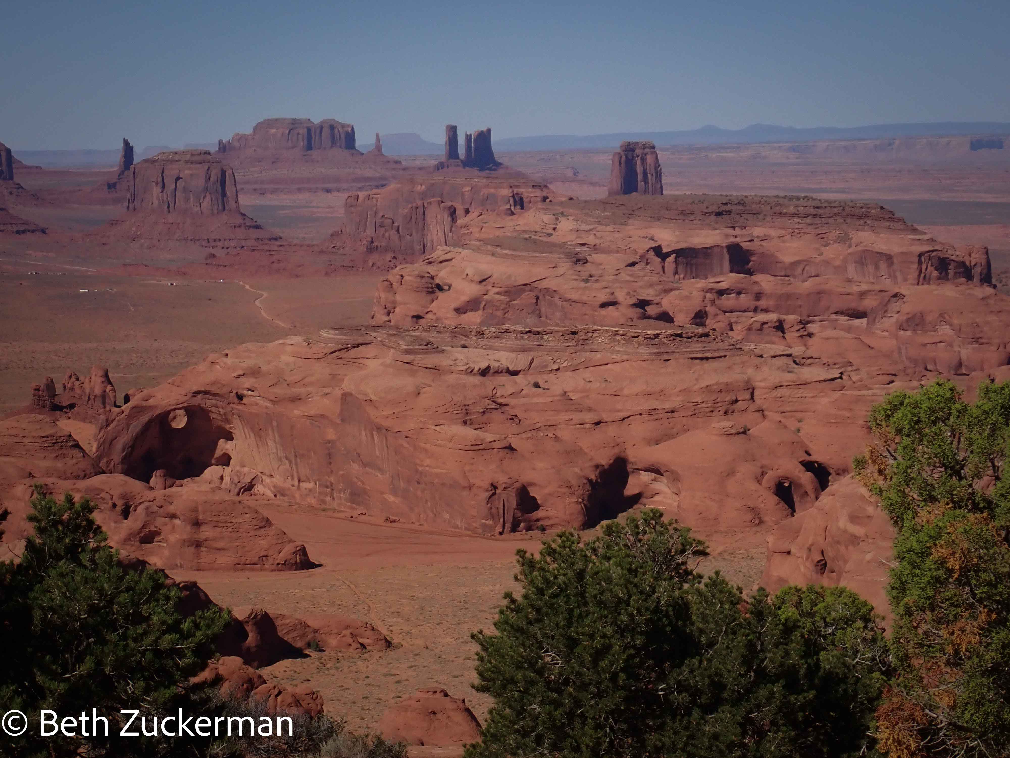
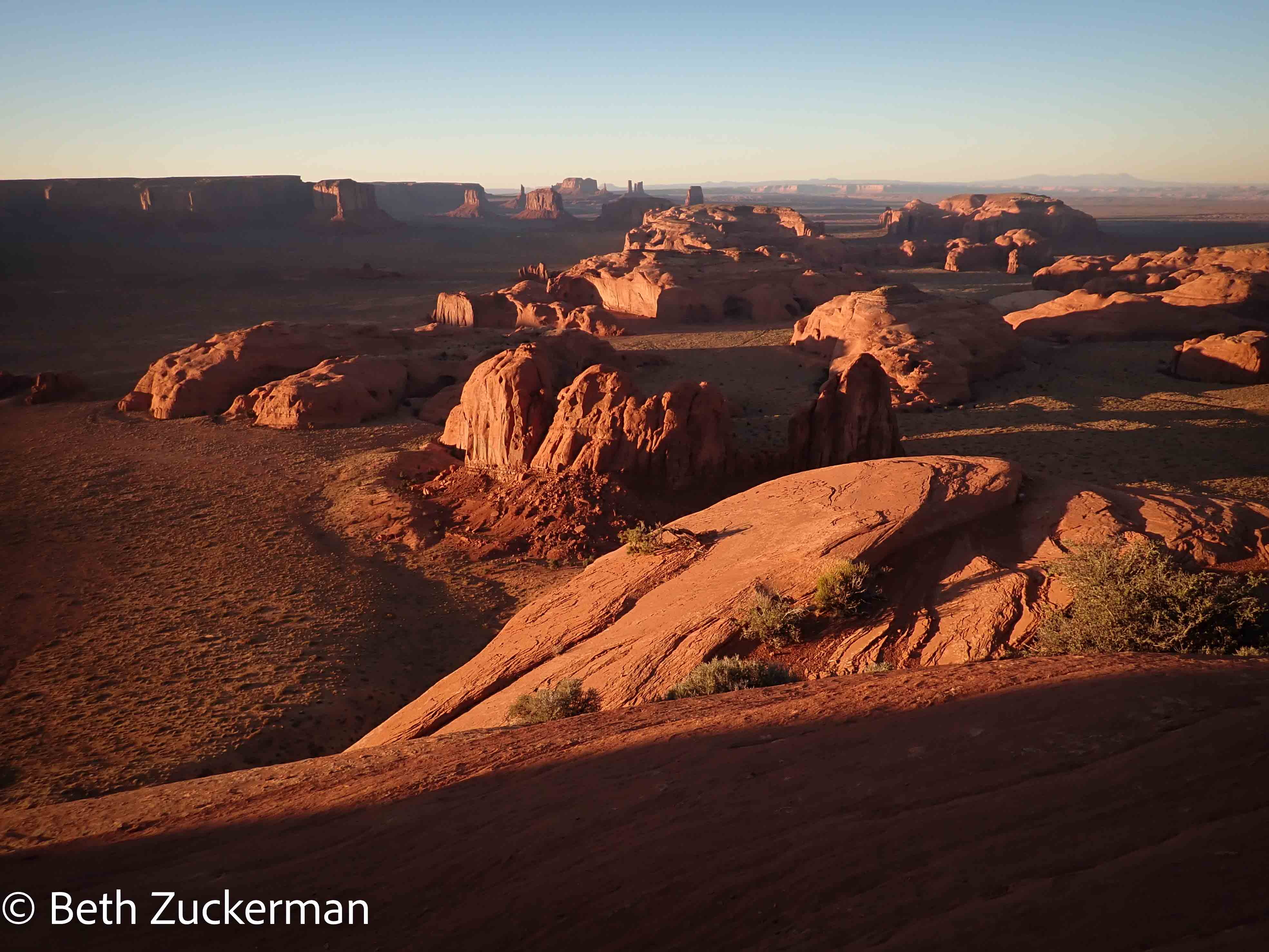
As we rounded a corner, Jon said, "Prepare to have your mind blown." What a sight!
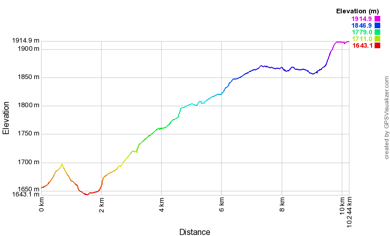
Eric's graph of our steep elevation profile.
We came to an open spot along the ledge with a picnic table and fire pit. Nadine thought that, if anyone else was coming up, they would have been there by late afternoon, so we started to set up camp.
Just as we were laying down the tent footprint, the predicted Suburban pulled up. An older Diné man got out, followed by a couple of European tourists. The driver told us that he had the rights to use the spot for the night.
We kind of felt that we had gotten there first, and that we had worked a lot harder to get there and were therefore more deserving. Jon was annoyed, but Nadine felt that, as a new business, they should work to get along with other tour operators. So, we picked up and moved to a less flat and spacious, but still excellent, part of the overlook. Nadine rode back to where she had left the truck. She later texted that, when she got home, she received a stern look from one of their dogs for taking the bike out and not taking him with her, so she had to go out for another ride with him.
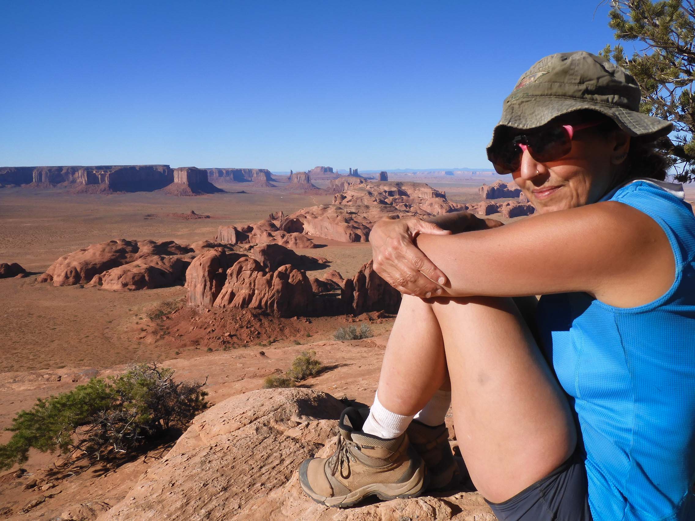
Eric photographed me at the overlook.
As we were setting up camp, another truck showed up, and a group of photographers got out and began to set up their tripods. Those guys were going to get the astrophotography shots I had been hoping for. Jon talked to their leader, who told him that there were even more campsites further around the ledge.
We took a hike out to the end of the overlook for dinner. Along the way, Jon introduced himself to the guide with the Suburban, whose name was Harry. They spoke in Navajo, and, by the end of the conversation, Harry was friendly and offered to let us share his illegal campfire.
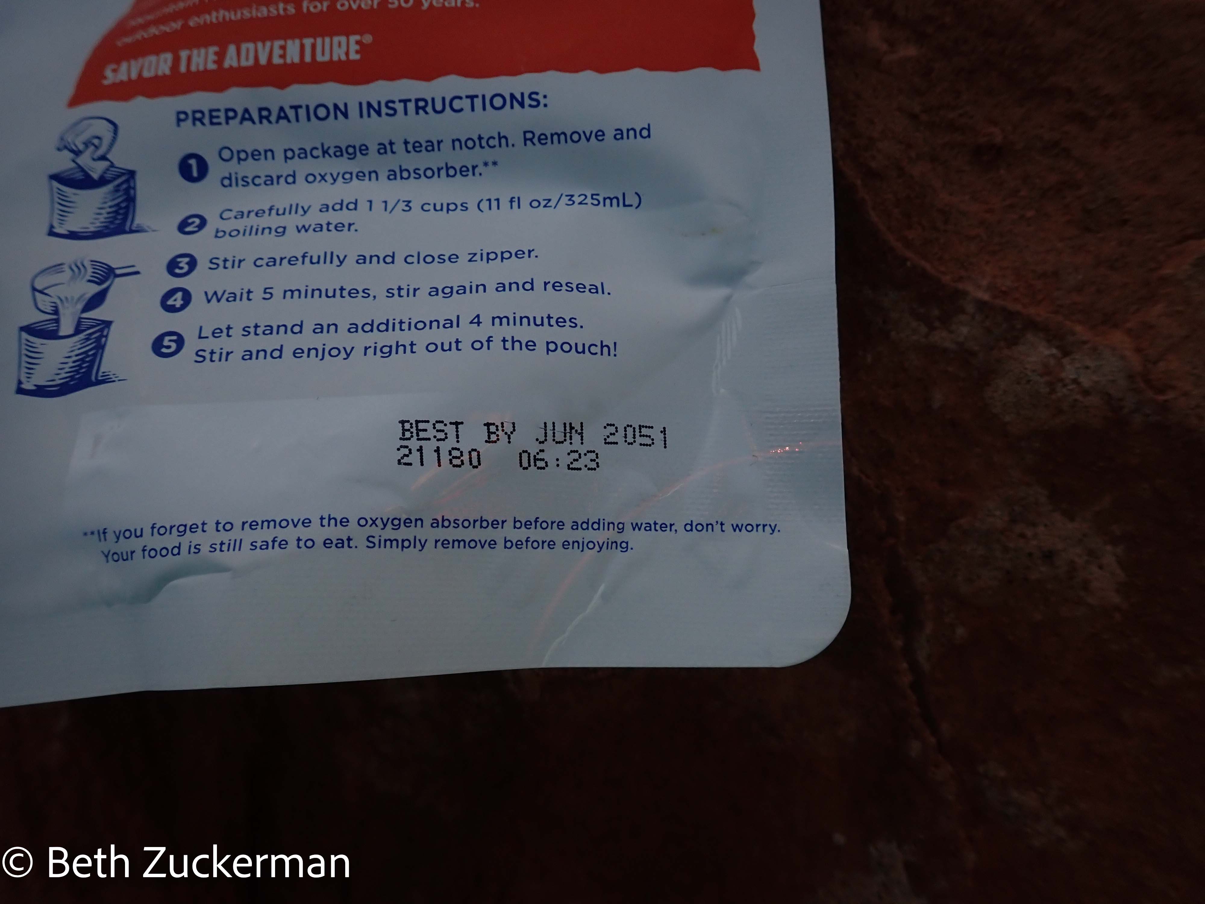
At the end of the overlook, with photographers and their tripods above us, Jon heated water for our backpacker meals on a white gas stove. I noted the expiration date on my backpacker meal.
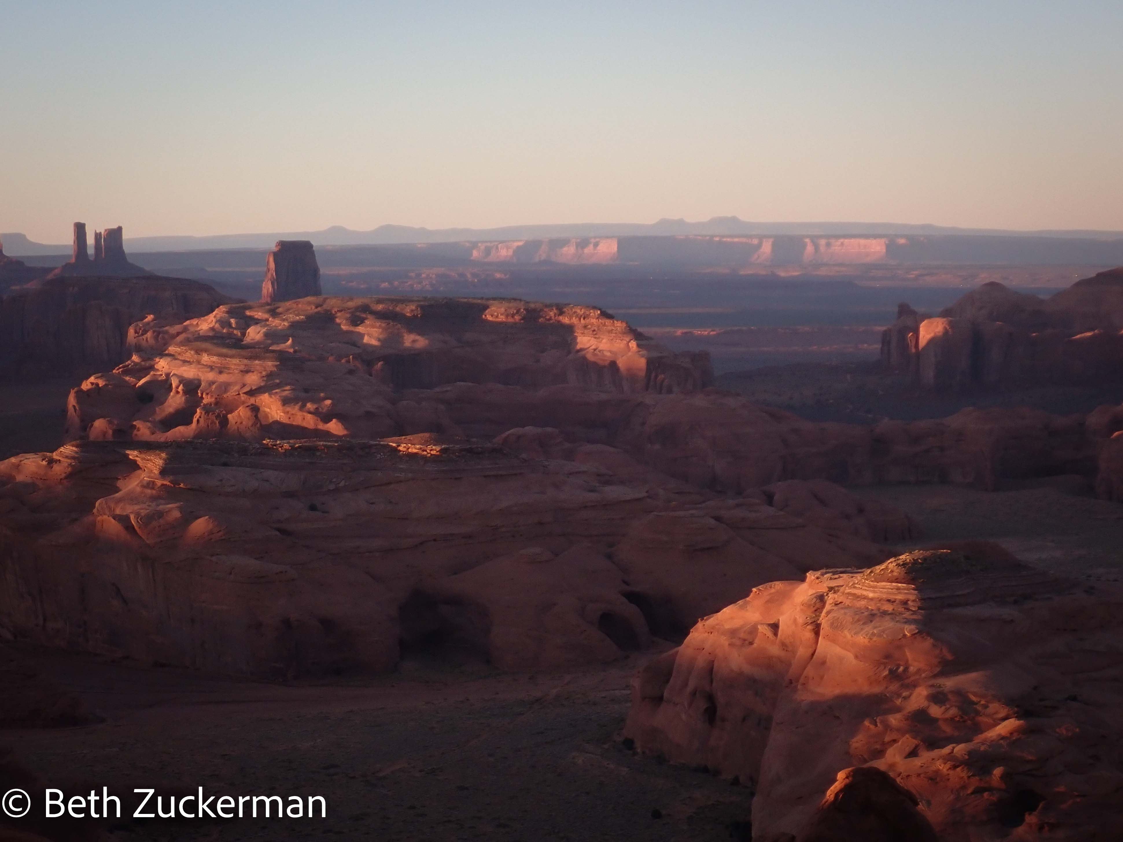
Over dinner, Jon told us something of the Diné tradition. We are now in the fourth world, the world of humans. The traditional beliefs are inextricably linked to the land and its unique features. There are seven pillars of rock that are especially sacred to the Navajo Nation. (The seven hogans were named for these; we stayed in #6, Governador Knob, or Ch'oolii). One of them was called El Capitan, which we could see from the overlook. The snake is a potent symbol, and El Capitan is where the snake lay down around the rock to sleep. Jon told us that owls are a warning sign, and that one of the pillars was an owl overlooking the highway.
We could see the Bears Ears in the distance, and Jon told us that, as the bear grew up, she began to behave jealously and badly. One of the gods punished her by cutting off several of her body parts, including the ears. There were other bear parts strewn about the land.
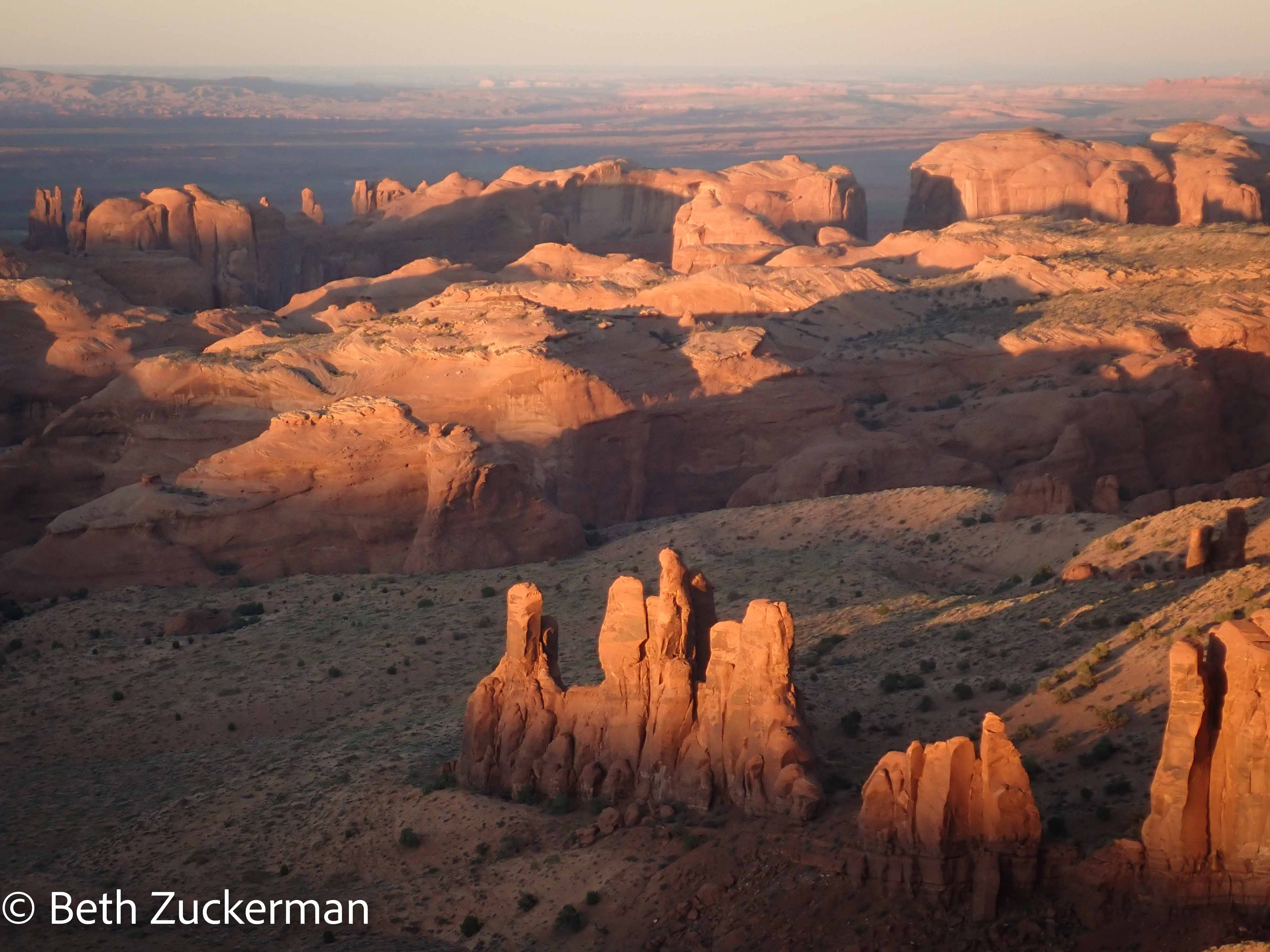
We returned to camp for the sunset.
The light was outstanding, and I wished for my DSLR. The Bears Ears are in the distance.
The Belt of Venus after the sun set.
Eric took a blue hour shot.
Just to the right of the mesa in the far distance in the above photo, you can see a feature incongruously called the "Totem Pole." Totem poles come from northwestern North America and are not Diné at all. But this rock stands as the most unusual feature in a valley of highly unusual features.
Monument Valley is made up entirely of ancient rock. Jurassic Navajo Sandstone is the top layer; the Entrada Sandstone layer has eroded away here. At the top of features like the Totem Pole is the Shinarump conglomerate, composed of relatively resistant rock. Beneath that layer is the more easily weathered DeChelly Sandstone, and, beneath that, Organ Rock shale. As the rock was uplifted, vertical cracks developed. Streams ran through the cracks, washing away the underlying DeChelly Sandstone. As the streams cut all the way down into the further underlying shale, they spread out wider, undercutting the rock above. Over time, the towers we see all over Monument Valley narrowed, leaving us with the spectacular and dramatic landscape we see today. This beauty results from a very unusual and lucky set of circumstances. [Geology Underfoot in Northern Arizona, Abbott & Cook, 2007]
The moon was new, the sky was dark, and the Milky Way was already up over the horizon when it appeared. We stared up at it for a little while, but since astrophotography seemed out of the picture (ha-ha), we went to bed shortly after sunset. After the day's climb, we managed to sleep in until about 7:00.
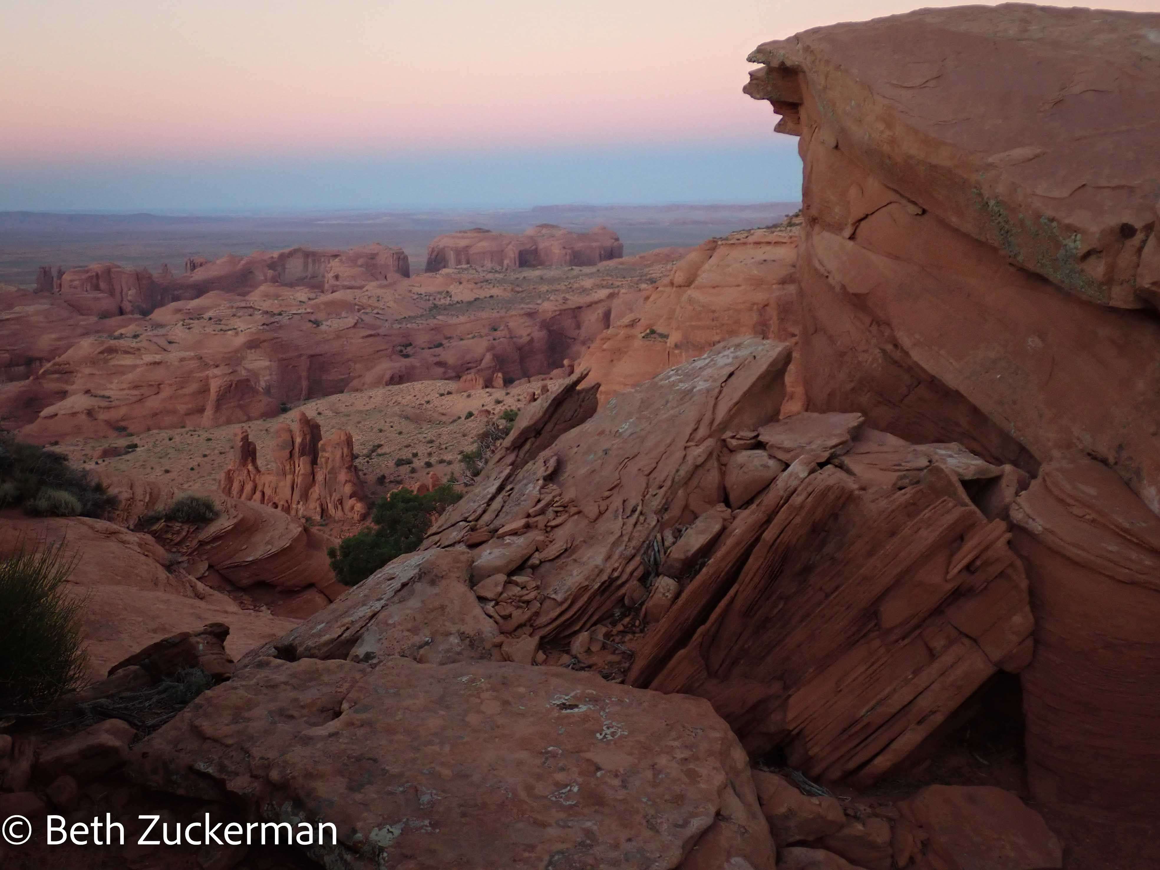
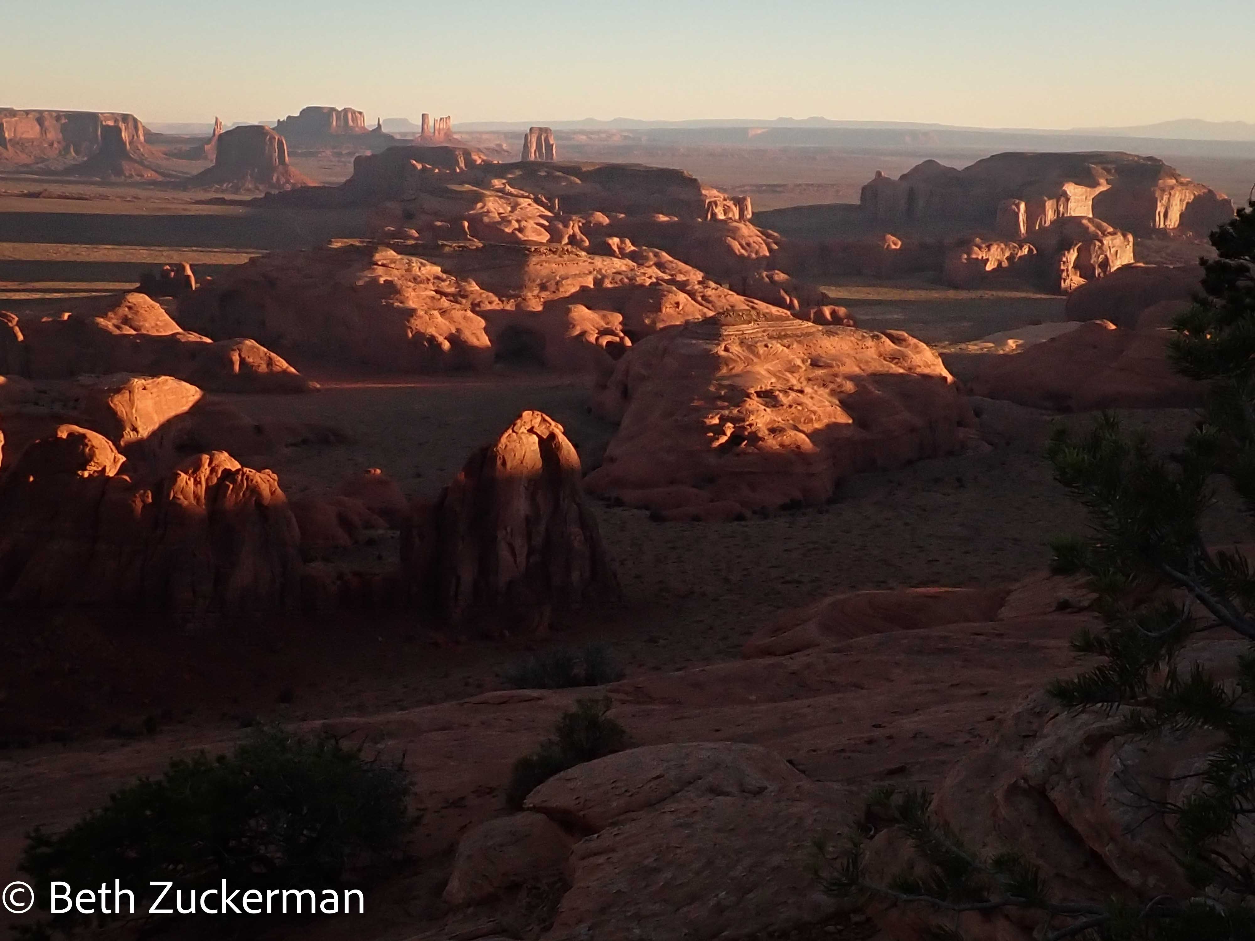
The light at sunrise was even more perfect.
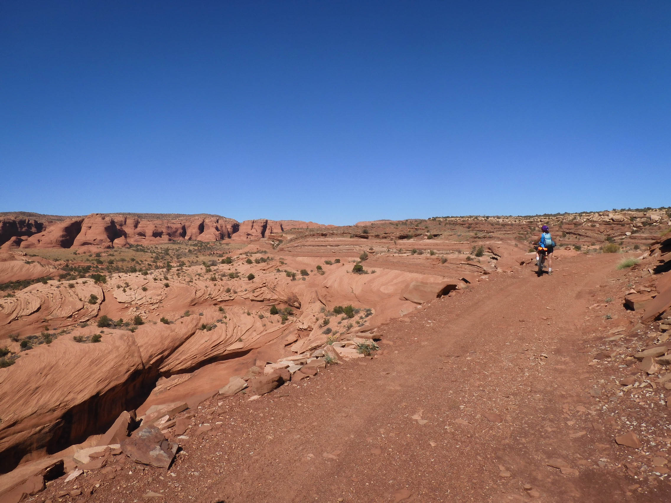
Jon led a non-aggressive pace, telling us that Nadine had found she could drive the truck a little further along the road, and that she would meet us at a closer point. We unhurriedly had Clif bars for breakfast and packed up our gear. Even with the extra gallon of water Nadine had brought up onto the mesa, I didn't feel like I had enough water for tea.
As we began the descent, Jon was full of mountain biking advice. He taught us a 3-1 rule, whereby you spent three seconds looking down negotiating the territory immediately before you, but after three seconds, look up for a second to plan the route ahead.
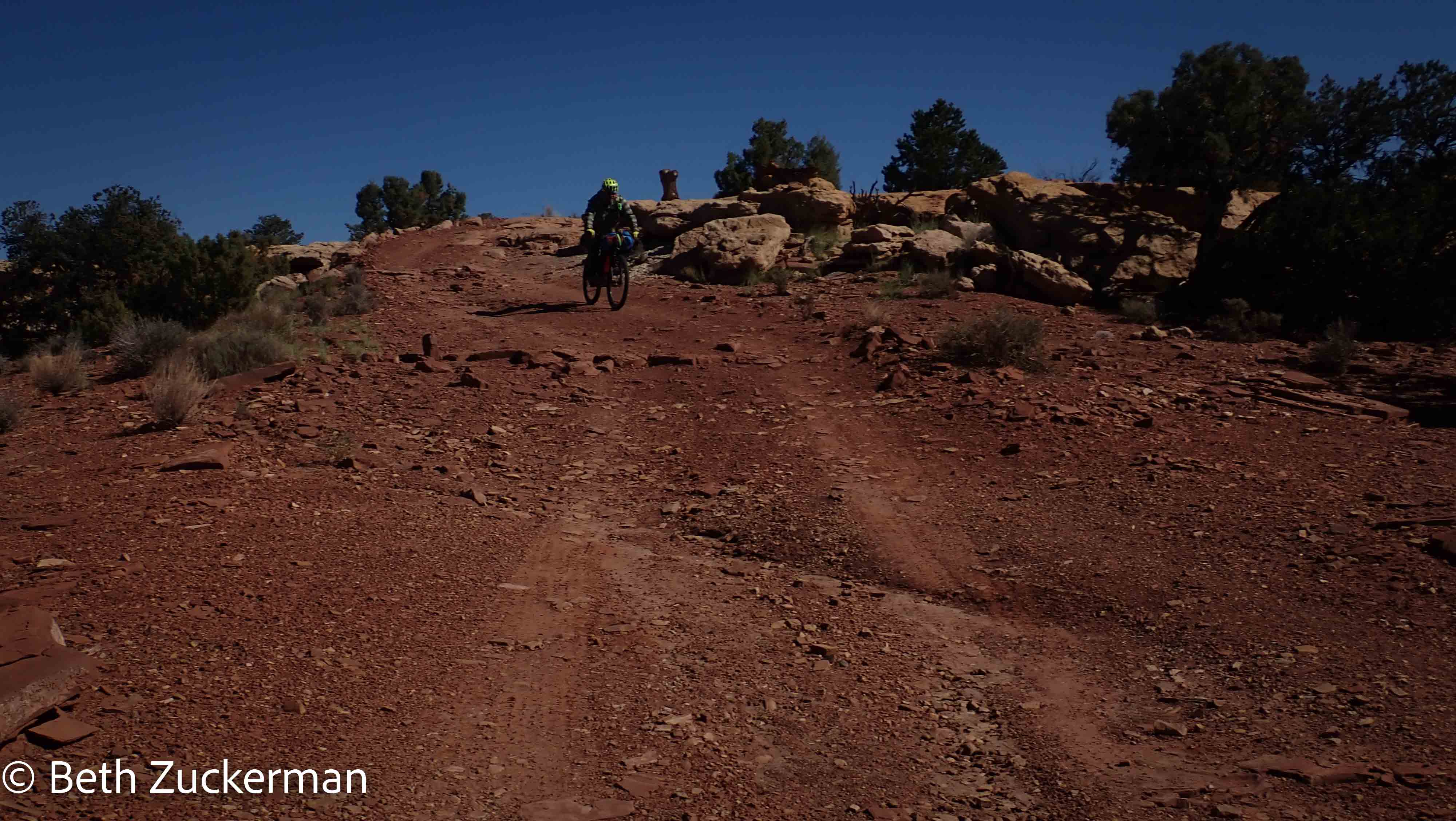
Eric took a picture of Jon riding through the sand.
The road had this amazing saddle.
I walked down the steepest, rockiest parts, but Eric rode down some impressive hills. I tried to shoot a video, not really knowning how to work the video functions on the Olympus, and thus failed to capture either a still photo or a video of his most impressive descent.
I rode down something fairly steep, trying to keep up enough momentum to get up a small hill beyond. As I tried to downshift, my chain became stuck just as Eric's had. However, the problem was even worse. Part of the derailleur had jammed into the gears and didn't want to budge. I couldn't even walk the bike.
Jon pulled the lever out with a tool, and Eric rigged it to stay in place with a zip tie. The cable had also snapped, with the (expected) result of the chain landing all the way in the highest gear. Eric took a picture of this kludgey repair.
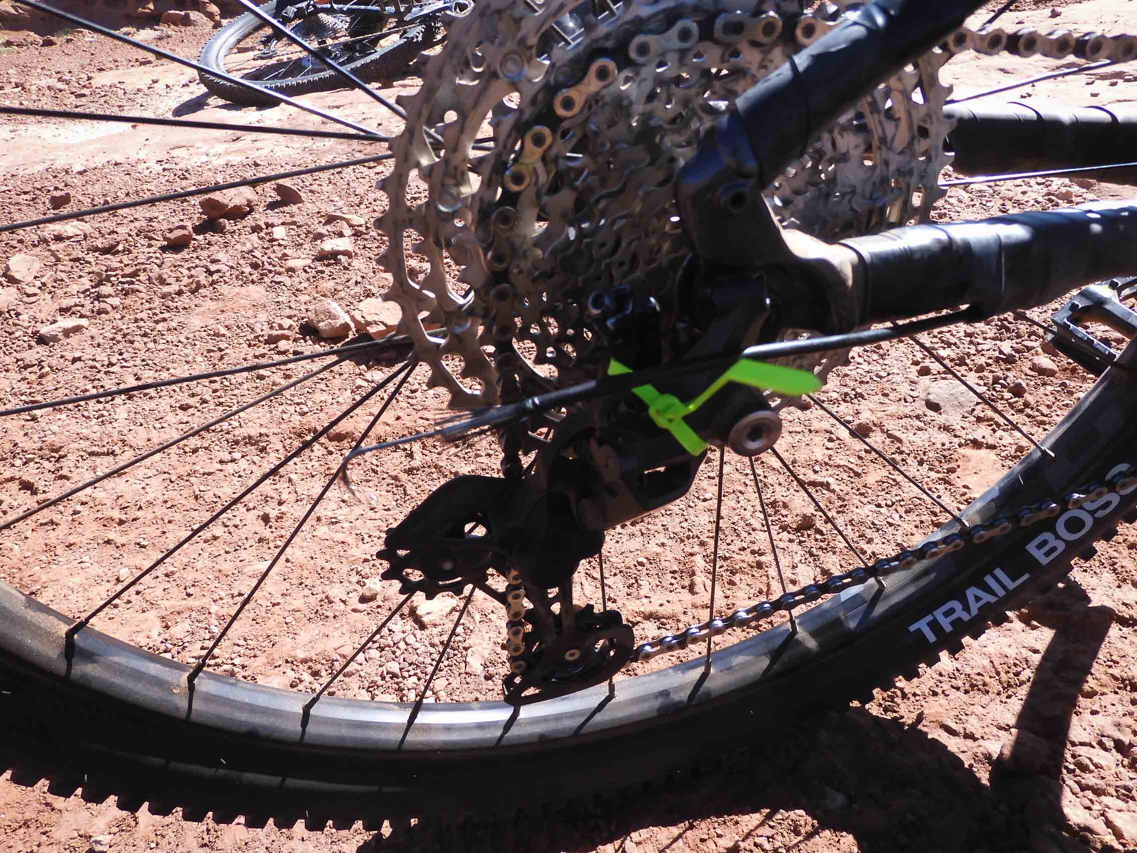
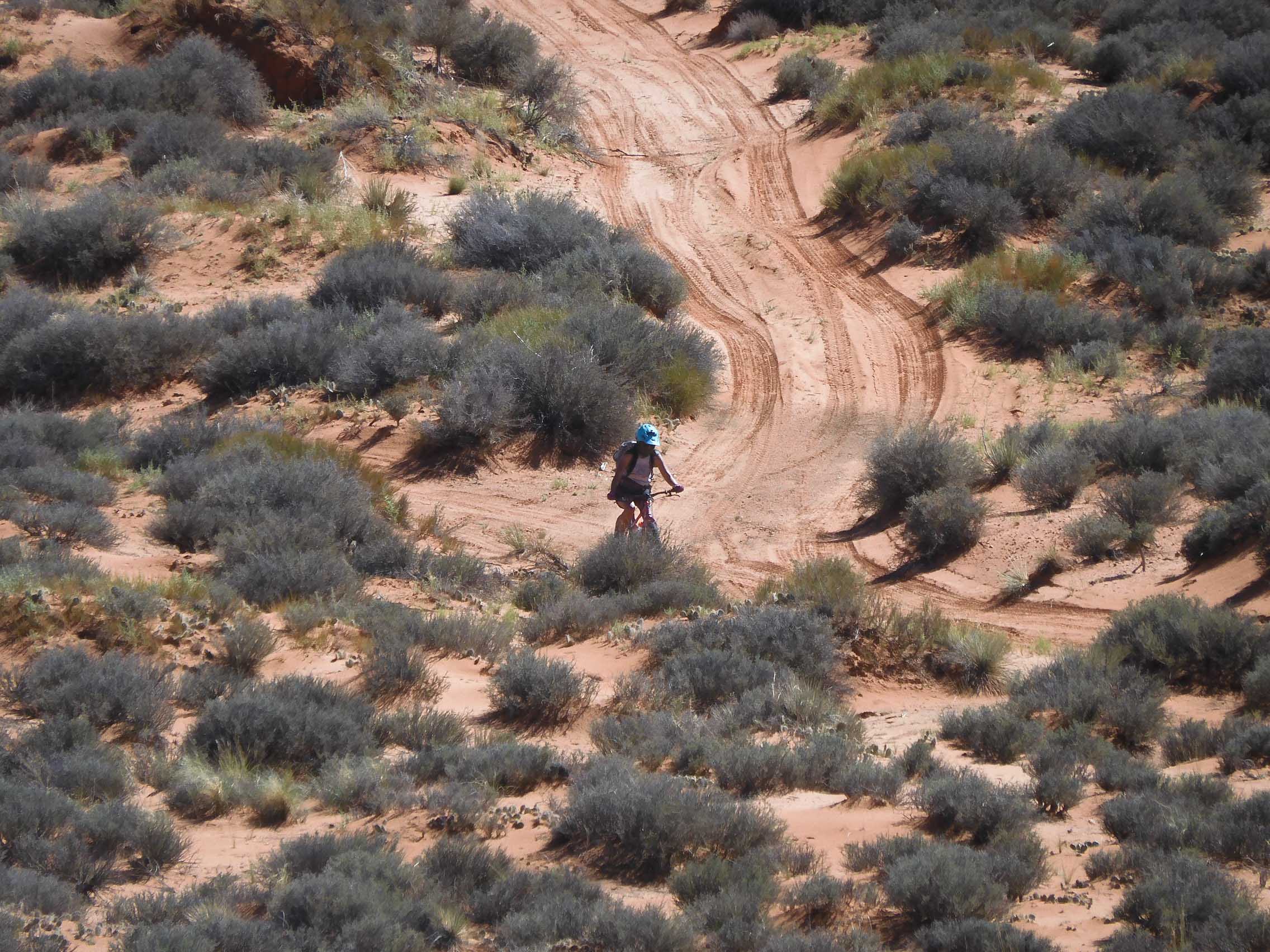
Stuck in only one gear, a fairly high one, I couldn't climb any upgrades at all, and pedaling did not provide a lot of power on relatively flat areas. The middle-ish gear provided by the zip-tie fix, precluded climbing and also failed to provide full power on the flat parts. Mostly, I was coasting down. Eric took a picture of my rolling along.
Nadine met us with the truck, saving us some pushing the bikes through the sand. She drove us back to their home in Kayenta, and we unloaded the gear and put the bikes on Mather. We thanked our guides profusely.
Nadine gave us some stickers.
We returned to the hogan for unloading and showers, but Eric insisted on visiting the drive-through Church's Chicken in town in order to replenish our electrolytes. We had a relaxing afternoon and evening in the hogan.
There was no rush to get us out of the hogan in the morning, so we took our time planning the last part of the trip. We had toyed with the ideas of an adventurous rafting trip in Canyonlands, or a tour of the Lehman Caves in Great Basin National Park, or a visit to the railroad museum in Ely. We decided instead to take the more conservative COVID course and instead hike in Black Canyon of the Gunnison National Park in Colorado. So, we spent some time making and canceling reservations, and researching hiking trails and geocaches. Packing up Mather with the bikes took even longer than the usual packing job, so it was about noon when we left the hogan.
At Jon's insistence, we stopped on the way out of Kayenta to see the owl. Haunting, indeed.
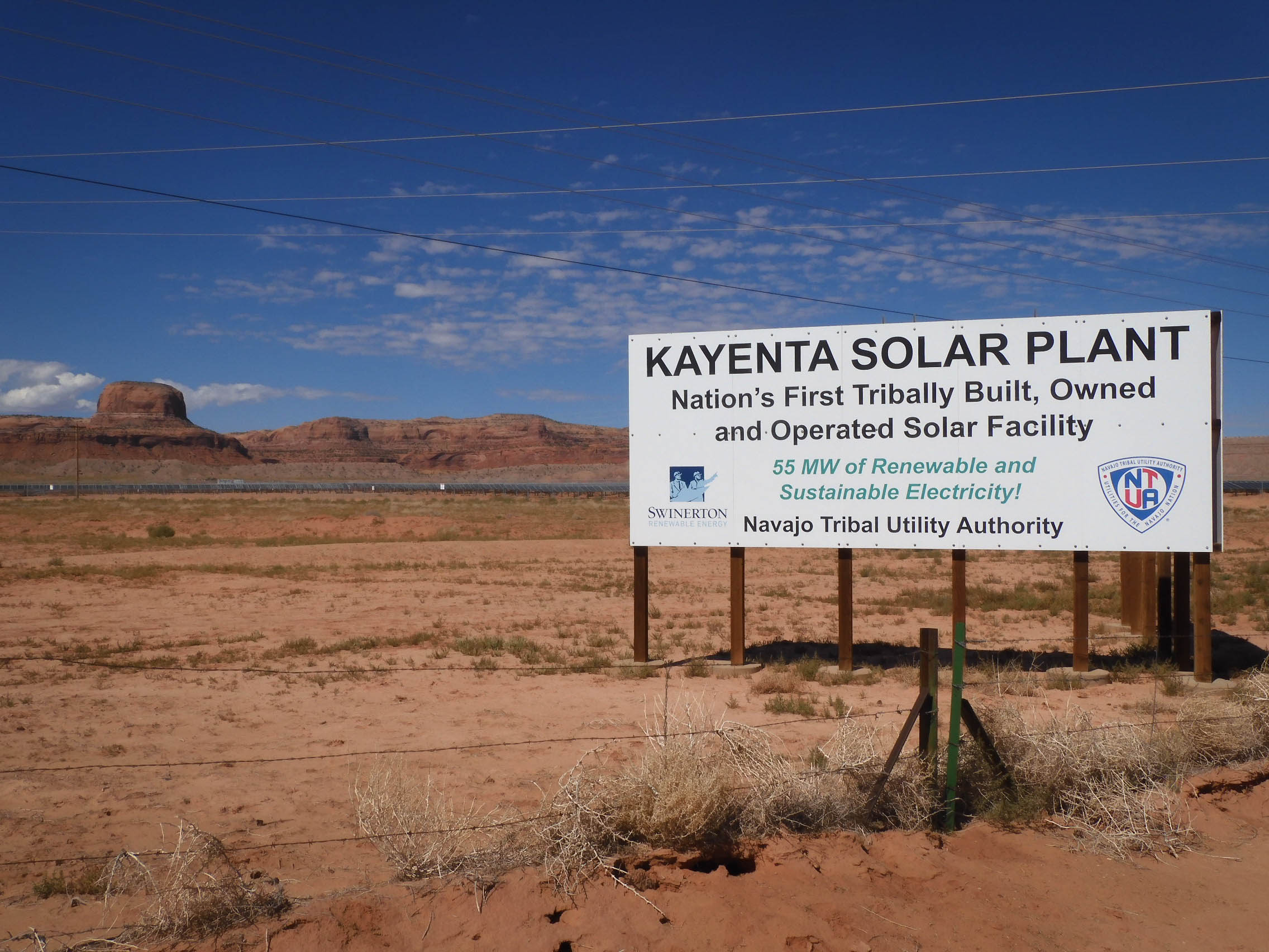
Eric took a picture of the Navajo Nation's impressive solar array. Jon had noted that this energy isn't /for/ the Navajo; it is utilized by Las Vegas.
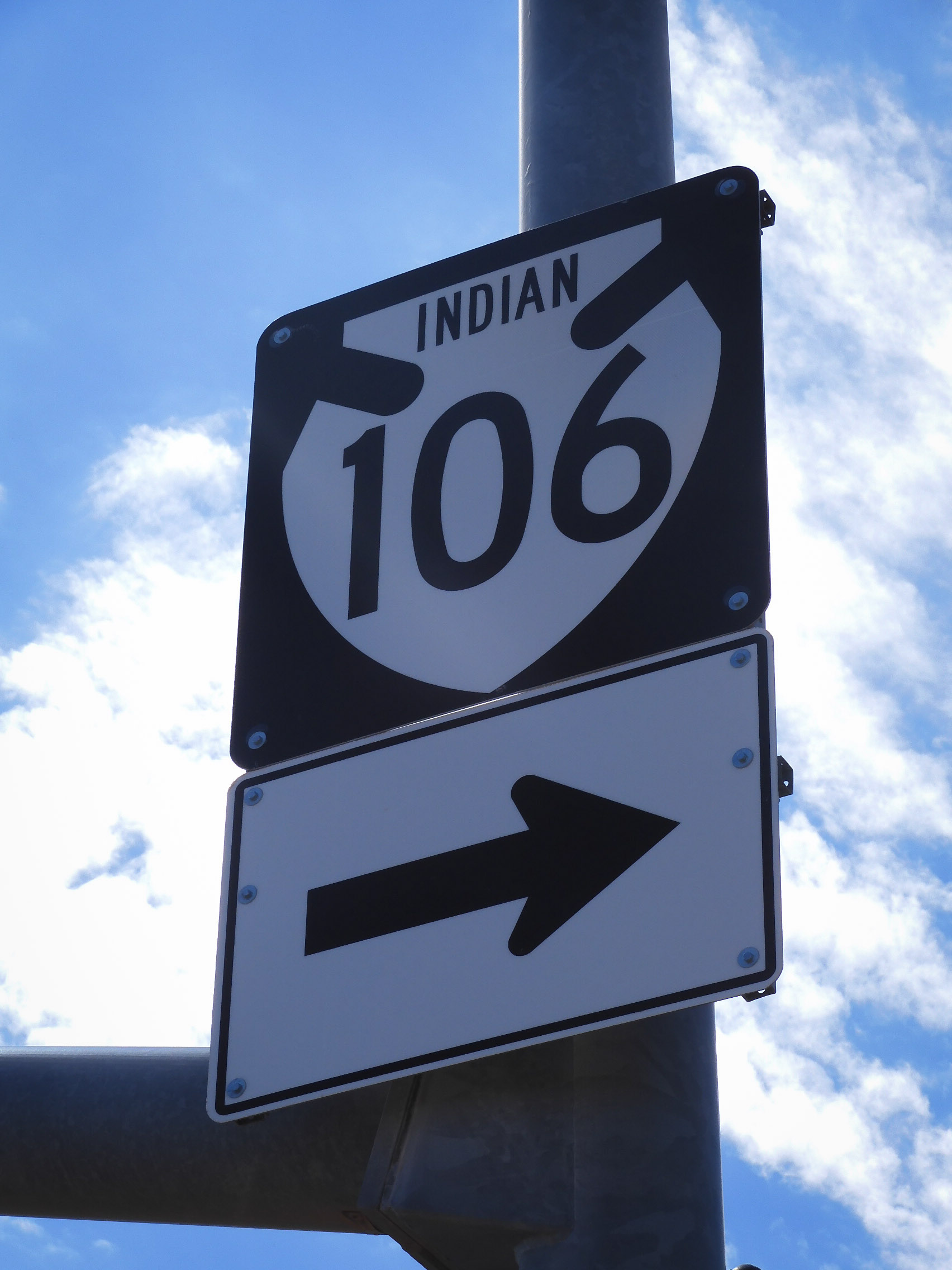
Even the road signs were different. Photo by Eric.
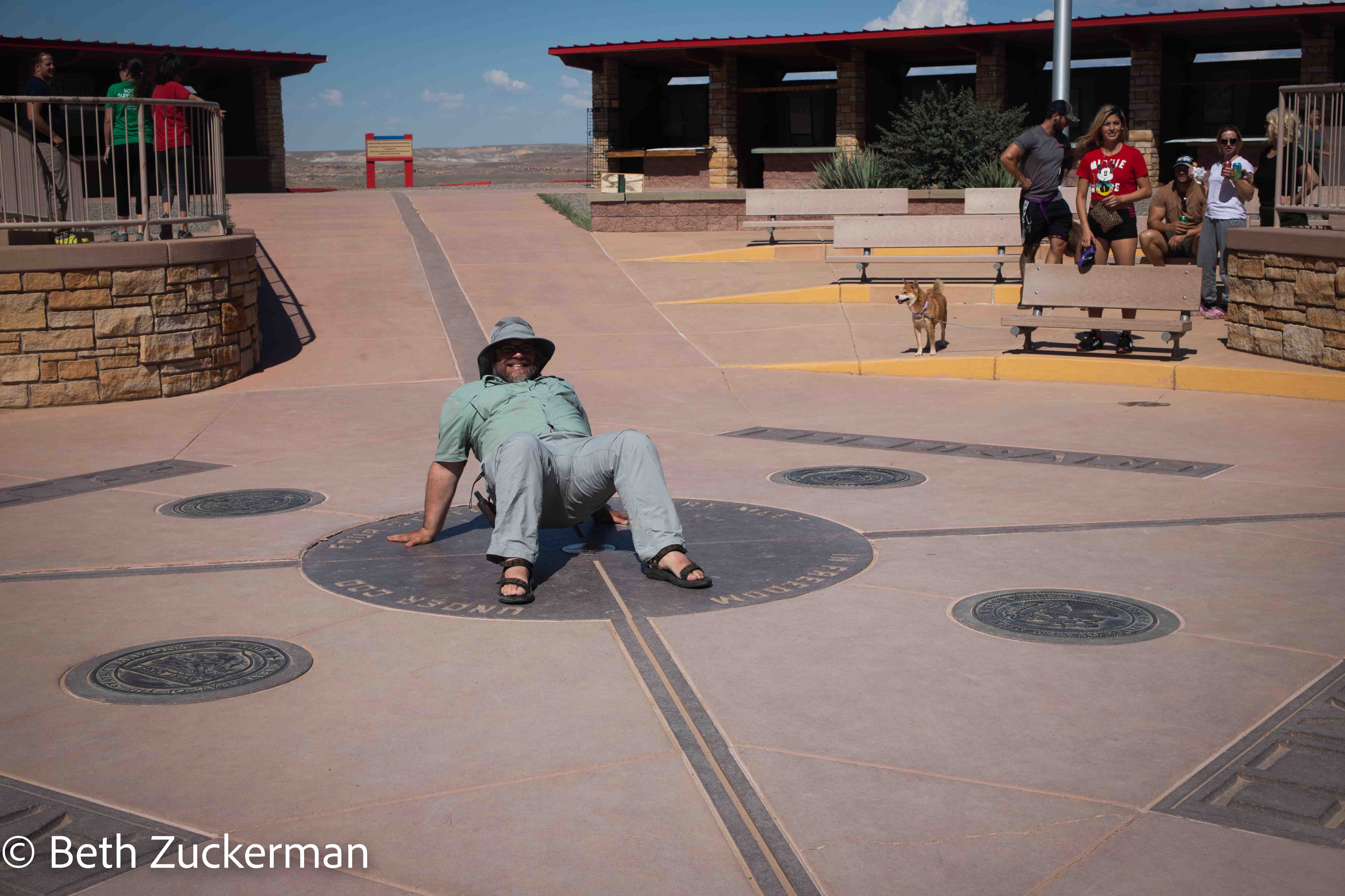
We had planned a side trip to the Four Corners Monument (not a US national monument, but a Navajo Nation monument, meaning our annual park pass was not useful). Eric had never been to New Mexico before; it was a new state for him as well as a fantastic geography spot.
Eric with one limb in each of Utah, Colorado, New Mexico, and Arizona.
Eric took a picture of Grandma's Frybread Shack. A passing man told me it had been there when he had last visited 30 years before.
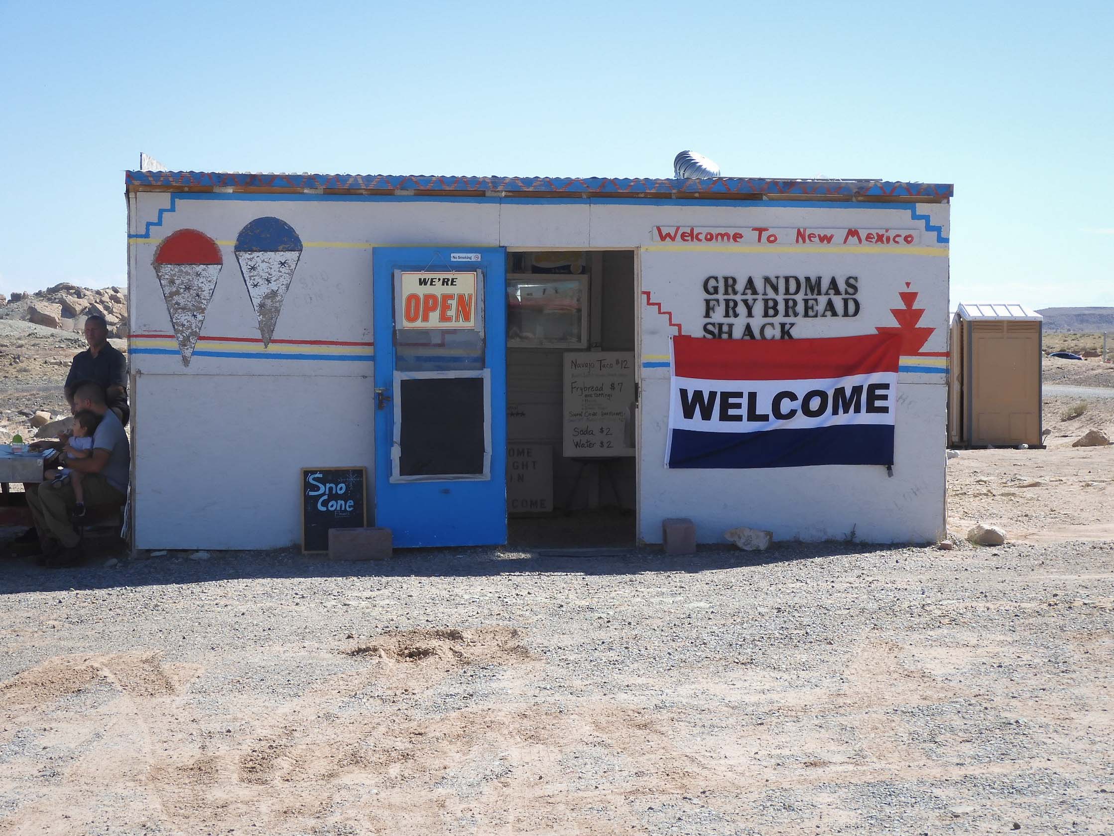
We didn't want to go inside the shack, but we did enjoy tacos from a nearby food truck, made on poofy, crunchy frybread as we watched through the window.
Eric took a lookback photo as we returned to the United States.
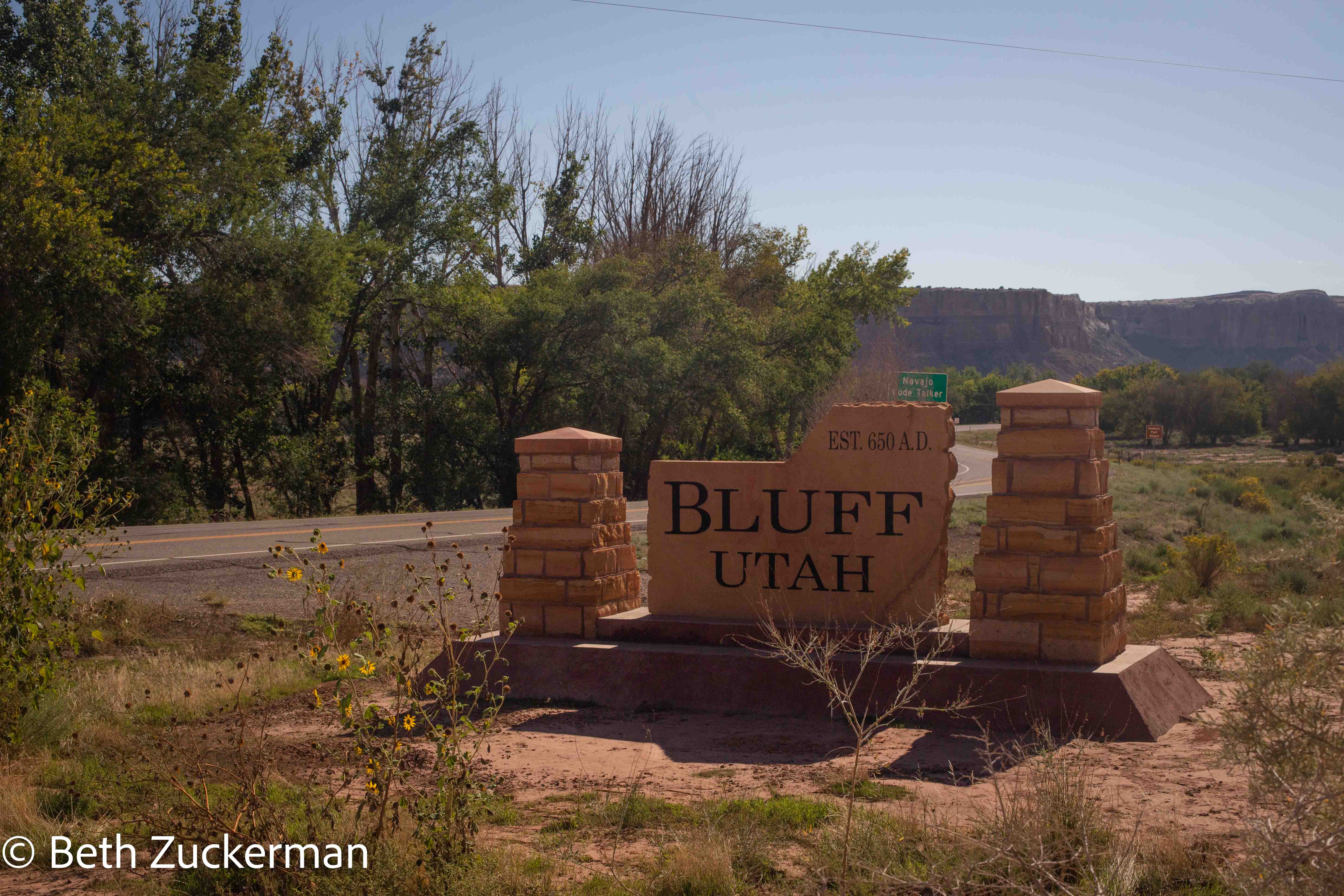
We were impressed by the (presumably approximate) founding date of Bluff, Utah. Time with Diné gives you such a different perspective!
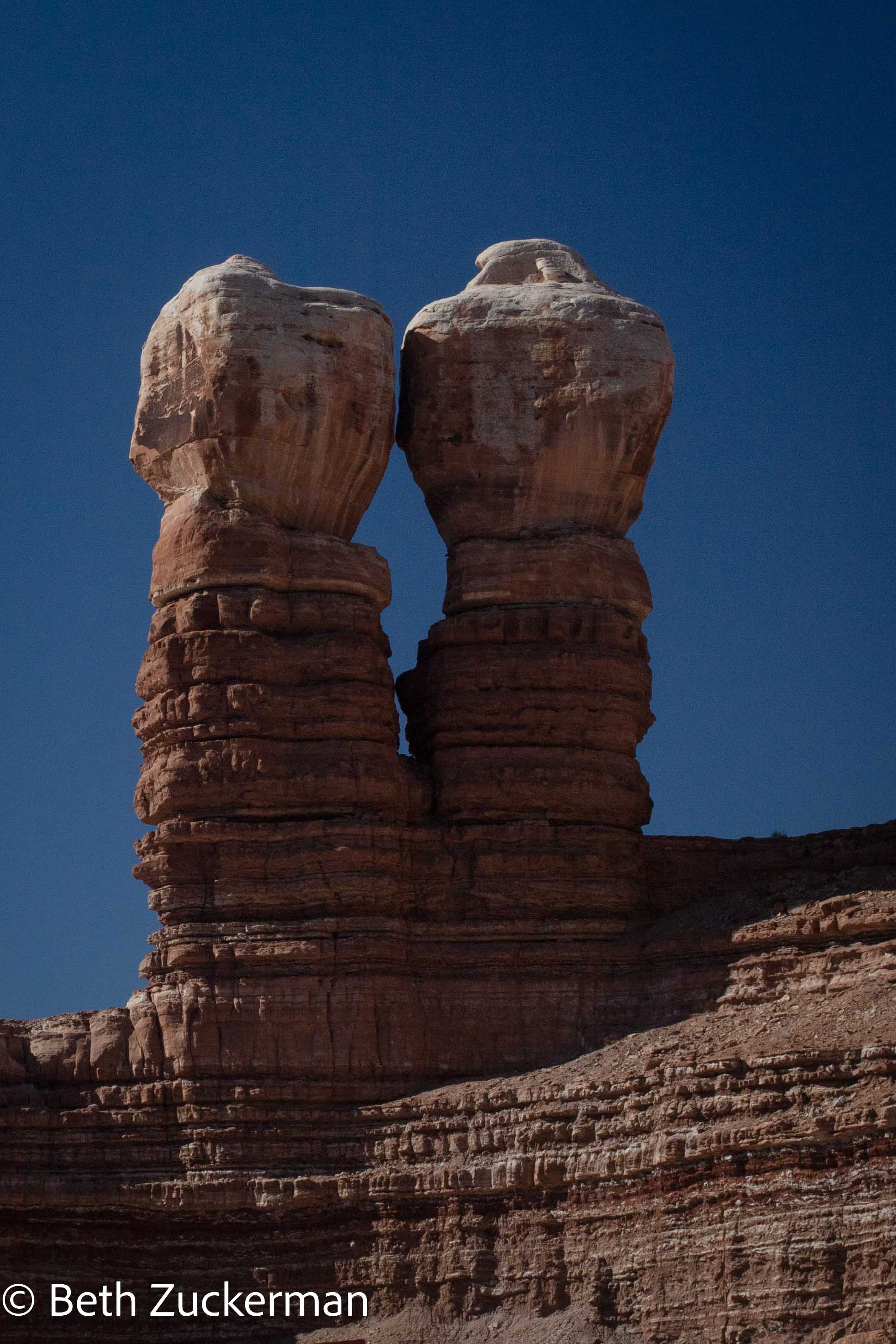
Beautiful Twin Rocks in Bluff.
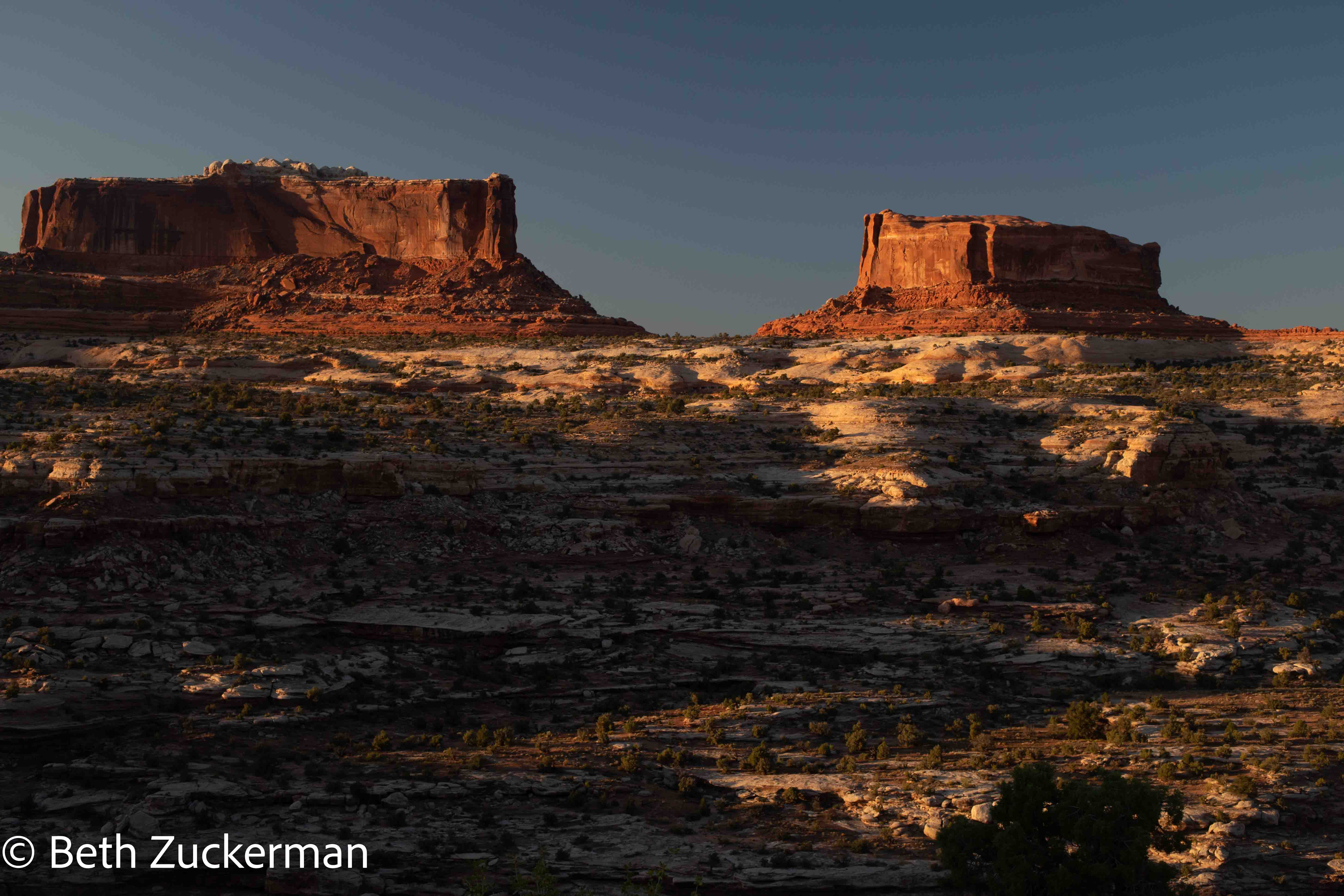
Monitor and Merrimac viewpoint... after having gone back through Moab to drop off the bikes, on our way to Dead Horse Point State Park.
Our exciting and unusual Hunts Mesa bikepacking trip was the highlight of our vacation, and we will never forget our adventure.
Day 8 distance cycled: 10.4 km/6.4 mi
Day 9 distance cycled: 8.7 km/5.4 mi
Day 7 distance driven: 338 km/210 mi, cumulative 2,380 km/1,479 mi
Day 8 distance driven: 3.2 km/2 mi, cumulative 2,383 km/1,481 mi
Day 9 distance driven: 9.7 km/6 mi, cumulative 2,393 km/1,487 mi
Day 10 distance driven: 478 km/297 mi, cumulative 2,871 km/1,784 mi
Day 7 caches found: 2
Day 8 caches found: 0
Day 9 caches found: 1
Day 10 caches found: 4
On to Canyonlands National Park and Dead Horse Point State Park.