Gunnison Route to Canyon Bottom
Thursday 29 September, 2022
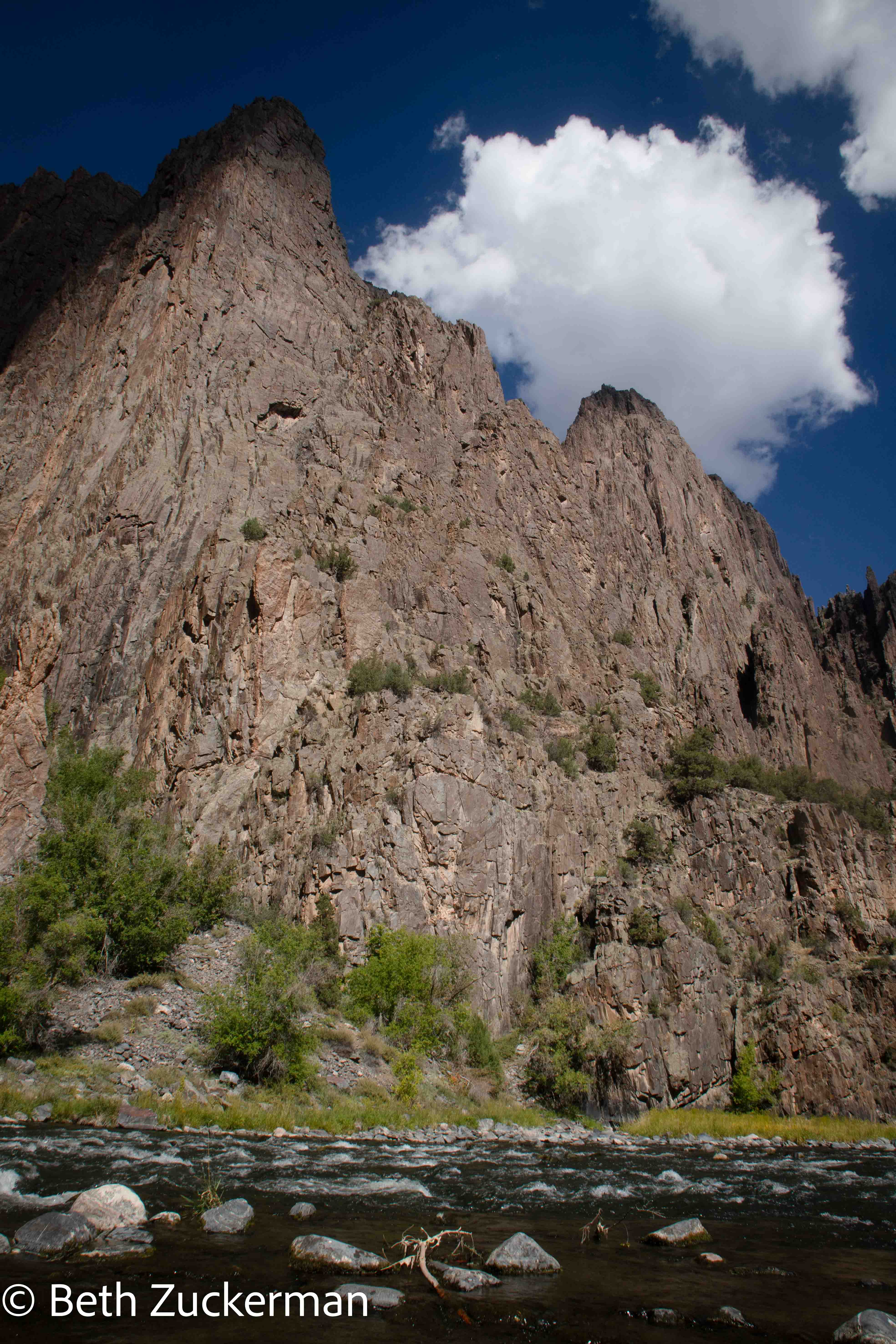
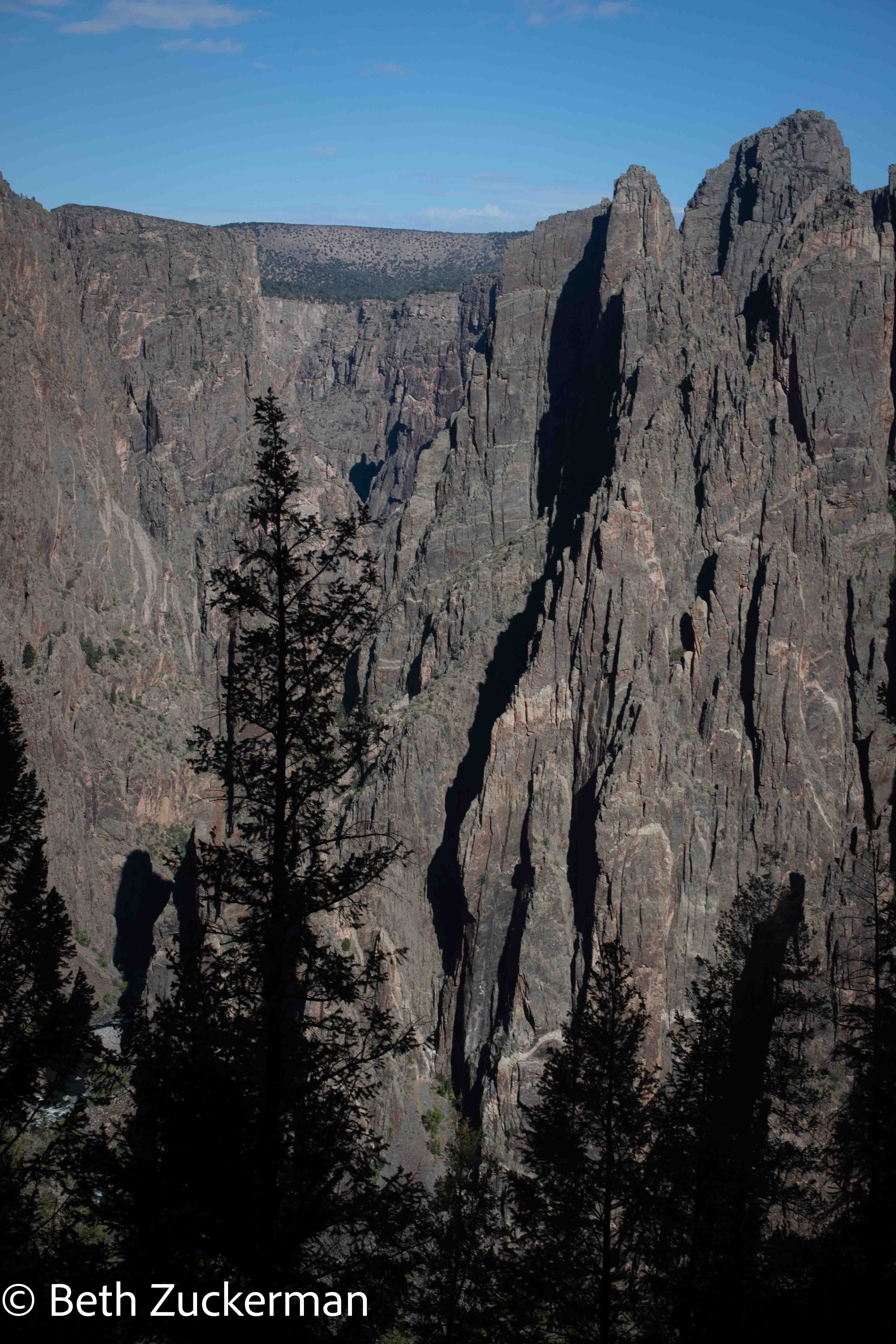
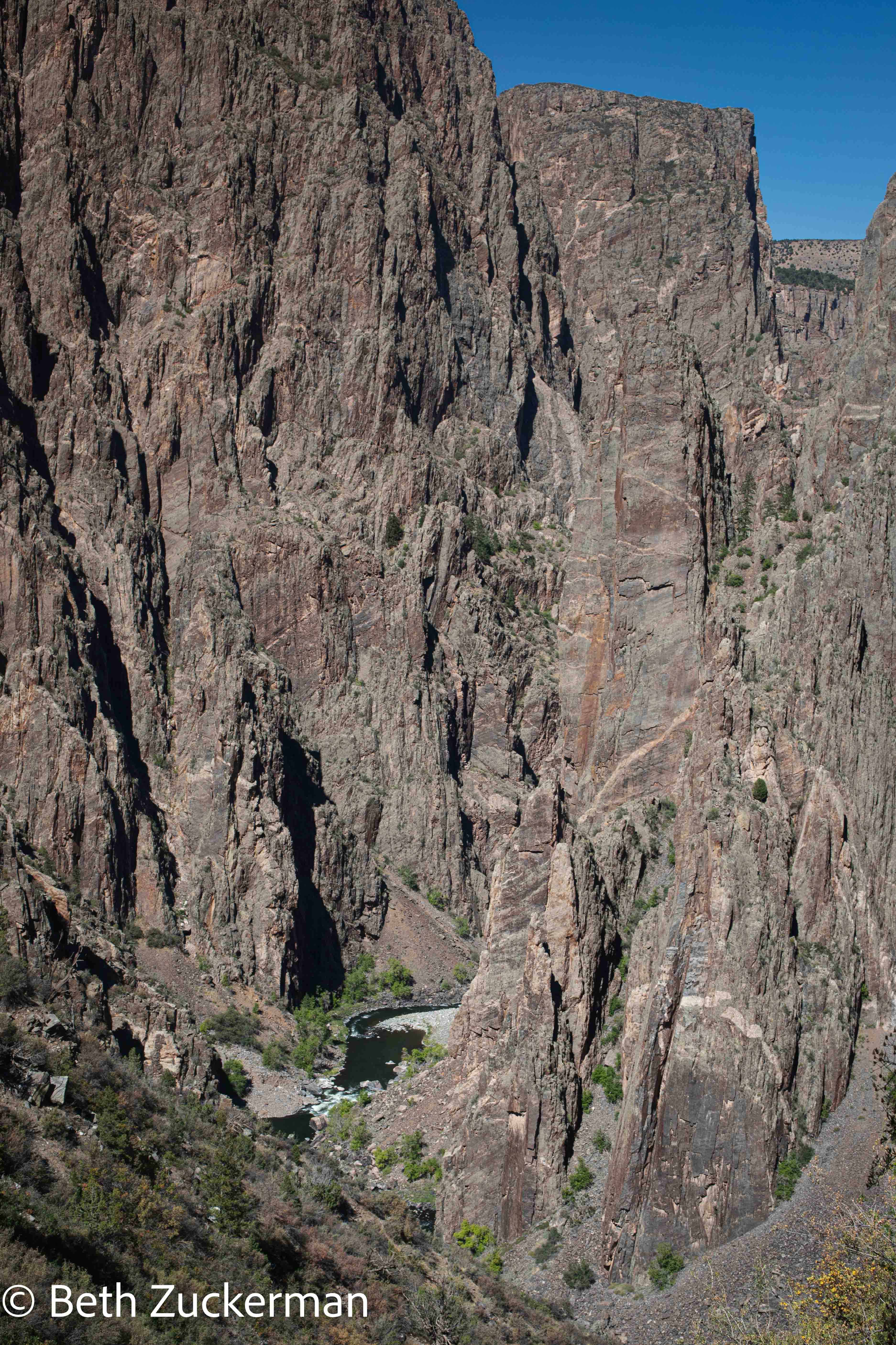
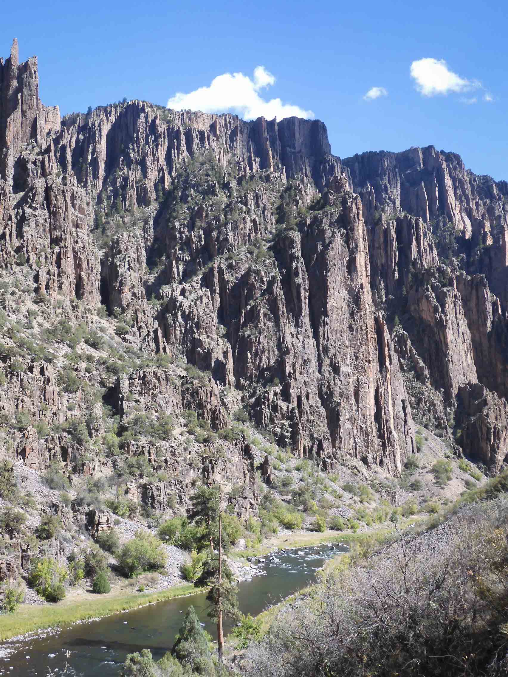
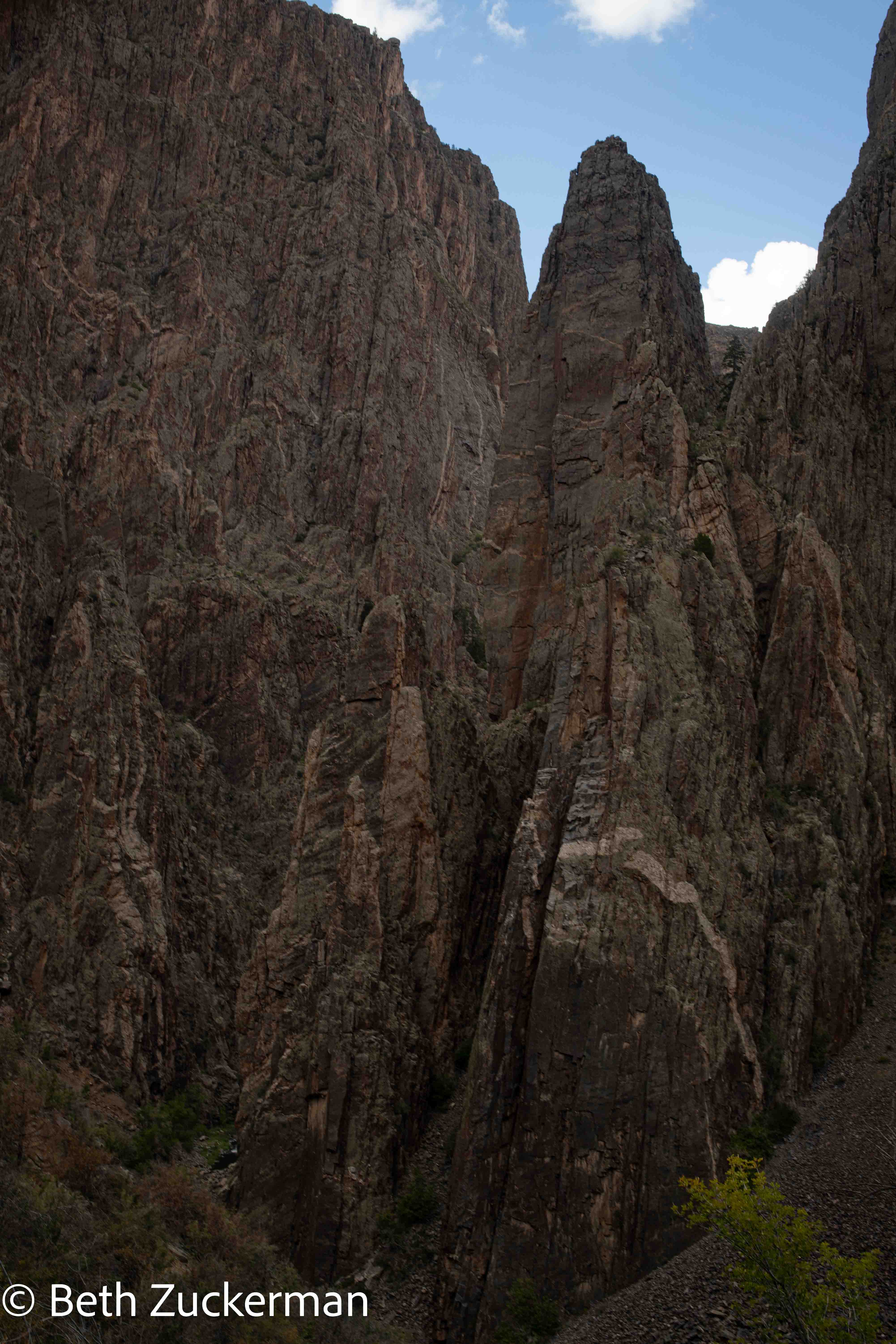
Looking up at the north wall from the Gunnison River.
The most exciting thing to do in Black Canyon of the Gunnison is a hike down to the bottom of the canyon, and then, necessarily, a hike back up to the ridge. The Park Service requires a wilderness permit in order to enter the canyon. I had emailed the Park Service and received a reply that they would not require viewing the orientation movie indoors, and that a ranger would be willing to do the orientation with us outside.
All the same, we weren't sure. The routes are relatively undeveloped wilderness routes, and are all steep and very difficult. The hike into the inner canyon would require an entire, very strenuous, day. The Park Service video described some very difficult trail conditions. On the other hand, we figured that, right at this moment, we were in the best hiking shape we'd ever been in, and, if we were ever going to attempt such a thing, the time was now. We decided to obtain a permit and go at least part of the way down, ready to turn back if the going became too tough -- although, of course, up is more difficult..
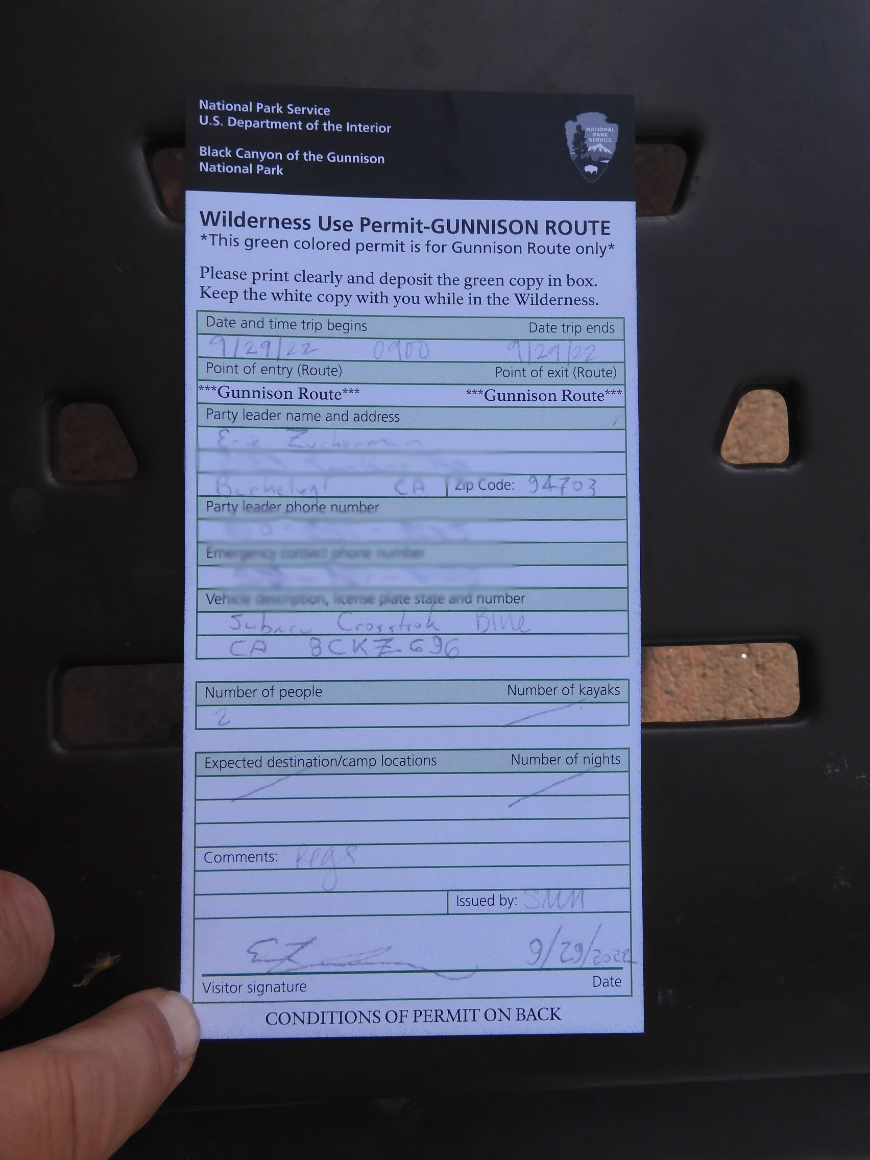
Ranger Sara(h?) came out of the Visitor Center and showed us a book with photos and route descriptions. We discussed how much water to carry (we each took six liters), how to find our way, and the use of WAG bags to carry out any solid waste. Ranger Sara(h?) recommended the Gunnison Route, which would take us down 549 meters/1,800 feet in 1.6 km/1 mi, as the "most moderate" of the available routes into the canyon. One part of the route, near the beginning, had a chain to help you descend and then ascend the steep terrain. She said most people would take 4-5 hours to complete the entire route, so I assumed we needed to plan on 10. It was a little bit after 9:00, so I thought we had just about enough daylight.
Ranger Sara(h?) said, "The hike into the canyon is optional. The hike out is mandatory." She warned us that, if we failed to return that day, a search for us would not be instituted until the next morning.
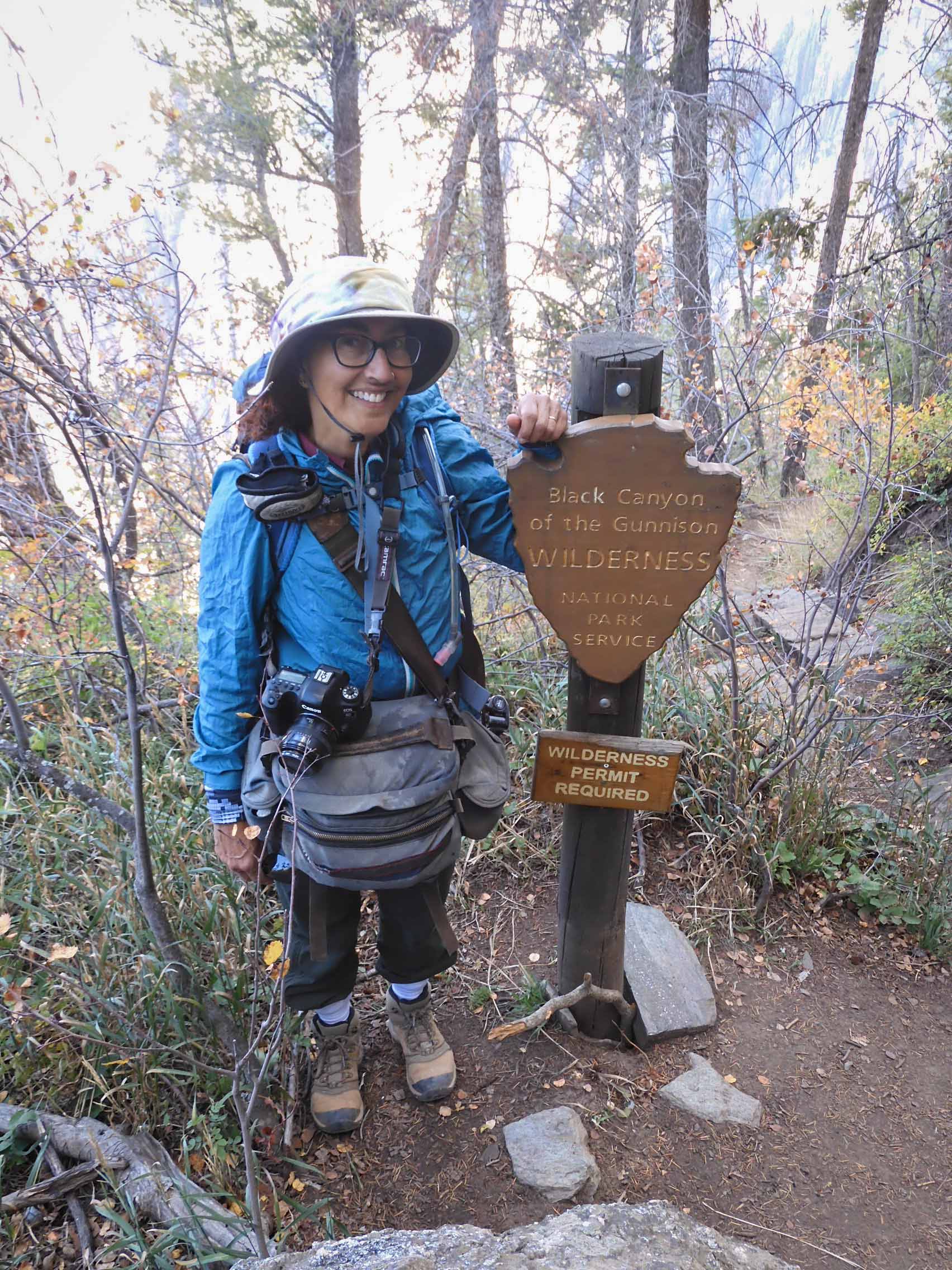
Eric photographed the permit Ranger Sara(h?) issued to us. We're taking a certain amount of pride in our collection of wilderness permits.
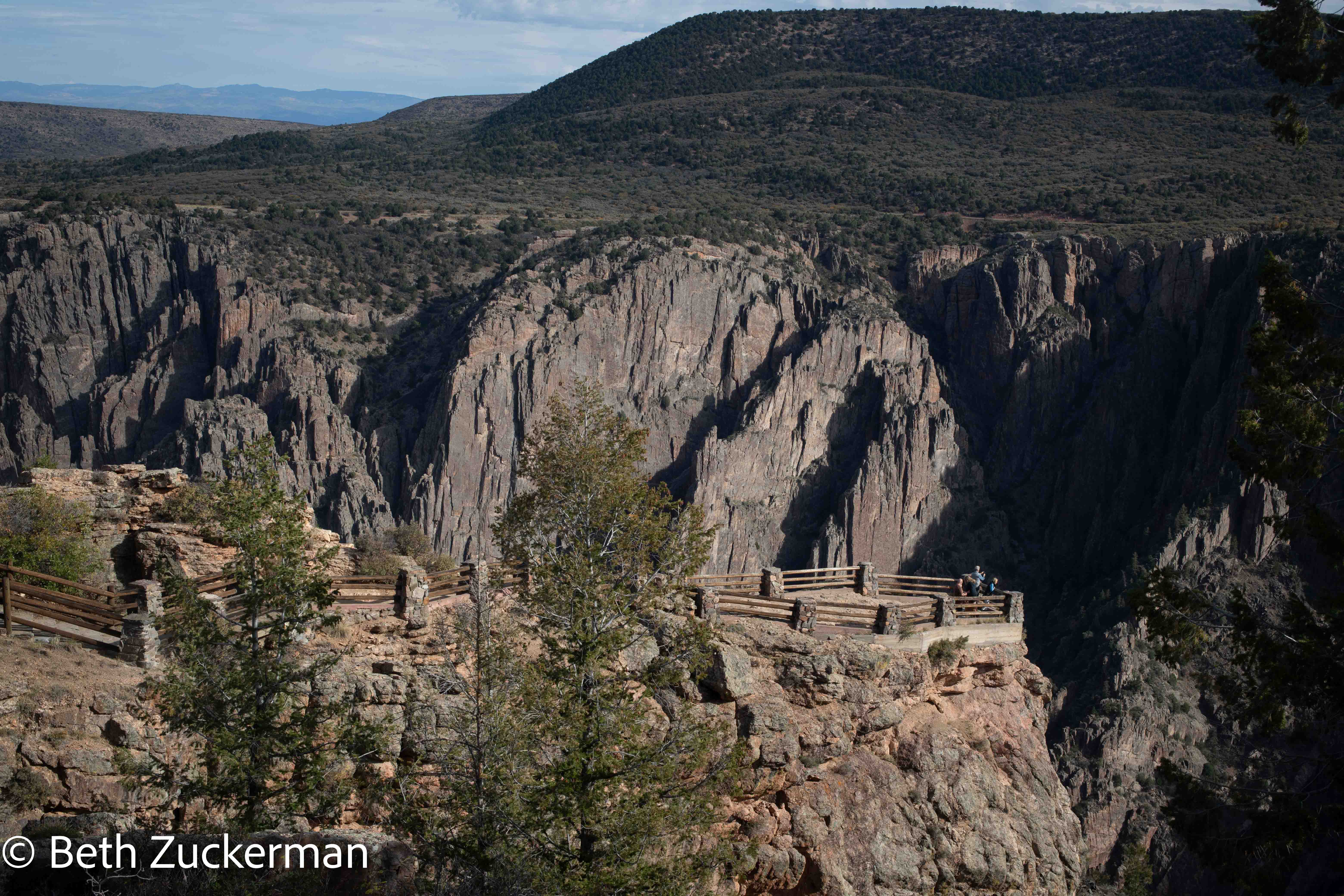
We filled our water bottles, packed food for the day, and stopped to take in the view from this overlook.
We set out on the Oak Flat Trail, which leads to the Gunnison Route, at exactly 9:59. I told myself that, even if the hike took ten hours, we should be beyond the difficult part before full darkness fell.
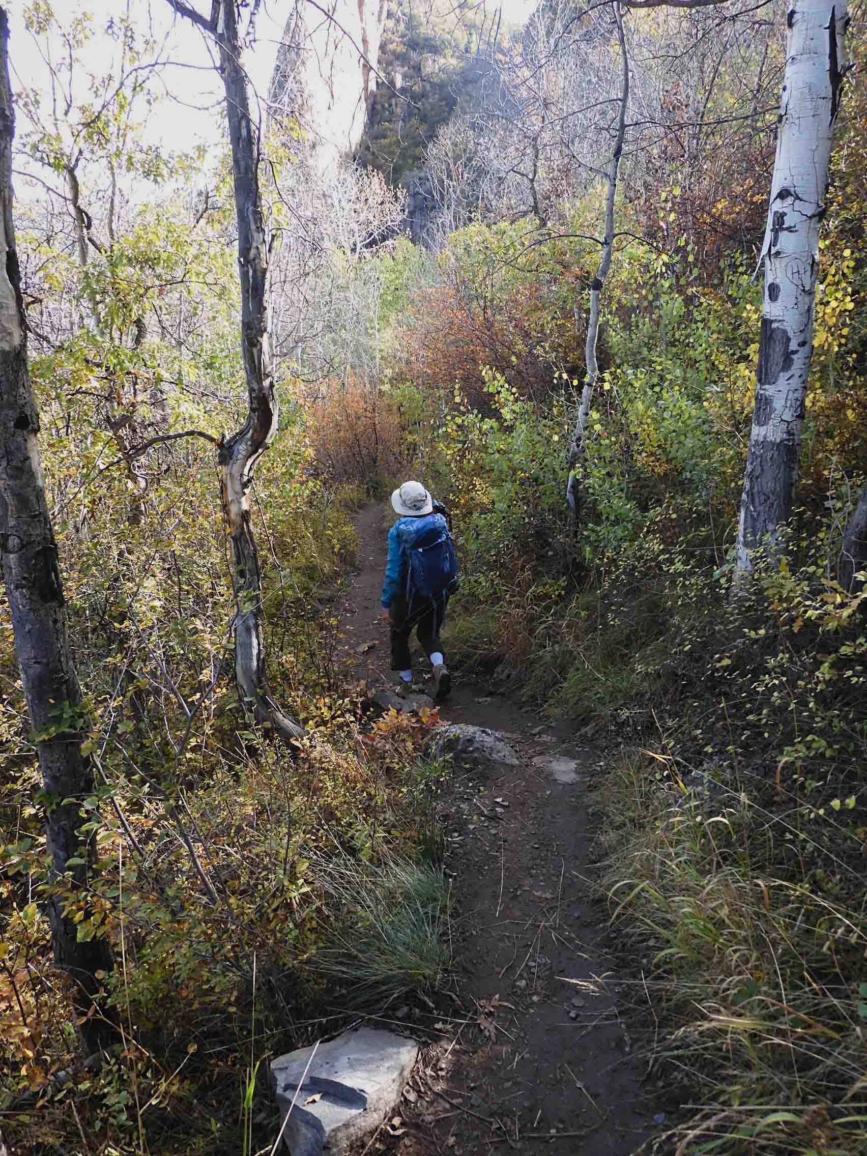
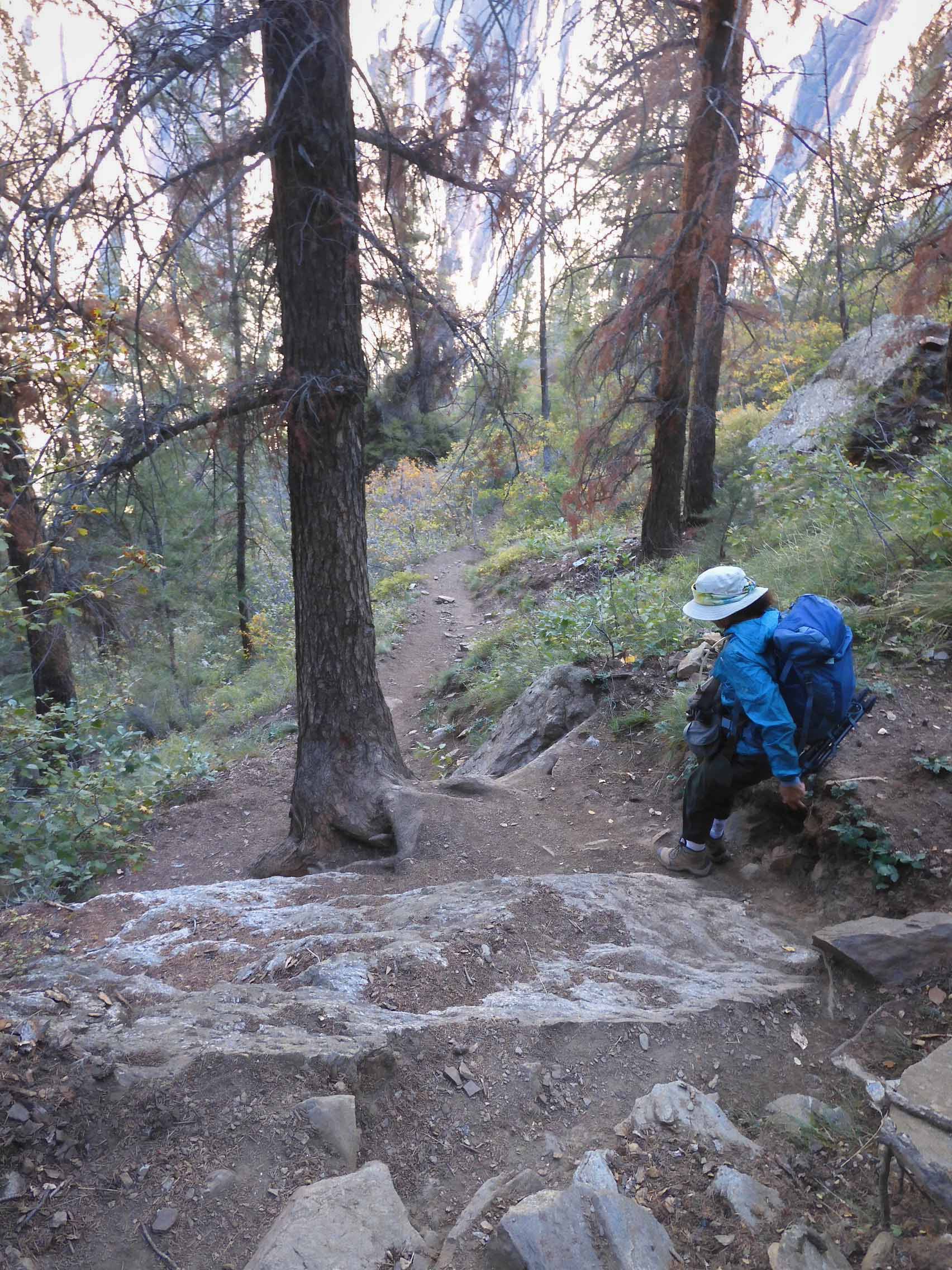
Eric took my picture descending through the beautiful forest.
Eric photographed me at the wilderness boundary sign. We were on the Gunnison Route! This was our fourth wilderness in 2022, a very exciting year for hiking for us.
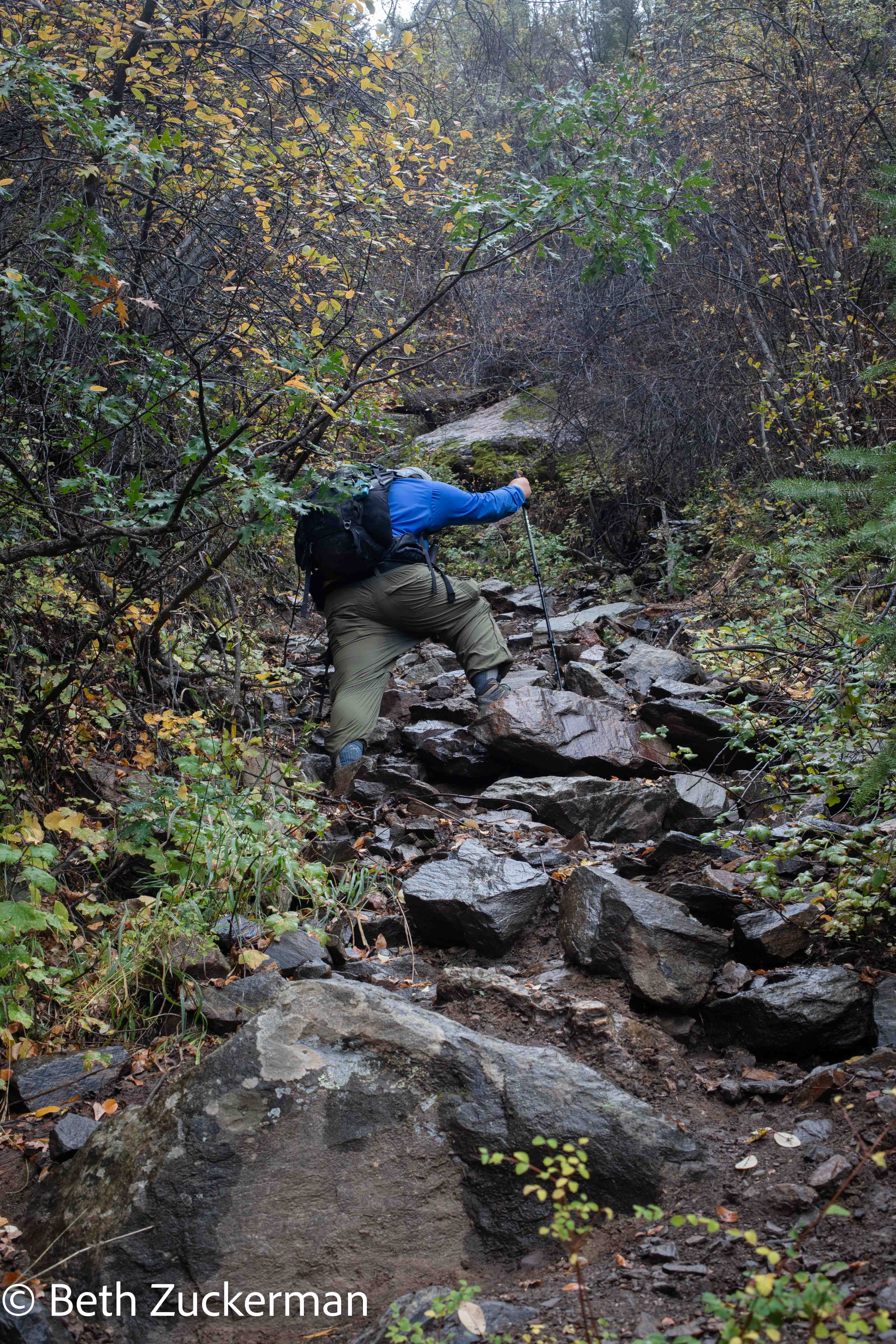
The trail became steeper and more difficult, but the upper part did have some switchbacks. Photo by Eric.
>
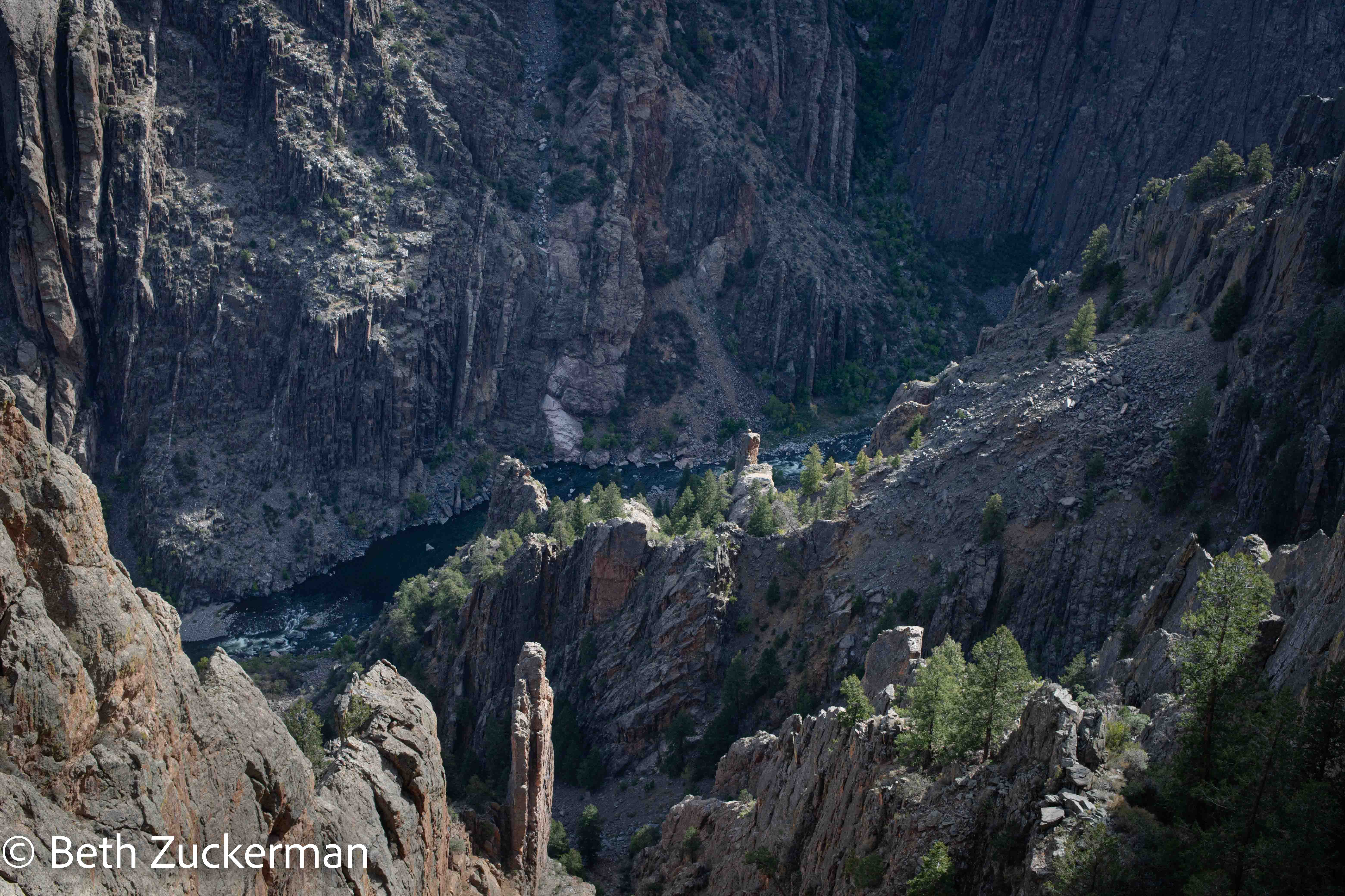
Looking down at the lovely green river below.
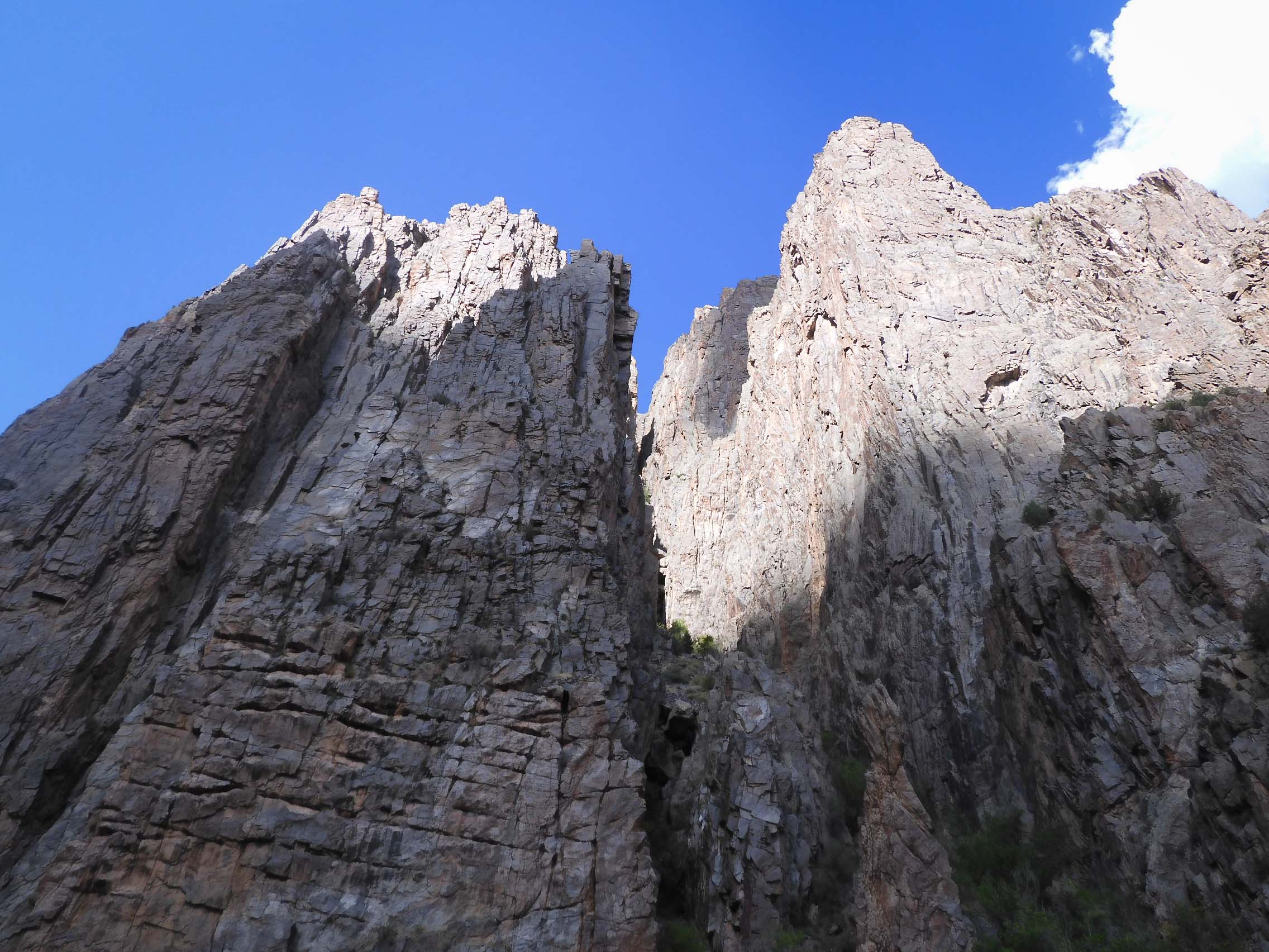
I looked out at the beautiful, steep canyon walls.
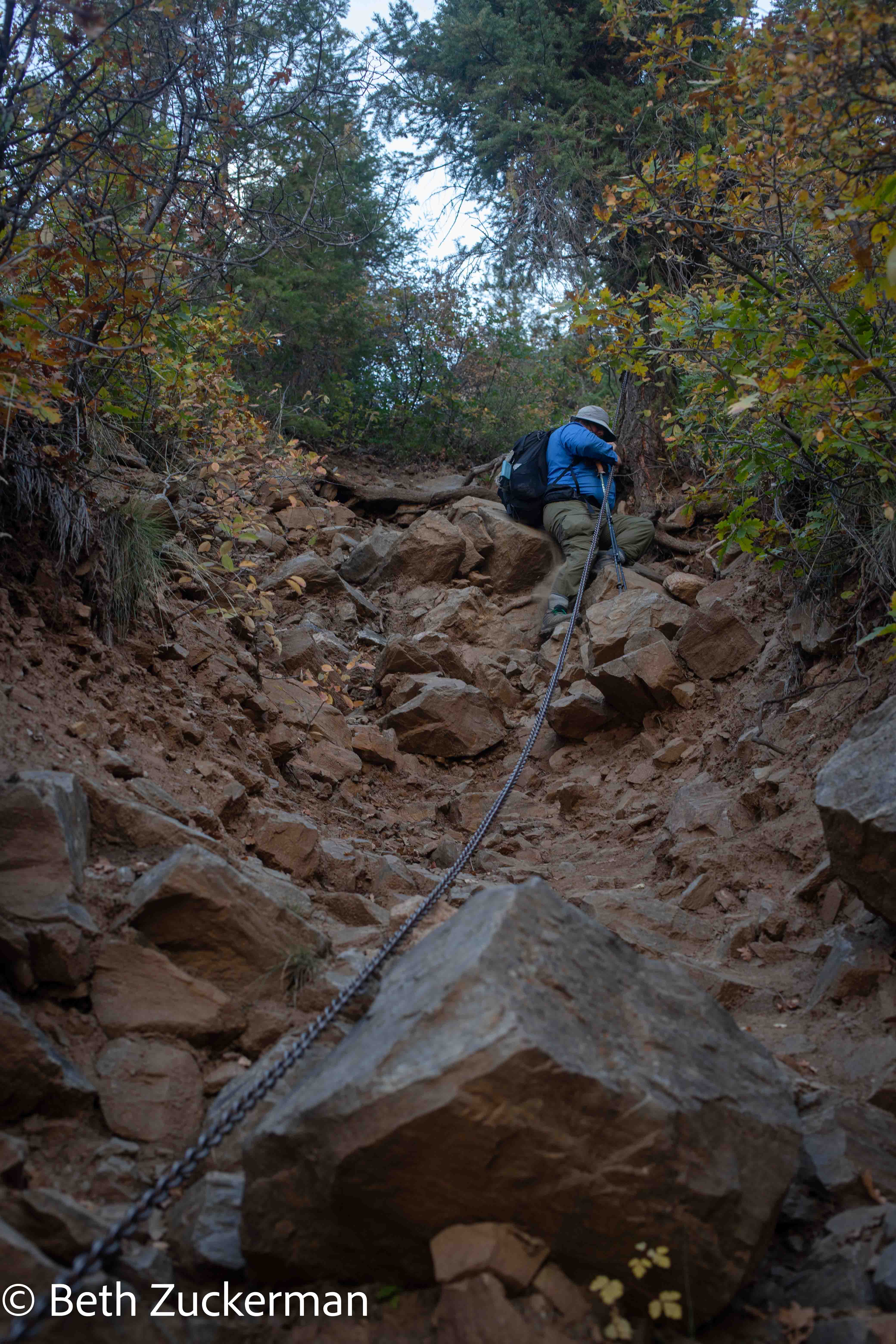
Eric took a picture of my descending along the chain.
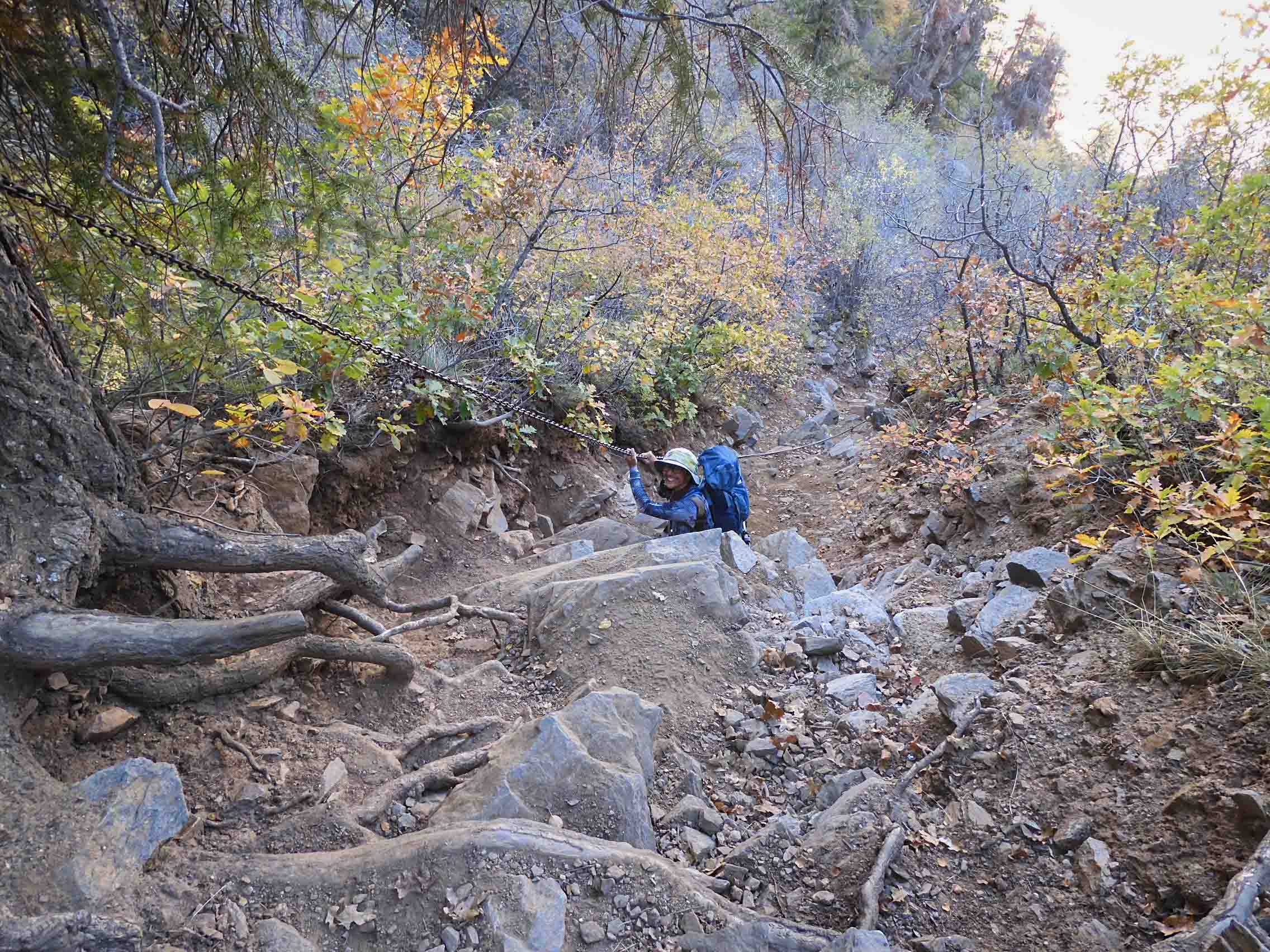
Eric descending along the chain.
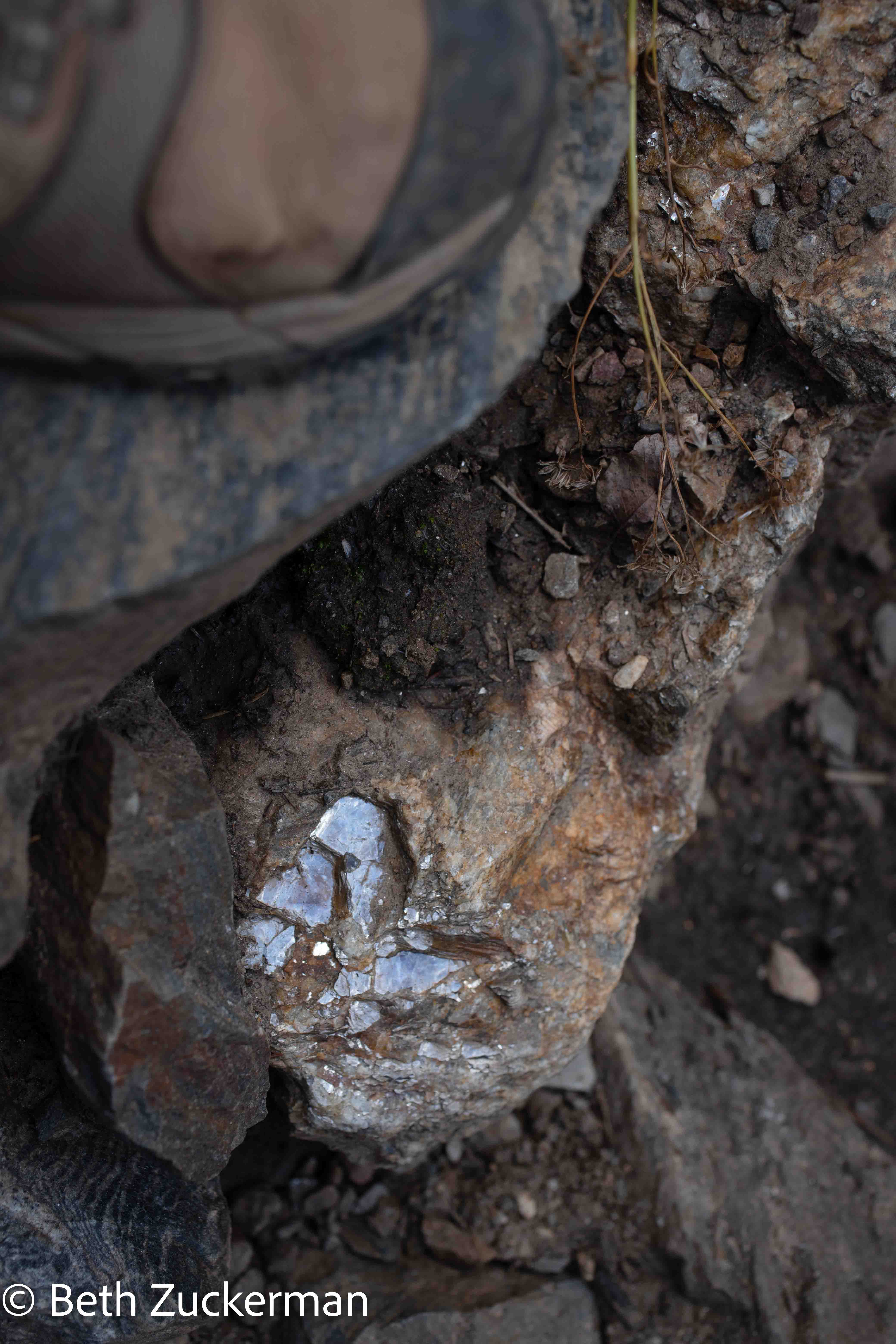
We saw this shiny mineral everywhere. Mica? Pyrite? Some sort of fool's gold.
We carried on for quite some time, and the river below started to look closer.
As Ranger Sara(h) had warned us, the lower part of the trail was filled with loose scree, and it was a challenge to find footholds. It was reminiscent of our difficult descent from the summit of Mt. Dana in June, or Wheeler Peak in 2021.
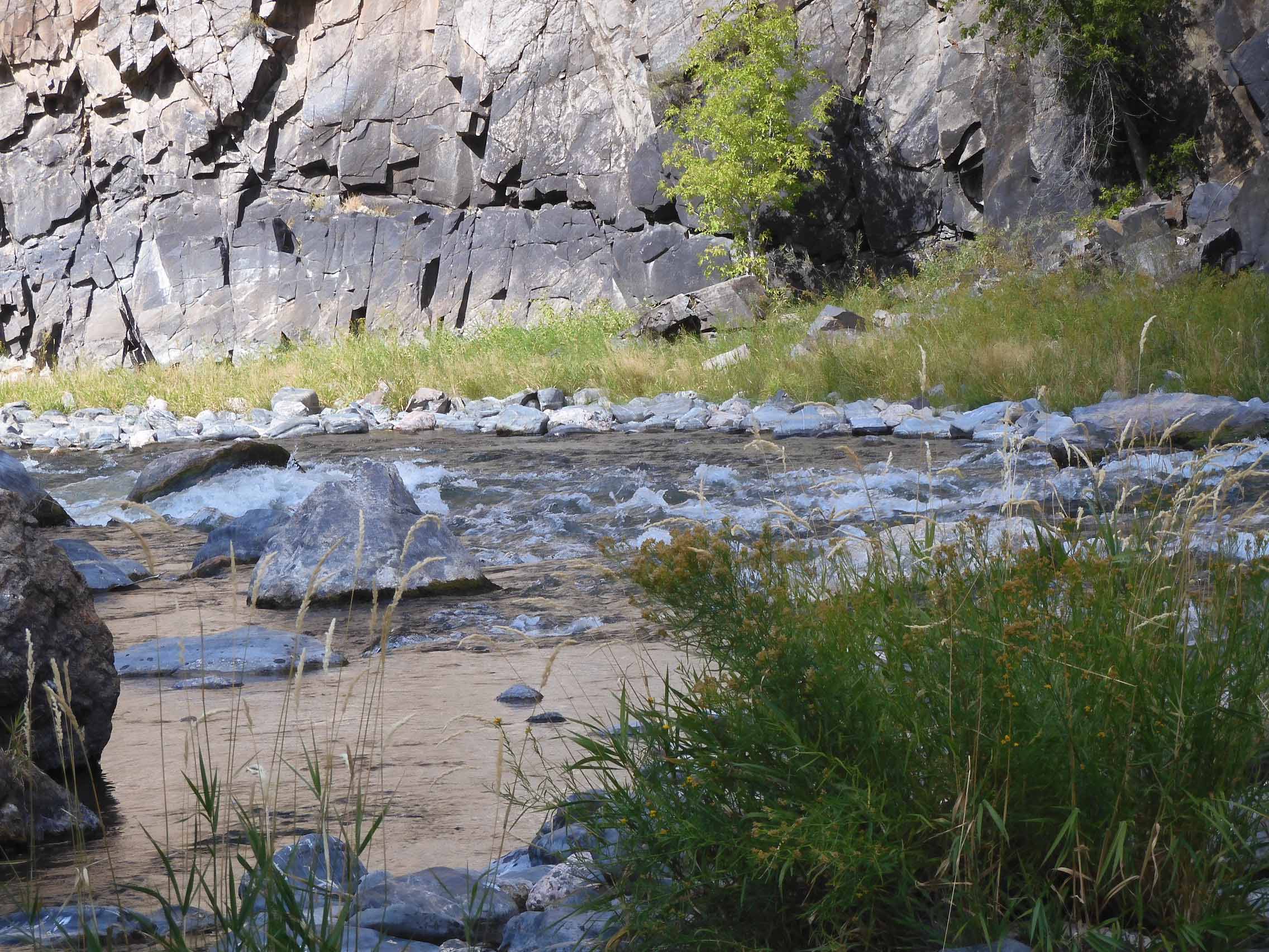
Eric took a picture of the Gunnison River as we were nearing it.
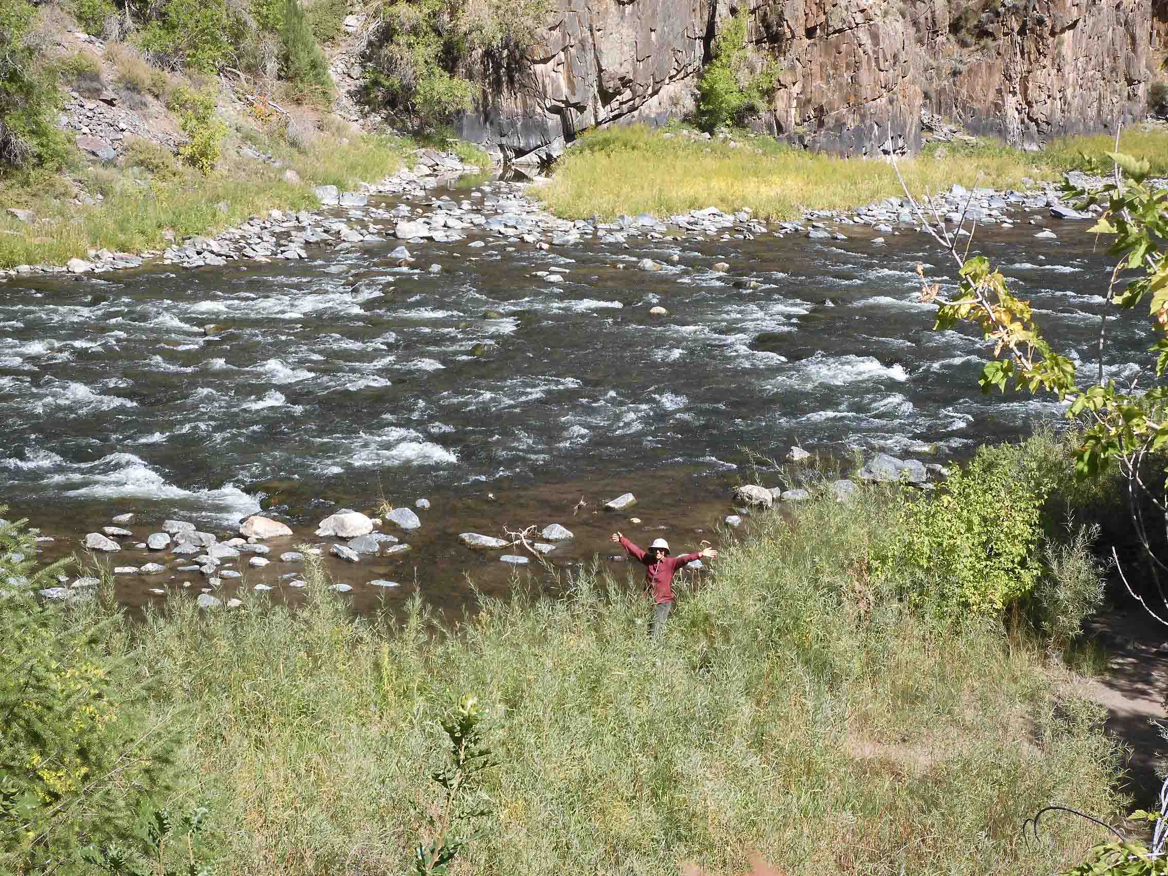
Eric photographed me as I reached the river at last!
Eric looked up at the steep canyon walls above us.
Eric looked out across the pretty river.
Although Ranger Sara(h) had predicted that it would take us about the same amount of time to ascend as to descend, I had planned for half again as much time to ascend as descend, so I had estimated our turn time at 14:00. We remarkably reached the bottom at 13:49, allowing us a few minutes to take in the beauty of the river. Ranger Sara(h) had warned us that the river was swift and strong and thus dangerous to enter, but we both wanted to touch and experience the water. I rinsed my face in the river, and Eric put a toe in.
In this International Dark Sky Reserve, I thought it would have been amazing to have camped beside the river and photographed the slit of the night sky between the canyon walls. But even if we had brought camping gear, it would have been overcast. Ranger Sara(h) had warned of a 20% chance of rain. It was lovely and sunny until we got to the bottom, but clouds covered the sun as soon as we began the ascent.
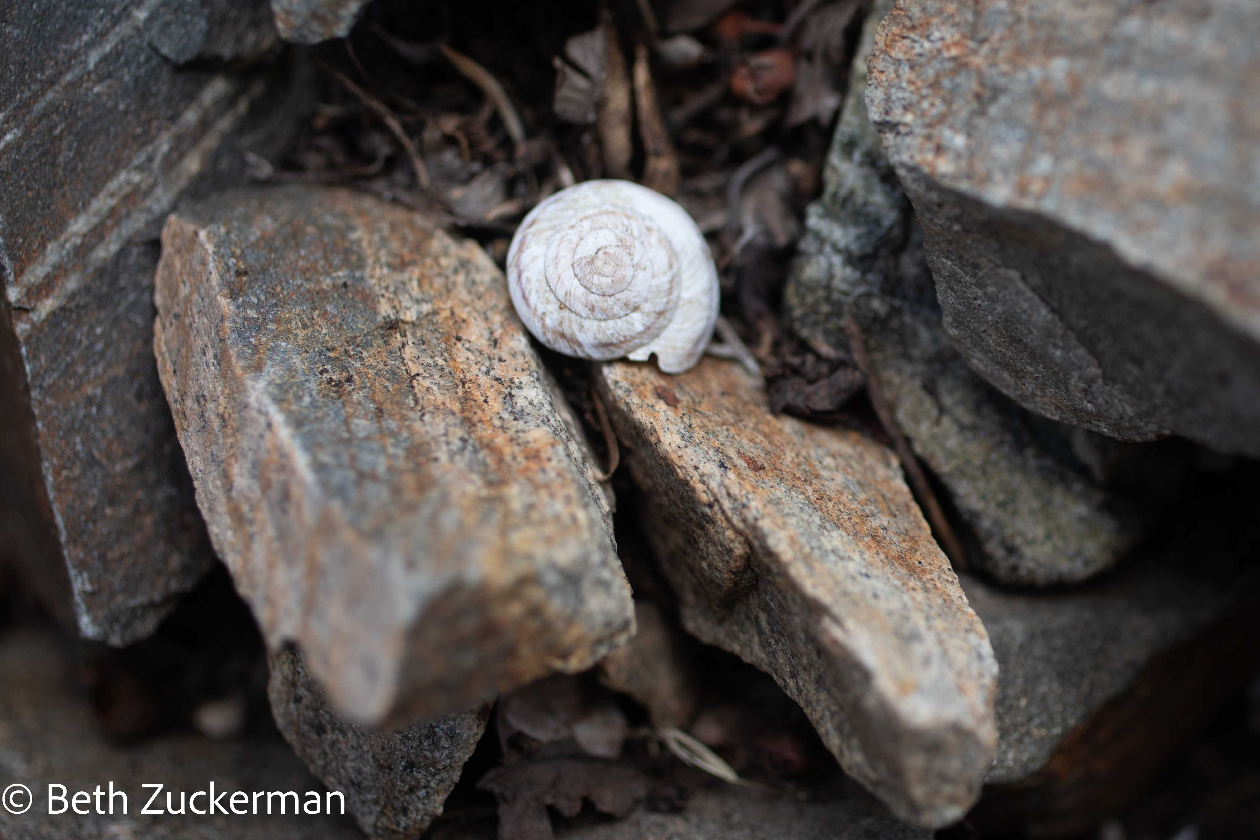
On the lower parts of the trail, I found a number of these swirling shells along the route.
I looked out at the incredible atmosphere around me as we struggled through the ascent through the scree.
Eric made his way up through the loose rock.

A drizzle began to fall, making the slippery rock even more treacherous. The temperature dropped, and I was thankful I had carried extra layers.
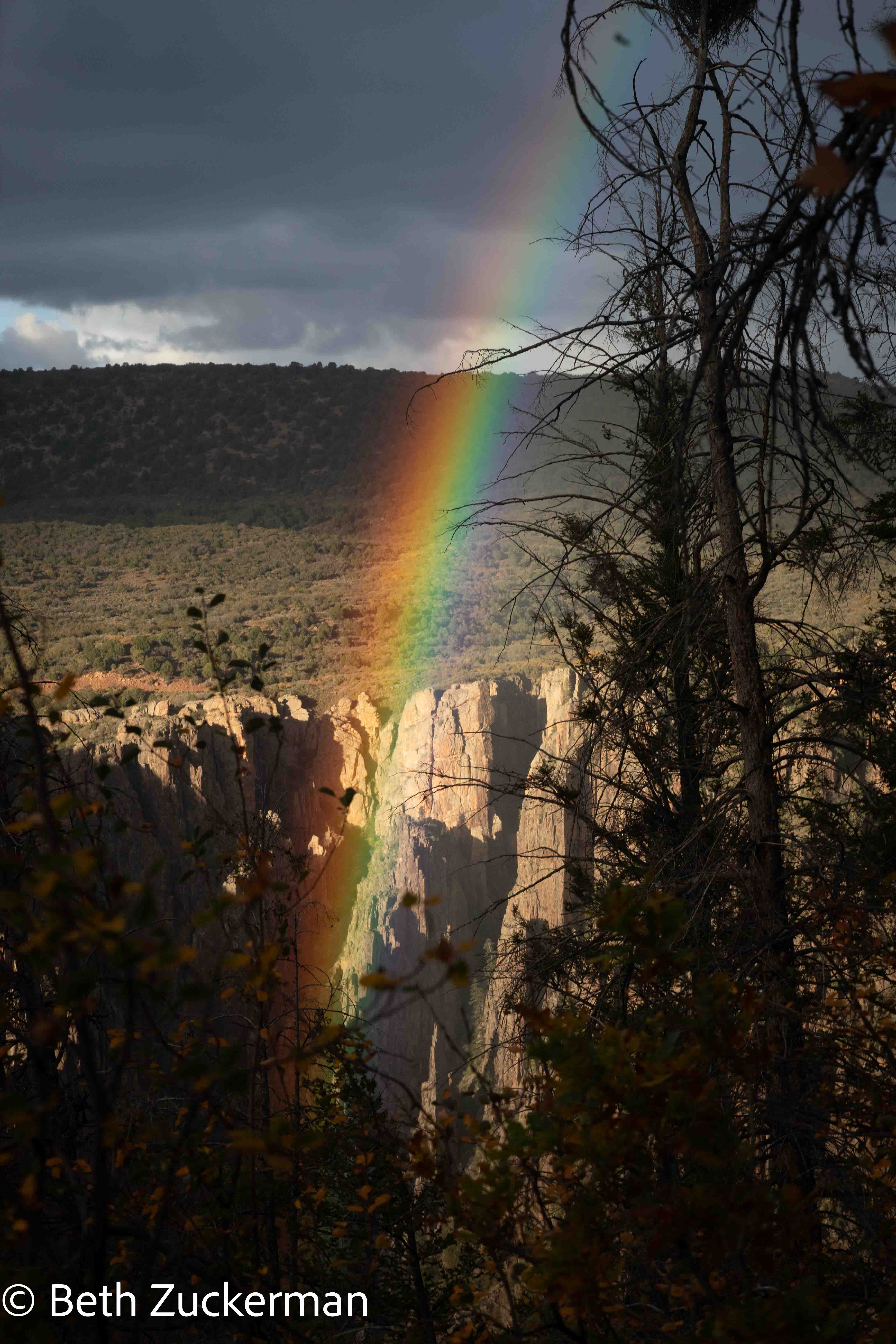
Eric kept saying that, if we were going to hike in the rain yet again, the Park Service should have provided us with a rainbow. We deserved a rainbow. At last, as we were nearing the wilderness boundary, a bright rainbow broke through.
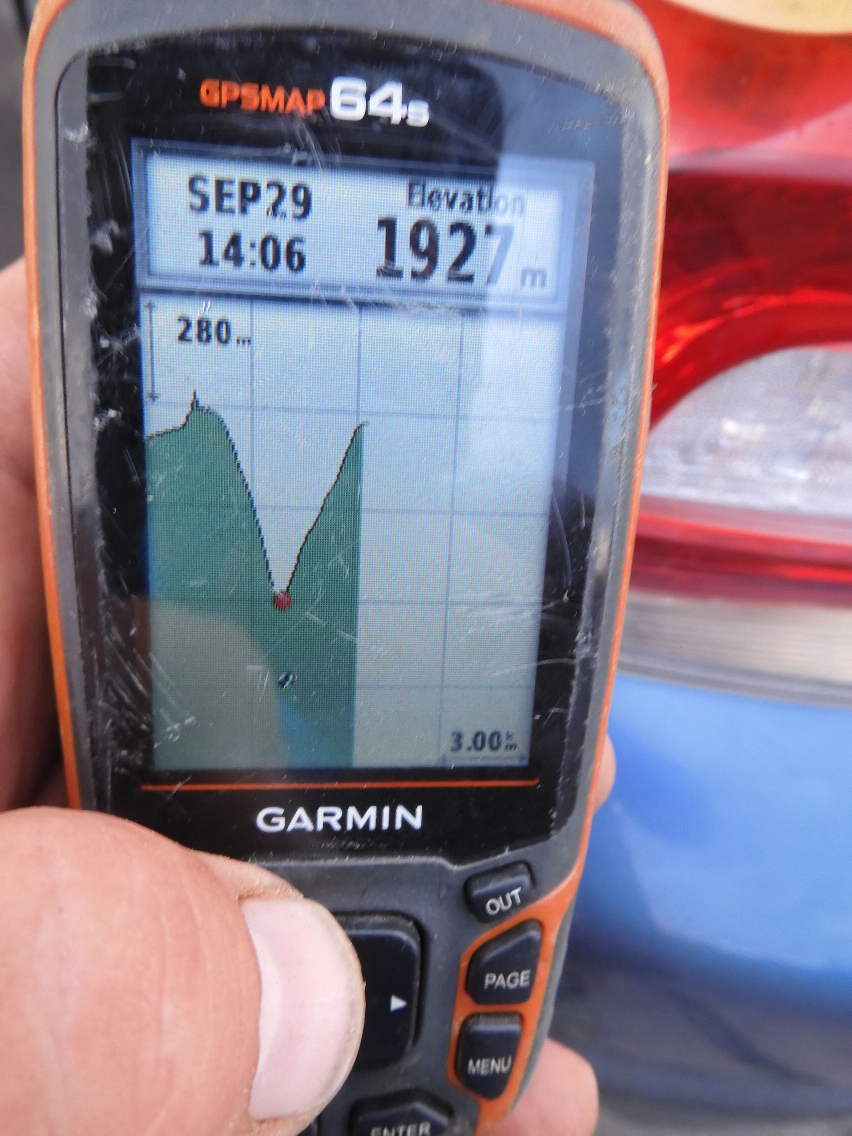
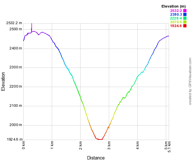
We were delighted to complete the hike in only 8:32, arriving back at the Visitor Center at 18:31, before sunset! Eric photographed our dramatic elevation profile.
He later mapped that elevation profile (GPS signal jitter spread our ascent over an inflated distance; it was of course every bit as steep coming back up, as it was on the way down):
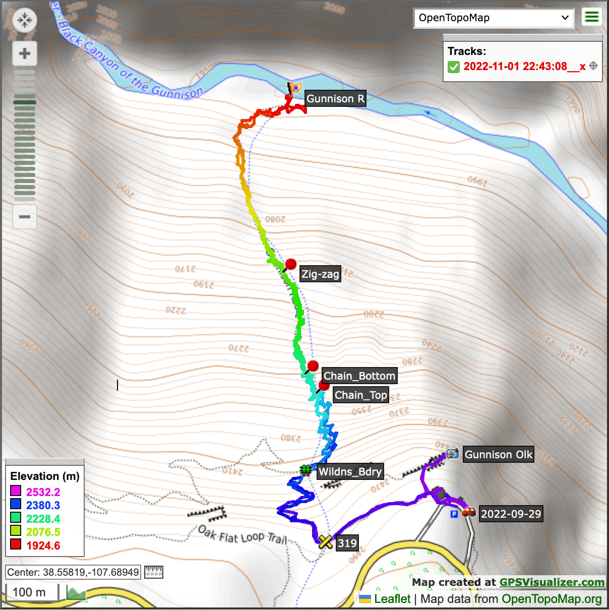
Map of our incredible descent and ascent:
As exhausted as we were, we were overjoyed and proud to have managed another iconic national park hike! This was a tremendous achievement, adding another layer of adventure to our incredible vacation.
On to South rim of the canyon.