Canadian Rockies
Friday-Sunday 7-23 June, 2024
Mountain goats by the side of the road. Photo by Eric.
What makes the Canadian Rockies such a special place? Ben Gadd, in Canadian Rockies Geology Road Tours, tells what makes this area unique: "The Canadian Rockies are folded and thrust-faulted mountains of mainly sedimentary rock, much of it in parallel northwest/southeast-aligned ridges, with deep U-shaped valleys and rugged peaks in a region of heavy glaciation." What this means is that these mountains are unusually beautiful and dramatic. This area also a triple Continental Divide, a high point from which water flows not only to both the Atlantic and Pacific Oceans, but also to the Arctic Ocean. This is the crown of North America.
What this means is that the Canadian Rockies are an excellent place to see:
Dramatic mountain scenery--Marble Canyon, Kootenay
Outstanding waterfalls--Tangle Falls, Jasper
Beautiful mountain lakes--Lake Agnes, Banff
Fantastic wildlife--Big-horned Sheep, Jasper
Fascinating geology--disharmonies, Kootenay
And soothing hot springs--Photo by Eric of me in the Aquacourt at Radium Hot Springs, Kootenay.
June, I thought. June is the best time to visit the Canadian Rockies! It'll be late enough for roads to be cleared of snow, but early enough to avoid the worst of summer crowds and autumn wildfires. It won't be great for photography, sunset and sunrise shoots will be nearly impossible if we're going to get any sleep, but this is clearly the only time visiting is really feasible.
The unexpected is a part of travel, indeed. And high elevation weather is, of course, more variable and unpredictable than lower elevation weather. Perhaps, when visiting glaciers, we should have expected snow, ice, and freezing temperatures. It's hard to imagine those conditions so close to the summer solstice even at high altitude and latitude. But that's what we got. Trying to camp in a summer tent at Lake Louise Village at 1°ree C. Visiting waterfalls with snow falling on us. Postholing along a trail covered in snow. Snow, snow, snow. Tour guides frequently told us that these weather conditions were unusual, and that we were just unlucky. They also told us that crowds would be much, much worse in July and August, so perhaps the snow was more tolerable.
At this snowy triple watershed, we were on the backbone of North America, at the hump that is like a grizzly's spine. Water from Banff flows to the Pacific, and from Jasper to the Atlantic and Arctic. Each of Banff and Jasper has a lower-elevation central area centered around a town, with the Icefields Parkway running between them, with parts in each park. I have created pages for the central areas of Banff and Jasper, and a separate Icefields Parkway page, even though it is technically part of Banff and Jasper. We also visited two nearby national parks at lower elevations in British Columbia, Kootenay and Yoho, and stopped in Glacier, long enough to find a geocache.
You can follow the pages through our cold and wet travel with links at the bottom of each page, starting with our journey northeast via our friends Katie and Devon's family apple farm.
Or you can use the direct links below to pages with specific tales of beauty and harsh weather.
- Our journey northeast, via our friends Katie and Devon's family apple farm, including a brief stop at Canadian Glacier National Park.
- The central part of Banff National Park.
- An amazing visit to Lake Louise and the hike-in Lake Agnes Teahouse.
- Beautiful views at Moraine Lake
- Hike through Johnston Canyon with lovely waterfalls
- Beautiful Marble Canyon and relaxing Radium Hot Springs in Kootenay National Park
- Cambrian fossils at Yoho National Park
- Icefields Parkway overview, with our lodging at Sunwapta Falls
- The stark, icy beauty of the Athabasca Glacier
- Driving tour of the Icefields Parkway--Banff and Jasper
- Steep hike up to the viewpoint beyond Wilcox Pass, Jasper
- Jasper overview, including Jasper Town
- Boat trip to Spirit Island on Maligne Lake, with visit to Miette Hot Springs
- Many waterfalls in Maligne Canyon
- The voyage home, via Seattle and Portland
Katie and me.

Famous Lake Louise.
Me at the Lake Agnes Teahouse. Photo by Eric.
Moraine Lake from Rockpile.
Lower falls.
View from the parking lot of Marble Canyon.
Anomalocaris.
Sunwapta Falls. Photo by Eric.
Athabasca Glacier, Jasper.
Waterfall in Mistaya Canyon, Banff.
View from cliff edge near Wilcox Pass, Jasper.
Locomotive display in Jasper Town. Photo by Eric.
Spirit Island, Maligne Lake, Jasper.
Waterfall, Maligne Canyon, Jasper.
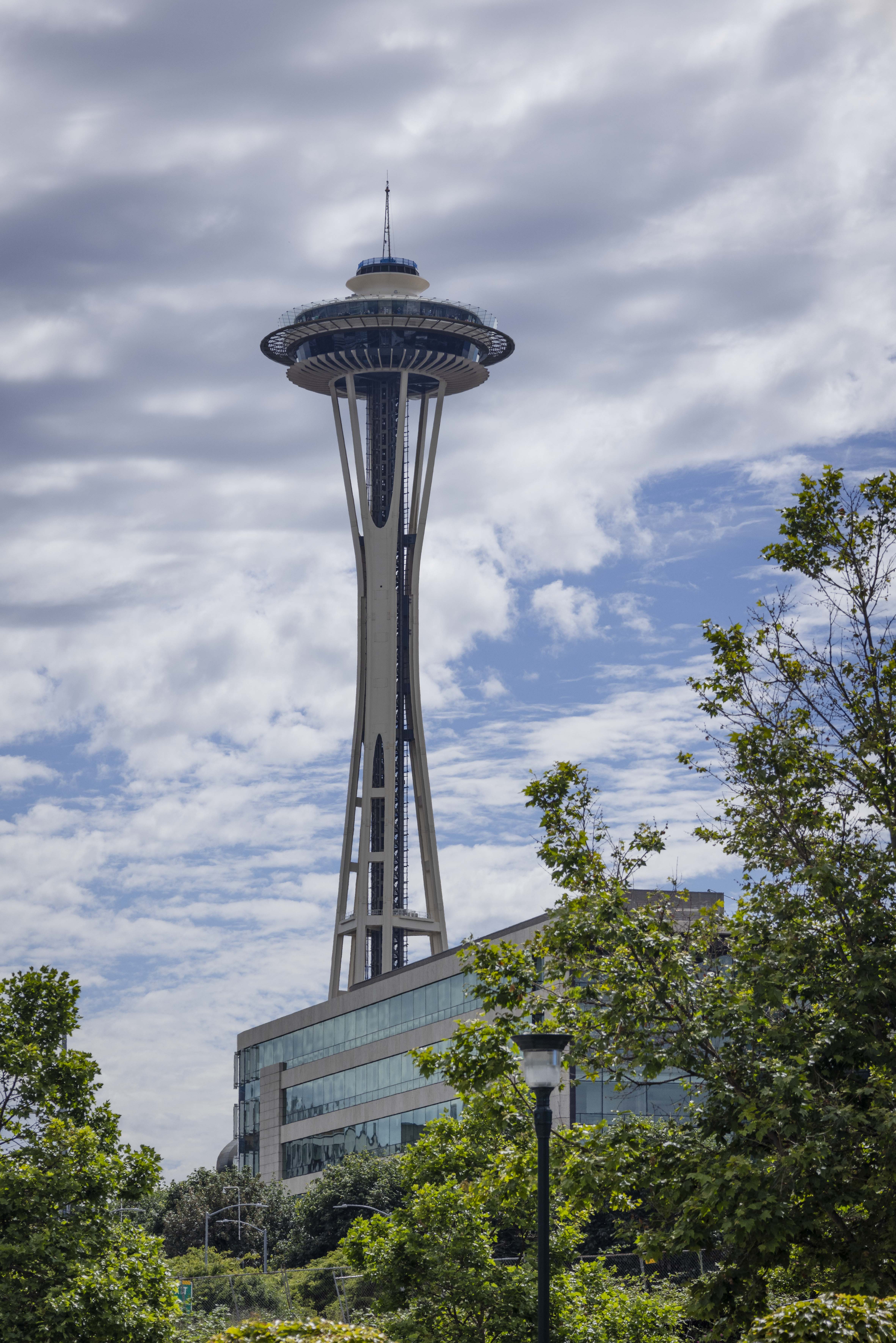
Seattle Space Needle.
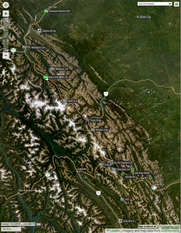
Map of our Canadian Rockies explorations.
The Canadian Rockies are an outstanding destination for scenery, geology, and wildlife, and we are grateful for the opportunity we had to see them. But this was a more difficult trip than most we have enjoyed. Unfortunately, like so many beautiful places, this is an area that suffers from overcrowding. The inclement weather which we endured would have been more manageable later in the year, but if we had waited, we would have faced much larger crowds, long lines, and great competition for resources. One tour guide told me that Parks Canada's mandate does not allow it to limit the number of visitors. Managing crowds in landmark locations is an increasing challenge for governmental agencies and Native tribes. Like US Arches National Park, I think we will be appreciate having seen Banff and Jasper. But if we return to this region, we will stick to the lesser-visited areas in BC.
Total distance driven: 3,873 mi/6,233 km
Geocaches found: 17